Sultan
2. Powerhouse to Fishing Access
| Difficulty | III-IV+ |
| Length | 2.1 mi |
| Avg Gradient | 50 fpm |
| Gauge | Sultan River Below Powerplant Near Sultan, Wa |
| Flow Rate as of 33 minutes | 342 cfsbelow recommended |
| Reach Info Last Updated | May 25, 2025 |
Projects
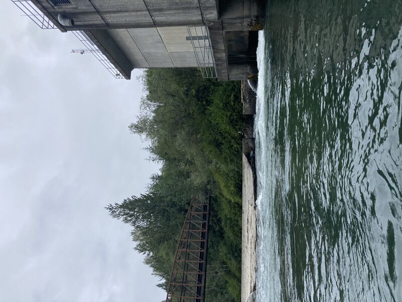
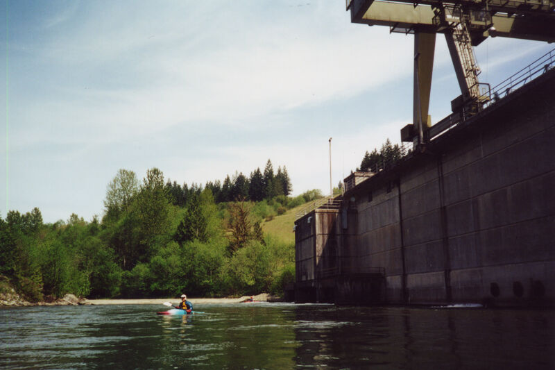
Snohomish PUD operates the Jackson Hydroelctric Project on the Sultan River. American Whitewater has a direct interest in river and riparian conservation and resource protection, appropriate public access to the river that protects resource values, and instream flows for the benefit of fishery resources, river and riparian condition, and [...]Read More
River Description
While technical creek runs higher up in the basin sit waiting for the spring snow melt, the Sultan can be enjoyed through the winter. It is also an option at the end of snowmelt when hydropower operations keep flow in the river. The Sultan offers a more technical paddling experience for those who are looking for an alternative to another Sky trip.
Most trips start at the Powerhouse, but this run can be extended by two miles upstream making a great 4 mile run if the gage for the upper below the diversion dam is reading at least 300cfs. This is the Horseshoe Bend section easily reached by continuing up the Chaplain Lake Road and taking a hike. See shuttle details above. The Horseshoe Bend section puts in right below Marsh Creek Falls and features a beautiful short gorge with numerous Class 3 rapids.
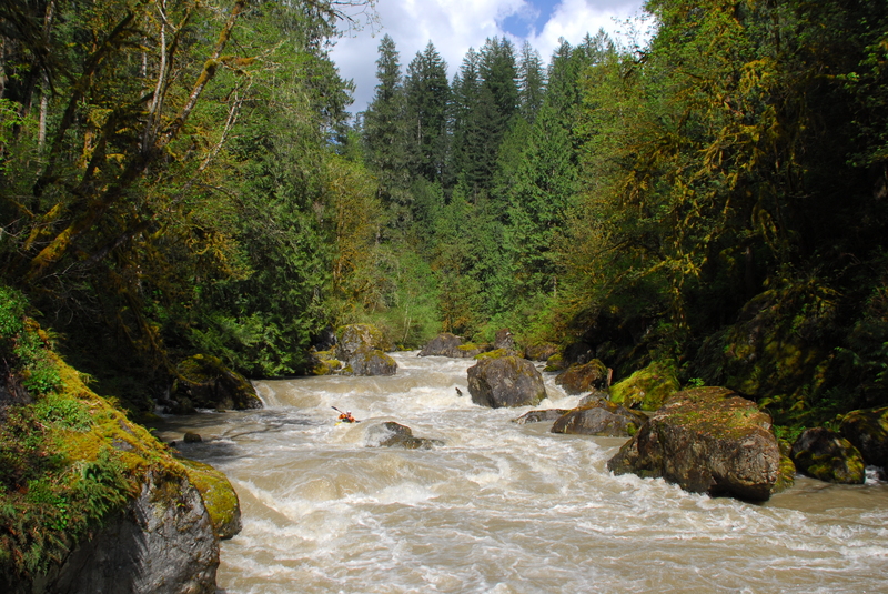
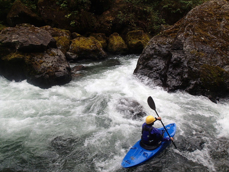
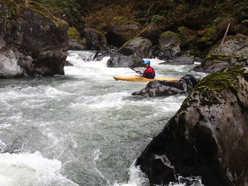
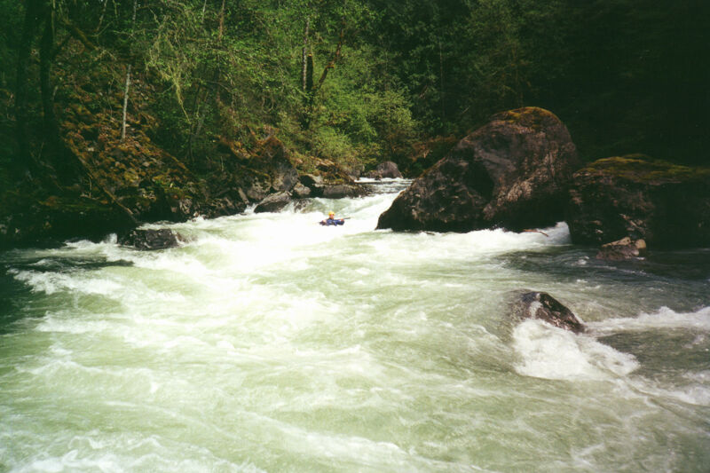
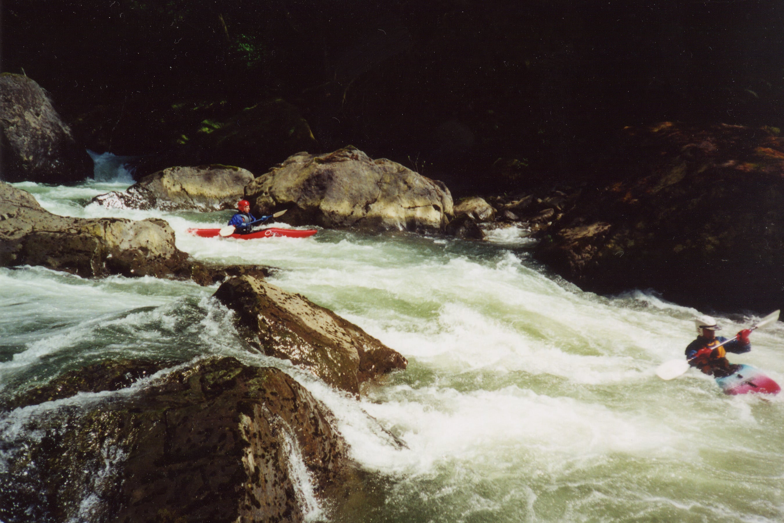
From the Powerhouse, the river tightens up a bit and plunges through a couple of technical class III+ drops. The most significant drop, Last Nasty, comes early in the run after passing through the first few drops. It's marked by a large eddy on river left, a rock wall on the left, and a large boulder near the center of the channel at a spot where the river takes a slight bend to the right.
Last Nasty can most easily be scouted or portaged on river right (although the eddy at the top of the drop on river left looks inviting scouting from this side is more challenging). The rapid itself requires a right, left, right set of moves with opportunities for skilled boaters to eddy out in between the sequence of drops and holes that need to be negotiated. It's worth a scout to pick your line and check for wood around blind corners. The crux move is the last ledge where you want to be far right almost up against the rock.
After Last Nasty the river continues with more technical class III+ drops similiar to the ones at the start of the run. There are a number of nice surfing waves and a couple of good pop up spots.
Once the river flattens out and home
...River Features
Jackson Powerhouse Put-In river left
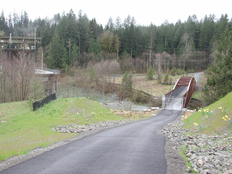
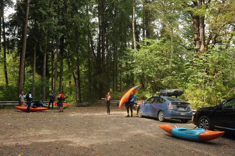
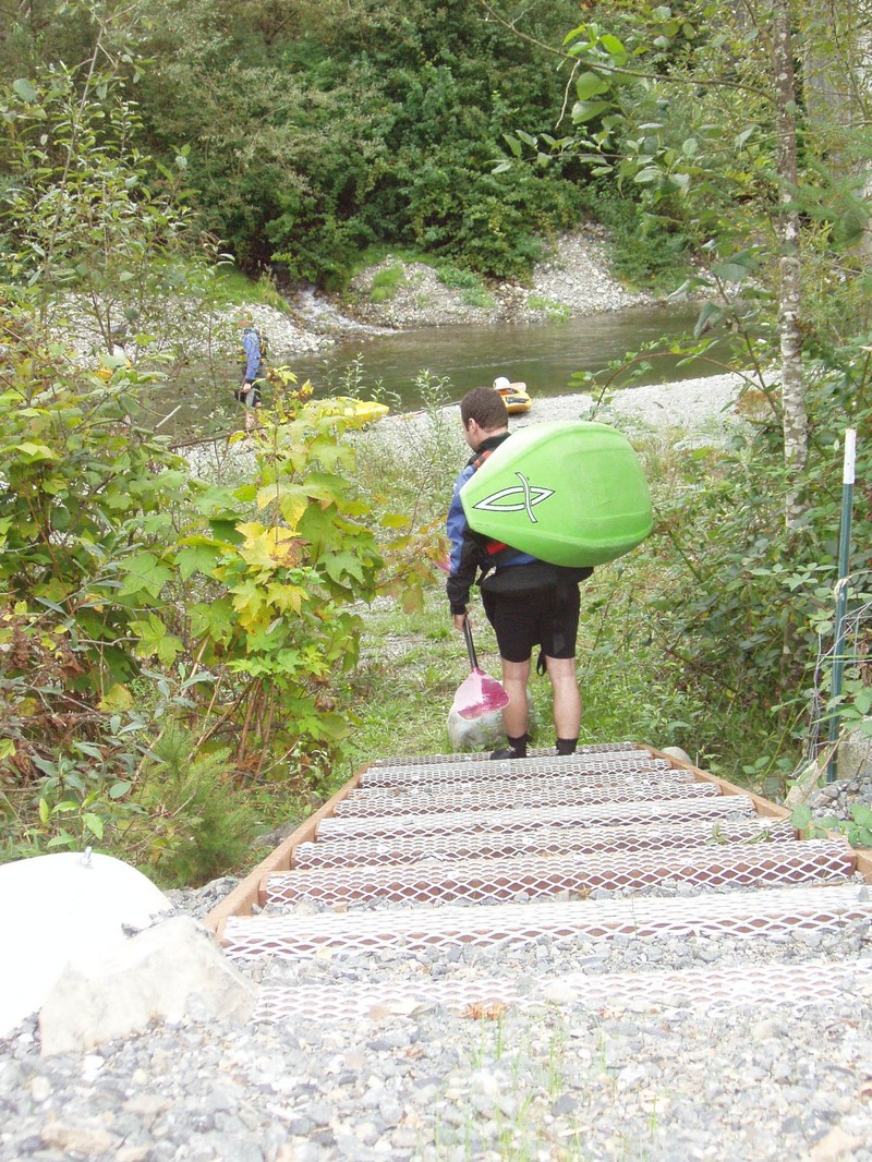
You can access the river from either river right or river left. Snohomish PUD made a put-in trail on the downstream river right side of the bridge. An alternative access is also available on the upstream river left side of the bridge.
Jackson Powerhouse put-in river right
Access on river right across the river from the powerhouse accessed from Lake Chaplain Road.
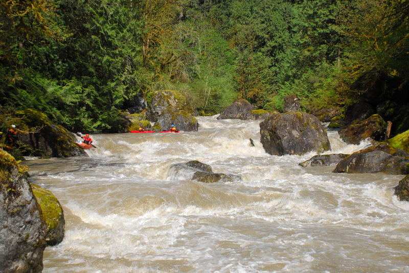
Trout Farm Road Take-Out
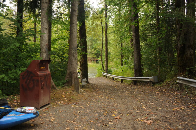
Public take-out on river left maintained as a public access by Snohomish PUD as a condition of their hydropower license.
Trip Reports
Log in to add a reportBefore heading out on the Sky for the day my buddy and I decided to take a quick dip in the Sultan. I had only done this run once before ~450cfs and it was too low for my liking so I was stoked when I saw the gauge a little over 600 that morning. To keep the shuttle easy and to make the run a little longer we floated down to Sportsman's Park in Sultan. Our group was one kayaker and one packrafter.
We put in at the powerhouse, the first rapid exiting the pool is by far the easiest rapid until you exit the gorge so don't be fooled. Around the first corner comes the first real rapid, the river splits roughly halfway through the rapid before rejoining and slamming into the right wall, take the left side going in and the right side around the island. There is a short pause before another rapid that is fairly straightforward but should be checked for wood. After another short pool is Last Nasty, which I think separates into three sections with eddies to catch along the way. The first section squeezes to the right of a big midstream boulder and then pounds into a cave on the right. Don't go left of the big boulder and also don't go into the cave (we actually pulled into the cave to stop and scout at 450 but any more water makes this option sketchy. The second section is a little manky and we ran through it on the right side too before catching an eddy above an obvious horizon line at the third drop. There is a flaking ledge on the river right side that creates a perfect boof into the pool below and could be lapped with some effort.
After Last Nasty the river cruises through another mile or so of fantastic class III/III+ boulder gardens with countless chutes, boofs, splat rocks and surf waves. A huge midstream boulder marks the beginning of the end of the gorge and the fun rapids, with only a short section just below before the river significantly changes and flows through wooded gravel bars. First island go either way, second island the left side fans out really bad and gets super shallow. Right side has a sketchy log to go around and then some dumbfuck landowner strung a rope across the river to the island from their property. Be careful of this as it's hard to see and is roughly at chest level. There are several other similar rope features on smaller river right side channels as you make your way down to the takeout. Takeout at the 3 bridges that cross over the Sultan just above the confluence of the Sky. Entire trip took roughly 2 hours but could be shortened if the gorge is pre scouted and you boogie out the lower stretch instead of dinking around.
A trip that began on the Upper with a release from the dam, we continued on down through this section to Trout Farm Road. With the additional flow from the powerhouse, this was a fun level for this section.
A few runs of Last Nasty and a swim during a juicy flow on an Upper Sultan release day (the release flow plus powerhouse generation).
For people new to this run. The description to the put in above is accurate. I'd suggest not using the information/map in the 'directions' tab at the very top.
Lower Sultan on a summer day.
Last Nasty at lower flows. 3/24, 350cfs
After American Whitewater raised the issue of lost access resulting from a bridge construction project near the powerhouse, the Snohomish PUD developed a new trail during summer 2004 that now provides improved public access to the water.
This new bridge was constructed during the summer of 2003 to provide PUD personnel with improved access to the watershed. This project eliminated historic social trails to the water but once the issue was raised by local AW volunteers, the PUD built an improved trail during the summer 2004.
The City of Everett keeps the Lake Chaplain Road gate locked at orange or above level terrorist alerts. Call them at 425-257-8200 to ask and/or complain about the gate. The 116th street gate (controlled by the powerhouse) was open Tues. 3/25/03 but I don't know their policy. Their # is 425-347-5549.
Thomas O'Keefe, James Girton, and David Wilson on the Sultan River.