Green
1 - Headworks to Kanaskat-Palmer State Park
| Difficulty | II+(III) |
| Length | 4 mi |
| Avg Gradient | 26 fpm |
| Gauge | Green River at Purification Plant Near Palmer, Wa |
| Flow Rate as of 19 minutes | 128 cfsbelow recommended |
| Reach Info Last Updated | October 15, 2019 |
Boaters have a long history of working for protection of the Green River Gorge. Explored by Wolf Bauer and members of the Washington Kayak Club (one of AW’s original founding clubs) in the mid-1960’s boaters quickly realized the Green River Gorge was one of the most spectacular river canyons [...]Read More
EVENTS: The annual Green River Cleanup takes place in spring every year and is coordinated by Washington Recreational River Runners and Friends of the Green River.
SEASON: October to May after heavy winter rains. The best flows often come in fall or spring.
LOGISTICS: If it's your first time, a map is helpful to make sense of the roads here. In Summit, at the junction of Maple Valley - Black Diamond Road (Highway 169) and Kent-Kangley Road (Highway 516), head east towards Georgetown on Kent-Kangley Road. In approximately 3 miles, turn off to the south on Lake Retreat-Kanaskat Road. In another 3 miles turn on to Cumberland-Kanaskat Road to the right up over the railroad tracks, and then cross the bridge over the Green River. Follow the road as it turns to the west (headed downstream) a short distance to the turn-off into Kanaskat-Palmer State Park. Once you've entered the park head toward the right and a parking area with a short path that leads to the river. A large sign board warning of dangerous rapids downstream (the class IV gorge run) marks the takeout on the river. Those who want to run a couple more good class III rapids can use an alternate take-out in the park (head left instead of right as you approach the river). To reach the put-in, head back out the park and drive upstream along river left. Just before you reach the bridge you crossed on your way in, you will see a turn-off for Headwords Road which parrallels the river. Follow this road upstream approximately 2 miles to a put-in. The preferred access is just upstream of the security gate but through an agreement that was negotiated by Friends of the Green, American Whitewater, and local boating clubs with Tacoma Utilities, boaters can obtain a pass from the security guard to access the put-in (if you need to reach the security office by phone they can be reached at 360-886-1601).
DESCRIPTION:
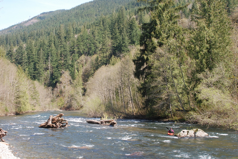
This is a good run for beginners led by a more experienced paddler. As with other dam
...
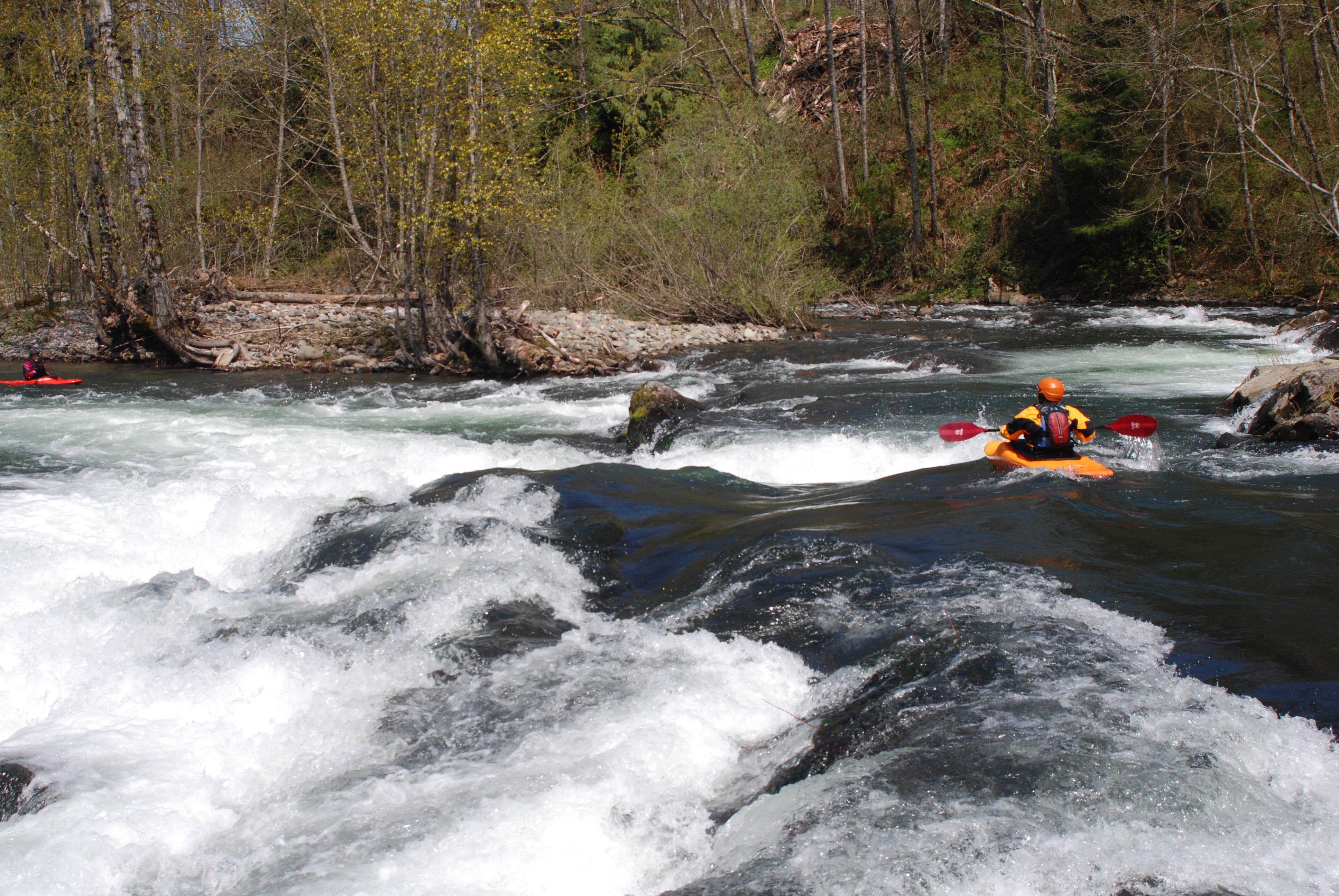
Railroad Drop is a bedrock ledge that extends across approximately 2/3 of the width of the river on river right. The preferred line is down the main tongue on river left where there is a break in the ledge. At lower flows (around 1000 cfs) you will encounter a shallow bedrock shelf towards the bottom of the main tongue. To avoid it, you want to execute a strong left to right move as you enter the tongue. As flows increase however (above 2000 cfs) this line to the right takes you dangerously close to the terminal hydraulic that forms at the base of the bedrock ledge that extends from the center of the river to nearly the right bank. If someone gets caught in this hole that approximates a feature characteristic of a low-head dam, it is extremely difficult to execute a rescue because it is beyond throw rope range for most rescuers. At these higher flows it is safer to follow the main river left tongue down the middle being sure to cheat to the left rather than straying over to the right. Another factor to be aware of if boat scouting is many experienced paddlers grab the eddy behind the large boulder about 200' upstream of the ledge. Be aware that if you grab this eddy you are right above the terminal hole at higher flows. It's a good place to get set up but you need to make a hard move across the eddy line when you peel out to hit the preferred line down the left tongue. A more conservative line at higher flows is to start from the river left shore and bypass the option to grab the eddy behind the big boulder. The rapid can be easily scouted, especially at lower flows, when you can get out on the bedrock on river left and scout or portage. Stay below the high water mark and off the private property that borders this rapid. Located at USGS river mile 57.9.
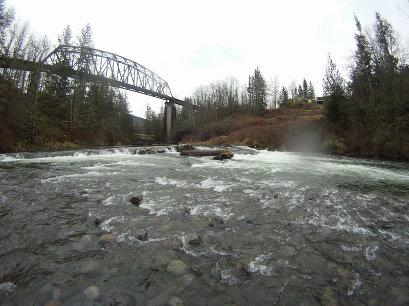
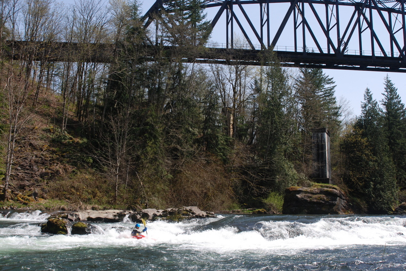
Access is available on the upstream river left side of the bridge. This access is often used when the State Park is closed and can serve as a take-out for the Headworks run or an alternate put-in for the Gorge.
Dec 31, 2025
Written by Candice Larson, photos by Sam Westover:
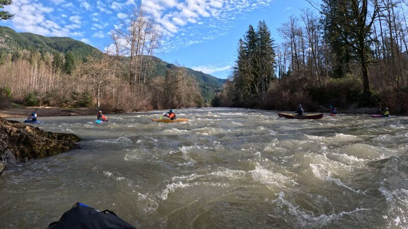
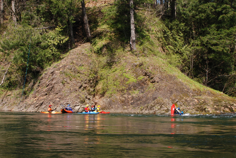
10 of us celebrated the last day of the year on the headworks section of the Green River. Outflow at the dam was 1220 CFS. The temperature was high 30s, but sunny and clear. One packraft, 1 canoe, 8 hardshell kayaks.
This was my first time since the flood. We ran the park. The braided section under the first bridge changed, but no other changes. No wood. Surf waves were in.
Jun 7, 2021
Paddled this section at around 1300 cfs yesterday. We were in 2 IK's, 2 hardshell kayaks and a cataraft. This was the first time on this section for myself and one other.
I have a couple of notes about it:
1. The warning posted on this description about the Headworks access is no longer needed. There was no wood in the water at the boat ramp inside the security gate. There was not a lot of wood on the whole route and nothing I would consider worthy of note on this date.
2. The description for this put-in led us to believe that the only way to get in the water is from the boat-ramp inside the locked gate. This is not true: there is a perfectly easy put-in next at the lot just before the gate.
3. There is a warning posted about wood on river left after the takeout. I did not see this, but since it may be farther downriver, let me clarify: The take-out at Kanaskat-Palmer State Park has a big red sign warning paddlers to exit before the next stretch. If you take out right at that sign, there is no strainer. Just after the sign there is a big ledge drop, class III. The easiest line is all the way to river right. There is wood in the water there, but it didn't keep four kayaks from breezing straight through it yesterday. Both there and farther down, I did not see the strainer river left which is in this warning. Perhaps at much higher flows, the trees on the bank I was standing on are actually in the river, blocking the use of river left and forcing paddlers to find a line in the center or river right.
All in all, it was a delightful paddle. We had some experienced paddlers showing us the rapids and (most helpfully) how to get through the railroad bridge drop. (That was easy in an IK, but I was very glad there was someone there to tell me where the line was.) Fellow paddlers are the best! We are learning from some terrific people. I am more eager than ever to get trained on my hardshell so I'll have that extra maneuverability.