Turtle Creek
B) Hwy.140 to Shopiere (PnP, 1.3, or 4.7 miles)
| Difficulty | I |
| Length | 5 mi |
| Avg Gradient | 3 fpm |
| Gauge | Turtle Creek at Carvers Rock Road Near Clinton, Wi |
| Flow Rate as of 36 minutes | 58 cfsbelow recommended |
| Reach Info Last Updated | March 3, 2025 |
Quick Facts:
Location: Hwy.140 to Shopiere (Approximately 6 miles NW from Beloit, WI).
Character: Rural scenery (fields, trees), an impressive scenic railroad trestle, mudflat and gravel shoals.
Shuttle Length: 1.3 miles or 4.9 miles. For whitewater enthusiasts, mostly recommended as (possible) park-and-play at railroad ledge near Smith Road.
General Overview
Removal of the Shopiere Dam (summer, 2000) had revealed a short bedrock ledge. Well, bedrock is probably the wrong term -- the bottom here is mud and clay. Unfortunately, the 'mud ledge' has now completely eroded away. However, additional scouting has found other potential playspots in this watershed. (See 'River Features' below.)
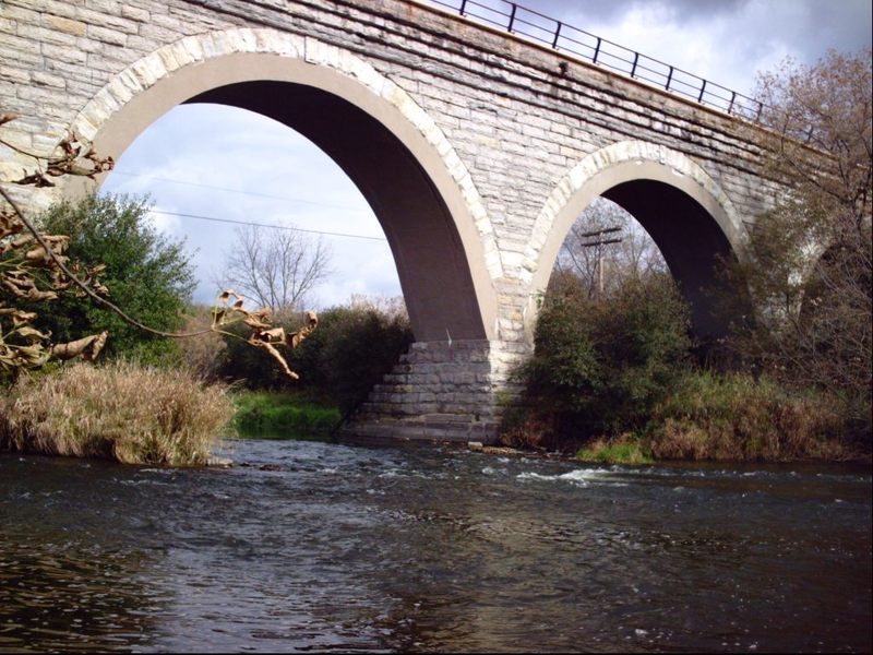
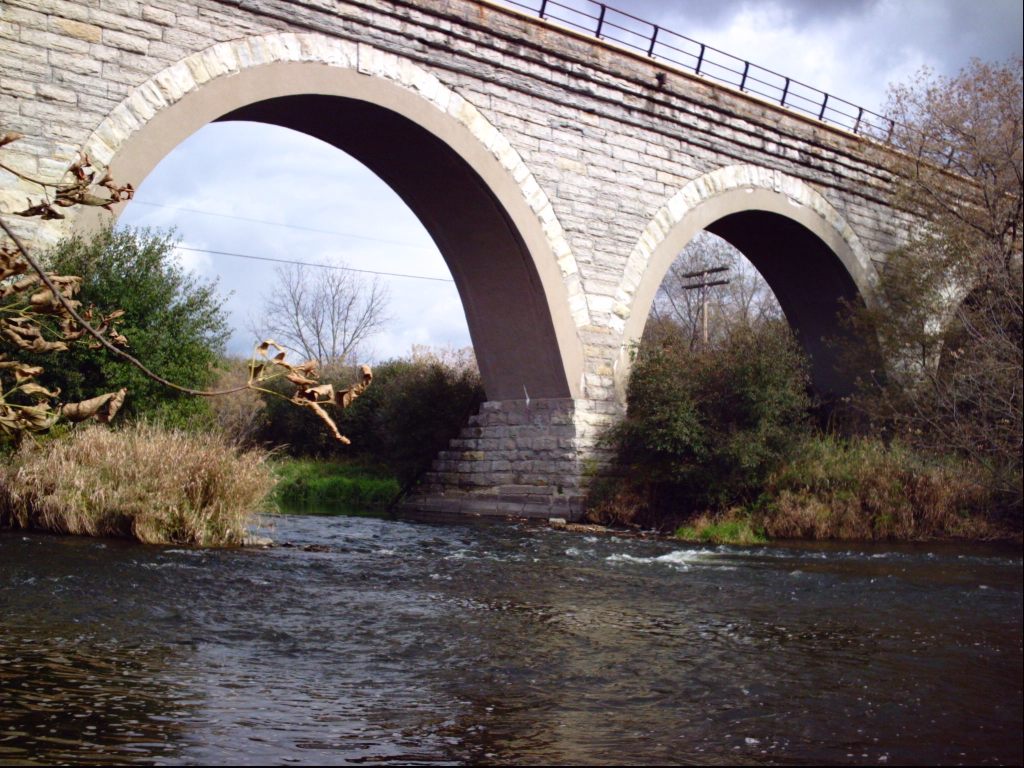
A very enjoyable, moderately scenic 4.7 mile float trip (flatwater paddle) starts from parking at a wayside at Hwy.140, 2.6 miles north of the town of Clinton, WI, and ends in a pretty little park (Sweet-Allyn County Park at Belding/Butterfly Road just north of Shopiere) where gravel shoals create a few minor riffs and rips leading downstream to the mown grassy area of the park for your take-out. I have not floated this reach, but I have heard that there may be at least one area where a rocky ledge and/or rock rubble forms a bit of pourover/wave (at some flows) which may allow for minor surfs. This is right at the very scenic (multiple high-arching stonework) railroad bridge which is about a mile upstream of Sweet-Allyn County Park, and may be accessed from nearby Smith Road for a park-and-play, or a run of just 1.3 miles with the best of the gradient (such as it is . . . just riffles and rips).

Testimony to the popularity of this stretch of river is the fact that there is a designated parking/access to the river at Hwy.140.
Drainage area at our listed put-in is about 202 square miles, and at the take-out it is about 221 sq.mi. (a 9% increase).
Smith Road crosses Turtle Creek on an old one-lane iron bridge. This location can serve as put-in for a short (1.3 mile) scenic run with the minor ledge/wave for play near the high stonework trestle railroad bridge. Or ... just park here, paddle down, play (for whatever it offers), and carry back up.
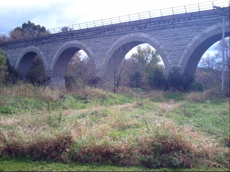
Definitely one of the scenic highlights of this trip is this high multiple-arch stonework railroad bridge. Immediately downstream of it, there is a (very small) bedrock/rock-rubble ledge in center stream, which may offer some minor play at low-moderate flows. (See header for 'featured photo' which shows the 'ledge' ... or go to the 'Gallery' where you can select the photo, and click 'Full Resolution' to see more detail, FWIW.)
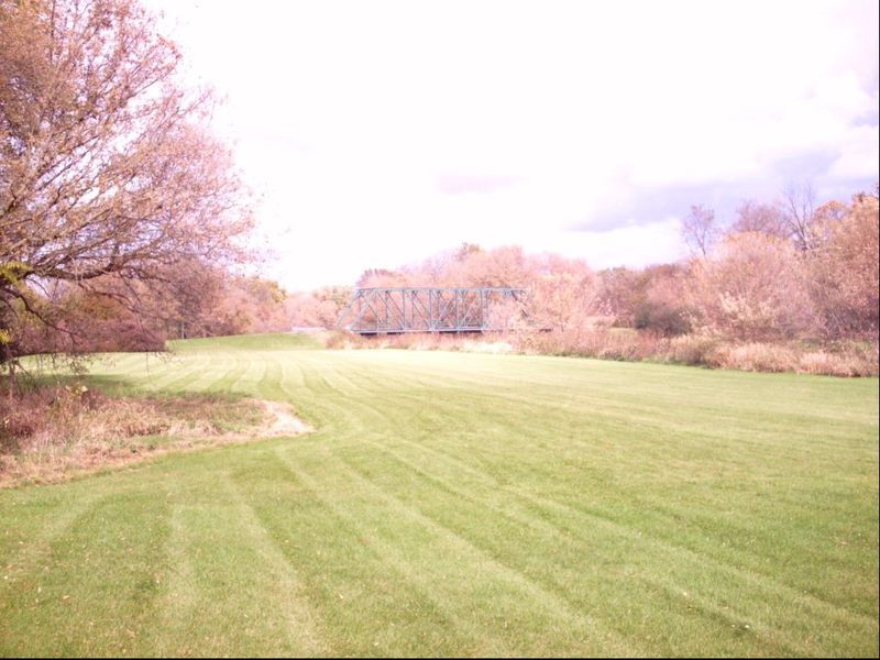
A fine little park on Butterfly Road in the unincorporated community of Shopiere provides access for take-out. Exit the river at a marker, or enjoy some final swiftwater down to the bridge, then carry back up to your vehicle.