Clear Creek
2. Blackberry Mountain Road to DNR Take-out on Cartecay River
August 25, 2013
| Reporter | Chuck Kirk |
| Gauge Reading | 1.7000000476837158 ft at Clear Creek-Clear Creek Rd to Cartecay River |
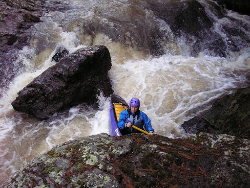
I built a trail from Clear Creek Falls on the Cartecay River to Timber Falls on Clear Creek. Many thanks to the hard work put in by Jason Butler. The Trail is .31 miles long takes about 7 mins to walk and the hike has a total ascent of 80ft. This puts you in just above Timber Falls and you get to drop 52.5 ft over .63 mile doing four class 3 rapids. So from the Cartecay at Clear Creek Falls - run the falls then eddy out on river left and follow the trail up beside Clear Creek. This part of the trail is an old horse trail or something and leads away from the creek. You will see a small creek bed on the right of the trail. Where this creek bed closes up to where you can cross it the trail we built begins a steep switchback for about 20 feet high and then the trail cuts off to the left once at the top. Until we get it blazed follow the downed tree limbs lining the trail. Jason Butler and myself got 2 laps in today after building and then ran into Woody Janssen, J.d. Grogan, and Craig Davison who joined us for our 3rd lap. It definitely adds to the fun of the Cartecay. On the map the Steep climb is at A and is a gradual climb to B then it's all downhill. Hope ya'll enjoy so go get some laps! UPDATE August 25, 2013 - The trail is marked with a Yellow Blaze to make it easier to follow as it turns up the hill away from the old logging road... The flood a few weeks back cleared all the debris from all rapids and they are all good to go. It also removed several feet of the soil from the rocky banks and cleaned the view up some. It's really nice in there now. Ferns have overgrown on the trail itself as not many people have traveled it. Please take the time to hike and paddle this great stretch of river when you run the lower Cartecay.