Banklick Creek

Independence Station Road to Doe Run confluence (5 miles)

DifficultyII-III
Length5 mi
Avg Gradientn/a
GaugeBanklick Creek @ Highway 1829 Nr Erlanger, Ky
Flow Rate as of 1 hour
12 cfsbelow recommended
Reach Info Last UpdatedJune 13, 2004

River Description

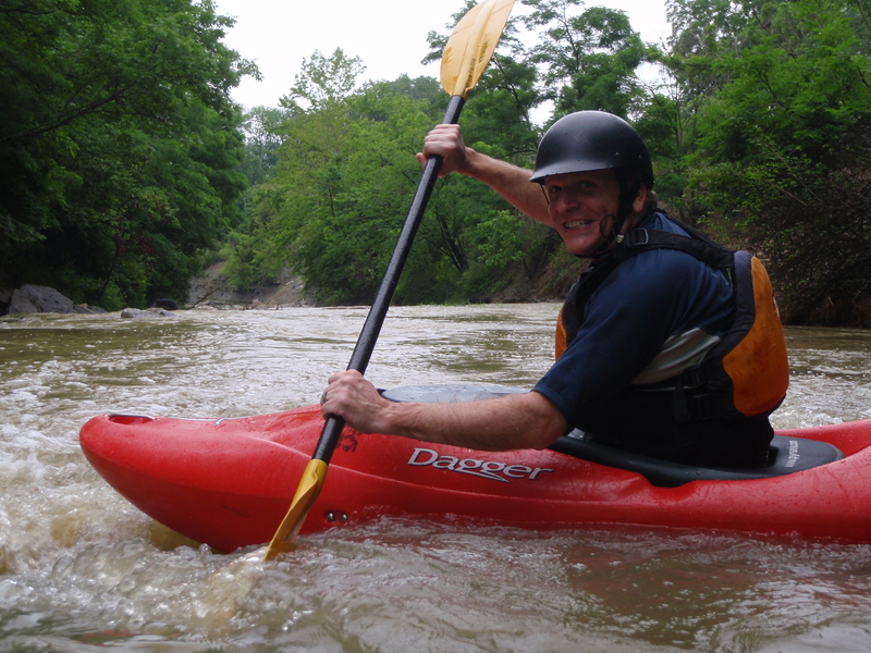
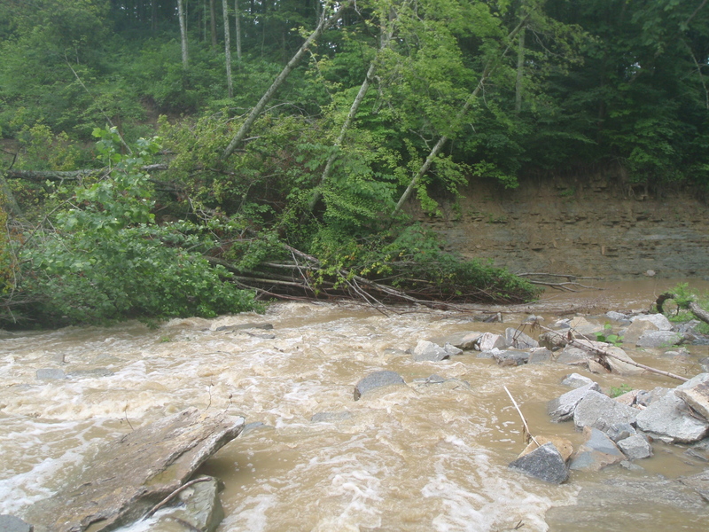
When we ran this one in 1995 and 1996, we knew it was marginal water quality, not only because of the industry along Ky Rt 17 downstream of the run but simply due to the environmental abuse by the people who live along this creek. For many of them along the whitewater section, the creek in their backyard means that they're allowed, no, supposed to dump their garbage (and more) there. After it flooded in May 1997, 30 million dollars worth of damage occurred to homes and property downstream from the run, and the sewers along the creek were all blown apart. That summer, the sewers were repaired; poorly. The following spring, a somewhat smaller but still effective flood blew the sewers off again, and it will take years for this creek to regain it's health.

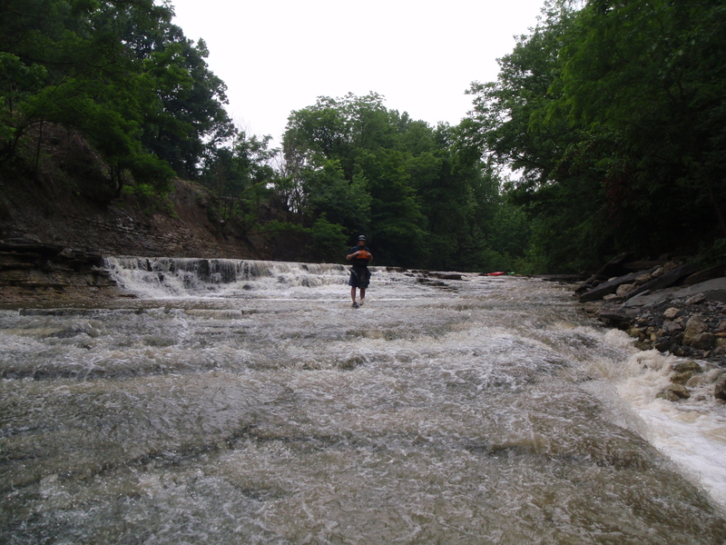
When looking at the destruction, the drops look like they have improved a lot. The first 3 rapids are in a little canyon about 200 yards long and 60-80 feet deep. The first is a 3 foot ledge. A churning, twisting left hand turn gets you out of the canyon. Then it's just easy class II until the last half mile. It only reaches class III when it's really full. There are some big waves in the last half-mile of the run.

Banklick is a tributary of the Licking River, located in Kenton County, and the takeout is along old Rt 17.


River Features

Put In

Distance: 0 mi

Take Out

Distance: 5 mi
Take Out

CS
Chris Shively

Jun 21, 2011


Here you can see the creek going into a small canyon above 1st rapid

CS
Chris Shively

Jun 21, 2011


This creek changes all the time and there are often river wide strainers be ready to get out quick.

CS
Chris Shively

Jun 21, 2011


I wish someone would update the page b/c we paddled it @ 260 CFS and the top drop was unrunnable at that level.

CS
Chris Shively

Jul 20, 2010


paddled on 5-2-10 level was 900 CFS or 6.5 feet...... river class III+ at that level
River was at flood stage almost no eddies.
Top drop had 16' of water flowing over it class III+
Fun but dangerous at this level good news is all strainers are gone

CS
Chris Shively

May 2, 2010


First drop had 16' water going over lip class III+ at this level
almost no eddies @ 900 cfs river at flood stage
good news all strainers were washed out clean clear lines

?
Untitled

Oct 31, 2009


we paddled on 10-31-09 @ 10am level 567cfs and falling 150cfs per hr. Good water level a few spots we low we had to scrape by. The level above the first drop was shallow making the approach to the 3ft drop hard. Strainer still above this 1st drop runable on river right then drop 10ft off the right hand bank.

CS
Chris Shively

Jul 30, 2009


Previous post about water quality are either old or wrong. Only 2 spots that smelled bad.
With all the rain water that is in this creek when it runs the water is not a hazard at all.

CS
Chris Shively

Jul 28, 2009


We ran this on 7-28-09 gauges showed 350cfs (-12cfs per hr). The run was a little shallow. We had to push through a few spots. The run was NOT a II-III at this water level I would call it a II only because you need a little boat control. THe whole creek needed 6' more water and really would have been fun with another 12'. *** IDEAL level = 600 CFS for a fun class II ***