Boise
Downtown Boise(Barber Park to Willow Lane Park)
| Difficulty | I-III |
| Length | 8.7 mi |
| Avg Gradient | 11 fpm |
| Gauge | Boise River at Glenwood Bridge Nr Boise Id |
| Flow Rate as of 41 minutes | 661 cfsbelow recommended |
| Reach Info Last Updated | April 20, 2025 |
A transformation is underway on the Boise River as the recreational potential of this heavily regulated urban river is being realized. While easy access to the spectacular whitewater of the Payette drainage an hour to the north is what brings many boaters to Boise, opportunities within town on the Boise River provide some options for a lunch break or evening session.
Barber Park to Ann Morrison Park:
This six-mile section of the river is known as a summer booze-cruise tubing float and includes The Weir, an urban park-and-play spot known for years and described in Grant Amaral's guidebook, Idaho The Whitewater State. In the summer of 2013, 135,000 people entered the river at Barber Park.
For more information on this section above Ann Morrison Park, check out the map on the Float the Boise website.
At super-high-flood-stage flows (4500 and above), a feature comes in at 'Bubb Dam' known as the Barber Park Wave. This is fabulous surfing and only comes in every few years. The wave is river-wide and there is usually eddy service on river left (Depending on the flow). If you get flushed downstream there are spots to take out on river left and walk on the greenbelt back up. Playboaters can put in at Barber and float about a quarter mile downstream to the wave and then hike back up on the greenbelt. When this wave is in, the banks are swamped and the river is fast, so beware of strainers and don't swim.
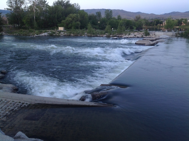
After Ann Morrison Park, it is easy to float to the Boise Whitewater Park, but this is floated less often, so watch out for hazards at high water. Be wary of the Settlers Canal Diversion Dam, this low-head dam looks like a potential killer. It is rumored that this dam might be replaced with another wave feature.
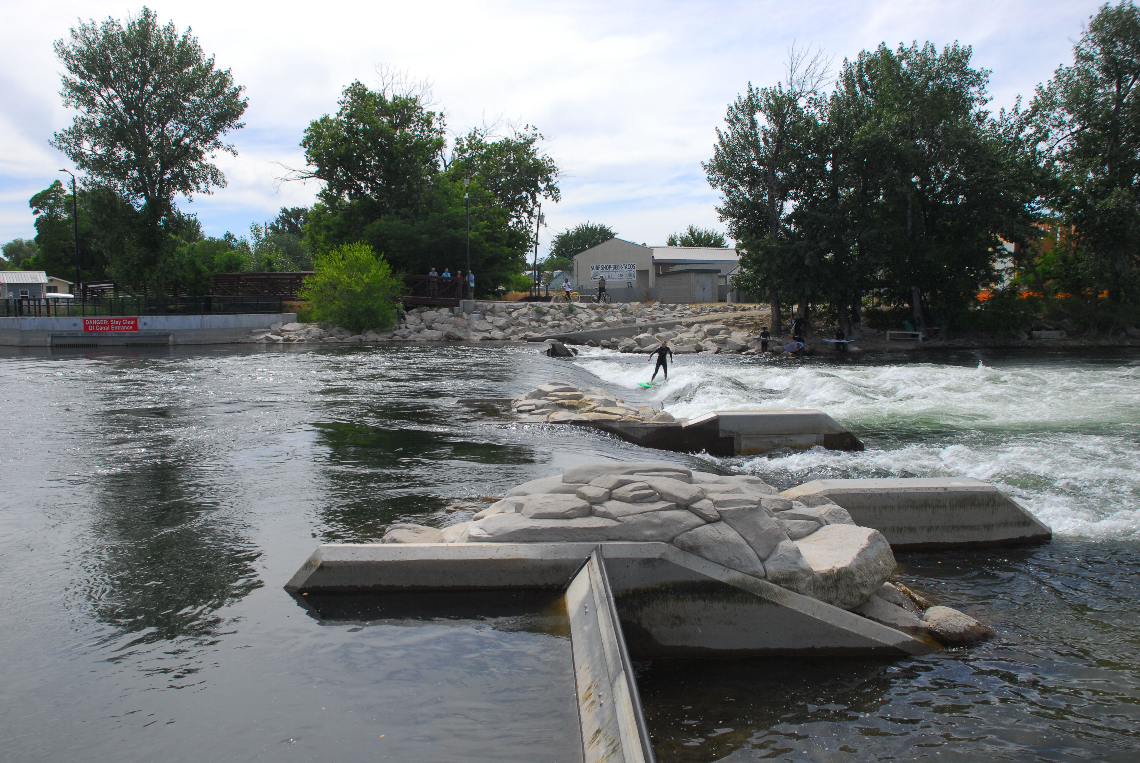
Boise Whitewater Park:
The Boise Whitewater Park is located between the Fairview Avenue and Veteran's Memorial Parkway bridges
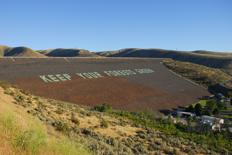
...Located upstream of the reach that is typcically boated, Arrowrock Dam is a 350' high concrete arch dam constructed in 1915. It is a water storage facility operated by the Bureau of Reclamation. More recently, a federally-licensed hydropower facility (P-4656) was added that generates up to 15 MW of power.
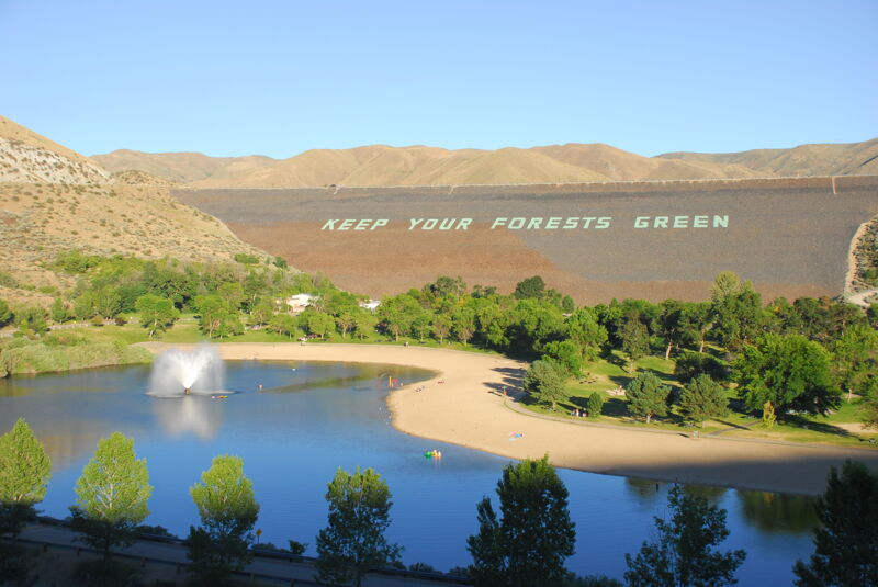
Located upstream of the reach that is typically boated, Lucky Peak Dam is a 340' high rolled earth and gravel fill embankment dam constructed in the early 1950s, The dam's primary purpose is flood control, with a secondary purpose of irrigation. It also produces up to 101 MW of hydropower (P-2832).
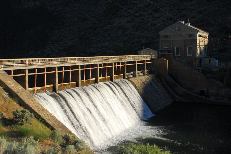
Located upstream of reach that is typically boated. The dam diverts flow into the New York Canal. The dam also has a federal hydropower facility that generates up to 3 MW of electricity.
Located upstream of the reach that is typically boated. This federally-licensed hydropower project (P-4881) that provides limited power production (up to 4 MW) and has significant operations and maintenance issues. It is a candidate for removal.
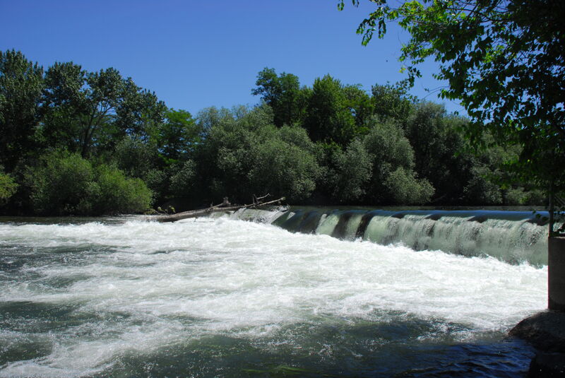
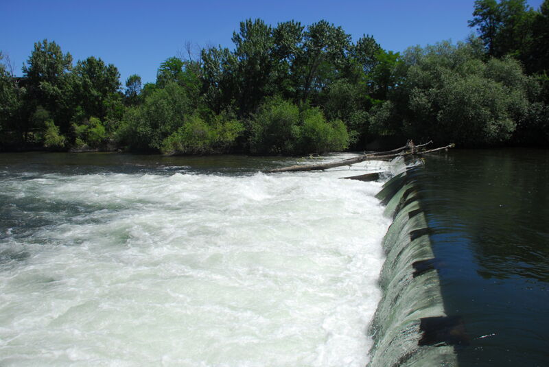
Diversion Dam immediately upstream of the standard put-in that diverts flow into the Ridenbaugh Canal which has been in operation since 1878.

Good river access and a standard starting point for urban float trips. Located at river mile 58.2.
USGS River Mile 52. This is the takeout for the booze-cruiser's. Downstream of here is less travelled.
Diversion dam located just upstream of the N Americana Boulevard Bridge and adjacent to Ann Morrison Park.
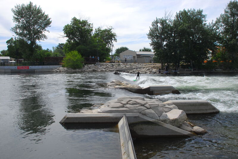
The Harry W. Morrison Dam at the Thurman Mill Diversion was opened in June 2012. It has a wave shaper and viewing area off of the Boise Greenbelt and is a great location for park and play easily accessible from Esther Simplot Park, a 55 acre complex that includes Quinn's Pond for flatwater training and practice.
Jun 13, 2018
Diversion dam on the Boise River located in town.