Hershel Run
Belfast Road to Stonelick Creek
| Difficulty | III-IV |
| Length | 1.3 mi |
| Avg Gradient | 145 fpm |
| Reach Info Last Updated | December 3, 2011 |
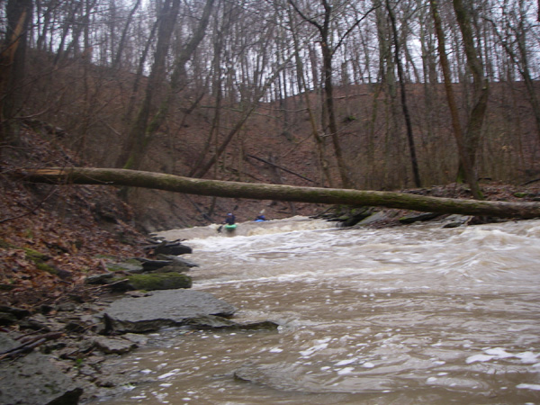
A tributary of Stonelick Creek which was one of the first of the steep creeks discovered in Southwest Ohio. Brandon Roy and I got the first descent on May 8, 1998. And if we would have run it with another six inches of water in it, we could've gotten in serious trouble. It was full of very bad strainers, and we ran it just above minimum. We cleared it out since then, only to have it fill up with wood even worse the next spring. Then it cleared out partially again naturally in the big spring 2003 flood. It is only 20-30 feet wide and twisting with ledges sometimes coming one right after the other. Things happen very quickly.
It is little, tight, and in southwestern Ohio terms, it's full on steep creekin'. It is almost 1 1/4 miles long and drops 180 feet. You put in and go through the tube under the road and over a 4 foot ledge. Then it's just easy downhill about 200 yards into strainers which may be boofed. Two huge trees (no limbs) lay across the creek but can be easily boofed at flows of two foot or more. Then it's boogie water for a ways. After this you will reach the first few ledges, which are fairly small.
The first big ledge you get to, Church Pew, is 5 feet, and once you get to it, all hell breaks loose. This ledge is likely to get very sticky at higher flows. Just below that it's one ledge or one downhill-leaning rapid after another, with a tight s-turn and a long fast sluice thrown in. About 7 ledges in all, ending in a funky diagonal horseshoe shaped ledge.
Eddies are scarce. Some of these ledges contain some big, nasty sticky holes. Be prepared and cautious. Right above the horseshoe ledge is the place that catches the worst strainers. Hopefully, this creek will be free of all strainers in the very near future. After that ledge, a 150 yard sluice / rockpile ledge rapid cranks downhill until you hit the second set of ledges. Along this section are three overhanging trees which you can get under at levels below 2 1/2 feet.
<...