Cheoah River
Santeetlah Dam to Calderwood Lake Boat Launch
Trip Reports
Log in to add a reportCheoah ELF - Runable essentially any and every day - Mark Thompson
Jul 5, 2023
Check out River Kings Video of this run at ELF (extreme low flow)
https://www.youtube.com/watch?v=zhZfETIKc\_M
I've been doing this run since I invented it in 2007. People first thought I was crazy, but over the years I've probably taken close to 500 people down this run at this level. You can go as low as 100 cfs. (and I've done it down to 75, but don't recommend)
I tried to contact that 'powers that be' so to speak the Cheoah Streamkeeper and advocate that this river SEVERELY needs to be broken into sections, but was met with nothing but dismisive rebuttle.
There are some rivers that get very bangy and boat abuse when they're low, THIS ISN'T ONE OF THEM. The bottom section chanels out brilliantly. At this level, it is the single best river I know for introducing people to creeking.
The put in is the second cement ramp, and you paddle down to the normal lake take out.
lat/lon put in: 35.4331769, -83.912124
Google map:
Nick Prete
Dec 9, 2018
Here's a video of the last 2 miles of the run: https://www.youtube.com/watch?v=LMbbh7QwIPk&t=1s
Ken Strickland
Mar 5, 2018
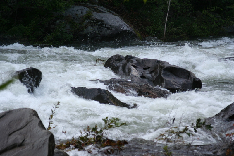
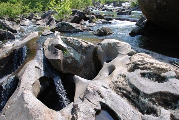
A large pothole exists below the right edge and downstream side of the large rock that divides the river in the first ledge below Bear Creek Falls. Its opening is keyhole shaped and approximately 2' wide at its top, pinches in a bit, then widens at its base to 4'. It varies in depth from 7' at its top to 4' at its lower end. The shadowed area in the upper right corner of the photo is looking upstream at the river-right side of the large rock. Something to be aware of.
Curtis Warner
Jun 26, 2016
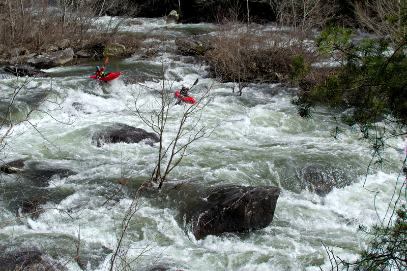
Myself and Craig rowed 13 foot catarafts down the Cheoah this past weekend at 1000cfs. The upper section was a little tight with the brush but half way down it opened up nicely. Craig ran 9 foot oars, l ran 8 footers. Had an awesome time.
Dennis Huntley
Nov 7, 2015
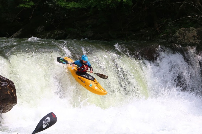
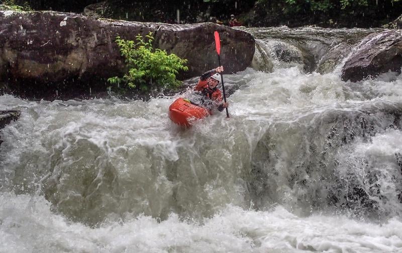
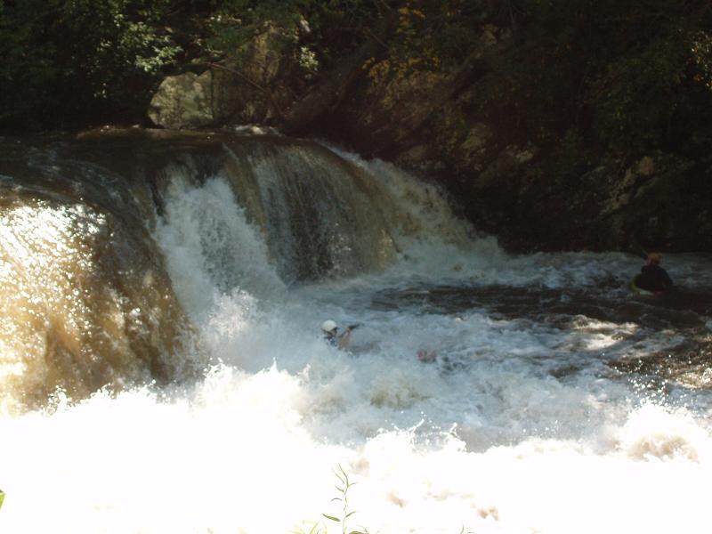
Bear Creek Falls on the Cheoah River at a normal release in 2015. This is called the Creek Line, or Middle Line. Photo by Jeff Macklin
Donald Holden
May 26, 2013
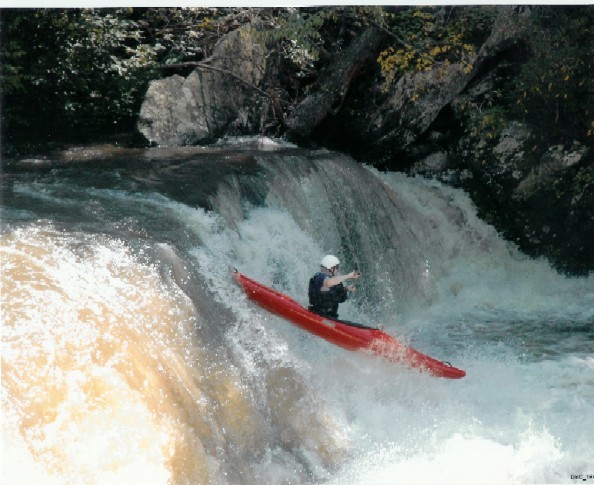
Here is Joshua Holden on his first run down Bear Crrek falls making it look easy.
Robert S. Farmer
Jul 8, 2010
To see some cool pictures of this section, check out my friend Woody DuBois's photos and videos http://picasaweb.google.com/tm.dubois/20090621Cheoah# . These were taken in 2009. P.S. I'm in the blue Prijon Boxer, number 10 frame.
Paul Killian
May 26, 2010
It is not yet known how he is doing, but thanks to Shayne he was revived and air lifted to Knoxville. If anyone has any more information please post it as it helps us all paddle safer.
Robert Strangia
Jul 9, 2007
Updated Rapid names.....
Craik's Ledge, III mile 8.5
Southern Revival, III+, mile 6.4 (first long rapids below the store) Pipewalk, III+ mile 6.3 God's Dam, IV mile 6.2 Jeff's Wood, Class III (rapid below God's Dam) Takeout, IV(IV+)mile 6.1
The lines from right to left...
The Good, The Bad, & the Ugly Hancock's Ledge, III+(IV) mile 5.6 Yellow Creek Rapid, III+(IV) mile 5.1
Land of 1000 Holes, IV Mile 4.6 The Dead Sea, mile 3.7 Forest Service Bridge mile 1.9 Rod's Hole, III, mile 1.8 Fear Factor IV+ mile 1.5 (Entrance to Bear Creek Rapid), Bear Creek Falls, IV+ mile 1.1 Tail of the Dragon(River Right), IV mile 0.7 West Prong Line(River Left), IV+ mile 0.7 Tapoco Lodge Rapid, IV mile 0.5 Yard Sale,The Holes...
(Cupcake, Beefcake,& Shitcake)IV+ mile 0.4 Fugitive, Class III mile 0.1
Ben VanCamp
May 19, 2007
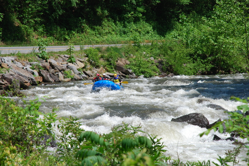
Group of private rafters turning the corner approaching the falls.
The rapid in front of Tapoco Lodge with no paddlers in it.
Yard Sale rapid with no paddlers taken from the bridge
A whole bunch of paddlers in front of Tapoco Lodge running the rapid.
Dooley Tombras
Apr 21, 2007
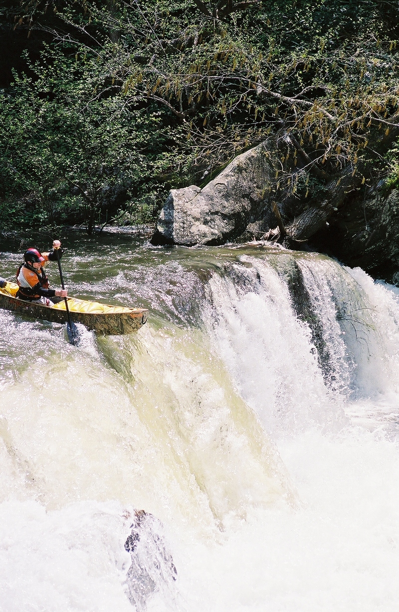
Canoe lining up for the main drop.
Canoer boofing the falls.
Open Canoe Boofing the Big Un.
Brandon Hughett
Oct 14, 2006
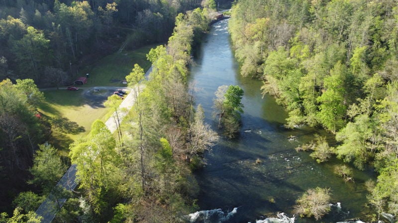
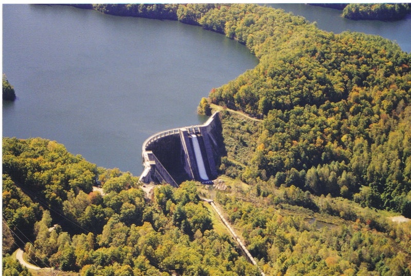
This shows an aerial view of Santeetlah Dam with the low water release that AW worked so hard to secure.
Jeff Macklin
Apr 14, 2006
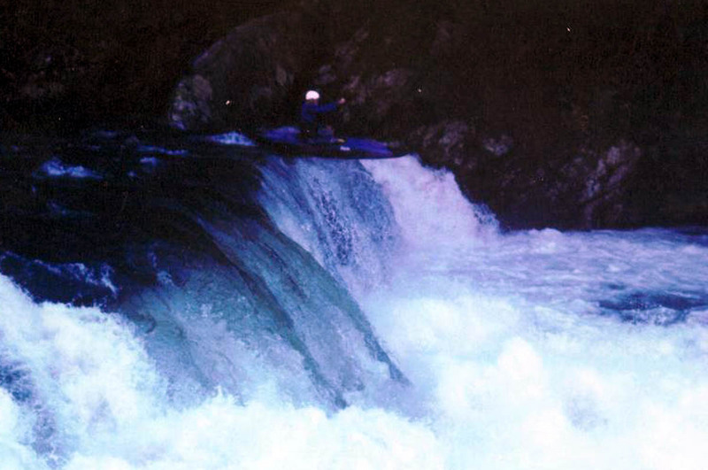
If you piton on the left falls line or hit the wrong spot... ouch!
If you flip on the right line, you might loose some knuckle skin... Mom says, 'wear protection' ;-)
Brad Roberts
Oct 5, 2005
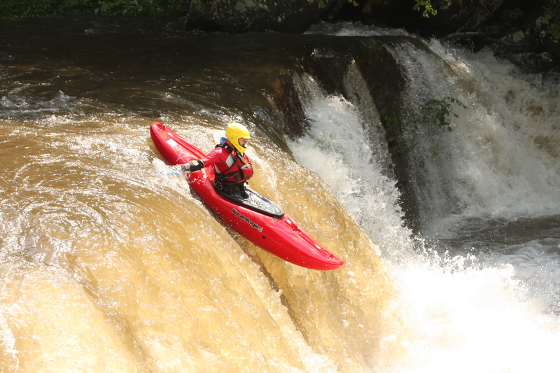
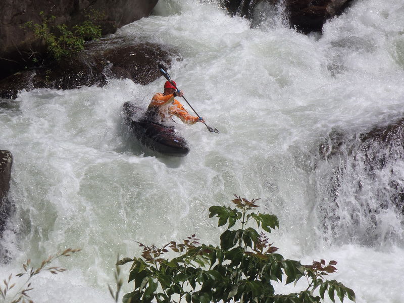
I'd have to call the approach, the falls, and the runout three seperate rapids. With bear creek being the stuff below the falls.
Sutton Bacon
Oct 1, 2005
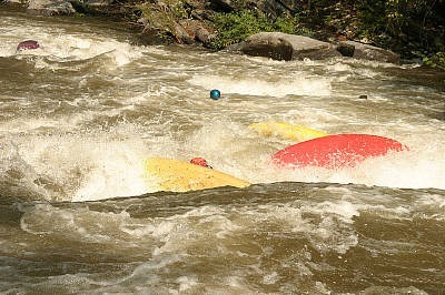
Group carnage in the rapid below the bridge courtesy of the Appalachian Hairboaters Association. Dennis Huntley was the only person left unscathed.
Robert Maxwell
Oct 1, 2005
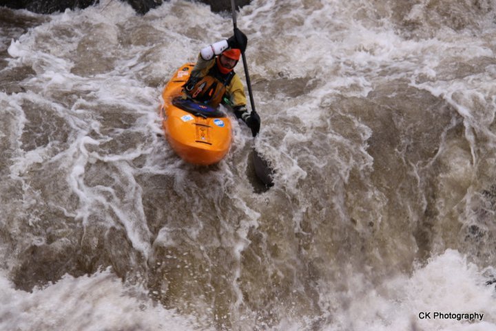
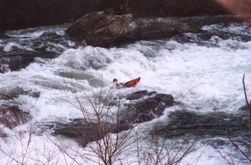
Bear Creek Rapid has several lines to choose from. There's the right ramp, middle creek, waterfall and far left sneak. So, if you are into petoning onto shallow rock or getting worked in a hole, Bear Creek is guaranteed to please.
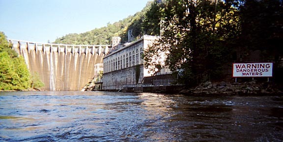
The dam on Calderwood Lake was featured in the movie 'Fugative' starring Harrison Ford. I like the sign better than the movie.
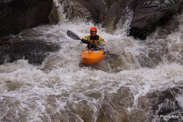
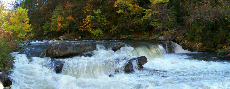
God's Dam is a river wide 4 foot ledge that can be run almost anywhere. There is a fairly meaty hole on the right and rocks on the left. So, somewhere in the middle is the preferred line.
This rapid actually isn't at the put-in, but it is the first rapid of note on the run. It is river wide and usually run straight down the center. At 1150 the hole at the bottom is easy to punch. At 1500 its easy to swim.......
Kevin Colburn
May 8, 2003
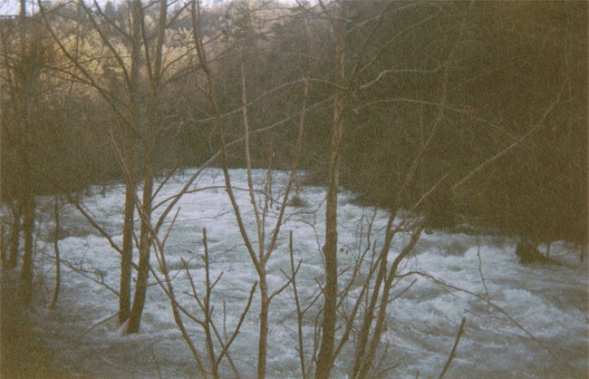
The Cheaoh Peaked at 12 thousand cfs during this uncontrolled spill from Santeetlah Dam. A normal boating flow is around 1,000 cfs, and It has been run at least as high as 3,000. Wow

Kevin Colburn
May 8, 2003
After a 12,000 cfs spill on 5/7/03 big chunks of the road (129) are gone. So while the Cheoah is running 2G and holding (a VERY GOOD LEVEL), there is really no way to access it that i know of unless you feel like running a 200+ mile shuttle! Call DOT before heading out there. It is possible you could run part of the River but just not the whole thing...
Check out a photo... Notice the debris on the road that shows that there were several more feet of water in the river....
Sutton Bacon
Jan 30, 2002
This is the largest rapid on the upper portion of the Cheoah. It comes around the next bend from the lowhead dam beneath the pipe. At this water level, it is a very difficult rapid and one of the few on the Cheoah that are tough to scout from the road. Be sure to scout this one before you launch; otherwise, it may force you to 'takeout' after being thoroughly hammered.
John Gangemi
Jan 28, 2002
Some email reports just in over the
weekend. Thought I'd share with the
paddling world.-JTG
Geoff Kohl comments-
Just ran Cheoah with some other
first-timers on Saturday, January 26,
2002, at around six feet, a level we guess
that would equate to something like 2,700
cfs (it dropped to about 5.4 while we were
on the river). It was big, pushy and
thrilling. The Cheoah is definitely an
instant southeastern whitewater classic.
The big ledge and the area immediately
downstream on the right are the only parts
that seem to start to get troubling due to
the nature of some huge offset holes. The
rapid below Tapoco Lodge (past the bridge)
is worth remembering, well-defined lines
with huge hidden holes at five-and-a-half
feet.
It could definitely go higher than this,
but I don't think any of these rapids will
wash out--they'll just create more monster
holes.
There is one hazard I'd mention, and that
is a set of cables that are in the river
just upstream of the power house (and just
downstream of the below-the-bridge rapid).
Even though I saw them while in an
upstream eddy, I lost track of one
silverish cable and came quite close to it
while paddling downstream. My friend said
he saw black cables in the water too. This
is quite close to the upstream IV rapid
when the water is up, and a paddler in our
group swam just above the cabled section.
Had he not found an eddy, it could have
been a scary situation.
-Geoff Kohl
Scott Hanshaw comments-
Ran it on Sat, Jan 26, 2002. Level was
around 5.5 on the USGS gauge. This
was an unbelievable run! This level is
higher than the test releases, which
made for an incredibly wild ride, But I
can see that at the higher end of
the test levels (900+) This would still be
a great run. A group of us
paddlers from Arkansas would usually make
4+ trips a summer, out east, to
the Ocoee. We have slowed down some in the
last few years because the Ocoee
has lost its 'zip'. If regularly scheduled
releases were set up on this
river, I'm certain we would be road
tripping often. At the release levels
I'm guessing that the play potential would
be excellent. At this level it
was 'hang on to your hat and look out for
the monster holes'. Very Sweet!
I will defiantly be watching the gauges
and when it runs again on a weekend
I will be loading up for a road trip!
Thanks
Keep the rivers flowin'
-Scott Hanshaw
Don Kinser comments-
Ran the Cheoah yesterday at 5.34 feet on
the Bear Pen Gauge (CFS not
available). It was big. There is no way in
hell the section below the bridge
just above the lodge is class 4 at this
level. Much more like class 5+.
Reminded me of Pine Creek on the Arkansas.
It is big, continuous and
unrelenting. Once you went under that
bridge you were committed.
The section above from the little store to
the bridge was outstanding and
totally continuous. Big waves, big holes,
big fun.
There were many people on the river and it
had come down to 5.34 feet from
almost 7 the day before.
Keep up the good work.
-Don Kinser
Kevin Colburn
Jan 28, 2002
The Cheoah got paddled on january 25th, 26th,and 27th at flows ranging from well over 2500 cfs down to 1000 cfs. higher flows were NOT compared to the ocoee, they were compared to the Arkansas Numbers with Pine Creek Rapid at the bottom, like the Lower 5 of the North Fork of the Payette, and like a continuous Lochsa. Even the lower flows were awesome and challenging and aesthetic. The water was clear/blue, the air was 60-70 degrees, the locals were curious and enjoyable to chat with, and the river was incomparable. There is nothing like it left in the Southeast, It is Incredible.
Sutton Bacon
Jan 26, 2002
Not far from the grocery store put-in, the rapids on the Upper Cheoah are some of the most difficult on the river, especially because of the trees both in the riverbed and clogging most otherwise usable eddies. Once you see the water diversion pipe, prepare yourself for the vicious lowhead dam that follows immediately below. At this water level, the dam is difficult to avoid and quite dangerous. Power far right or left over the drop.
This is one of the top drops at Takeout. As you can tell, its difficulty lies in the pushiness of the water, the size of the holes, and most importantly, the TREES! Because of these factors, Takeout at this water level is nearly unreasonable.
This thicket of trees is the only respite between the first part of Takeout and its bottom ledges.
This image gives you a good feel for the middle and bottom part of Takeout. This rapid consists of four mega-holes, several of which are visible here. Complicating matters further, trees stud what would normally have been the main line through this large rapid. The riverbed opens up on the Cheoah significantly in the section following Takeout.
This ledge represents the entrance to Takeout and consists of a nasty riverwide hydraulic. We would have run a sneak river right, but as you can tell, there was a forest in our way.
This is a typical scene on the upper part of the Cheoah. I can't stress the tree-problem enough. They are everywhere!
This is a typical rapid on the middle part of the Cheoah. This middle section opens up considerably from the tree-infested upper part. It's about five miles of rapids like this: big, pushy, very similar to Upper Gauley rapids but much, much more continuous. This section, although difficult, is not as demanding as the tighter upper two miles, largely because of the lack of trees.
The entrance rapid to the big drop on the lower portion of the river is just as difficult as the drop itself. It is very long and pushy, and suprisingly steep abounding with large waves and holes. The horizon line downstream is the big drop. At this water level, hug river right from the very top of the entrance rapid; the left 3/4 of the big drop is not a fun place to be.
This is a shot of the lower part of the entrance rapid to the big drop. Prepare to power far right at this point.
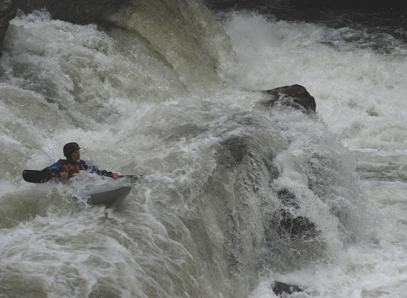
This is the biggest vertical drop on the Cheoah, about 10 feet, found not far upstream from Tapoco Lodge. The lower two miles of the Cheoah drops over 100 feet/mile, which at a level of 6.8 (or around 2600 cfs), represents a whitewater experience not often found in the Southeast.
This is a complicated drop at 6.8 ft. Whereas lines open up far left and center at lower water levels, the only line this day was far right. Most of the water from the entrance rapid above pours directly into the center/left, either place not a pleasant one to be (notice the river left, center, and right-center keepers). This is only the first drop (and easiest) of a rapid that lasts at least another 1/4 mile.
The fun only begins at the big drop. The next set of rapids, combined with the drop, form the most demanding part of the entire river. Continuous Class V whitewater rages through several enormous holes. One of which you can see through the trees here.
This is a photo of the final hole in the set of rapids below the drop. At this level, they combine to form one HUGE rapid. This particular hole can be found at the bottom of the righthand channel and was the subject of lots of scouting that weekend.
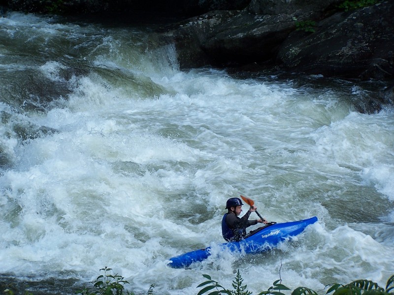
The rapid alongside Tapoco Lodge is one of the river's best; it funnels into a great playspot almost parallel to the lodge. Below it, enormous waves continue until under the bridge.
After the river crosses under the bridge, it drops into a steep, beautiful mini-gorge that rushes into the lake about 2/3 mile from here. Strong rapids continue all the way to the lake and alongside them, several outstanding playspots.
Michael Brown
Jan 1, 1900
Mike running the big un
Rapid right above the big un
A little carnage at the big un
Above the big un
Robert Maxwell
Jan 1, 1900
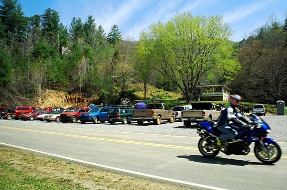
O'Henry's private put-in is across the street from O'Henry's private parking area. (Funny how it works out that way.) There are several local business men trying to make a few bucks on the Cheoah WW releases. Although there are free options along the river, sometimes its a good idea to pump a few bucks into the local economy. Besides, O'Henry is a very friendly guy......lets keep him that way.
O'Henry's is a private parking area just downriver of the store. For a few bucks you can park on his property, buy a river pass, use his put-in, port-a-pot and he'll watch your car all day. There's even a shuttle service. Although there are free options along the river, sometimes its a good idea to pump a few bucks into the local economy. Besides, O'Henry is a very friendly guy......lets keep him that way.
O'Henry's is a private parking area just downriver of the store. For a few bucks you can park on his property, buy a river pass, use his put-in, port-a-pot and he'll watch your car all day. There's even a shuttle service. Although there are free options along the river, sometimes its a good idea to pump a few bucks into the local economy. Besides, O'Henry is a very friendly guy......lets keep him that way.
Michael Tavares
Jan 1, 1900
First Group down the river riding the surge on the second release, Sick Bra
Boyd Ruppelt
Jan 1, 1900
when you see a horizon line below God's Dam, and a big rooster tail over a rock pile downstream...be carefull... a sieve is in those rocks! just fyi... It's definitely something to avoid... this shot was takin' while the water was going down. A girl I know found it the second release weekend...Not hard to avoid, but something to be aware of...