| Difficulty | I-II |
| Length | 9.9 mi |
| Avg Gradient | n/a |
| Reach Info Last Updated | November 7, 2021 |
River Description
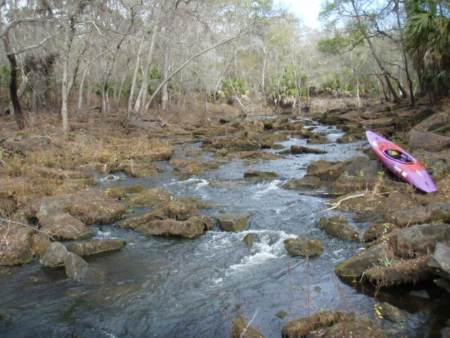
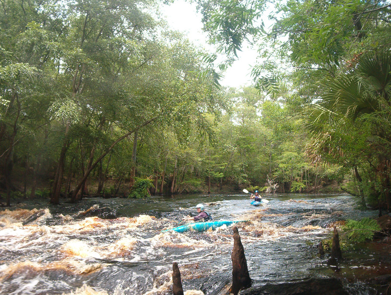
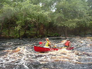
There are about 5-6 sets of shoals on this run including Big Rapid, a cranking Class II and Florida's second-biggest rapid. All of these are easily navigated, though inexperienced boaters should scout Big Rapid. The rapid is commonly known as Lost Dog Rapid (because of the tendancy of lost hunting dogs to show up here). It is possible to drive to Lost Dog Rapids.
The gauge station (indicated at the take-out) is long gone. This take-out is called the Burnt-Bridge take-out, and is about 150 yards upstream from the remains of an old bridge, though all that is left of the bridge are the abutments.
Use the USGS gauge at Lamont: Aucilla at Lamont
Lost Dog Rapids is best near flood level. It's an easy rapid with little maneuvering needed. It's easily scouted/portaged from the left bank where a well-maintained section of the Florida Trail runs along the river. At higher levels surfable waves will be present, but resist the temptation to surf without a helmet, as a couple of 'got ya' rocks of sharp, fractured limestone are concealed in the right of the wave train. (In a normal run down Lost Dog Rapid, you'll be well to the left of the sharp rocks.)
Less experienced paddlers will be more challenged by an S-turn about four miles into the trip than they will be by Lost Dog Rapids, which is easily portaged, while the S-turn is not. Every few years, the remains of a boat will be found wrapped around a cypress tree at the bottom of the S-turn. To avoid mishap, paddlers should hug the inside of last turn. At flood levels, water flows over the middle and lower part of the S-turn through trees and brush, creating potential entrapment hazards.
It is not clear if trot-line fishing remains legal on this section of river; it has been in past years. Regardless, lines tied to tree limbs should be left alone as you will find fishhooks at the end of them.
Access to this section of the river is not as eas
...River Features
Put In
Access PointDistance: 0 mi
Take Out
Access PointDistance: 6 mi
Trip Reports
Log in to add a reportCG
Scouting Trip - caleb gibson
Nov 22, 2024
Went to float the Aucilla, River levels looked great, but the other person in my party wasn't able to get up the take-out due to hip problems. Put in at Reams landing was obviously good, its the only paved ramp in the area.. Jones Mill Creek access on east side of river was inaccessible due to trees down, End of Trail take-out was doable for most, just one big step up to drag the boat thru.. Will try to plan another trip soon, as its one of the few rapids in the state of Florida.. I'm including pics of the map from florida department of enviromental protection and pictures of the take-out at End of Trail..
Oh and if you use River gauge at Lamont you want it to be atleast 48' but below 54'. The river on this day was 50.4'
DK
Donald Kelly
May 12, 2017
Photo taken 1/9/12 to demonstrate how small gauge changes have major impacts. Minimum recommended is 48'