Salmon
2. Wilderness Trailhead to Arrah-Wanna Road
| Difficulty | II+(III) |
| Length | 5.4 mi |
| Avg Gradient | n/a |
| Gauge | Sandy River Near Marmot, or |
| Flow Rate as of 37 minutes | 371 cfsbelow recommended |
| Reach Info Last Updated | February 8, 2024 |
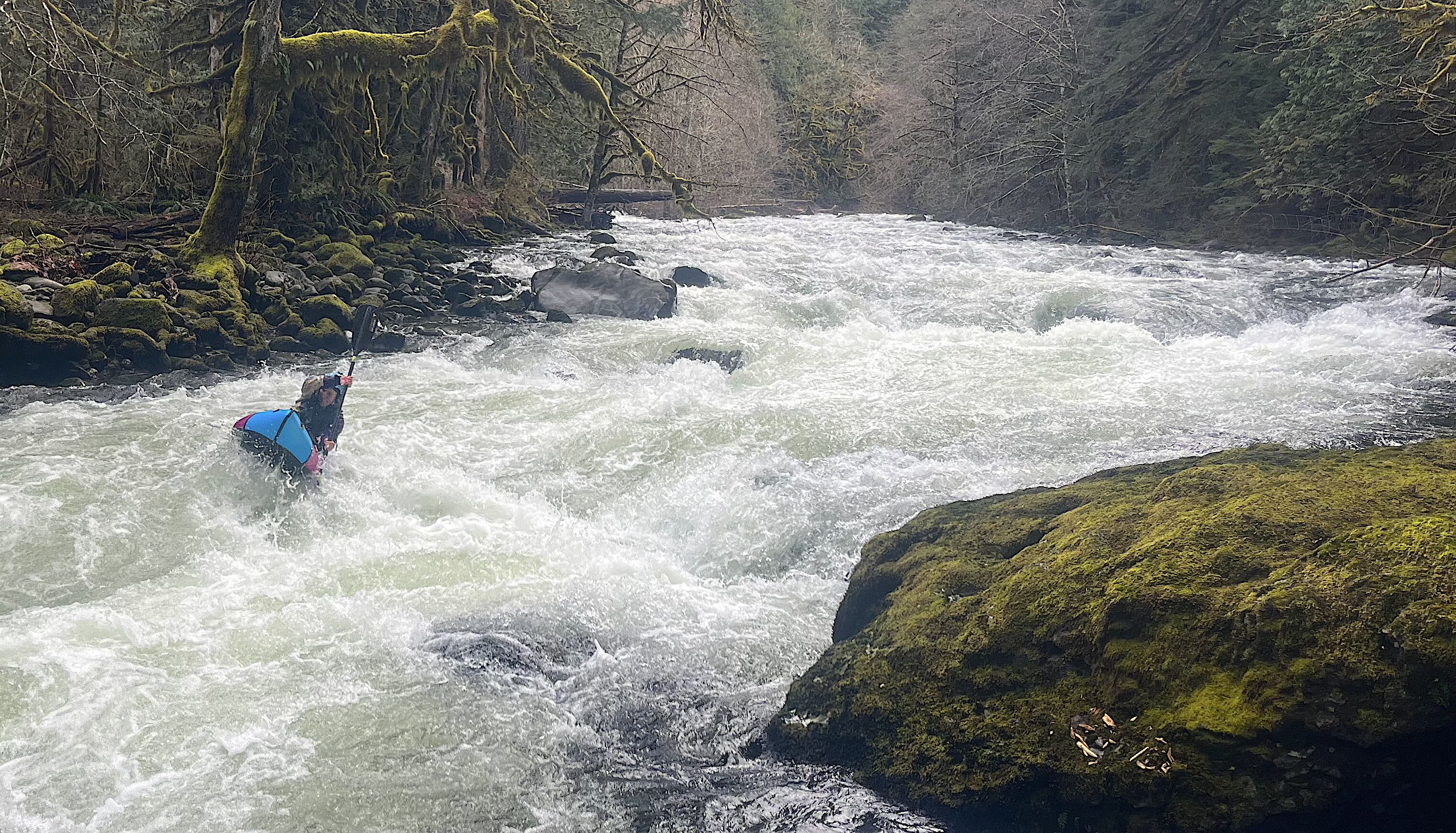
This is a beautiful class II-III run, flowing down the flanks of Mt Hood. The largest rapid (III-III+) is Taffy Puller, which is run down the middle. Wood is usually present, but does not often require portaging. Downstream visiblility is typically adequate to see any wood hazards with time to grab an eddy. For runs fitting this description, stick to the recommended flows.
If you are interested in more excitement, just add water. Some locals with previous knowledge of the run don't consider the Salmon at ideal flows until it hits 4k on a rise. It can be helpful to have someone who knows where the eddies are at those levels. The high water limit on this run is less about the whitewater, and more about when wood starts moving around, which is usually at about 10k on the Sandy @ Marmot Gauge.
The Salmon also gets paddled at low water (down to around 1,000 cfs) by locals desperate for a paddle, but at those levels is best described as a more engaging alternative to walking the Salmon River trail.
Boaters looking for a full day will often continue down the Sandy River to the Sleepy Hollow Rd bridge, or even beyond.
Feb 8, 2024
3,000 cfs on the Sandy Near Marmot gauge equated to a friendly and fun medium flow. The Brightwood Loop bridge gauge was at 5'.
The only notable wood was the old growth log visible from the Salmon Slab that has been there for many years, we were able to duck under it on the right. There was a riverwide tree just a couple seconds downstream that seems more temporary, we went over it on the right.
Feb 11, 2019
I was going off memory, and spaced-off the big (5' diameter) log about 1.5 miles down from put-in. We ducked it at a low-medium so didn't register with me. Reports say it is still there and makes the upper part of this section unrunnable in a practical sense for cats/rafts at any flow because of lack of portage options and no good access downstream of it. At higher flows it creates a serious hazard. Recent look by a friend says there is also other wood scattered around in the river in the vicinity of the climbing wall. Sorry for misleading original post.
Feb 4, 2019
11/29/2017 Ran from Wilderness Trailhead to Arrah Wanna bridge, level 2200 Sandy at Marmot, low side of medium. Totally clear of wood, run took 90 minutes.
