Potomac, North Branch
5. Bloomington, MD to Black Oak (Gary Yoder River Access) Nr. Rawlings, MD(Westernport/Keyser Section)
| Difficulty | II |
| Length | 12 mi |
| Avg Gradient | 20 fpm |
| Gauge | North Branch Potomac River at Luke, Md |
| Flow Rate as of 49 minutes | 336 cfsbelow recommended |
| Reach Info Last Updated | May 13, 2026 |
Ed Evangelidi: This stretch (which starts at the Bloomington MD take-out for the Barnum to Bloomington section) is a nice Class 2 section that is rarely paddled since early in the run, you have to portage the Paper Mill dam on river right, then paddle by the huge monstrosity that is the paper mill. But the river entertainment continues all the way to Keyser
Portage the dam at the paper mill in Luke, MD on river right.
The Dam portage and the ugly stretch of river around the abandoned paper mill can be avoided by putting in 2.1 miles downstream at Westernport, MD or 2.0 miles downstream at Piedmont, WV. This run can also be shorted at the bottom by approximately 4 miles by taking out under the bridge on Potomac Dr. at Keyser, WV.
The shuttle from Westernport MD is to take MD 135 east 5 miles to US 220 north for 3.5 miles to the Gary Yoder (Black Oak) river access for a total shuttle distance of 8.5 miles one way. One weirdness on the reverse shuttle is that the signs on US 220 south towards MD 135 west to Westernport direct a left turn onto an older road that goes under US 220 and joins MD 135 west without approaching the bridge over the Potomac to Keyser, WV. You should take this turn, but if you miss it, there is another opportunity to turn (right this time) onto MD 135 after the Chat and Chew restaurant and a gas station but before the bridge. Total shuttle distance is the same.
Lat/longitude coords are approximate, from TopoZone.
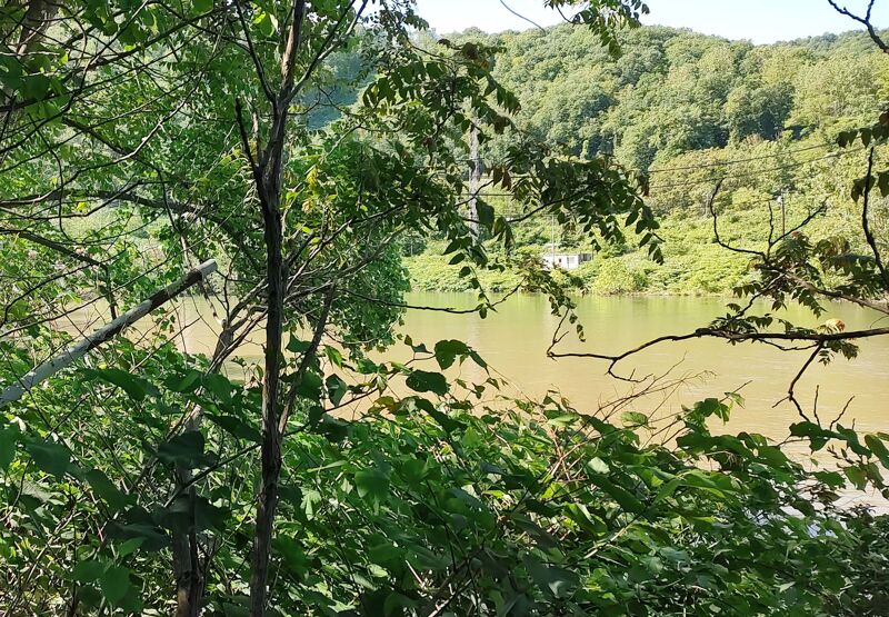
A less common Put-in at confluence of Potomac River and Savage River from Maryland side. The Westernport put in (2.1 miles downstream) or the Piedmont put-in (2.0 miles downstream) are generally more popular put-ins because portaging the Dam is avoided and the section of river between the Savage /Potomac confluence and Westernport runs behind the closed paper mill and is industrially ugly.
Portage this low head dam on river right.
Directions: US-220 south from Cumberland, turn right on MD Route 135, follow it to Westernport. Take the bridge on the left and cross the river into Piedmont, WV Turn right onto 3rd Street. From 3rd Street make the second right onto Jones Street and follow it down to a parking area along the river.
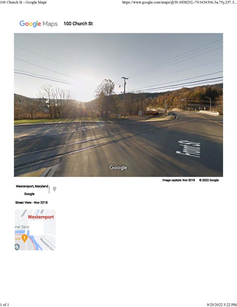
Directions: US-220 south from Cumberland, turn right on MD Route 135, follow it to Westernport. Turn left onto Maryland Avenue. The soft access site is located on the Eastern side of the Rt. 46 bridge along Front Street in Westernport, MD at the junction of George's Creek and the Potomac River Bridge. This Maryland side put in is in the middle of Westernport on a small gravel road right next to the railroad on the river side. Kind of hard to see, but it is directly across from the Subway. Put-in parking is somewhat limited. but additional parking is available at the lot on the corner of Clayton Street and Rt. 46. The gravel road is not great for long vehicles, or vehicles with low ground clearance. Vessels must be carried a short distance from the parking area to the water. This site is for non-motorized vessels only. You may want to park in the Subway parking lot and scope it out before you commit to it, as it can be confusing.
Westernport Rapid is just below the Piedmont Bridge and the Westernport river access. The plan here is to stay right and avoid tree branches.
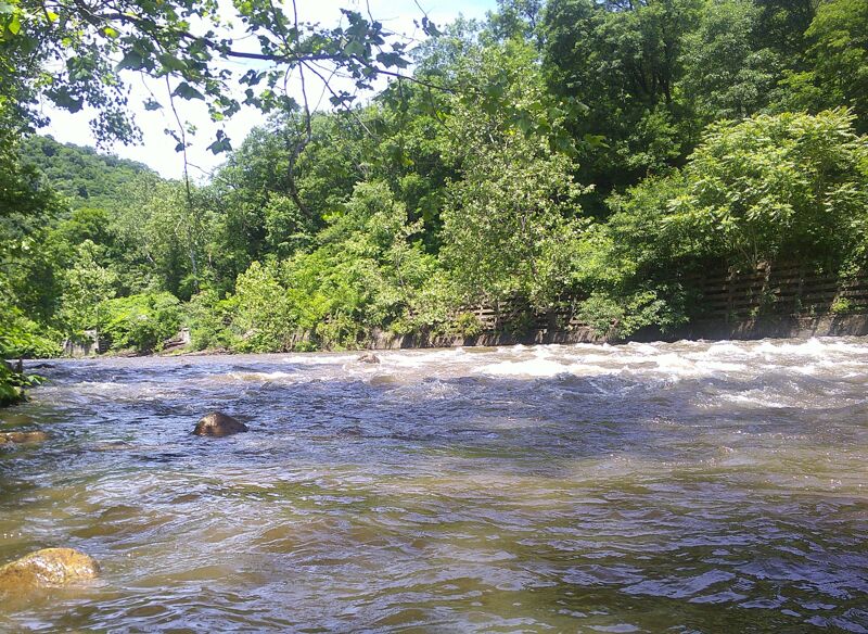
AKA 'Stoney Run' rapid. The river makes a hard right hand turn against a concrete wall on river left that contains a culvert for Stoney Run and which supports the road (MD 135) and the railroad siding that connects warehouses in Luke, MD to the B&O mainline at 21st bridge. Set right angle to make the right turn, then there are a couple of ledges generally run in the center. Class II at 1,000 cfs or lower; might be higher classed at higher levels.
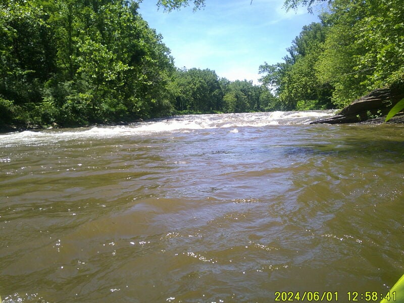
Take the left channel (the right channel just shoals out). The river takes another right turn against the left bank and because it shoals up to the right, you can't just sneak the right side. There are two ledge holes against the left bank to avoid, but which also may be playable. Start left, but set a line to the right to avoid dropping into the holes, finishing the rapid in the center. Class II+ at 1,000 cfs, but maybe class III or more at higher water levels. This rapid is named for the late Kelly Day, who liked to work those features. It is unclear whether the preferred name is Kelly's Hole or Kelly's Ledges; so best call the rapid 'Kelly's'.
McCoole Boat Access - Maryland side. Directions: Take US-220 south from Cumberland. Turn right onto MD Route 135 and proceed for approximately 1 mile. A gate on the left side of the road marks the entrance road which leads to an open, grassy field with parking for cars or trailers. The turn into the boat access is hard to see from the road until you're on it. The gravel road into the boat access is badly washed out and not good for vehicles with low ground clearance.
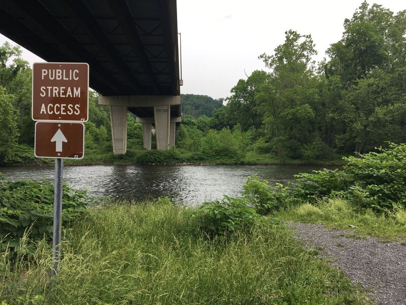
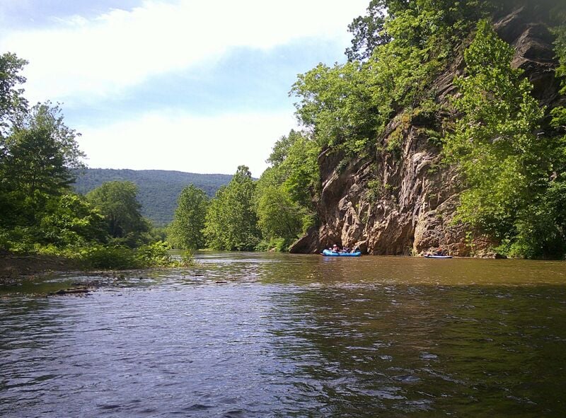
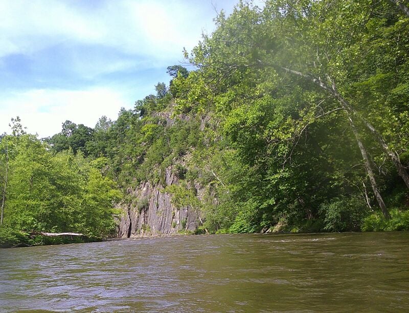
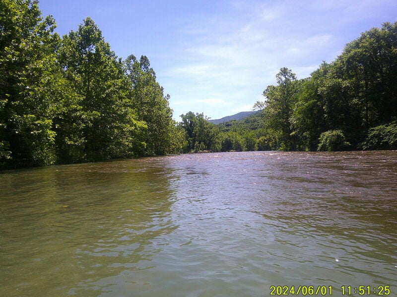
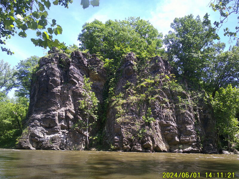
Keyser North Branch Public Stream Access - West Virginia side. The bridge passes over Keyser WV (US Rt 220). Going South on 220 pass over the bridge and take an immediate right (ramp) towards the Martins Supermarket - stay on this road and cross under the US Rt. 220 bridge and then turn left on N. Main St, cross RR tracks and follow to the end. At the end, turn left on Potomac Dr. A Parking pad and the Put in is directly under the bridge. The Scenic portion of the run begins below Keyser WV starting with Queen's point overlook on the Maryland side (river left) which continue with several rock outcroppings, some of which extend down to the water on the West Virginia side (river right). The rock outcroppings extend along the ridge on the West Virginia side extend for the next 4.4 miles - almost all the way down to the Gary Yoder river access take-out.
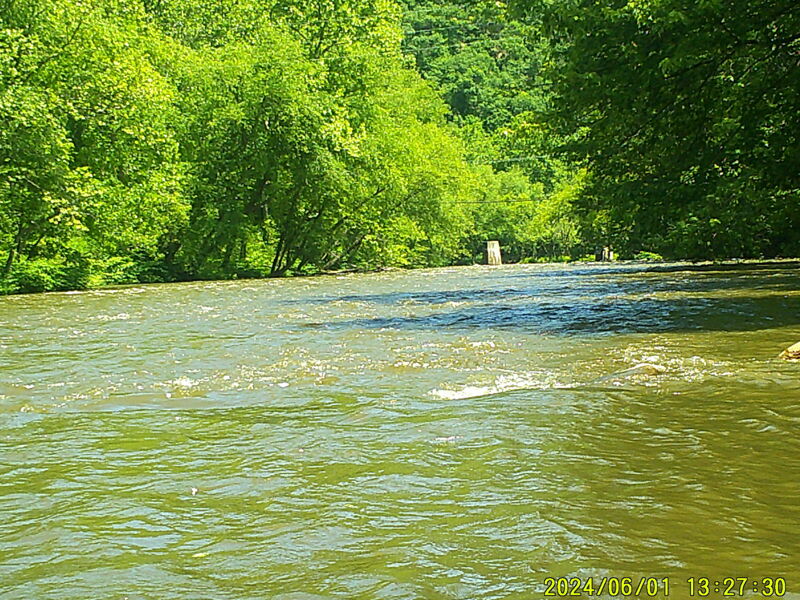
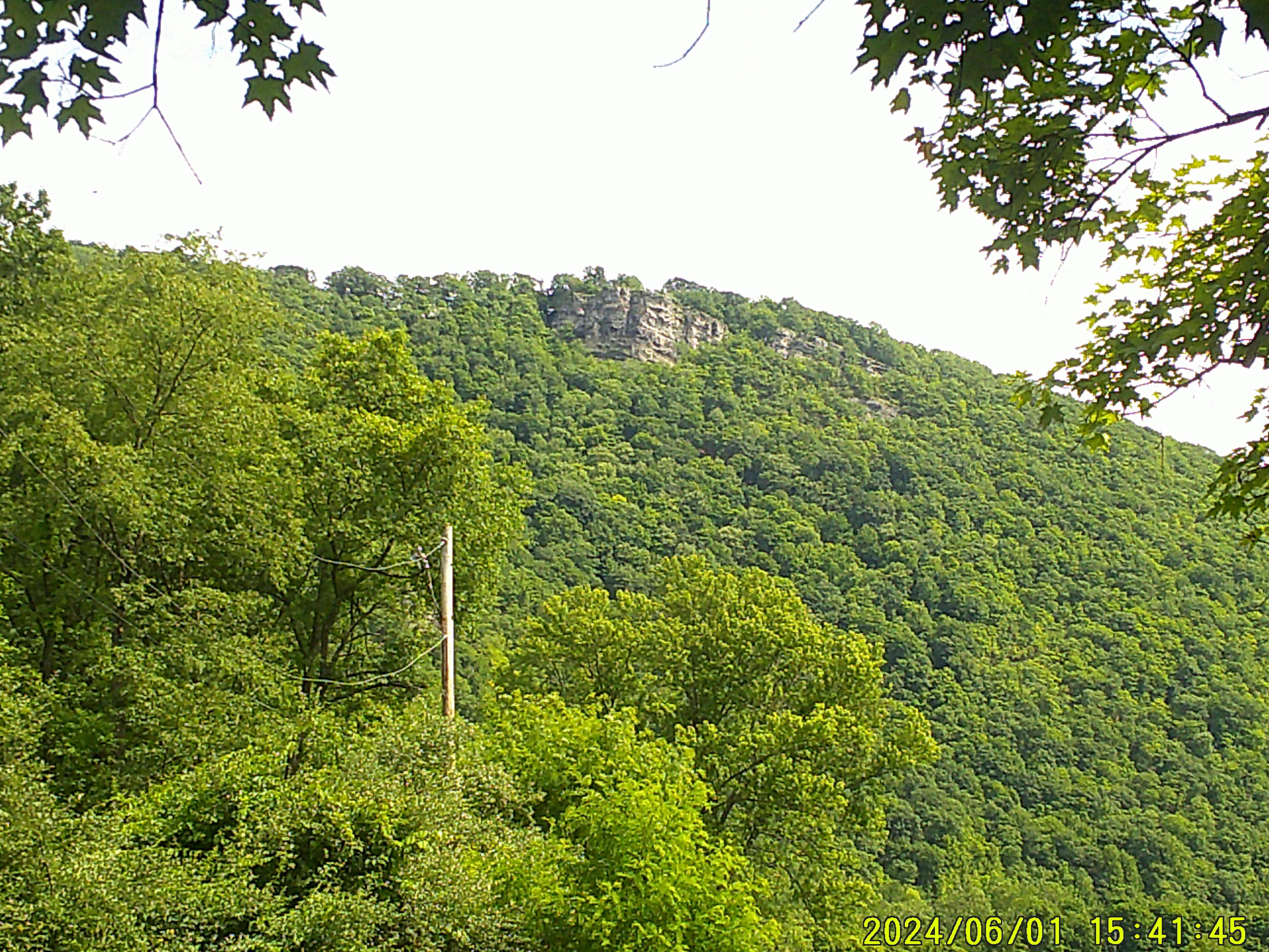
Below the Keyser River access there are some old bridge pilings. The river briefly picks up some gradient here and there are some rocks to avoid, but the run is generally in the center. This is the last notable rapid on this section of river, the gradient becomes noticably flatter. At the bottom of this rapid, if you look up the hill on the river left (Maryland) side, you can see the Queen's Point Overlook.
Very easy rapid against a rock formation on river right.
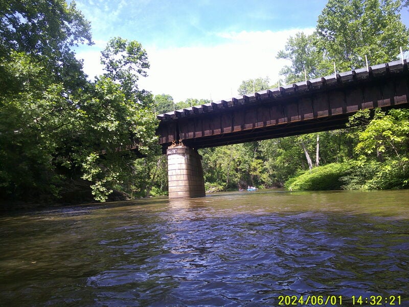
No rapid. The main through railroad (Chessie System) crosses the river (& Maryland/West Virginia State line) at this point. Named 'Western Maryland 21st bridge' because is bridge is 21 miles upstream from Cumberland, MD.
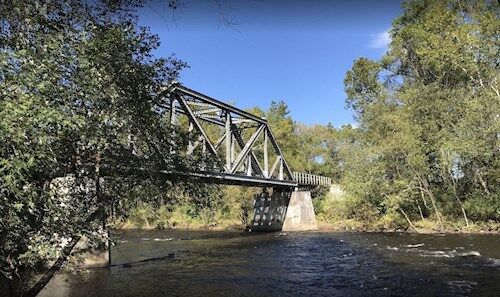
The takeout - Gary Yoder Soft Launch, locally known as Black Oak Bottom, is just above the private bridge - river left - Maryland side. The take-out can be hard to see from the river, but it is just above the bridge. Directions: The Black Oak boat access is located on the Maryland shore just upstream of the Black Oak trestle bridge at Dawson. To reach the ramp, take Maryland Rt. 220 South to Black Oak Road. Cross the railroad tracks, take a right, and then an immediate left. The turn from US 220 is across an unprotected active railroad crossing - be sure to look both ways before you cross the railroad tracks. Park in the open, grassy field and carry your boat to or from the river. There are great fisheries along this stretch of the river. This site is for non-motorized vessels (canoes and kayaks) only. There is a picnic table on location. The site can be muddy in wet weather and there is a gravel road down to the ramp. Please beware of the sometimes slippery riverbank and poison ivy.
Jul 8, 2019
Great class 2 trip since the paper mill has closed! The water quality is so much better! I never would have ran it before when I used to live there. Thinking about taking a trip there tomorrow while it’s running!