| Difficulty | V+ |
| Length | 3.2 mi |
| Avg Gradient | 80 fpm |
| Gauge | Blackwater River at Davis, Wv |
| Flow Rate as of 54 minutes | 30 cfsbelow recommended |
| Reach Info Last Updated | July 21, 2025 |
River Description
For a low water video of Red Creek featuring the ZoneDogg and most of the named rapids, check out this link.http://www.youtube.com/watch?v=lBEBhCXLUEk
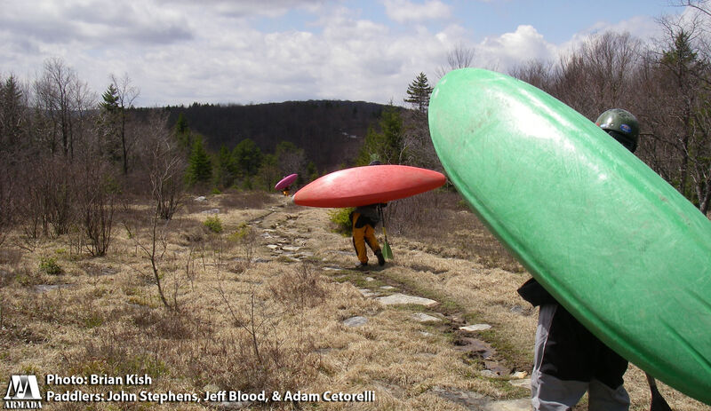
Red Creek is one of the prettiest and most remote runs in West Virginia. The gradient is very steep and there are several slides, cascades, and falls. The riverbed is unstable and loose so the run changes often after high water. There have been several changes since the hurricane of 2003, most for the better. However, a lot of new trees have fallen due to the storms of 2012 as well. Be on the lookout, there are strainers everywhere! The 2 mile hike at the start and the length of the run causes endurance to come into play. Those who are in shape and possess the skills to do the run are going to have a spectacular time!
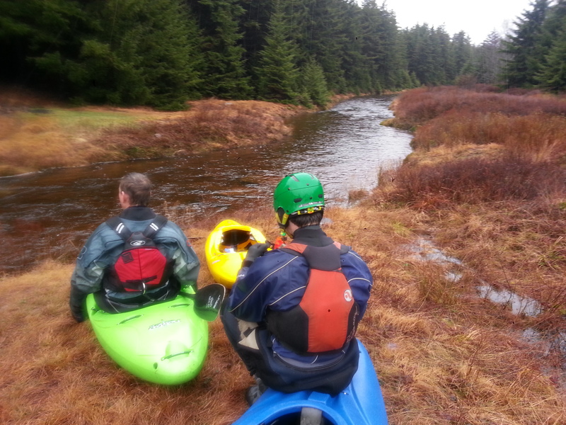
There are two ways to access the creek via the Blackbird Knob Trail. The most popular is from Red Creek campground in the Dolly Sods. This puts you on Alder Run, a small tributary. Hike along this creek for a mile or so (paddling through the forest can be fun but generally more trouble than its worth). Eventually you reach the confluence with the main branch of Red Creek. This is when you get an idea of the flow. Local judge the level based off some of the rocks on the beach here. The first 2 miles of Red Creek are relatively easy, flowing over continuous small rapids and slides, but it is junky and there are some surprises, including the 'Pincushin' rapid. As you approach the steep section, the slides will get longer and then you will see a major tributary come in on the right. This is the Left Fork, and if you hiked in from Timberline this is where you join the main fork of the creek. This is also where the good stuff starts.
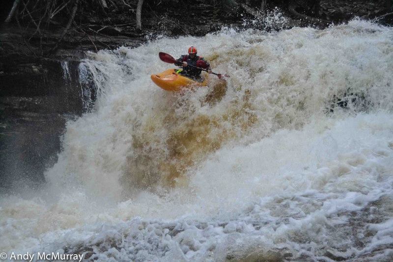
1st big Slide- Not far below the confluence, after a warm up slide you come to a large horizon line. Here the creek cascades 20-30 feet over a smooth slide lasting about 100 yards. Be prepared to get som
...River Features
Put In
Access PointDistance: 0 mi
Take Out
Access PointDistance: 3.24 mi
Trip Reports
Log in to add a reportDF
New video - Red Creek Sessions 7-18-2022 - David Fielding
Jul 19, 2022
Dumpster Fire Road Trips posted a new video to YouTube, a well-produced mini-doc you gotta see - https://youtu.be/c6A4Qx7wUh0
EB
Eric Brooks
Dec 9, 2014
Since we were staying at Old Timberline (behind the gate), we were able to hike in via the Valley View trail at the top of the hill (next to Timberline). The hike was easier than coming in the traditional way (via Red Creek Campground) and took us about 35 min of mostly downhill (trail 511 towards Blackbird Knob). We put on the Left Branch of Red Creek and were able to paddle the full way down to confluence which (took about 35 mins). The Left Branch was very low and scrappy but never got out of boat and no real wood issue. Once we joined main flow - all was good.