| Difficulty | II-III |
| Length | 5.2 mi |
| Avg Gradient | 65 fpm |
| Gauge | Greenbrier River at Buckeye, Wv |
| Flow Rate as of 40 minutes | 2.31 ftbelow recommended |
| Reach Info Last Updated | October 1, 2008 |
River Description
The East Fork is considered the mainstem of the Greenbrier River.
Lat/longitude coords are approximate, from TopoZone.
River Features
Put In
Access PointDistance: 0 mi
Take Out
Access PointDistance: 5.1 mi
Trip Reports
Log in to add a reportLS
Lee Scott
Aug 30, 2013
Take out before Greenbrier. Some books say it is a short paddle back up to the main bridge; however, if the forks are up, the current is very strong. It took me over an hour to eddy my way back up!
FC
Fritz Crytzer
May 19, 2003
13 Apr 03: Great run, but definitely need to catch it with a decent water level. If it looks like it will float a canoe at the low water bridge on Forest Service Road 51, then it should work. Watch out for fallen trees! There is a good camping spot at the low water bridge. Fritz Crytzer
SZ
Stephen Zerefos
May 15, 2003
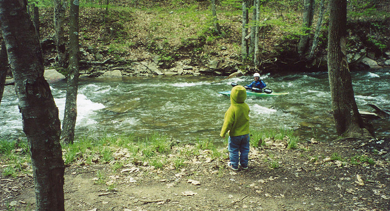
Paddling past my son, Kenny, at our campsite at Island Campground (a FREE campground!)