Canyon River (Satsop trib.)
FR 2260 to Cougar Smith Rd.
| Difficulty | II |
| Length | 13.2 mi |
| Avg Gradient | 20 fpm |
| Reach Info Last Updated | November 17, 2019 |
SEASON: November to May
DESCRIPTION:
A few class II rapids. Be aware of trees.
lat/long approximated by Tiger map server
for additional information see
Korb, G. 1997. A paddlers guide to the Olympic
Peninsula. third edition..
local expert: Gary Korb & Carol Volk, 4930
Geiger Road, Port Orchard, WA 98366, 206-876-6780
Nov 17, 2019
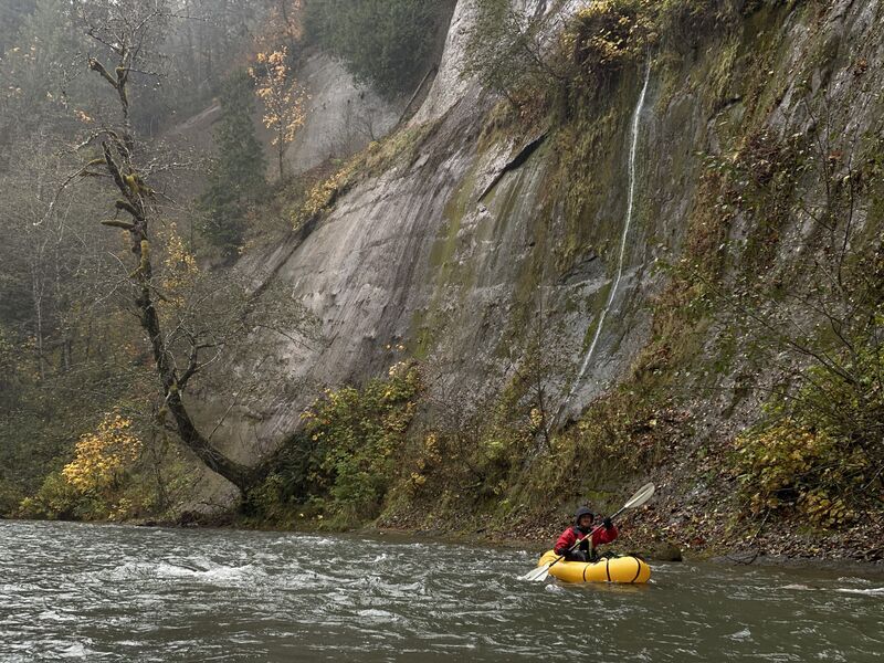
Did this with packrafts and a bike shuttle up the Shaffer Grade. Put in at old bridge site at RM9 and floated to Cougar Smith Rd. The lower 4 miles of Canyon were the most scenic. GPS said 13 miles in 5 hrs. Satsop gauge was at 2200cfs.
Feb 19, 2007
If you're looking for something a bit different and longer than your normal class 2 run then this might be the ticket. The heavy rains of the 2006-2007 season have left this run in relatively good shape. As is typical with any Olympic Peninsula river, wood is an issue. But thankfully the only wood encountered that required portaging and/or technical boat handling occurs before entering the canyon on this run (~first 4 miles) in the braided channel portion of this run.
You'll know when you are entering the canyon as a very large water fall will appear through the trees on river left and a large cliff comes out of the water. From here down the scenery gets better and better. Moss covered trees and more green than you could ever imagine will surround you. To add to this the water is absolutely clear and is fed by countless springs coming from either side. While not technical in nature, opportunities do arise for the occasional surf on one of the many small wave in the canyon. The overall geology is sandstone, with some very interesting rock formations and lots of clay in the upper portion of the reach.
Upon reaching the confluence with the West Fork Satsop, take a moment to look around. You'll also notice the water gets much greener at this point. Where these 2 rivers meet is truly one of thos special places. From this point you have about 3.5 miles to the takeout.
If you head out, a minimum of 500 cfs is recommended otherwise you'll be scraping or carrying more. And plan for a full day and arrive early. The shuttle is long (~25 miles one way) so plan accordingly.
All in all a nice wilderness style river for the class 2 paddler and/or those wanting something easy and long.