Potomac, S. Branch
5. Big Bend Campground to S. Grove St., Petersburg WV(Lower Smokehole Canyon)
| Difficulty | I-II(III) |
| Length | 15 mi |
| Avg Gradient | n/a |
| Gauge | South Branch Potomac River at Franklin, Wv |
| Flow Rate as of 29 minutes | 1.80 ftbelow recommended |
| Reach Info Last Updated | July 3, 2025 |
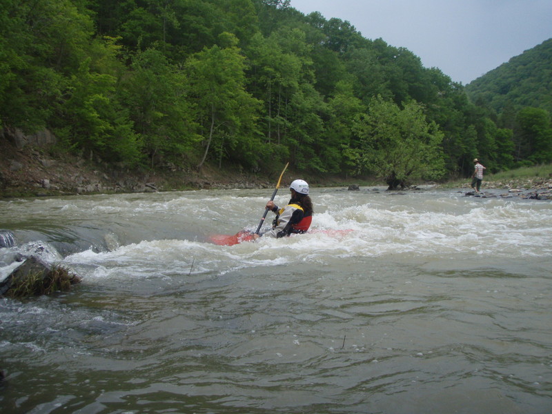
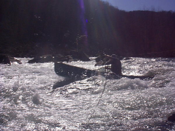
Most of the rapids are straightforward gentle drops over gravel and cobble bars. The most vigorous drop is called 'King Queen Jack' (III-) and is usually run right or right of center. The rapid was formed when part of the canyon wall on river left fell into the river. The old scar is visible high on the mountain for a considerable distance upstream. This is the reason for the alternate name 'Landslide', but some people find this confusing because of another 'Landslide' rapid on the Upper Smokehole Canyon.
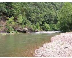
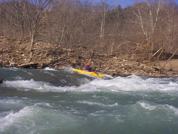
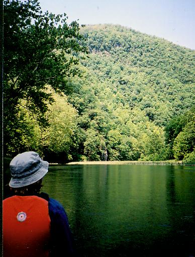
It is a beautiful river, with steep canyons walls, usually remarkably clear water, great vistas, and fun shoals and riffles. It is often done as an overnight trip When there's enough water, this section is suitable for canoers and beginning kayakers who have competent eddy turns in their bag of tricks.
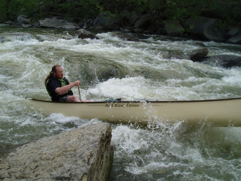
The remains of the old Royal Glen Dam is below the confluence of the North Fork. It is easily runnable in breaches far left (easiest) and center.
The earliest take-out is shortly below here on river left and is accessible from WV 28/55 (turn-off near state road maintenance garage) via River Road (CR 28/1).
Take-out - Petersburg, WV. A few hundred yards further down the river past the 220 bridge, on river left, is a gravel lot for boaters, along with an access ramp.
Lat/longitude coords are approximate, from TopoZone.
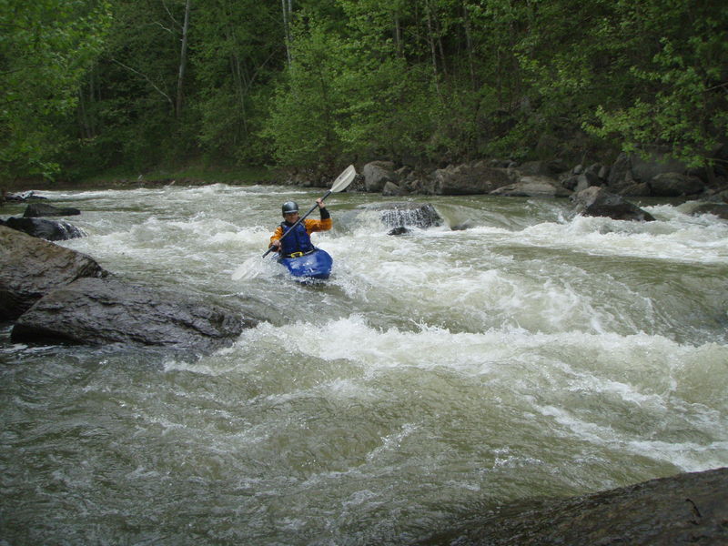
'King Queen Jack' Rapid - AKA 'Landslide', AKA 'The Falls'. The most vigorous drop is called King Queen Jack (III-) and is usually run right or right of center. The rapid was formed when part of the canyon wall on river left fell into the river. The old scar is visible high on the mountain for a considerable distance upstream. This is the reason for the alternate name 'Landslide', but some people find this confusing because of another 'Landslide' rapid on the Upper Smokehole Canyon.
Royal Glen Dam remains - The remains of the old Royal Glen Dam is below the confluence of the North Fork. It is easily runnable in breaches far left (easiest) and center.
Take-out is shortly below the Royal Glen Dam on river left and is accessible from WV 28/55 (turn-off near state road maintenance garage) via River/Royal Glen Road (CR 28/1).
Take-out - Petersburg, WV. A few hundred yards further down the river past the 220 bridge, S. Grove Street, on river left, is a gravel lot for boaters, along with an access ramp.
May 27, 2025
I just wanted to alert people that the access on river right just past the US 220 bridge is now off-limits; there are no signs on from the water, but coming from the road, there are signs warning that this take-out site is for official use only. I'm sure a lot of people on here are aware, but if you're a first-timer, heed this warning.
I did my research for a Smokehole trip using this site (which I love, of course) and the statemnent 'there is also a public boat ramp site on river right accessible from US 220 via CR 220/2,' viewed in conjunction with satellite imagery from Google Maps where the gravel road down to the river is clearly visible, led me to assume that using that access point would be just fine.
We dropped our vehicle in the Petersburg municipal lot across the bridge (paved, with parking lines, also very evident in satellite imagery) without bothering to check on the access across the river. When my brother went to fetch his vehicle at the end of our trip, he realized that there was a problem, but by then the canoe was already unloaded, so we decided to just try and skedaddle out of there quickly. We did not move quickly enough - a WV state official showed up, and although he was kind enough to listen to our explanation and not write us a ticket, it was not an ideal situation. He also showed us a (fairly new-ish, I think) gravel lot for boaters, along with an access ramp, both on river left a few hundred yards further down the river past the 220 bridge. Use those to avoid trouble.
Jun 2, 2020
I'm not sure why the Landslide rapid is included in this description, since it is miles upriver from the put-in at Big Bend. The trickiest rapid encountered along this stretch is 'King Queen Jack', which is a joyful and swift ride roughly at the trip midway point. I say this, but since last year a memorial plaque to a paddler has gone up on a tree near the end of the rapid. There are generally large wave trains, especially in the last 2 miles, that seem to not get the mention that they should. The old Royal Dam seems best run left with no problem for my inflatable but will turn an open canoe into a bathtub if not done well. I ran it at 2.33 and it was boney but doable if you don't mind getting out and walking a half dozen times. I ran it again at around 2.75 and that seemed to be perfect. Do not park at the public fishing access site (takeout) or you are likely to get towed, despite the signage being unclear. Park across the street in the municipal lot mentioned elsewhere.
But yeah, both the overall trip description and the pictures mention Landslide rapid, and that is NOT the same as King Queen Jack. Landslide is only in the upper canyon, within half a mile of the first pullover/put-in when you turn into the canyon. The lower run starts many miles past Landslide.