Straight Fork
Round Bottom to Raven Fork
| Difficulty | III-IV |
| Length | 5.2 mi |
| Avg Gradient | 136 fpm |
| Gauge | Oconaluftee River at Birdtown, Nc |
| Flow Rate as of 1 hour | 332 cfsbelow recommended |
| Reach Info Last Updated | January 3, 2025 |
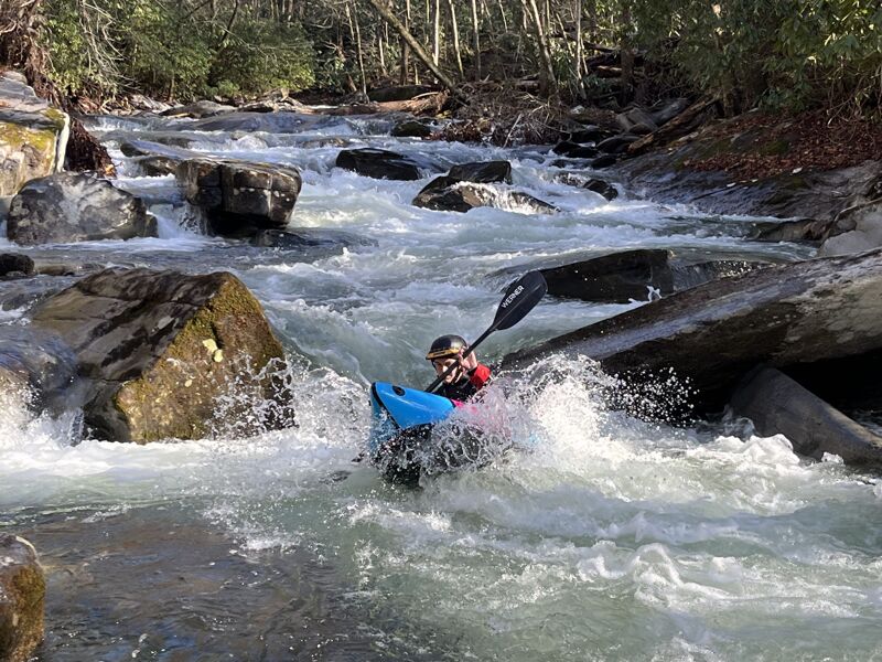
This is a great intro to creeking run. Its fast, semi blind in places, and non stop for 4 miles. The run can be thought of as one long non-stop rapid, with the occasional small eddy. The whole run is roadside which makes for easy scouting and portaging. Taken individually, none of the drops are any harder than class 4-, but due to the non-stop nature and occassional strainer the creek feels like its Class IV. Lots of back to back boulder drops. There are also two good sized ledge drops.
This may be a restricted run after it enters the reservation, as it's takeout is in the Cherokee Qualla Boundary. The majority of the run is in the Great Smokey Mountains National Park, and taking out at the gated park boundary is a good option.
Be aware that the park service does lock the gate from time to time - including much or all of the winter. Check the NPS website for closure information.
A run from the large metal bridge & horse park to the confluence is about 5 good miles of water. The roadside stretch above the bridge appeared to flatten out. If you have more info on the upper stretch, please add it in the comments section. There is good parking at the confluence and above the confluence at the Park service gate if you would like to cut out some of the flatter water. At higher flows, continuing down the Oconaluftee River would make for a fun longer run.
You'll want at least 1200 on the Oconaluftee River near Birdtown [ NC ] gauge and likely 1500. 8 inches on the bridge gauge at the confluence of Raven Fork and Straight Fork should be about minimum. With no trees this little run would be a blast with a lot of water. On the other hand high water would send you into hidden trees faster than you could probably react.
Dec 30, 2024
This run had some fun intermediate rapids, only one tree portage, and was objectively too low. I'd want at least 1500 on the Oconaluftee to return, but it seems likely that the Straight Fork got less rain than the main Oconaluftee in the storm we were enjoying. The gate was closed so we opted for packrafts and hiked up. The main rapids were all still fun at this level be the in-between was kind of suffery. Hurricane Helene seems to have turned over some rocks and generally made the rocks grippier than before the storm.
Apr 14, 2010
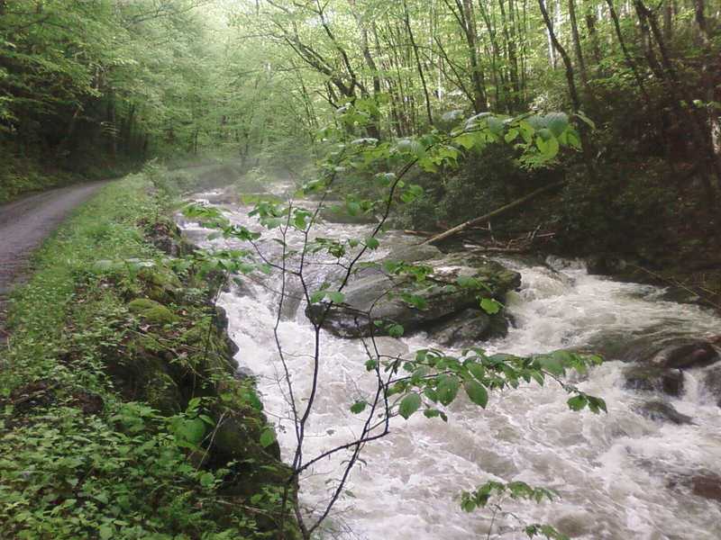
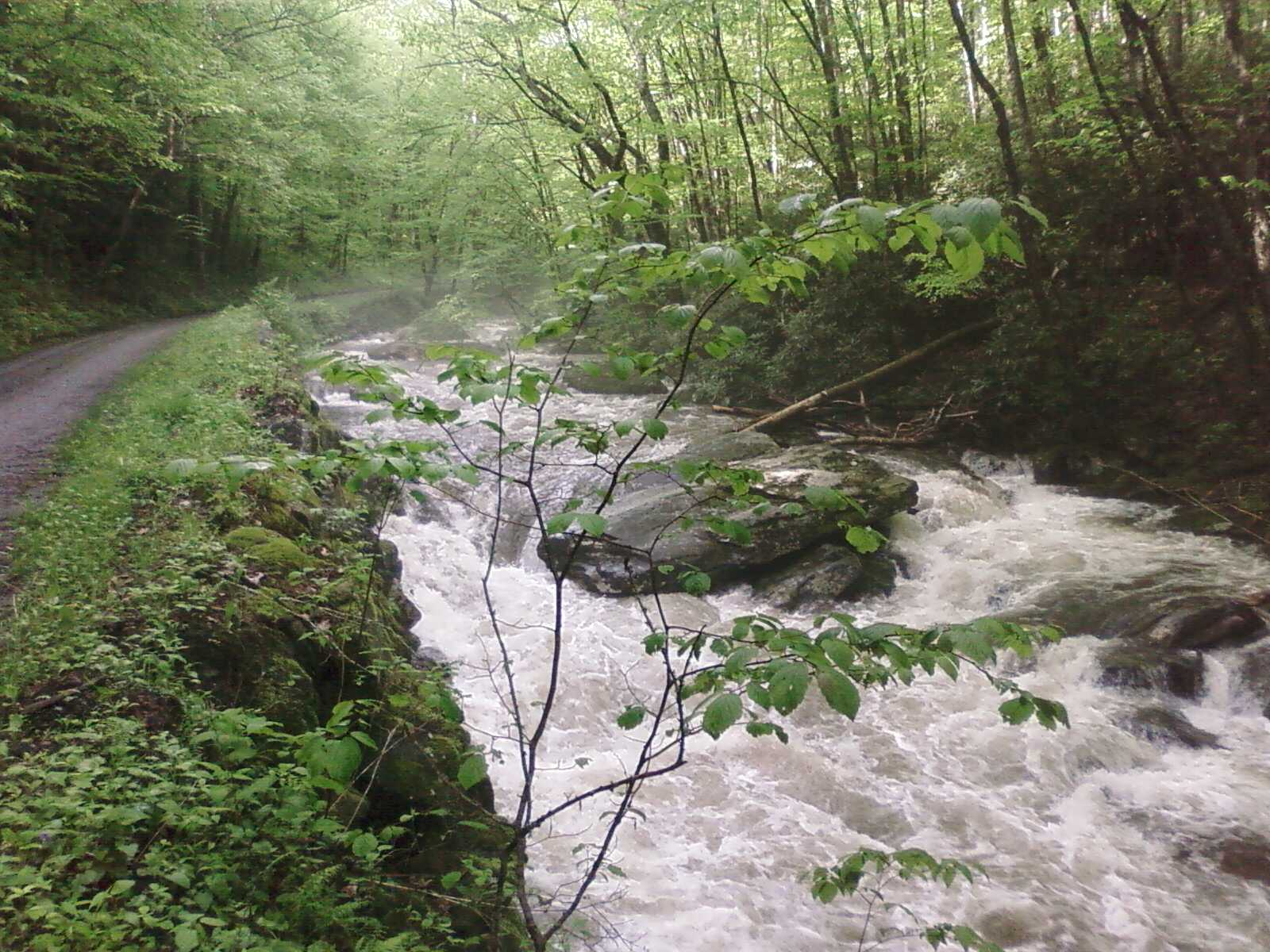
This run is very nice. It is all roadside. No wood problems as of April 2010. If you enjoy the little in TN but don't have the time to get to it, this makes a great class III option for you. The run is as pretty as other smokies runs, but without any houses (like lower big creek) or passing cars (like at the little). It has a greater wilderness feel to it without the pressure of running class V, like at the other more wilderness runs of the smokies. If you are just getting into creeking or just want to do something new go check out the straight fork. You can also do a one car shuttle fairly easy. Just bring a bike or hike up with your boat if the road is gated off. Which it is not in the spring or summer. The put in is the second bridge. The take out is the parking lot by the gate. Below is a low head dam so it is best to get out at the gate. Above the bridge the creek is unreasonable due to lots of wood. A fishing trail goes into that part but the gradient doesn't pick up and the wood thing is a real problem. All-in-all though I would recommend this run to anybody who loves boating in the smokies. O and the rapids are distinguished and fun class III instead just one long continues rapid. More like what you would see on the little than lower big creek or tremont. However the run is easier than both of those runs.
May 9, 2009
The whole run was a 3 mile III/IV rapid. Mostly boogie water, with a few more defined rapids. There was wood through out in some and in some bad places
Jun 26, 2003
Re: Straight Fork, NC Info please. by rbednar Apr 15 2003, 5:38 GMT New
Date: Apr 15 2003, 10:03 GMT
From: moheinous
Not a whole lot to it. About two miles long, typical fast moving smokies water, nothing above class III. Easier than lower Big Creek, similar in difficulty to middle prong without the ledge drops. Potential for much harder water upstream but no trails enter into it. Oconoluftee was 1800 when i ran it, considered a low but runnable level.
Apr 11, 2003
Got a recent report of a run at 1800 on the gauge. Was close to optimal.