Cache La Poudre
08. Poudre Park Picnic Site to below Pineview Falls(Poudre Park)
| Difficulty | III-IV+ |
| Length | 2.3 mi |
| Avg Gradient | 67 fpm |
| Gauge | Cache La Poudre at Canyon Mouth Near Fort Collins |
| Flow Rate as of 1 day | 252 cfsstale data |
| Reach Info Last Updated | June 2, 2025 |
This reach of the Poudre River flows through the community of Poudre Park and there are several bridges that you will need to avoid.
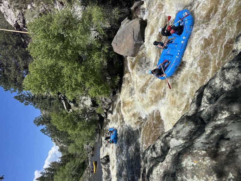
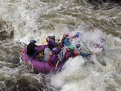
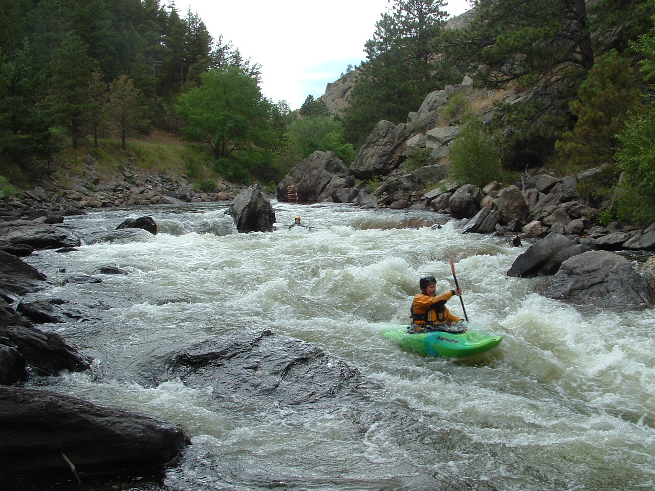
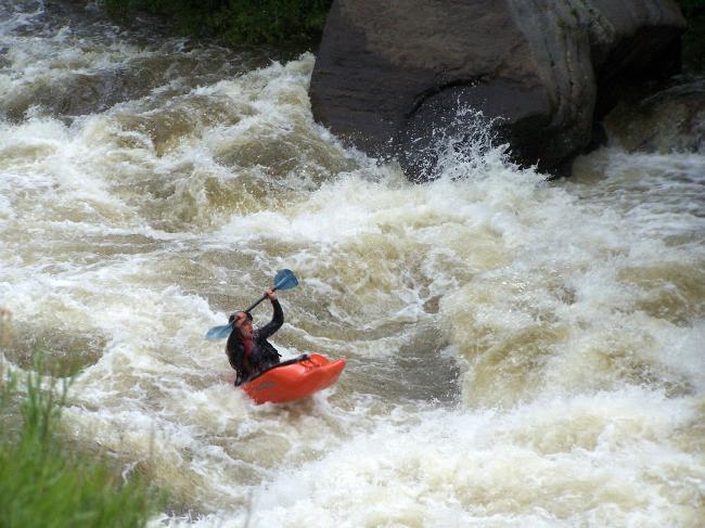
The two largest rapids are in the last mile just above the takeout. The first is Cardiac Corner (IV), which boats easier than it looks like from upstream. This rapid cannot be seen from the road, and it has a scary looking overhanging/undercut rock at the bottom, and it tends to intimidate intermediates and paddlers who float into it unaware. Shortly downstream is Pineview Falls (IV), just upstream of the falls on river left is the Poudre River Pineview gauge. This gauge is hand-painted on a rock on river left above Pineview Falls. A local boater reads the gauge and posts it on his website at www.poudrerockreport.com most mornings during the boating season. Pineview Falls has a couple of large holes, so pick your line carefully and hang on for the ride! Above 4', Pineview is a powerful rapid and the big hole is best avoided by a right to left line.
For descriptions of Colorado runs, see Whitewater of the Southern Rockies by Stafford and McCutchen, or Colorado Rivers and Creeks by Banks and Eckert.
See also: Big South (Class V/VI), Joe Wright Creek (Class V), Spencer Heights (Class V/VI), South Fork (Class IV/V), White Mile Run/Upper Rustic (Class III), Grandpa's Gorge/Lower Rustic (Class III/IV),
...
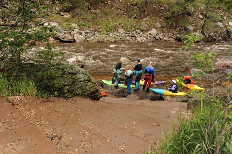
Poudre Park Picnic Site is a picnic site located on Highway 14 west of the Hewlett Gulch Trailhead administered by Arapaho and Roosevelt National Forests. A set of steps provide access down to the river. This access is located at Poudre Canyon Highway mile 110.7.
This is an informal access point popular as a put-in for those running from here and down through the Bridges run. It is located on river left just upstream of the Hewlett Gulch bridge. Parking is available in a dirt pull-out on the side of the road opposite the river. A short trail goes from the road to the water. This access is located at Poudre Canyon Highway mile 111.3.

The river bounces around an island, two bridges, and a lot of rocks. Many lines exist, but the right side tends to be deeper at low water.
Cardiac Corner is on blind right turn shortly after a low gray concrete bridge. Big holes develop here at high water, and a big eddy/cave on the left shore collects driftwood that should be avoided.
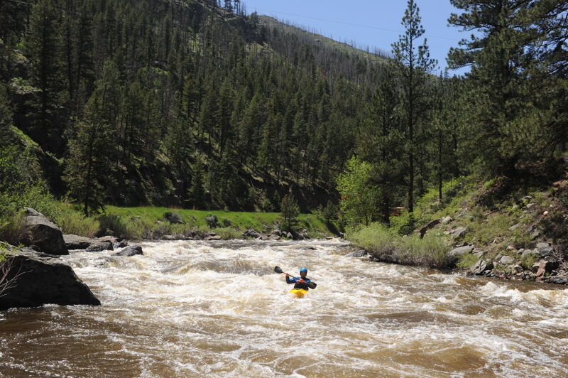
A section of class III boogie water between Cardiac and Pineview, this stretch is named for its '18 holes'.
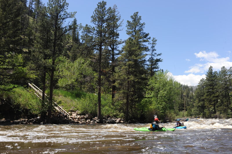
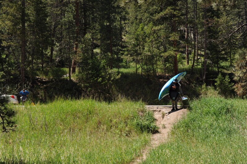
There is a small dirt parking lot here, with a long wooden staircase leading down to the water. If you put in here, bring your A-game -- Pineview Falls is almost immediately below. Legend has it this river access was built for the 'Whitewater' episode of Walker, Texas Ranger. This access is located at Poudre Canyon Highway mile 112.6.
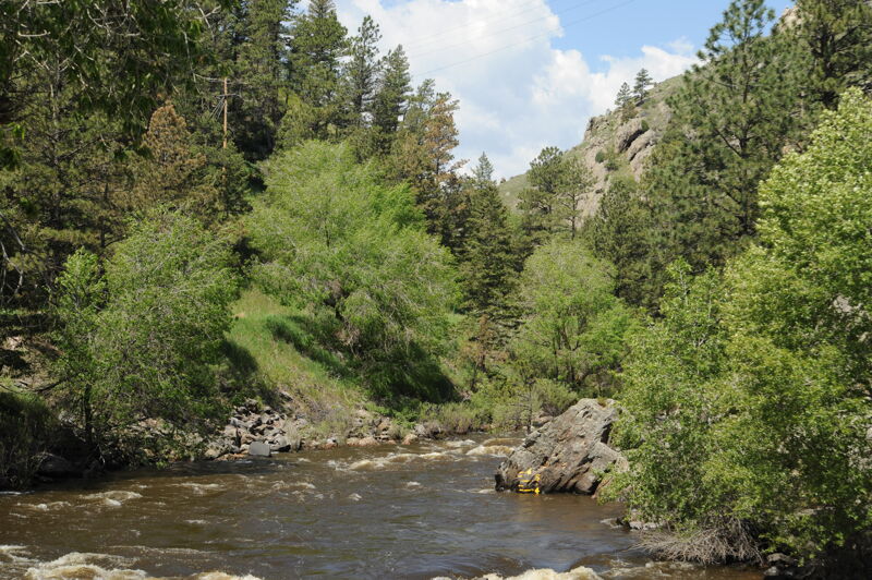
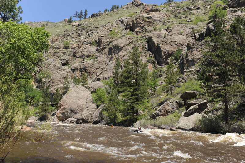
A hand-painted gauge on a rock above Pineview Falls is what most boaters use to measure the flow on the Poudre. This is visible from the road as you drive up to the upper sections of the canyon. A local boater reads the gauge most mornings and posts the information on his website at www.poudrerockreport.com.
The hardest rapid on the Poudre below the Narrows, Pineview is steep, with fast current, large rocks, and/or stout holes in it. You can scout this rapid from the road at Poudre Canyon Highway mile 112.7. There's a narrow pull-out on at the upstream end on the side of the road facing the river, and a wider pull-out on the side away from the river. From the water, the easiest markers that Pineview is approaching are the wooden stairs upstream at Chuck Norris and then the yellow hand-painted gauge on the rock.
Don't let your guard down quite yet -- the fun continues a short distance below Pineview!
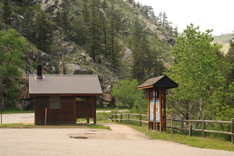
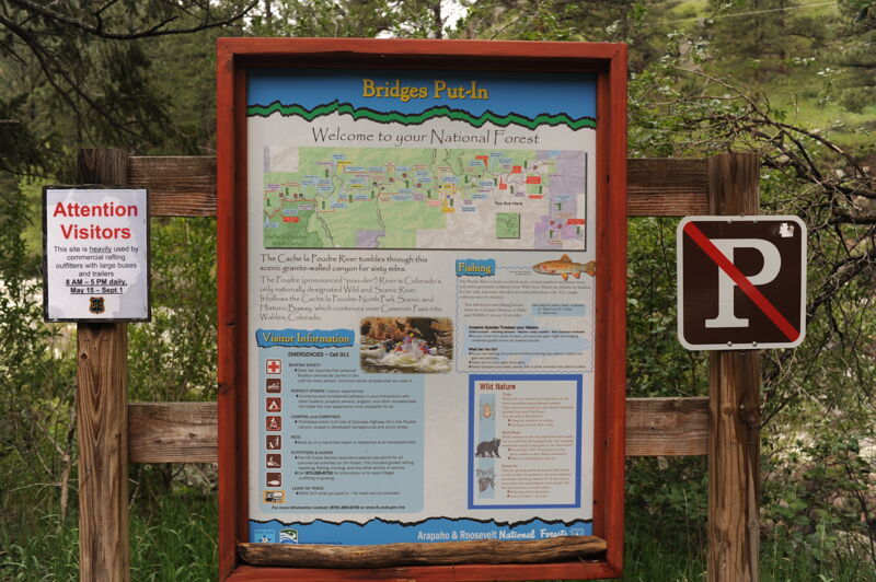
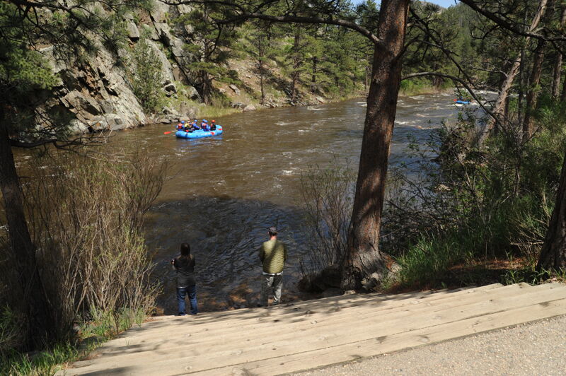
A paved pull-out has parking and two sets of concrete stairs to access the water. This area is heavily used by commercial raft outfitters; watch for the 'no parking' signs in parts of the pull-out. In the summer, the outfitters maintain a porta-potty here. This access is located at Poudre Canyon Highway mile 112.9.
May 28, 2025