Cache La Poudre
09. Below Pineview Falls to Bridges Take-out(Bridges)
| Difficulty | III |
| Length | 1.9 mi |
| Avg Gradient | 33 fpm |
| Gauge | Cache La Poudre at Canyon Mouth Near Fort Collins |
| Flow Rate as of 15 hours | 242 cfsbelow recommended |
| Reach Info Last Updated | June 2, 2025 |
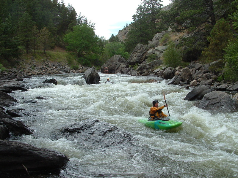
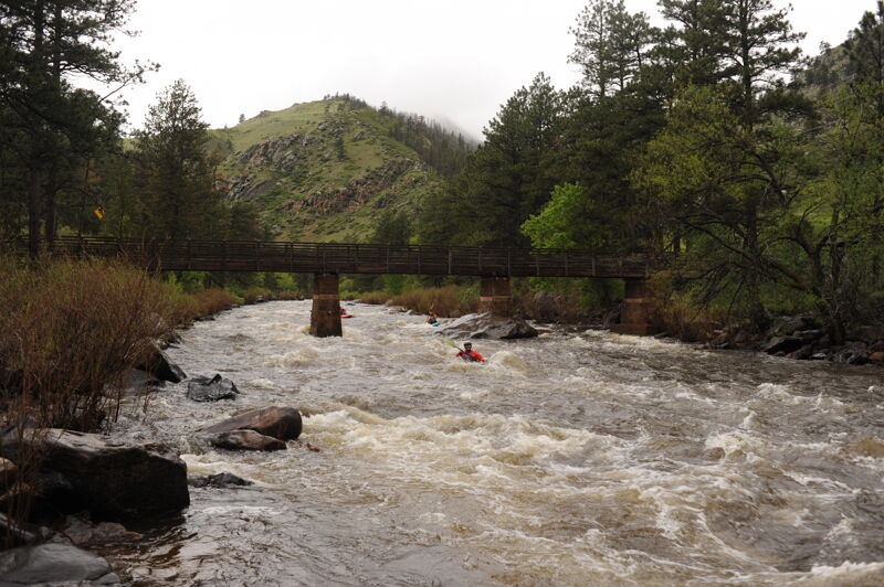
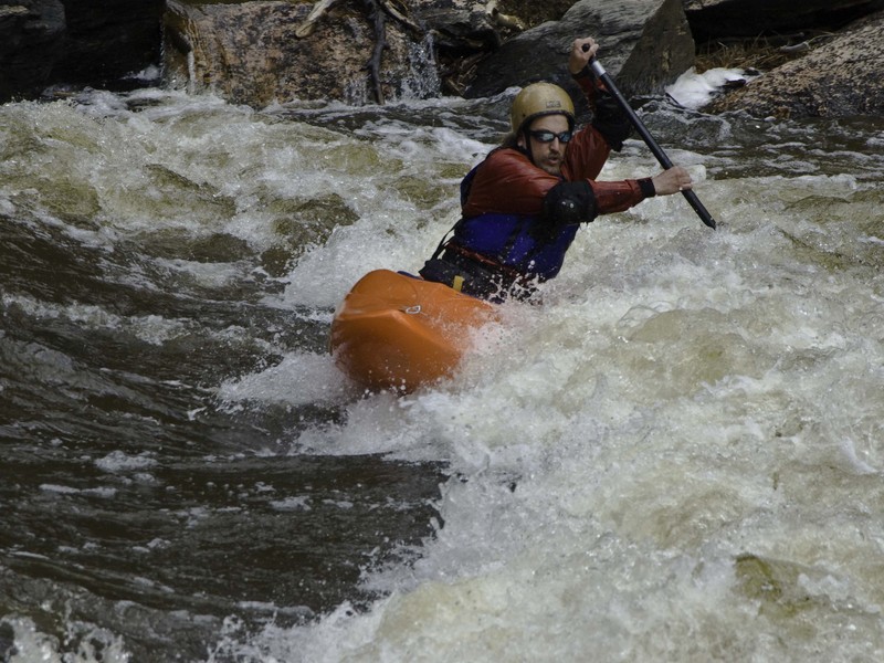
The Bridges section of the Cache la Poudre River, nestled in the scenic Poudre River Canyon near Fort Collins, Colorado, offers a classic Class III whitewater experience. Named for the bridges spanning its path, this stretch requires careful maneuvering around bridge pillars, particularly at Killer Bridge Rapid.
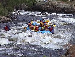
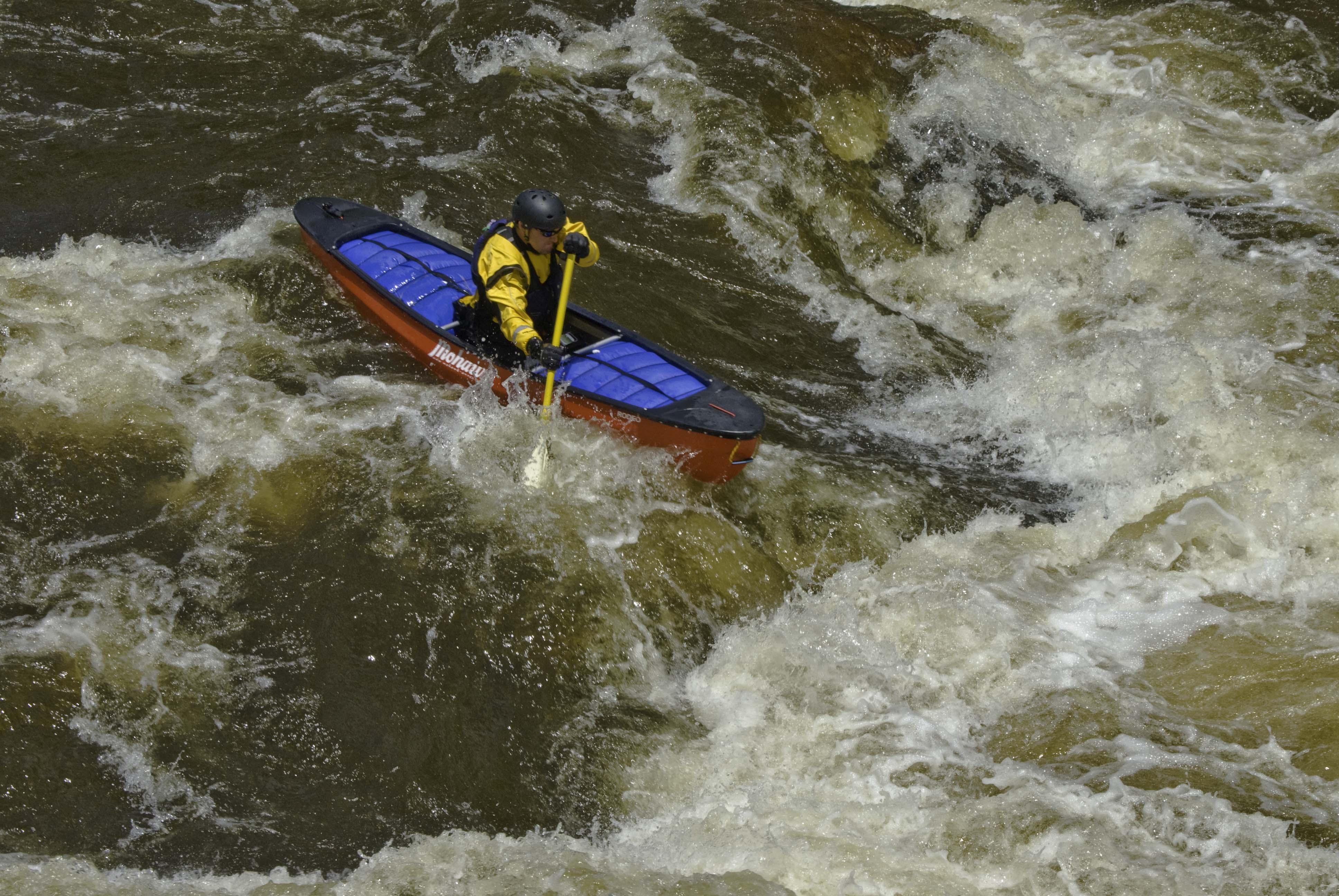
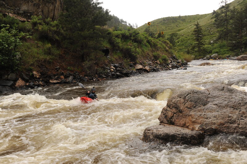
The river flows through a scenic, steep-walled granite gorge, offering continuous rapids with short pools in between. During medium flows (approximately 1,200–1,800 cfs), boaters encounter fast-paced, technical whitewater, dotted with boulder gardens and play spots. Spring runoff and cold water amplify the challenge. Unlike other sections, Bridges maintains navigability at lower flows due to its narrower, deeper channel.
Popular among local paddlers for after-work outings, Bridges suits those with solid Class III skills. For a more demanding adventure, enthusiasts often launch upstream at Hewlett Access, incorporating additional Class IV rapids from the Poudre Park run and continuing downstream through Bridges.
Locals reference water levels using a painted rock above Pineview Falls, located about half a mile upstream of the put-in. Gauge readings are regularly updated on www.poudrerockreport.com throughout the boating season.
For more detailed descriptions of Colorado's whitewater runs, consult resources like 'Whitewater of the Southern Rockies' by Stafford and McCutchen, or 'Colorado Rivers and Creeks' by Banks and Eckert.
Additional Nearby Runs: Big South (Class V/VI), Joe Wright Creek (Class V), Spencer Heights (Class V/VI), South Fork (Class
...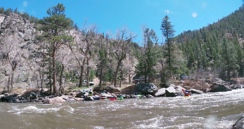
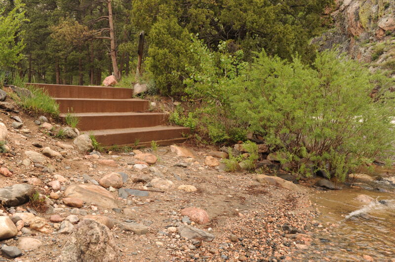
The Bridges Put-in (BPI) is a long narrow pull-out below Pineview Falls at mile marker 112.9. Make sure you don't park in the commercial bus territory or your car may be towed. Two sets of stone stairs lead down to the river.
A small wave train near and after the Greyrock Trail bridge. There are a number of good surf waves in this area.
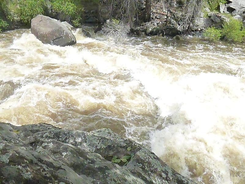
The rapid is an S-bend left and back to the right, followed by a series of waves and holes. A right-side sneak line is possible. At flows above about 3', it's possible to sneak the whole rapid; below this, the S-bend is mandatory, but the bottom half is sneak-able. Some people consider this and Killer Bridge to be a single long rapid.
A series of rocks, waves, and holes above a low concrete bridge. A wide rock/hole in the center, 75' upstream of the bridge, typically pushes boaters to the right. Most of the current runs into the central bridge pier. At most water levels, it's possible to go to either side of this pier, but it's important to commit to a side early (especially in a raft). A left side sneak of the whole rapid is possible at levels above about 2.5'.
A long, fun wave train at most levels, with a crescendo towards the end. A pair of shallow submerged fang-rocks lurks near the bottom on the right, waiting to catch and injure unsuspecting upside-down kayakers. The left side is generally safer.

A large hole in the center-left. Most of the flow funnels into it. A right-side sneak line is available above about 2'.
A pair of great surf waves, between the two sets of staircases at Bridges Take-out (BTO).
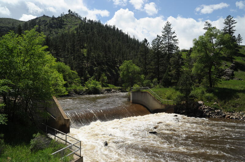
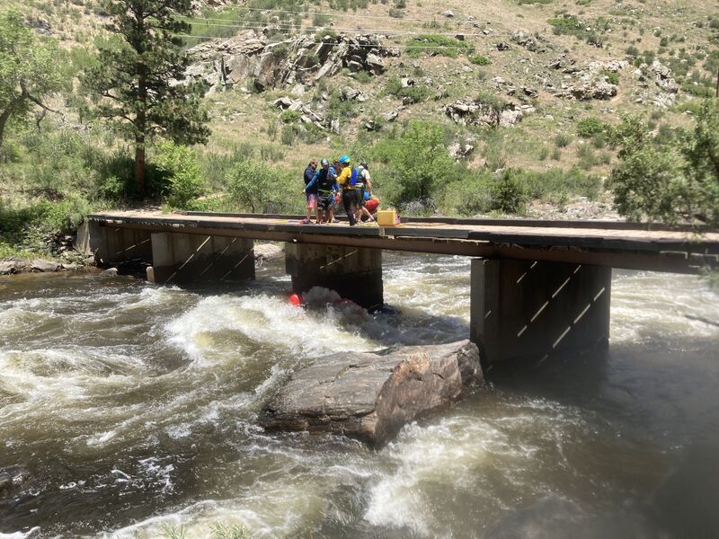
The Bridges Take-Out, locally known as BTO, is a pull-out at mile marker 114.7. If you haven't used this take-out before make sure to scout it so you know where to get out, about a half mile downstream is a low-head dam. There are two sets of stairs. The fiirst set is before the play wave. To reah the second set, take the current to the left and then paddle right to the eddy to the second set of stone steps.
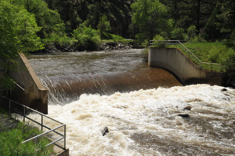
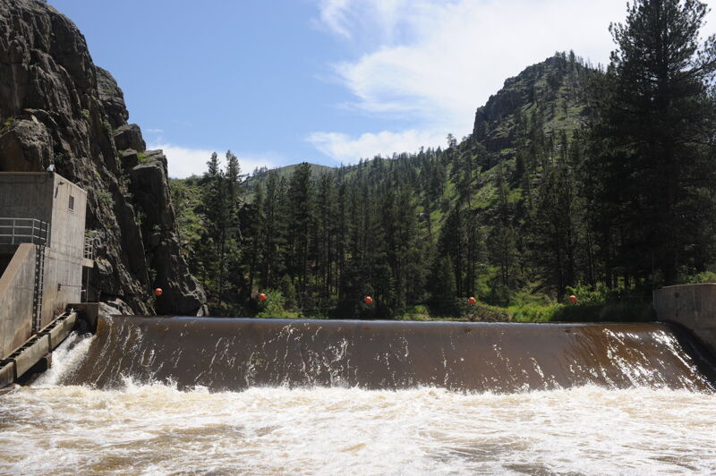
The Munroe Canal Diversion on the Poudre River is a diversion dam used to divert water from the river to the Munroe Canal, a component of the Colorado Big Thompson project for agricultural water delivery. This dam is about a mile below the take-out. Legend has it that the dam is boatable at high water, but you'd want to be sure you were doing it on purpose. Otherwise, be sure not to miss the take-out. American Whitewater is working to address public safety at this high hazard low-head dam and provide for boat and fish passage.
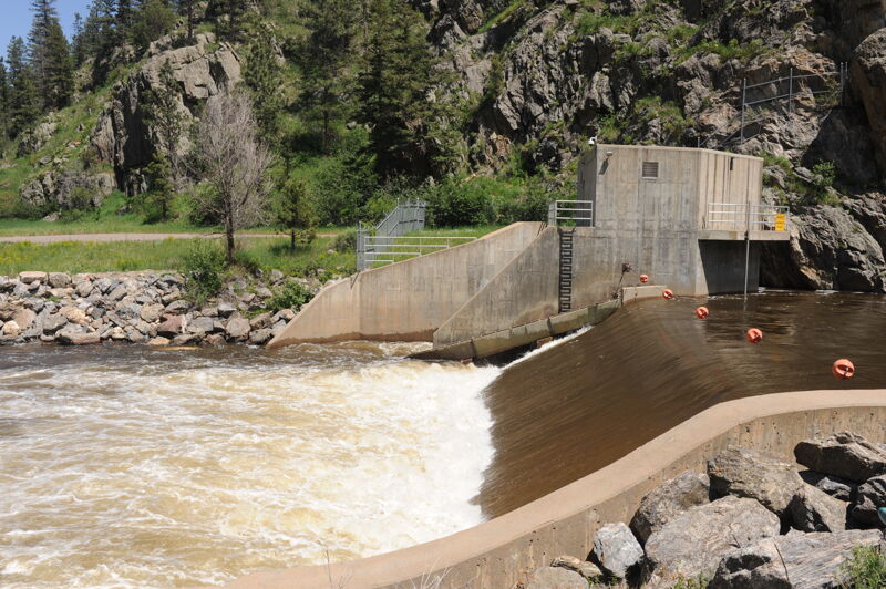
The Gateway Diversion Dam serves to divert water for municipal use for the City of Fort Collins American Whitewater is working to address public safety at this high hazard low-head dam and provide for boat and fish passage.
May 28, 2025
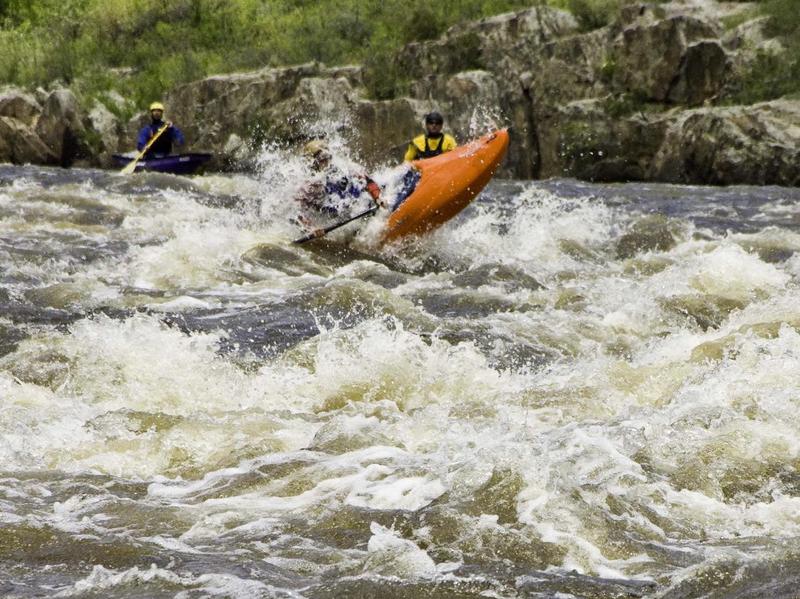
American Whitewater staff were in town for a retreat and planning session and got out with the local community for an evening session on the Bridges run of the Poudre.
Jan 1, 1900
Photo courtesy of and copyright by www.allaboutrivers.com.