Apalachee
3 - High Shoals to Price Mill(High Shoals)
| Difficulty | II-III(IV) |
| Length | 5 mi |
| Avg Gradient | n/a |
| Gauge | Apalachee River Near Bostwick, Ga |
| Flow Rate as of 1 hour | 135 cfsrunnable |
| Reach Info Last Updated | August 3, 2025 |
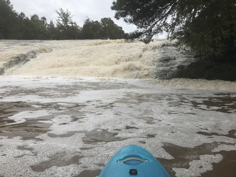
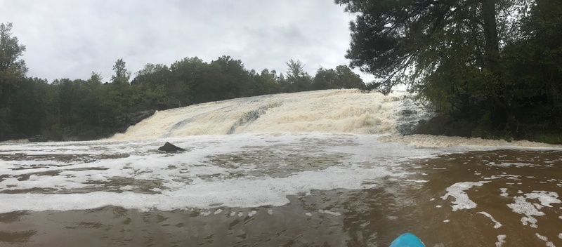
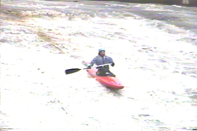
Directly below the Hwy 186 bridge, there is a 6 foot high dam followed by a series of small drops that lead to a large sliding drop of about 25-30' that ends in a big pool. The dam is best run far left. See WARNING below. The sliding drop can reportedly be run on most sides although the launch pad in the center is preferable for nice boofs at higher water.
Minimum level should be considered around 350 cfs, but at this level it will be mighty scrapy. Better flows are from 500 or so and more. Around 2000-3000 cfs, boofs off the launch pad get really fun and lofty.
Below High Shoals the river is class I-II until Price Mill Shoals which is just upstream of the Hwy 186 Bridge. Price Mill is a straight-forward rapid but does have several large hydraulics to punch.
WARNING: As of 2021 the landowners on both sides of the river, below Hwy 186, flanking High Shoals, do not want trespassers on their land. It is suggested that you scout the dam from under the bridge on river left. Run the dam far river left and make your way to the center island. You may be able to get out on the island and scout the final slide. If not study the image of the shoals below (to be posted soon). The blue line takes you right of the island, then cuts back left to hit a boof that skips you over the bottom hydraulic. The green line goes right of the island and is the direct, more steep route. Still good. WARNING: Do not get out on the beach on river left, this landowner is purportedly very aggressive to trespassers and may be armed. If you encounter this landowner, do not engage.
There is no known place to park and put on at Hwy 186. The best option is to park at the Post Office and find someone who is local and ask permission. Otherwise put in at Snows Mill Road upstream. To bypass High Shoals altogether, it may be possible to put in on Robinson Creek at Gober Rd and float/scrape 400 feet to the main river.
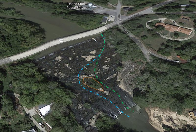
Drop over the dam on far river left. Follow the green or blue dotted lines. You can get a scout of the main slide from the island outlined in orange.
Apr 19, 2026
Flow about 76 cfs. Portaged dam at High Shoals on the left and wheelchaired down the rest of the slide. Big boof at the end, on river left. Many (7 or so) river wide dead falls that seem newish. Ok to paddle or climb over but budget an hour or more to deal with these. Sandbars became problematic towards the end of the run due to the low flow, but dealable. Price Mill rapids, wheel chair on the left then back to the middle for decent fun. Tookout river left below the bridge. Parked on the ROW on the downstream, river left side of the road. There is a faint animal trail to the river so not a horrible hike out.
This run is challenging access and obstacle wise but incredibly beautiful. With stealth you can spot otters, racoons and owls. Water quality seemed good.
Sep 29, 2020
Updates for 2020 on access, the road leading down to the sandy beach below the falls is private property. At 600cfs the falls was fun on the left side, the autoboof centerline was too scrapy. I am going to post a picture of the far right side drop. Definitely runnable, but there is a rock in landing area to watch out for and the rebar at the top.
Feb 26, 2020
Looking for a paddling buddy or two in the Oconee County/Athens area. I get up to Chattooga a couple times a year, but I want to check out some of the closer options such as Apalachee, Barber Creek, and the Broad while we have such wonderfully wet conditions that most 'normal' folks seem so bent out of shape about! I can't find a personal message option on AW, but would like to meet up for some floats if anyone has any interest. I've got a raft and a yak.
Sep 9, 2019
I have been paddling and researching the Appalachee for the last few years. I would like to restructure the 3 reaches currently listed in the AW database with 4 sections. These would be labeled 2-5 and would go from Treadwell Bridge Road (just above Hwy 78) to Hwy 278 at Lake Oconee. This would encompass 36 miles. The restructure will enable updates to be made concerning access, rapids, dams and the infamous swamp. Sections 0, 1 would be reserved for the upstream reaches I have not paddled yet. The restructuring would be done so as to preserve existing information (comments, etc) for the 3 sections already in place. If you have comments, suggestions, please let me know. Thanks!
Sep 13, 2017
Ran this section yesterday after the river peaked from Hurricane Irma. Put in above the Hwy 186 Bridge. Sneaked the far left side of the dam down to access the falls. Took out at Price Mill. No strainers or new deadfall in the river. Water level was 465 cfs.
Video can be seen here: https://youtu.be/eQtrW4u8qMM