Yuba, North
1. Wild Plum Campground to Downieville(Wild Plum)

| Difficulty | IV-V |
| Length | 14.5 mi |
| Avg Gradient | 108 fpm |
| Gauge | N Yuba R Bl Goodyears Bar Ca |
| Flow Rate as of 40 minutes | 170 cfsbelow recommended |
| Reach Info Last Updated | March 7, 2023 |
The Sierra City run.
Wild Plum canyon is one of the uppermost regions within the North Fork Yuba River.
The only creeking above this point is 40 degree gradient on mixture of sharp granite substrates that few salmon can make it past.
We dubb this the Sierra City run.
Sikbird note: This run can be notched up considerably by adding the Love Falls section above the Pacific Crest Trail bridge.
Seasonal rain and snow events frequently bump this run up quickly.
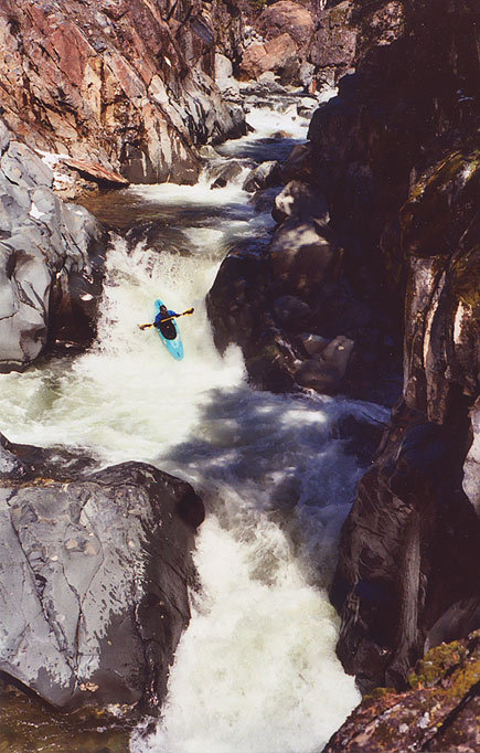
This run offers clear and cold water, beautiful and challenging rapids in steep gradient with real consequences for the uninitiated.
Reference: 'California Whitewater, Third Edition' Jim Cassady & Fryar Calhoun
Travel HWY 49 North East from Downieville for 12 miles to Sierra City. Continue uphill through Sierra City and turn right following signs to Wild Plum Campground. Put-in is available at first bridge crossing 1/2 mile from HWY 49.
Loves Falls are a series of pool-drop cascades that vary considerably with volume. This area is just below Salmon Creek coming down from the Sierra Buttes.
This rapid begins with a quick shelf that slides river right up against an undercut wall. Different levels can make this rapid a portage for some boaters.
this dam should be scouted
the hole can get retentive and the dam debris downstream is a hazard
the first view of HWY49 from the creek
Scout this rapid from the road on the way up.
Or, scout river left.
Caution: higher flows cause Ladies Canyon hole to be riverwide. This is a hole that you want to be upright after hitting because you are headed directly into action.
This campground is typically used by rafters running commercial trips.
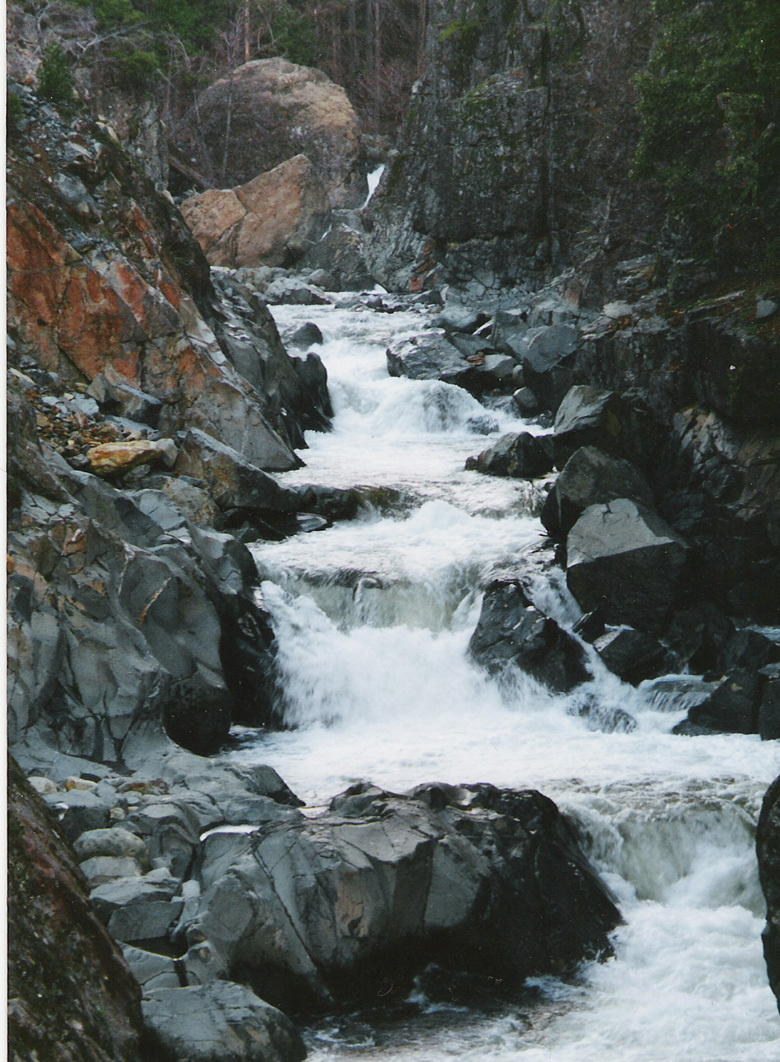
Moss Canyon is away from the road and becomes a section of this run not to forget at high water. This beautiful, tight canyon packs rapids with big holes behind big rocks. Lots of twisting rapids with momentum-stopper holes.
The big daddy hole in Moss Canyon
One of several good rapids with constrictions and stomper holes that finish off the Moss Canyon.
The river bends from right to left, Jim Crow Creek enters river left, the Shangri-La resort has stone walls at the river and a bridge crossing the North Fork Yuba.
When you see Downie Creek enter river right, you are in Downieville. Cross under the first bridge and takeout river right.
Oct 17, 2004
Wild Plum to Downieville has a high alpine start, drops swiftly into tight rapids, blind sweeping class IV/V with a lead into the green moss covered rocky canyon reaches above Moss Canyon. Once into the steep and fast Moss Canyon you will meet up with Boss Moss, Floss Moss and Lower Moss Rapids, when they conclude you might wash up in Downieville.
This run is frequently underestimated at high water, where its a screaming run.
Rosassco Canyon lies below the confluence of the North Fork Yuba and the Downie River in Downieville.
May 15, 2003
This is the first drop after the put-in for Love's Falls. Many drops after this one increase in complexity and committedness. After crossing under the Pacific Trail bridge, two more significant falls occur, then the river twists and constricts into a very committing but relatively short canyon.