Holly Creek
Cohutta Wilderness
| Difficulty | IV(V) |
| Length | 6.2 mi |
| Avg Gradient | 165 fpm |
| Gauge | Holly Creek Near Chatsworth, Ga |
| Flow Rate as of 1 hour | 43 cfsbelow recommended |
| Reach Info Last Updated | February 26, 2003 |
Holly Creek runs through a deep roadside gorge in the Cohutta Wilderness. For most of the run the road is a steep 200 to 300 feet above the creek.
From the junction of Old CCC Camp Road and Mulberry Gap Road down to the gauge bridge the river drops as follows: 80, 170, 240. Total drop for the 3.2 miles is 526 feet.
As of the Winter of 2002 the upper 2 miles is still choked up with wood. 4 spots are completly choked. The most dangerous is just after the split to the right. Many portages and limbos if you run this one. Most of the rapids are clear except for a few.
Thanks to a few boaters from Atlanta Patagonia for the work they have done. Locals are slowly making progress on the upper 2 miles.
Local Expert Simon Bishop.
Directions:
From Atlanta take I-75 north to Highway 411 north to Chatsworth. In Chatsworth go east on Highway 52 for about 2 miles, then north on Holly Creek Road. Holly Creek Road deadends into Ccc Camp Rd. Go right (east) on Ccc Camp Road into the Cohutta Wilderness. The road will turn to dirt when you cross into the wilderness area. Holly Creek will run alongside the road.
The take-out will be a large marked parking area where the road turns away from the river. The put-in will be the second bridge crossing upstream.
Other runs close by include:
and the Ocoee.
Jan 26, 2010
The Hike up section is good to go all the way down to 250cfs. Its probably not worth it to travel to this creek at this level, but its close to me so its great for an afternoon run. At this level there isn't push, however Im a big guy and didn't have to wheelchair. At this level make sure to boof heading right at Turkey Drop and land in the slot sideways going right at Turkeys Turn by driving up on the shelf on the right. -Zach F.
Mar 16, 2009
R. Hobby
The gauge is off a bit due to its location. Paddled the whole section today and the gauge is reading that the water is coming up currently (6:30) and we left about and hour ago and the water had peaked and was falling. So don't go by the gauge you have to scout it out yourself and make your own calculations. Great day on the water!!
Jan 6, 2009
Went to Holly Creek today around 4:45. Gauge was reading 1520 @ 4:00. Walked up the park-n-huck trail to the split. Mucho Grande !! 1400 @ peak would be good to go. 1500 and rising is definitely pushing the limits of sanity! Ran it @ 1200 2 wks ago awesome level!
Sep 9, 2008
Ran Holly Creek(park n huck) @ approx. 400cfs water was rising but peaked just above 400. Level was o.k. most certainly would have enjoyed more water. Some wheelchairing, one portage, but still fun. No major strainers, very clean, lets keep it that way!
Mar 2, 2007
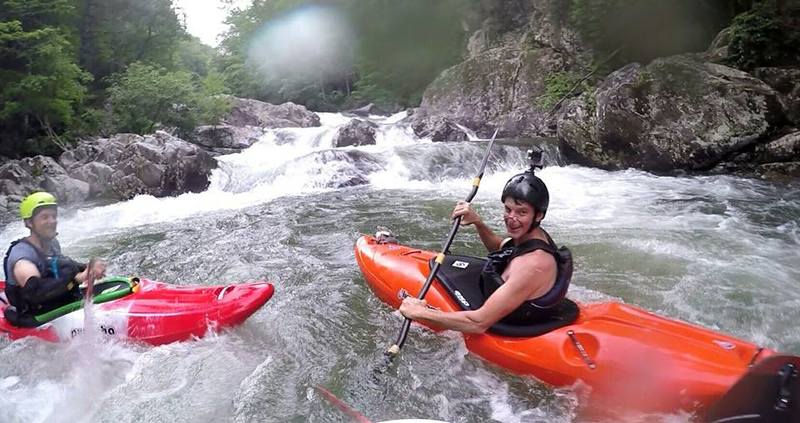
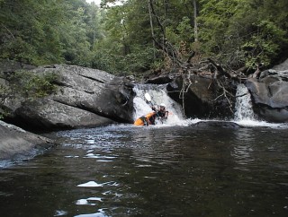
This is the first rapid on the park and huck section. The fun starts right away!
A typical drop on Holly creek. The holes will slow you down, but seldom stop you if have enough speed and hit 'em straight on.
Bombing down Holly Creek's park and huck section starts out immediately with some good fun Class III+ drops.
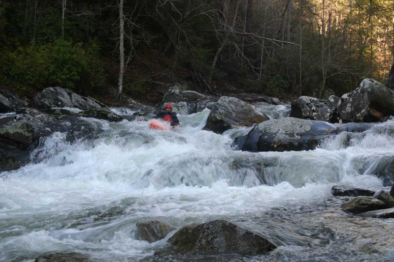
Run this one high and tight for a good clean line and you'll avoid pencilling in or even possibly pitoning at the bottom on a hidden rock.
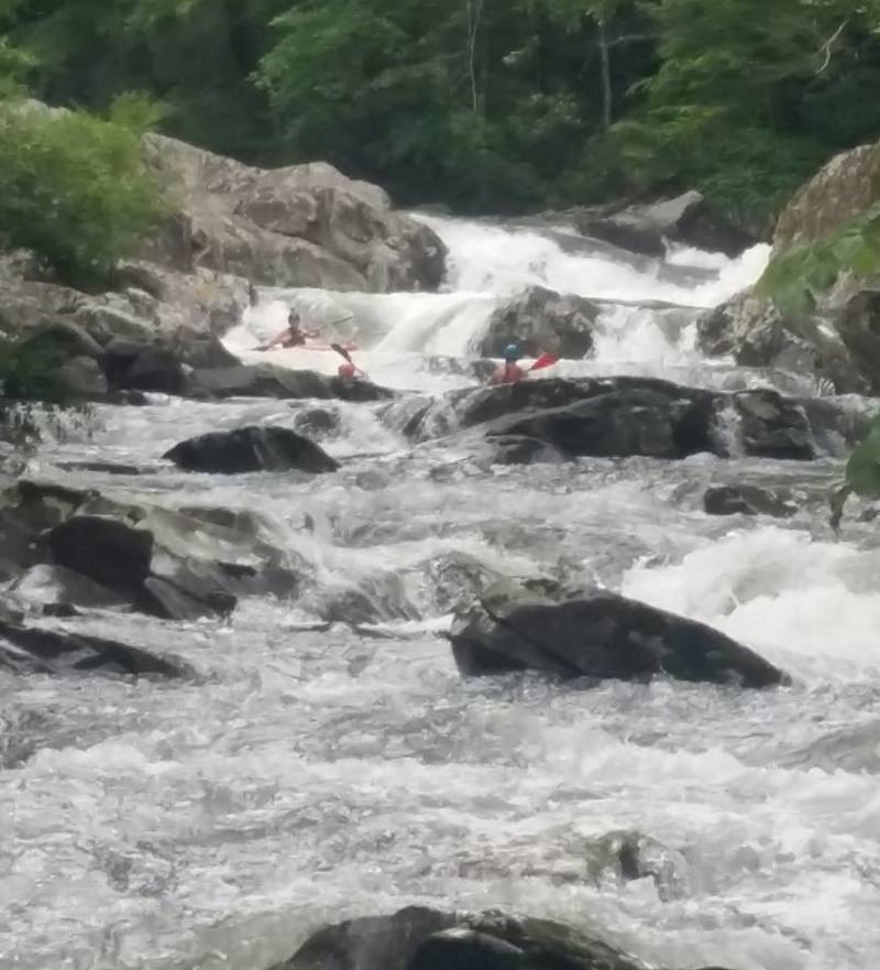
A good view upstream toward Turkey Split. The park and huck's lower section flattens out into easy Class II creeking.
Apr 23, 2005
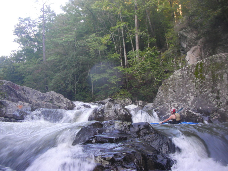
Shots from above Turkey Turn looking downstream. The angle doesn't do the gradient justice.
When running Turkey Turn expect to make a hard turn to the right. If you don't turn you can piton.
Feb 24, 2005
On 11/26/04 I went to Holly Creek. The USGS Holly Creek at Chatsworth gage read 400 cfs (falling) and the paddlers take-out gage read 5'. Waaayyy too low to run this section. The 'park-n-huck' stuff 1/4 mile above the put-in was ELF (Extremely Low Flow).
On 2/22/05 the USGS Holly Creek gage (Falling) read 1100 with the Holly Creek paddler's gage at 1 foot. A good level.
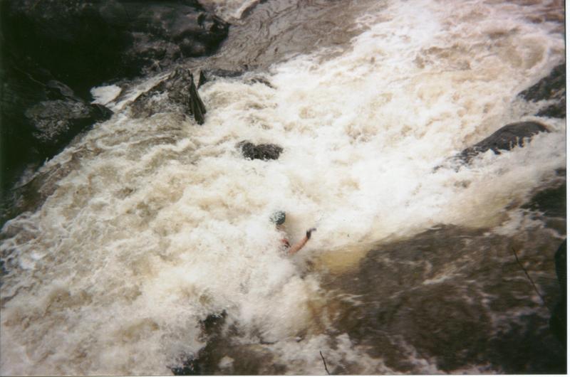
On 2/21/05 the creek was flooding: over the road and just under the gage bridge when the USGS Holly gage was only 912 cfs (but rising fast).
Minimum levels for Holly Creek are very dependant on whether the level is rising or falling on the USGS Gage. It sounds like 400 cfs might be a good minimum level if Holly Creek is rising quickly. If Holly is falling 800 might be minimum.
If you run Holly, please check the bridge gage and report your Date, Time and Levels to H2OLevelCheck@boatingbeta.com