Greenbrier River
01. Durbin to Hosterman
| Difficulty | I-II |
| Length | 8.5 mi |
| Avg Gradient | 20 fpm |
| Gauge | Greenbrier River at Buckeye, Wv |
| Flow Rate as of 39 minutes | 2.31 ftbelow recommended |
| Reach Info Last Updated | April 20, 2023 |
Lat/longitude coords are approximate, from TopoZone.
SHUTTLE- put-in on the west fork,just west of Durbin. to reach the take-out- cross the bridge on co. rd 250-11, conntinue up the hill and make sharp left turn at stop sign still 250-11, veer left on cr-1 ,road winds around quite a bit. take left on cr-1-24 to the booming metropolis of hosterman. when in Hosterman the gravel road splits in 2 (both looking like driveways) stay to the right and arrive at nice parking lot in a couple hundred yards.
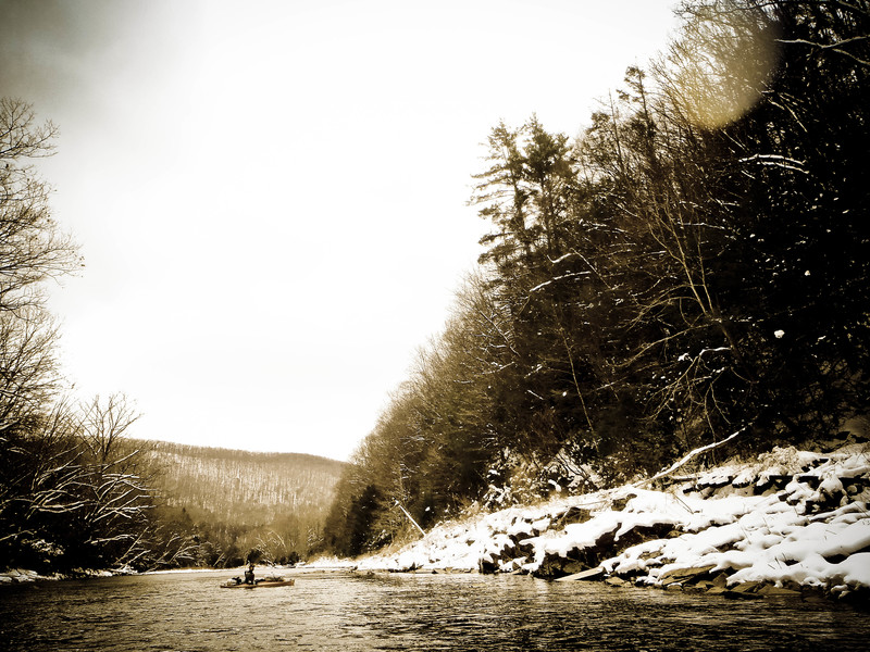
DESCRIPTION- This truely is a beautiful,near wilderness river ! On river right the old RR tracks have been restored and are now the durbin scenic RR. At the terminus of this RR are 5 picnic tables, privy, and fire ring. beyond this the RR tracks are completely undermined for miles !
At high water levels this stretch will be completed Way to fast (about 1.5 hours) so you might want to put-in higher on one of the forks or continue down to Cass. Given the right water -levels this would make a great float fishing river with great riverside camp spots..
Many paddlers would only rate the WW class 1+
Aug 22, 2014
Had to break ice to get on. Ran it low at a little over 1 foot on the Durbin gauge, but scraped down okay. This was back in the spring of 2013.
May 8, 2012
Another useful gauge for this section is the Durbin gauge, located very near the putin. This gauge used to have satellite transponder issues, so that the web page would have long gaps of no data, but USGS appears to have fixed that problem.
2.0 is minimum. At that level, you will have to read water well in the shoals to avoid scraping, but it can be done. Even a tenth more makes a big difference.
Jan 28, 2012
Grade A stuff. I'm uqnusetionbaly in your debt.
Jun 2, 2011
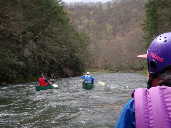
Ran this May 28th 2011 with friends and family in recrational kayaks and one canoe. Beautiful river! No trash and crystal clear water. We put in on the East Branch at the bridge by the campground in Durbin around 4:30 and ended around 7pm. Lots of fishing and playing around. River levels were at min runable on Saturday and below runable on Sunday. AW gage recomends 4.5 and I agree. Take out at Hosteman is getting overgrown. Mark your takeout on the river before you go or you will miss it. We took out from the main flow and portaged across the island to the parking lot. The road from the main gravel road 1/24 is starting to grow in with trees so mind your paint job. .
Apr 30, 2009
Ran from Durbin to Cass 4-24-09 at 4.7 feet on the Buckeye gauge. This was perfect for us with no scraping. Also no fish! 85 degrees, sunny and no other boaters, which amazed us! Exceptional trip.
Jun 11, 2008
I could use some help: I'm planning a 2 night kayak trip for 7 on the Greenbrier and want to do a section that has some Ievel IIs. We would like to camp along the river. We have our own kayaks, but would rather rent. We're coming from Ohio. Any suggestions?
Contact info: catfish74@yahoo.com
May 29, 2008
My friends and I recently floated the Greenbrier down to Cass. There were 10 of us, and we reserved the 'Durbin Rocket' cabooses on a Saturday (May 10th, 2008). We spent the night on the cabooses, which take you 5 miles down the river to a campground, and then leave you. The next morning, we floated the 11 miles or so down to Cass. It's a gorgeous river, and was fast-moving at just over 4 feet. There are two whitewater areas at that level, I would give the first a 2+, and the 2nd close to a 2, but neither were exceedingly technical - just long, high fast wave trains. It was cold and rainy, but WOW! Highly recommended. Probably not enough action for whitewater enthusiasts, but we were in open-water canoes.
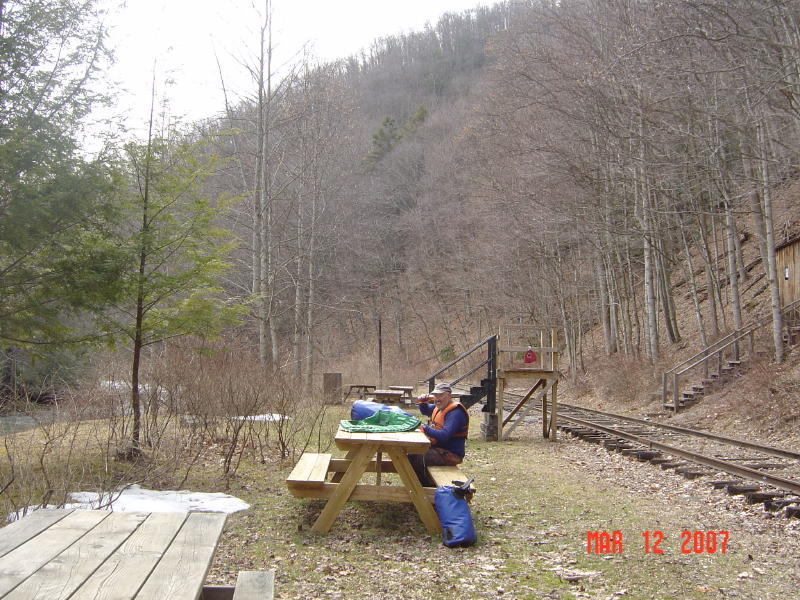
Mar 12, 2007
lunch stop