Flint Creek
Orleans to Phelps
Aug 2, 2016
Mar 22, 2014
10-20 minutes of carry along the hiking trail is required.
Also, at 250 cfs Flint Creek is runnable but a little too low to be enjoyable.
May 4, 2011
Flint Creek, Phelps, New York
Apr 24, 2011
Running Old Mill Falls, First time sine 2007. Great Job Ratt!!!
Apr 24, 2011
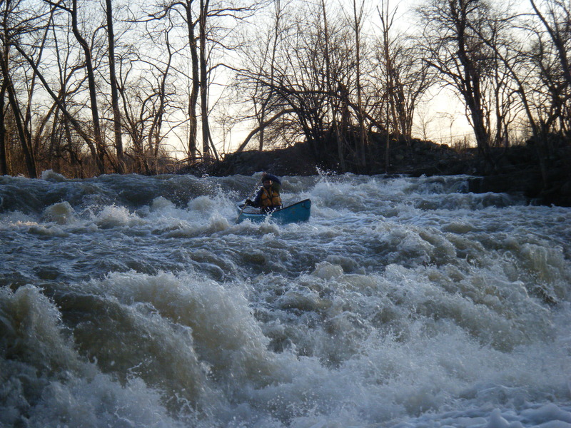
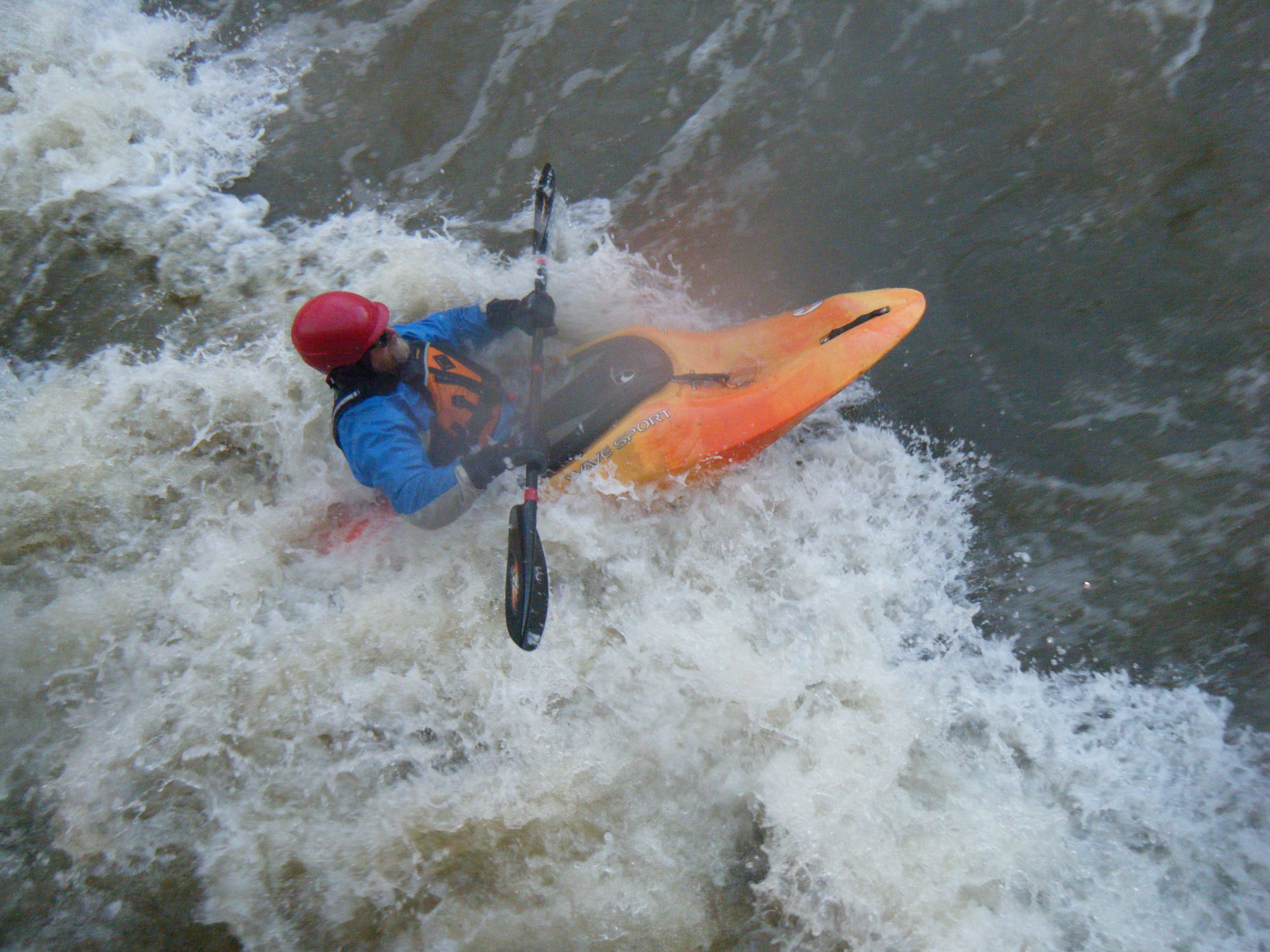
Just scootin' along
Mar 24, 2010
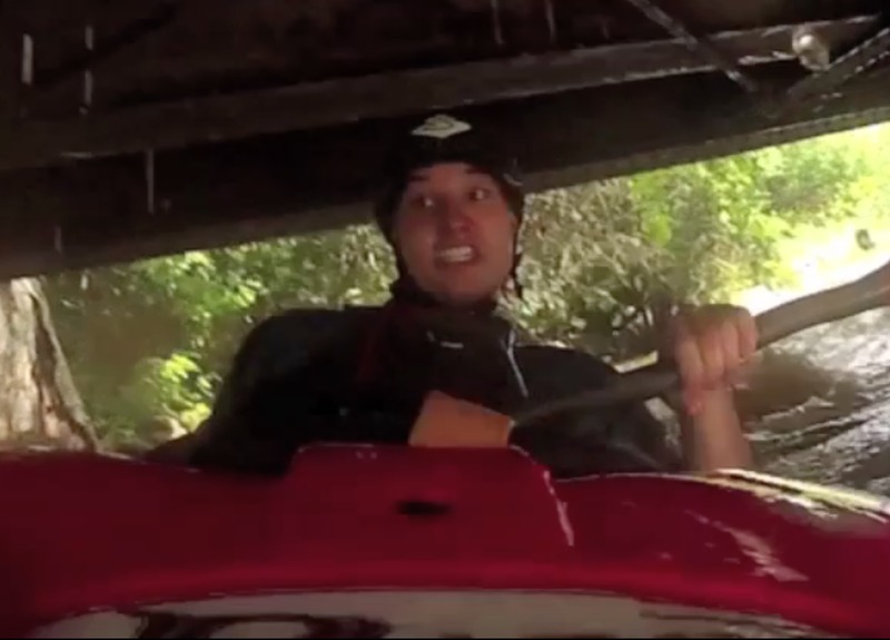
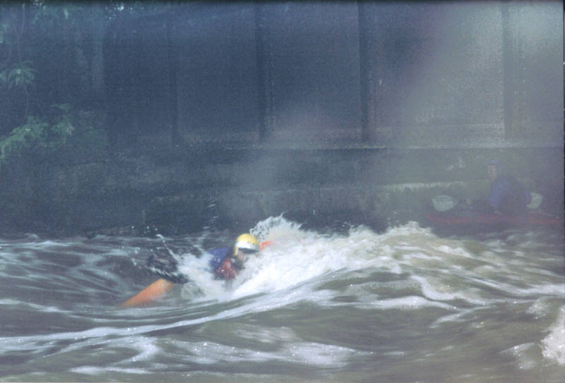
Flint Guru Steve Benedict plays in the hole at the end of Double Drop rapid. This photo was taken from the low bridge, which at this level (~600 cfs) left only ~ 3 feet of clearance.
Mar 24, 2010
Adrian VandenBout in Shroo Hole at 610 cfs.
Mar 24, 2010
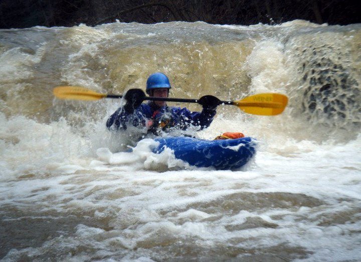
Hans Merritt between drops 2 and 3 at 600 cfs.
Mar 14, 2010
~875 cfs.
Feb 5, 2010
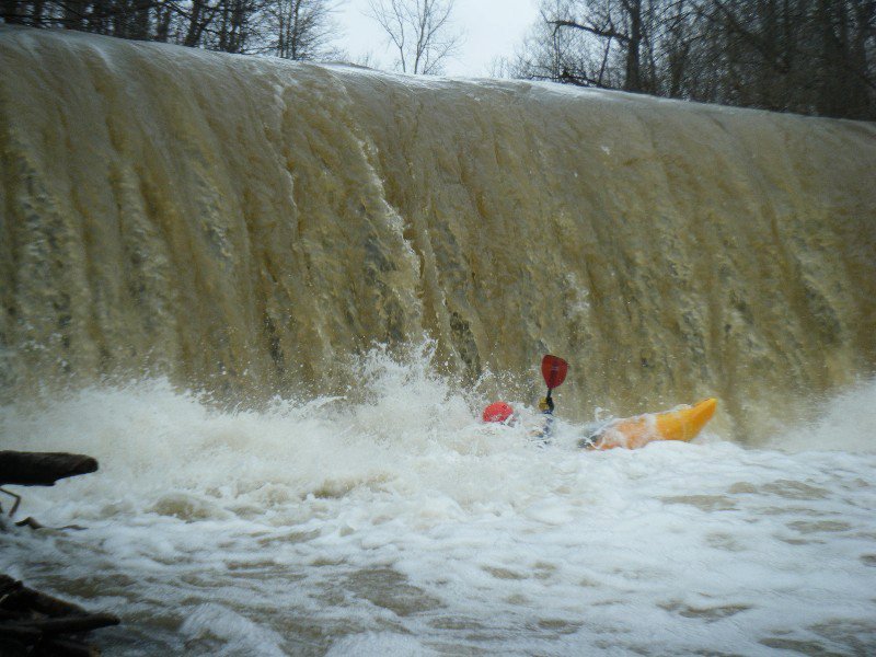
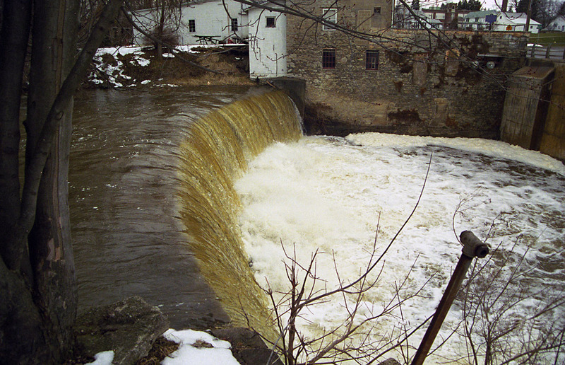
Mill Falls at 4.5 feet
Jan 31, 2010
Harry Marinakis logging air time at the Old Mill Liquor Store at 4.0 feet on the bridge gauge.
Jan 31, 2010
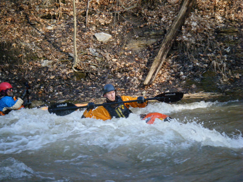
Passing the cement factory in Phelps
Dec 28, 2008
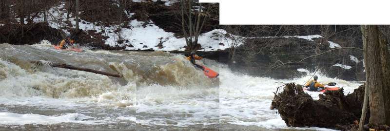
The highest I've ever run Flint. The big-ol' rooster tail, shown at the intersection of the two parts of this composite photo, was said to be quite a hoot to run; I chickened and ran left of it.
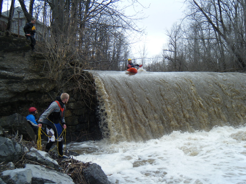
This bridge starts to get really sketchy at 1500 cfs. Though we all decided to walk the bridge, Flint Guru Steve Benedict got stopped and surfed left by a hole above the bridge. He saw a line, at the extreme left edge, and limboed his way under. Had he been in a creek boat (instead of his playboat), he might not have made it.
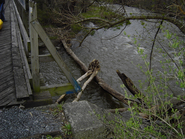
You like the wood stuffed under the right side? Yummy!
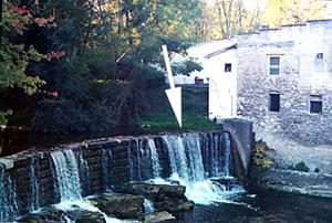
Apr 5, 2005
As of April 25, 2005 a river wide strainer very evident as you pass over the fist bridge on the Ontario Trail (I think that is the correct name). This strainer is just after the “Triple Drop”.
Mar 31, 2005
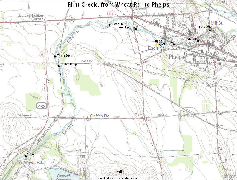
This map doesn't show the Orleans putin, a couple miles upstream. Map created with GPSVisualizer.com. Thanks to Flint Guru Steve Benedict for his input to the creation of this map.
Check out all the Ratt Boy Maps by clicking here.
May 25, 2004
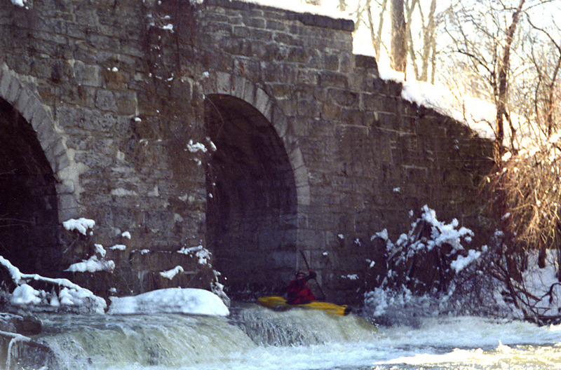
The light was poor, but you can make out the low bridge just behind Steve. At a thousand cfs, the bridge comes down to nearly head-level.