Dingford Creek
bl. Goat Creek to M.F. Snoqualmie

| Difficulty | V+ |
| Length | 1.2 mi |
| Avg Gradient | 820 fpm |
| Reach Info Last Updated | March 3, 2023 |
One of the most significant outdoor recreation areas close to metropolitan Seattle is the Middle Fork of the Snoqualmie River. Less than an hour drive from downtown, the valley is accessible to a population of over three million people and attracts visitors from across the country. Few places in [...]Read More
The Mountains to Sound Greenway stretches more than 100 miles along Interstate 90 from the shores of Puget Sound in Seattle, across Snoqualmie Pass, and into Central Washington. Encompassing over 700,000 acres of public land managed by local, state, and federal agencies, the Greenway protects an extraordinary landscape that [...]Read More
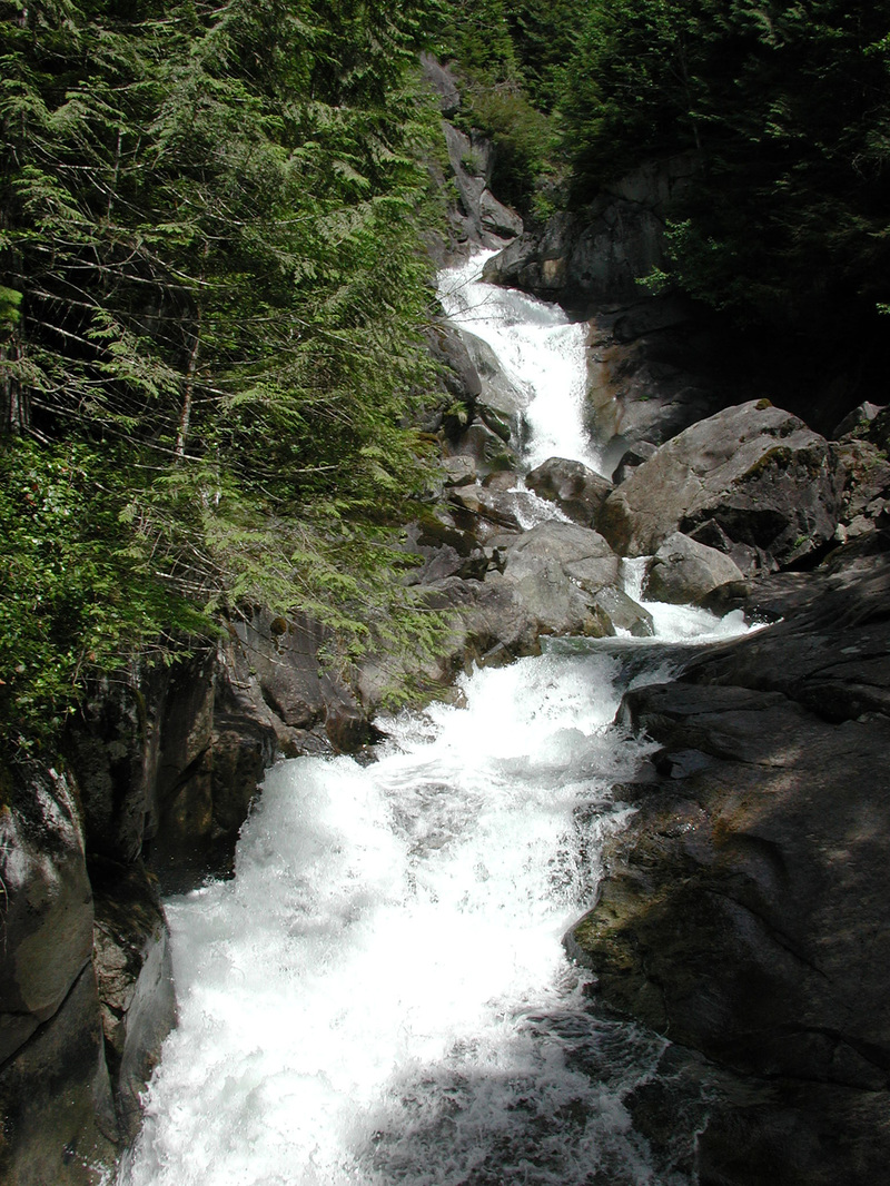
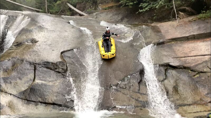
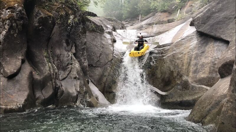
For all but a handful of paddlers in the world this creek is unrunnable. It's listed here to document the existence of whitewater that has been boated, but it is at the very extreme limit of what is being run. The last half mile is basically one long set of waterfalls and slides (it's basically the side of a mountain)
The 'run' was featured in the video Twitch 2000 and was also the site of Tao Berman's speed altitude descent record featured in Twitch IV. He paddled over five of the creek's waterfalls for a total of 100 vertical feet in 19.38 seconds in May of 2001. In the years since packrafters have even discovered the creek ( see video)
LOGISTICS: To check out this river take exit 33 off I-90 and head north towards the truck stop. The Middle Fork Road (FR 56) turns off to the right within a half mile or so. Start your trip odometer and watch for milepost signs. At mile 5 you will cross the Concrete Bridge across the Middle Fork and at mile 12 you will cross the Taylor River. Within 100 yards of the Taylor River bridge, the Middle Fork Road turns off to the right and heads up a short hill (it's easy to miss this turnoff as the spur road, which looks like the main road and continues straight, comes to a gated dead end). From this point on the road is in very poor condition. You could conceivably make it in a car, but a high clearance vehicle is strongly recommended. Continue another 6.6 miles from the turn-off to the Dingford Creek trailhead at Middle Fork Road mile 18.6. Park here and it's another hundred yards or so to the bridge across Dingford Creek.
Feb 19, 2019
Someone has digitized Twitch 2000 (https://youtu.be/6wBnL0v5JWM) the Dingford Creek footage is from 12:10-16:05
Sep 3, 2003
DAMNNNNNNNNNNNNNNNNNNNNNNN!!!!!!!!!!
That is one steep bitch of a run. How many portages are being done by Tao from the creek down? This might be the magic 1000 fpm creek!!!!
Anyway, According to Delorme's topo program, from the confluence up
1048 feet in the mile!!!!!!!!!!!!!!!!!!! damn. The next mile above that drops a 'mere' 240 fpm.
The steepest half mile in the final plunge to the snoqualmie is 650 feet.
thats the info on dingford. your numbers may vary.
cool.
Bradley
Jul 4, 2001
The view upstream from the Middle Fork Snoqualmie Road bridge across the creek.