Nason
2. Merritt to Coles Corner (Lower)
| Difficulty | II-III |
| Length | 4.7 mi |
| Avg Gradient | 60 fpm |
| Gauge | Nason Cr. Nr Mouth |
| Flow Rate as of 4 hours | 74 cfsbelow recommended |
| Reach Info Last Updated | April 26, 2025 |
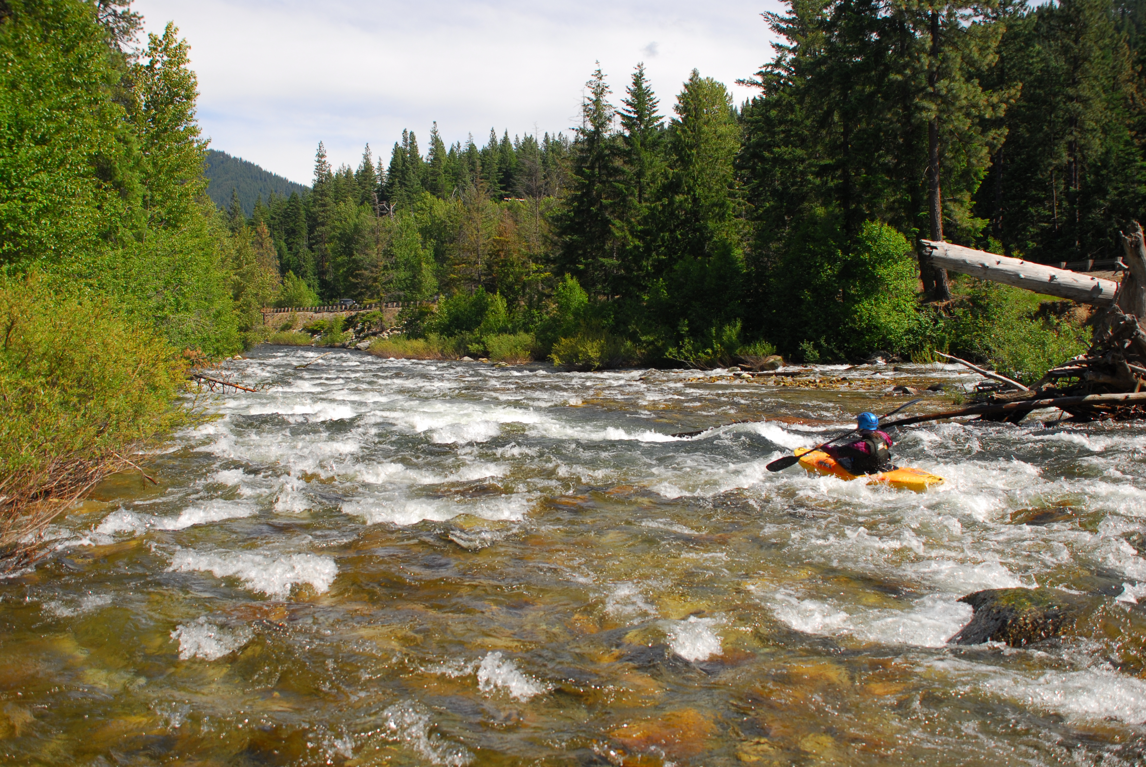
Enjoyed during the spring snowmelt, the run starts off with easy class II rapids and short stretches of flatwater as you pass by a few cabins. Once you see Highway 2 come into view the pace picks up and you will enjoy some great class II and III whitewater. The biggest rapids are visible from the highway as you drive the shuttle so you can get a good idea of what to expect and the relative flow. While the rapids are fairly straightforward you need to be alert for wood on this run. As you reach Cole's Corner, the pace slows and the river takes a big bend to the left to parallel Highway 207 where you will find an easy access.
Logistics: The put-in is accessed from Highway 2 mile 81.3 where you turn north onto Nason Ridge Road (just west of the Highway 2 Bridge across Nason Creek). Follow Nason Ridge Road 0.1 mile, turn right, and then continue 0.2 to the dead end at the old bridge crossing. Access is available within the bridge right-of-way. Upstream of this put-in the channel is more braided (until you reach the canyon of the upper run).
To reach the take-out go to Cole's Corner at Highway 2 mile 84.7, take Highway 207 to the north, and use the pullout 0.4 miles down this road. You can scout the run on the shuttle from a couple of places along Highway 2.
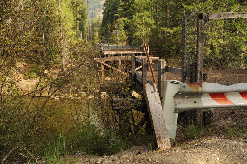
Access at the old Nason Ridge Road bridge.
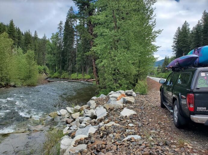
Roadside access along Highway 207 in Coles Corner.
Apr 25, 2025
Photos of access sites as we wait for flows to come up.
Apr 30, 2023
Really nice medium flow with a few easy portgages around log jams. Put in at the Nason ridge road downed bridge on the upstream side. See my gaia track with marked portgages. I also rand this yesterday the day before at 950 cfs. I took out at the Nason creek camground. The run is fun and has fairly long continuos class 2 rapids with the upper section 2+/3-. I noticed there are 3 large trees that are 2/3 chewed through by beavers at various locations. When they fall, they will block the whole river. This section is 8.7 miles and it took 2 hrs 8 minutes. 35 feet/mile.
Jan 1, 1900
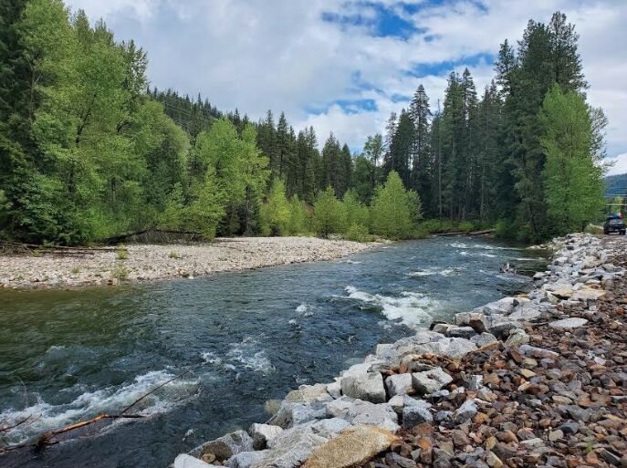
Take out just off Cole's Corner on State Route 207. There's roadside parking. There's a riverwide tree that needs to be portaged if you paddle past this point, it's visible from the parking area.
Jan 1, 1900
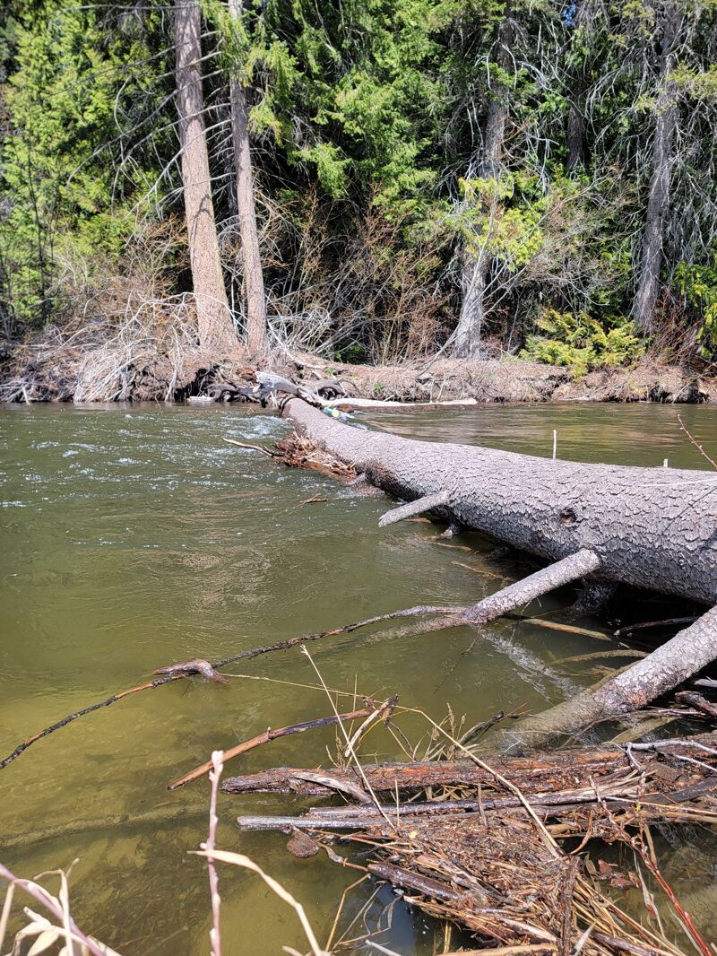
There's a river wide tree that comes off river right. This is below the crux rapid, there's a cabin on river right signaling it's coming up. You can see the trees coming off river right. At 924 cfs you could bump over the log in your kayak, any lower I would portage on river LEFT.
Jan 1, 1900
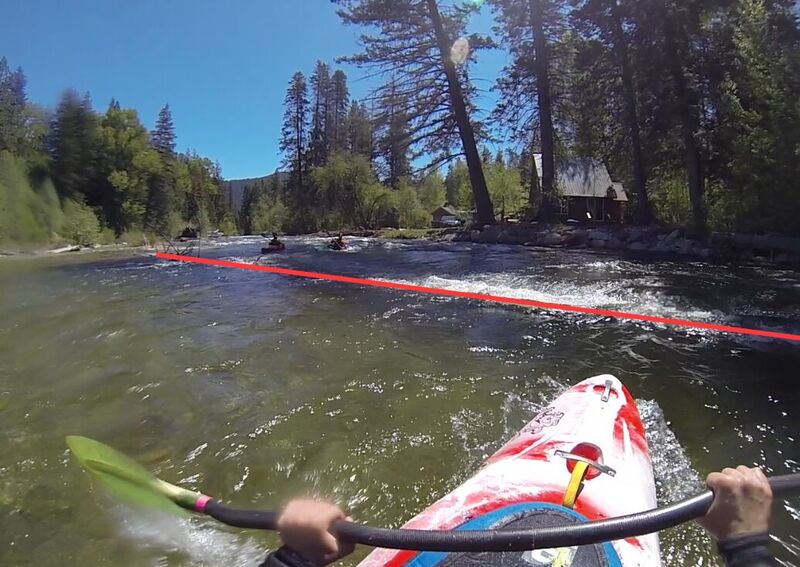
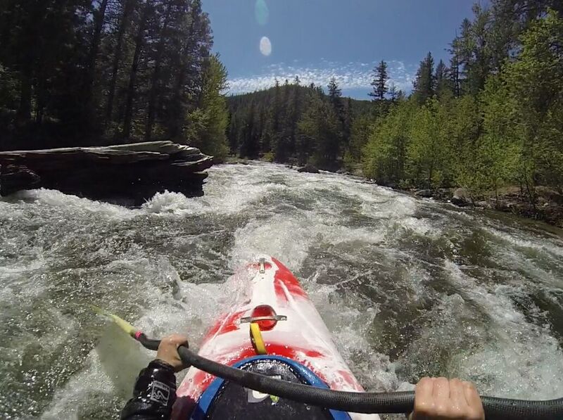
The entrance to the 'crux' rapid of the Lower Nason. There's some shallow channels on river right indicating this rapid is coming up. We took the far left channel with the most water. There's several large pieces of wood in the rapid itself, one top left, one center/middle of rapid, then there's a river right log jam with a clear left line that's open at the bottom. The most fun rapid on the this section!