Manitowoc
A) Leist Road to Cnty.Rd.S (PnP or 4.5 miles)

| Difficulty | I-II(III) |
| Length | 4.6 mi |
| Avg Gradient | 12 fpm |
| Gauge | Manitowoc River at Manitowoc, Wi |
| Flow Rate as of 36 minutes | 20 cfsbelow recommended |
| Reach Info Last Updated | March 4, 2025 |
Quick Facts:
Location: Clarks Mills, approximately 10 miles due west from Manitowoc.
Shuttle Length: 4.2 miles (or just PnP at one or both of the 'falls')
Parking for (Upper) Cato Falls: Sportsman's Park: 44.0943, -87.8888
Parking for Lower Cato Falls: Lower Cato Falls County Park: 44.0903, -87.8439
Take-out: Manitowoc County Park and Game Protective Area (Hwy.S): 44.0991, -87.8223
Character: Two areas of bedrock ledges, and a few random boulder-bed rapids.
Drainage area at listed put-in: ~390 sq.mi.
Put-in is approximately 795' elevation.
Take-out is approximately 650' elevation.
Thus total elevation change is approximately 145'.
General Overview
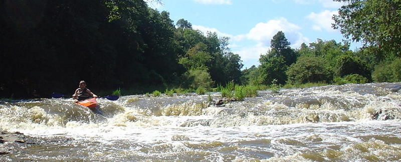
There are two main areas of whitewater interest on the 'upper Manitowoc'. The first, Cato Falls, lies just downstream of Leist Road. The second, Lower Cato Falls, lies in a county park which bears its name.
Whitewater playboaters tend to favor the latter of the two as a park-and-play wave/hole, and have taken the shorthand of just referring to it as 'Cato Falls' (or just 'Cato'). Unfortunately, this may cause some confusion, since Cato Falls is the proper name of the upstream feature (and in the unincorporated village near it!), and 'Cato' is the name of town about four miles to the north.
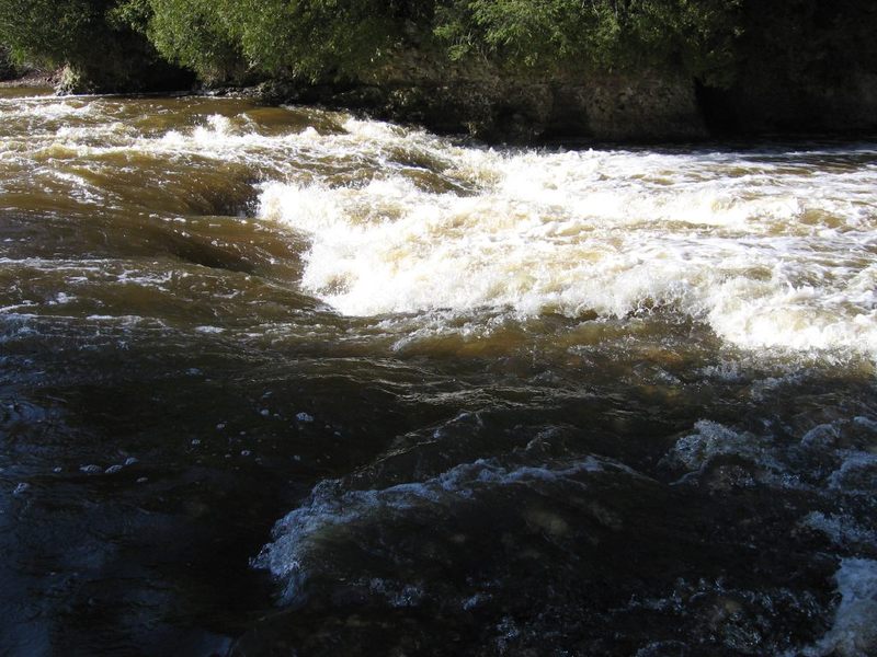
Neither of these is anything close to a 'falls'. Each is simply an area of bedrock intrusions/ledges, creating rapids and play potential. Cato Falls (the upper) is a longer stretch, and offers more variety with opportunities for 'working' the river. Lower Cato falls is the more significant concentrated drop, offering a few small 'set up' waves, a significant sliding drop into a pool in a rocky grotto, and (at flows above 1000-1200 cfs) one main wave/hole feature.
While some folks argue the contrary, I find water quality on this river to be quite 'iffy'. The drainage is dominated by cattle farms (a number of 'industr
...
USGS lists a sampling site about 2.3 miles upstream of our listed put-in, listing drainage area of 383 square miles.
Decent roadside parking, and easy carry to the river ... and the first feature is just around the bend!
The sportsmen's club (river-left) has been very accommodating (when I've found anyone there) to allow river access for park-and-play or for the run. If they are present, stop in and say hi ... maybe even have a cold one after your run.
Parking is fairly informal, just don't block the road. Carry back up the driveway to where the river is nearest to put in right at the first waves.
If you walk anywhere into the woods, be mindful of poison ivy which is pervasive here!
I would also repeat the notice that you are in the heart of dairy country. A farm with a large herd lies just upslope the right/south banks. As a result, air and water here tend to reek with the odor of manure. This diminishes enjoyment of 'full out' play here, as rolling, swimming, or getting too many face splashes seems a very bad idea.
Just downstream of the listed put-in the river takes a bend to the right and you'll encounter a few mild waves. As it bends back to the left the real action begins.
Do not expect a 'falls' here -- for that matter, there is not really much of a ledge. However, there is a fine series of bedrock intrusions, creating a series of sweet waves at good boatable flow -- probably best from maybe 800 to 1200 cfs, possibly worthwhile down to 500-600 cfs and up to 1500-2000 cfs. (Ranges are somewhat uncertain, as I have only been here at 1000 and 1500 cfs.)
At 1500 cfs, there is a very retentive looking hole center stream. It is easily avoided by heading far right to catch the eddy below it to either stage for it (if you want to give it a play) or to stage for the other waves which follow. At 1500 cfs, you can paddle up between trees river-left to get repeat play. Flows much higher than 1500 cfs are likely to make this whole area too much of a wash to offer much reasonable play.
The sportsmen's club (river-left) has been very accommodating (when I've found anyone there) to allow river access for park-and-play. However, be mindful of poison ivy which is pervasive in the woods here.
And I would repeat the notice that you are in the heart of dairy country. A farm with a large herd lies just upslope the right/south banks. As a result, air and water here tend to reek with the odor of manure. This diminishes enjoyment of 'full out' play here, as rolling, swimming, or getting too many face splashes seems a very bad idea.
Enjoy the following YouTube video of a run in a tandem open canoe. (Notice that they do have proper whitewater floatation, helmets, and PFDs!)
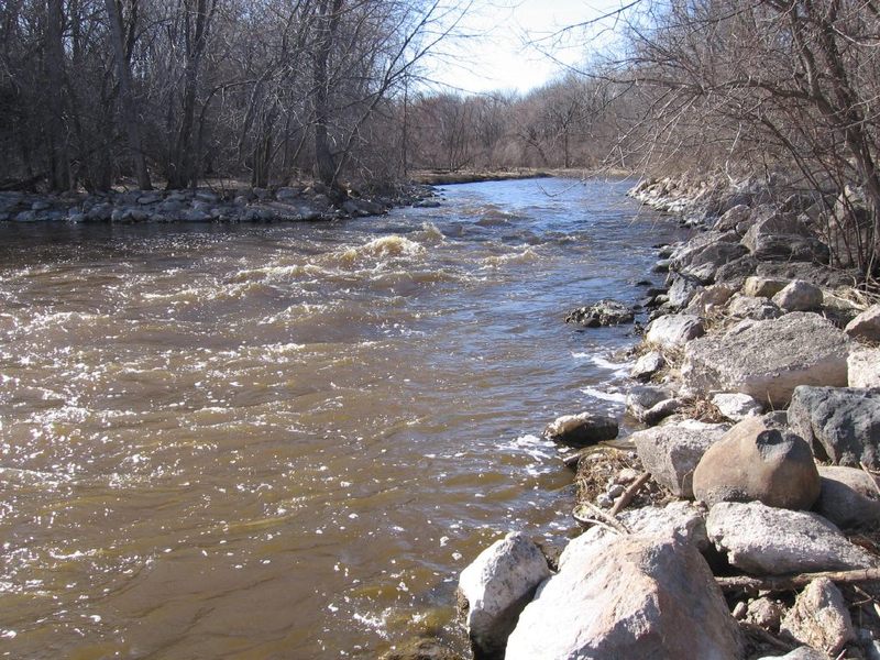
Even though (upper) Cato Falls offers a sweet series of waves and holes to run or play, some paddlers may wish to skip the long lake/backwater/flatwater paddle (which starts not far downstream of those waves) and may opt to use this dam as their put-in instead. There is parking and access here, just off County Trunk Highway (CTH.) J at Mill Street, in the unincorporated village of Clarks Mills.
The dam should NOT be run, as flow drops hard onto a concrete 'splash block' with large rocks immediately backing it up in the outflow. (This 'plunge pool' structure is to reduce or eliminate hydraulic scouring of the riverbed). Put-in well-away from the dam and paddle strongly out into the current. (There may be a persistent eddy trying to pull you upstream toward the dam.)
USGS lists a sampling site just upstream of the dam and shows drainage at this point as 399 square miles.
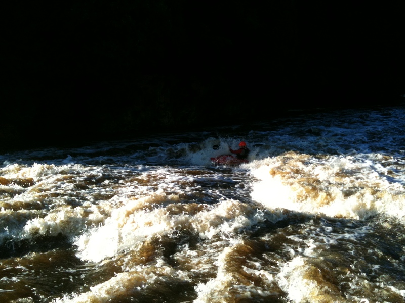
For South Eastern Wisconsin this is a 'falls'. There is a ledge/drop here, but it is hardly a 'falls'. It will be exciting/challenging for novice (non-whitewater) paddlers. For reasonably experienced whitewater paddlers, at low-to-moderate water levels, it will not provide any real difficulty. At higher flows (800-1500 cfs), there will be some decent play here. Some of the lead-in waves will allow tame surfs and spins, before dropping through the larger ledge and the couple of waves below it. At flows above 2000, the full-out freestyle crowd has been loving this spot!
This is a popular spot for fishing, as fish often aggregate in the pools to the sides of the main flow here. Expect to contend with fishermen at certain times of year.
Enjoy the following video of this spot at 2750 cfs:
Cato Falls Playing from Philllll on Vimeo.
Lower Cato Falls of the Manitowoc River at 2750cfs.
April 6, 2013
Parking and access from Lower Cato Falls County Park allow using this as a PnP ('Park and Play') location. Follow the signs for the path (down a series of wooden stairs) to get to the 'falls' (about 180 yarda/0.1 mile). There is a fine Disc Golf course in the park, along with restrooms.
Good parking and access to the river is available off CTH.S on river-left at a 'Manitowoc County Park and Game Protective Area'.
Site of a former dam, the river constricts here, then hits a broad pond. As a result, this area is prone to some decent compression waves.
Apr 27, 2011
the surf wave morphs at really high water levels and turns to this.
Apr 2, 2010
Access for PnP at 'upper' Cato Falls is very handy from the Sportsman's Club. I have used that a couple times, finding no one there to ask nor to take issue with our presence. At least a couple times I have found folks in the clubhouse/bar, and they were absolutely fine with me parking there and accessing the river. Generally I have found many private property owners (or in this case, groups) in Wisconsin to be quite amenable to allowing such access (and 'short term' parking), as long as one is as courteous and 'up front' as possible when explaining what you wish to do and asking for their permission. Of course, I have usually done so for pretty-much 'one time' (or once in a blue moon) access. It could be a different story if you plan on doing so a number of days in a row, or every time the river is at a playable flow. And, there is always the possibility that some individual associated with the Sportsman's Club, at some time, could be less amenable to allowing this access (especially at times when there may be club activities on the grounds) in which case one should be prepared to politely excuse one's self and move on.