| Difficulty | I-II |
| Length | 3.8 mi |
| Avg Gradient | n/a |
| Gauge | Buckhorn Creek Nr Corinth, Nc |
| Flow Rate as of 59 minutes | 0 cfsbelow recommended |
| Reach Info Last Updated | March 3, 2025 |
Very short stream with surprising gradient for length. Takeout on dirt road that approaches Buckhorn Dam. Creek continues on into confluence with mainstem of Cape Fear River. Area is famous for deer and turkey hunting , sometimes during in and out of season, and also many horse lovers ride the many trails in this semi-remote area. Stream is subject to bank to bank strainers. Very, very underpaddled stretch of water to be so close to heart of Carolina Canoe Club domain.
Update on Running this for the rapids:
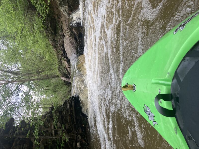
In terms of rapids in this stretch, there is a ripple right at Hwy 42, otherwise nothing before Buckhorn Road. You can park right by the creek on Buckhorn Rd and my recommendation is to park by the Buckhorn Dam at the Cape Fear River. The creek is class II, with II+ at higher water (250 CFS or higher). For the rapids, start anywhere near Buckhorn Dam; there is a trail that runs parallel to the river and creek. If water is very high, you can start at a pond right by the dam and paddle into the creek from there. About half a mile from the parking area several ledges drop about a foot each, some of which are fun easy surf holes. About 3/4 of a mile in, the creek curves to the right and there is a set of class II rapids with the biggest drops toward the end once you see an unexpected horizon line. For the most fun, hug river left catching two 2.5 ft drops with holes at the bottom. River right is a more gradual drop but the main flow will send you right into a rock that can flip you. This is followed by a small drop before flat water. The confluence is then about a tenth of a mile away. To make this run worthwhile, consider the more exciting rapids on the Cape Fear below Buckhorn Dam, which are most fun running either river right in the main channel or far right channel, working left and then ferry left of the island and far river left to get to Buckhorn Creek. You can then hike the trail to put in about a half mile. No matter how you r
...Rapids don't have any specific names, but a few class 1 ledges start at this point with some easy surfing. After the creek curves hard right, current pickes up and at the horizon line will be some bigger drops. River left at this point will be more straightforward and river right will require more manuevering.
Oct 7, 2024
I ran the rapids on the Cape Fear at 9,555 cfs (Haw and Deep River gages at Moncure combined) and then ran the short section of rapids on Buckhorn Creek at 333 cfs after. The creek was a bit easier, but you would still want to be somewhat experienced with whitewater at this flow. The whole section of rapids on the creek at this level basically merges into one long wavetrain rapid with a couple of holes to punch at the end.
Apr 16, 2023
I'd consider it high flow since I rarely see this even reaching above 130 cfs. I ran this with the gage at Hwy 42 showing as 321 cfs. At this level, the rapids merged together at the beginning to form some wave trains and the end part I'd consider class II+. There was a mildly entertaining surf wave just before the curve right. I ran the last drop twice, once river right, which was fast and once river left, which had what looked to be sticky holes but it was easy to glide over them. I then drove to the Rollins Mill busted dam above Harris Lake and ran the single drop there. Nice rapids on this creek, just not very many and at high level water, be prepared to run the drops on the fly with very few areas to catch an eddy.