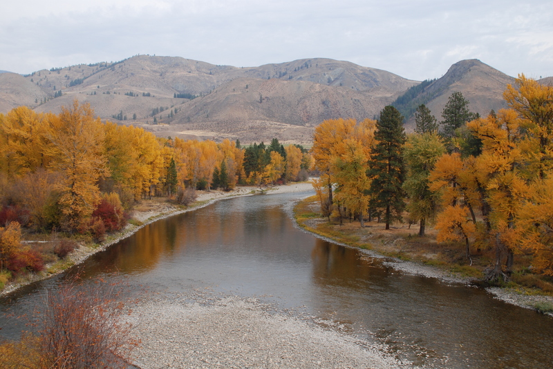
Methow
1. River Bend Campground to Carlton
| Difficulty | II(III) |
| Length | 50.2 mi |
| Avg Gradient | n/a |
| Gauge | Methow River at Winthrop, Wa |
| Flow Rate as of 51 minutes | 410 cfsbelow recommended |
| Reach Info Last Updated | August 17, 2022 |
The Methow Valley is one of the most important landscapes in the state of Washington and of national significance for outdoor recreation with a diversity of opportunities for the recreational pursuits our members enjoy. Every spring, whitewater boaters enjoy the experiences on the Methow River, Chewuch River, and Twisp [...]Read More
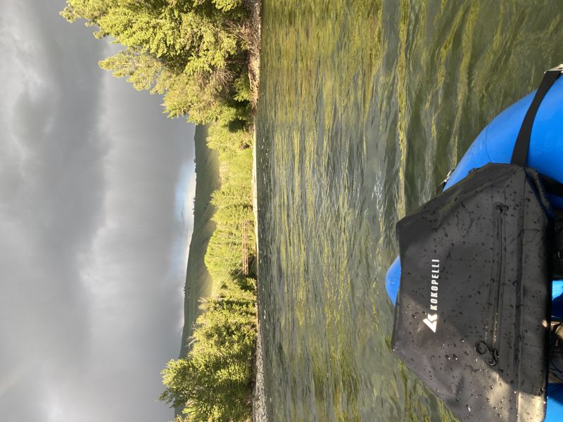
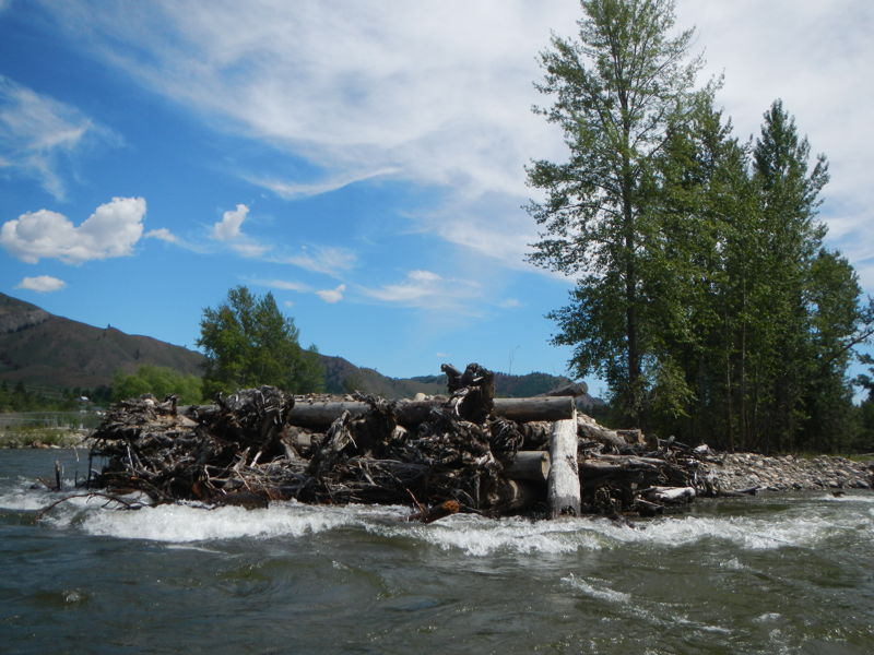
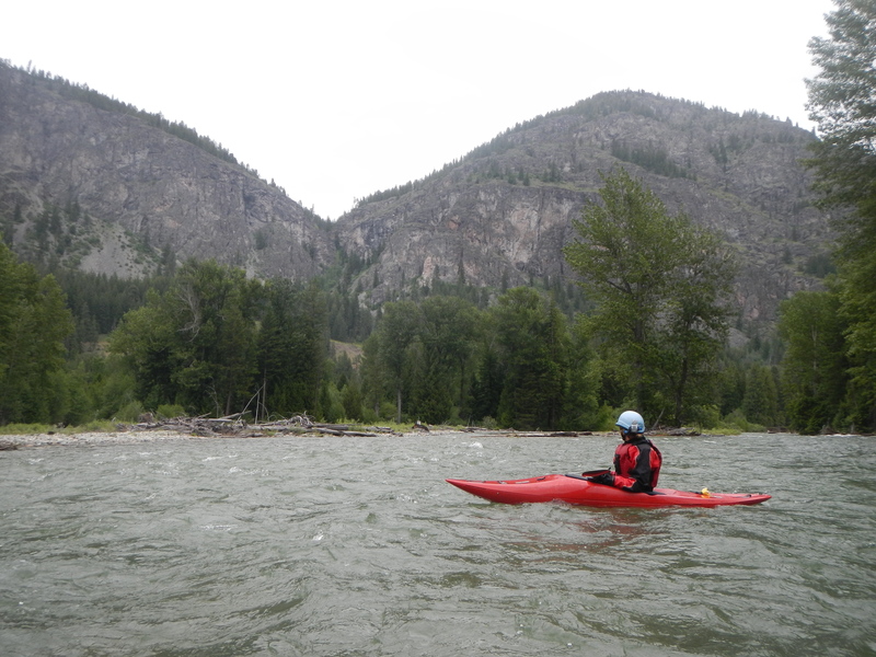
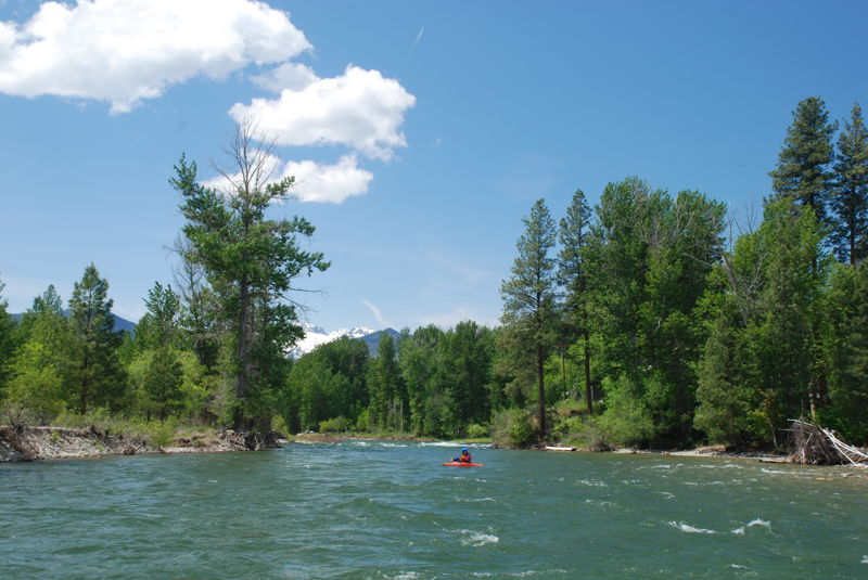
This is a long stretch of river and there are a number of different access points. The runs are mostly class II whitewater but beware of the ever changing wood hazards. In the upper reaches these can block the channel and during high spring flows the swift current requires quick and smart decisions.
Riverbend Campground to Mazama, 10.1 miles
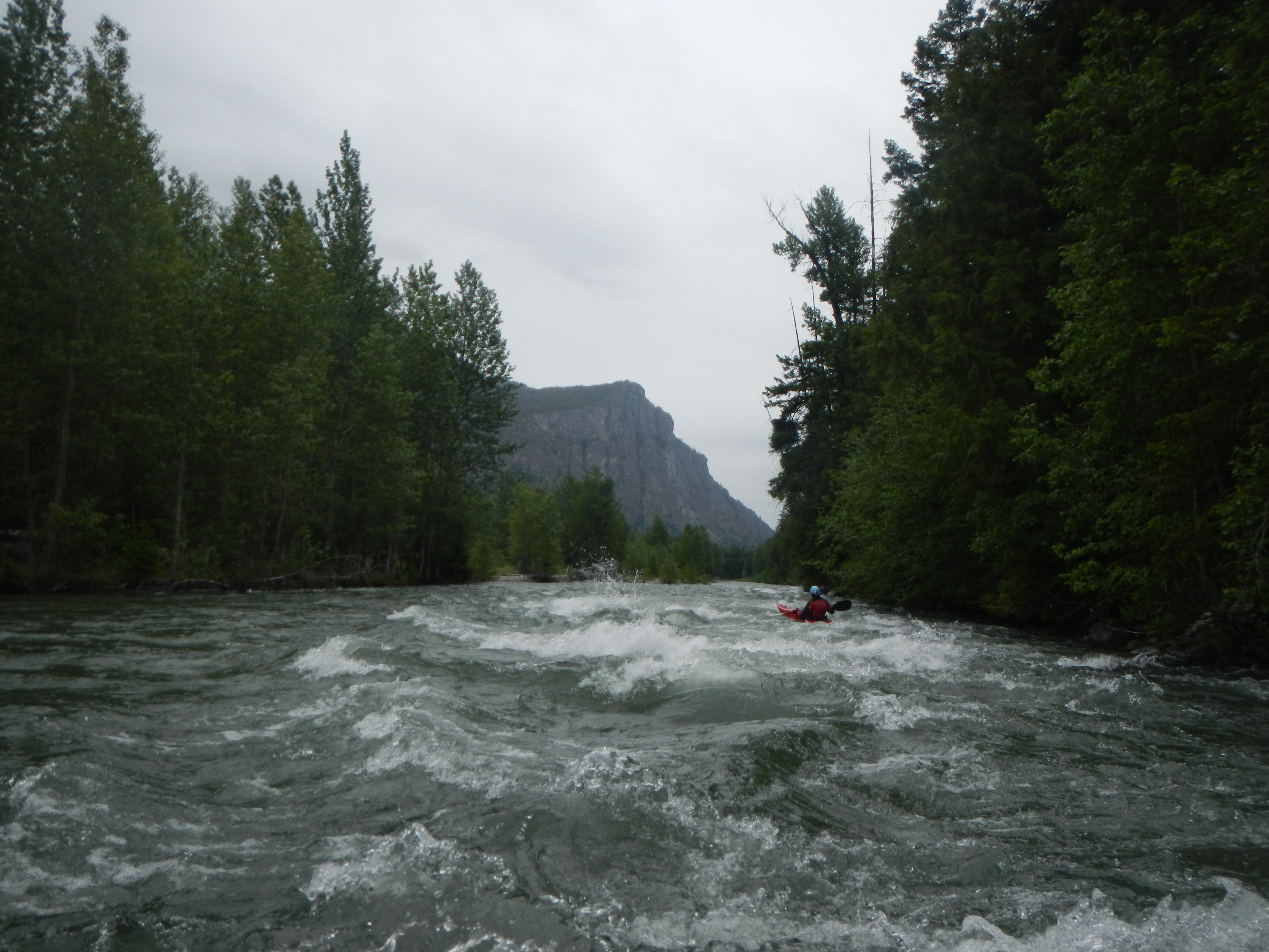
Starting at Riverbend Campground (river mile 75.5) the river begins its journey in the National Forest. It picks up additional flow with the Lost River (river mile 73.0) and then flows through Mazama (river mile 65.4). In this stretch down to Winthrop the river flows through a dynamic floodplain where rapids and wood hazards shift from year to year. For a nice 7.5 mile run on this section you can put in on the Lost River at the bridge, float down to the Methow, and paddle on to the town of Mazama. Park your bike at the racks at the Mazama Country Store for an easy bike shuttle. You will find some class II+ whitewater and great views of Goat Wall, the bold 1000' cliffs of greenstone that form the backdrop to the town of Mazama and attracts climbers.
Mazama to Winthrop, 15.2 miles
The section from Mazama down to Winthrop is less frequently boated but it is navigable. An intermediate access point (5.7 miles from Mazama and 9.5 miles from Winthrop) is at the Weeman Bridge (river mile 59.7). Lower gradient and frequent wood hazards can make this stretch particularly dangerous for inexperienced paddlers during high spring flows. Most enjoy this section by mountain biking or nordic skiing along the community trail that parallels the river.
Winthrop to Twisp, 10.0 miles
At Winthrop the preferred access is at the Red Barn (river mile 50.2), a community park at the west edge of town. This is just upstream of the confluence with the Chewuch River and with the enhanced flows the river flows through a wider channel with much more room to maneuver around the wood hazards that a
...This campground is reached by heading into Mazama (the turn off Highway 20 is at mile 179.5) and heading upstream on the Lost River Road that parallels river left. The campground is 9.6 miles from Highway 20.
Access the river at the Lost River Bridge and float down to the confluence to continue on the Methow. This access is only recommended for experienced whitewater paddlers due to the wood hazards downstream. The access is reached by heading into Mazama (the turn off Highway 20 is at mile 179.5) and heading upstream on the Lost River Road that parallels river left. The Lost River is 6.9 miles from Highway 20.
Access at the bridge across the Methow on the downstream river left side. This access is only recommended for experienced whitewater paddlers due to signficiant wood hazards in this reach. Located at Highway 20 mile 179.5 by turning into the road to Mazama. The bridge is 0.2 miles down the road just before you reach Mazama.
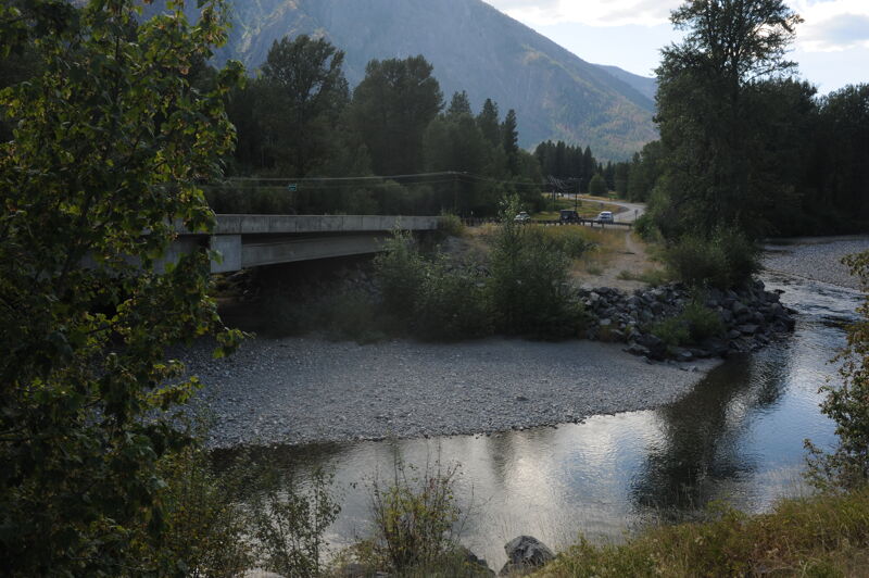
Access at the bridge across the Methow. This access is only recommended for experienced whitewater paddlers due to significant wood hazards in this reach. Members of the public do use this access point (typically upstream river right of the bridge) for access to the gravel bar for general water play in late summer. The bridge is located at Highway 20 mile 184.7.
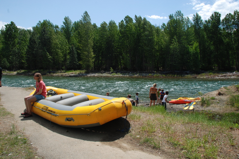
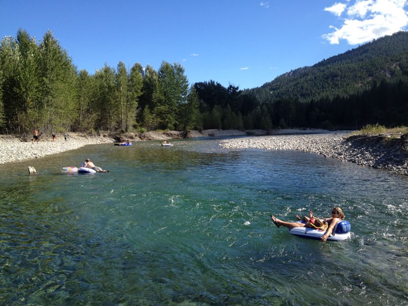
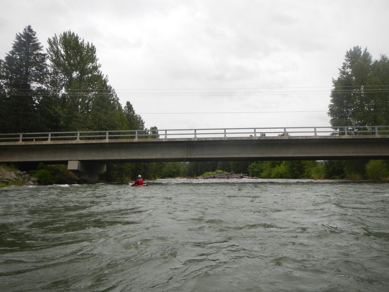
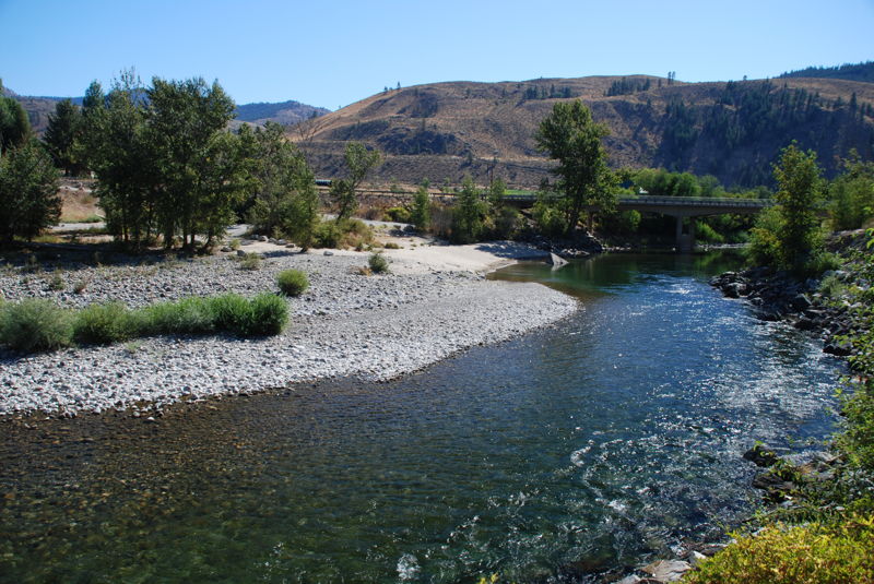
This access at the immediately upstream of the Chewuch River is the uppermost put-in for most floaters. Downstream of this point the river is more open and wood tends to be less of a hazard (although still present). In early spring this is a good access for rafts. In late summer when the water is warmer, this is a popular access for tubers. American Whitewater has supported efforts by the City of Winthrop to make modest improvements to this access point given the high level of use it receives. The access is located at Highway 20 mile 192.6 on the west side of town. The Red Barn should be obvious. Head towards the back of the parking lot towards the river for easy access suitable for rafts.
This access point is a popular option for tubers in late summer floating down from Winthrop. It is an intermediate access point on the run to Twisp located at a large pull out at Highway 20 mile 196.7. It is a steep climb up to the highway that is challenging for larger boats.
This access point is an intermediate access point immediately upstrem of the Riverbend RV Park on the run to Twisp. It is located at a pull out at Highway 20 mile 199.6. This site has convenient access to the water through a narrow gap in the vegetation. This is a good take out option for those floating down from Winthrop who are less confident at being able to make the take-out at the park in Twisp.
Access is available at the Twisp River confluence with the Methow River at Twisp Park and adjacent to the Wagner Pool. This is a tricky landing, particularly when the water is high, as you have to cross the incoming current of the Twisp River at the confluence and pull into a small eddy on river right. It's a short but steep haul up to the bank and some gaps in the vegetation make it possible to get a raft out here. American Whitewater has advocated for improved river access in Twisp. This access is located in the town of Twisp at Highway 20 mile 201.5: head two blocks east onto Twisp Avenue, and then two blocks north on Lincoln Street to the street end and the park.
River access site administerd by Washington Department of Fish and Wildlife. The site includes parking and a toilet with an unimproved access to the river. A Discover Pass or a WDFW Vehicle Access Pass is required to park a vehicle at the site. Access is at Highway 153 mile 22.4 on the upstream river left side of the bridge.
May 21, 2022
After taking a few laps through Winthrop on the Chewuch, I decided to cross the bridge and see what the confluence of the Methow had to offer. I put in at the Red Barn in Winthrop and I took out at Heckendorn Park. The float was short and pretty tame, especially after running the Chewuch. Directly after putting in there is a fun rapid where the river pours over some good rocks on the river left but this is really the only action on this whole run besides little riffles here and there.
From the confluence with the Chewuch there are little waves here and there but nothing significant. Cool to see the brown and blue/green waters mix at the confluence. Takeout at Heckendorn Park on the river left side, if you pass the concrete structure on the right bank you've gone too far.