Winnipesaukee
1. Tilton Road to Riverfront Park
| Difficulty | I-II |
| Length | 2 mi |
| Avg Gradient | 25 fpm |
| Gauge | Winnipesaukee River at Tilton, Nh |
| Flow Rate as of 1 hour | 301 cfsrunnable |
| Reach Info Last Updated | May 15, 2021 |
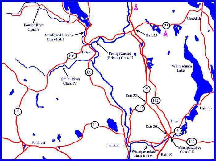
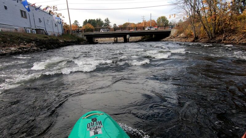
This is a great training river. It starts out very easy then gets a little harder as you head downstream. The first mile starts out with quickwater that gradually turns into class I. This class I rapid is great for learning ferrying and eddying manuevers. At the railroad bridge, run the middle channel between the abutements. Run the center of the next drop. There is a lot of pinning potential in the rocks downstream of this drop in low water. This drop is class II and II+ above 1000 cfs. The left side of this drop has a hole. You can eddy out just downstream to the left of the hole so you can get the best approach to a nice surfing wave adjacent to it. At the next railroad bridge look out for a pilling sticking out vertically just right of center of the center channel. At 700-800 cfs this pilling is just under the surface and hard to recognize. At lower levels it is obvious and easy to avoid. Just downstream of the bridge is a wide easy surfing wave just before the river splits around a small island with a town park on it. Just past a street bridge downstream, there is a nice wide surfing wave extending out from river right. This one does not have an eddy to serve it so you will need to catch it on the fly. Take out on either side of the river after the next bridge and past the line of restored train cabooses. River Left is parking for the Winnipeasukee River Trail; River Right has a picnic are and bathrooms in Riverfront Park.
Put in elevation........470'Take out elevation......418'Total drop..............52'Average drop/mile.......25'Distance................2.1 milesRiver width average.....60'River geology...........Small schist bouldersRiver water quality.....Good in spring fair latter in Summer, clarity fair to good.Scenery.................Fair, 1st mile forested, last urban with apartments right up to the rivers edge, some old dam remains with log cribbing and some rebarr.W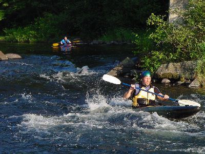
Class I in low water. This is the first rapid you come up to after negotiating a long section of quick water and riffles. Recognized by the first railroad bridge crossing. The center channel is usually the easiest. Approach the from river left then manuever right going straight between the bridge abutments.
Shortly after 1st Trestle comes the Crib. This rapid is formed by the old dam cribwork that can still be seen on the river right side of the channel. At medium and high water (greater than 500 cfs) a rather beefy hole forms on river left. Keep a straight line and run down the middle. At low water (less than 400 cfs) a good wave forms at the crib and can be accessed from a large rock on river left (which incidently forms the hole at higher water levels). Also, at low water levels, a long line of shallow pinning rocks become exposed on river right just after the Crib. Paddle far downstream to catch the eddy on river right.
The only thing to look out for here is a bridge pilling vertically sticking out in the middle channel of the railroad bridge. At medium to high water (700 to 1300 cfs)this pilling is just below the surface and can be difficult to see. Just below the bridge there is a nice easy river wide wave that forms just above Gazebo Island. This wave is much easier to access and surf than the one upstream at the crib.
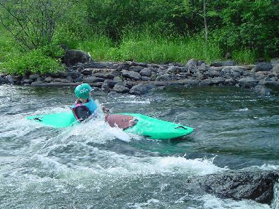
Just below the Bridge street bridge is a rather long rapid for this stretch of river. The general route is just slightly left of center. At medium to high water a nice glassy wave forms at the top of the rapid from river right and extends to the center of the river. However, there is no convenient eddy to access the wave so boaters must try to catch the wave on the way down. Look out at low water levels, this wave is formed by a log crib that still has some spikes protruding. A couple of boats have been holed here.
Jun 22, 2025
I ran this in a 15 ft open canoe with airbags. The put-in is super easy. There is a small boat launch with not a ton of room. The first bit of the float is easy riffles. At the current flow rate, the waves weren't huge and were easy for me to navigate. As you reach the end, you'll approach a bridge. The best route is to approach from the river left and hit the tongue by the third pylon. The current will try to push you far right, but it's easily avoided. Take out before the Dam on river right. There is a nice surfing wave when you're done. Overall, a really easy run.
Oct 17, 2022
I ran the Upper Winnie today. Not sure what the actual flow was, because this site claimed 540 cfs but a gauge I saw just above the first tressel was reading 320.
I don't have anything to add to the info here on the established sections. However, today the dam was open below the takeout area, and the level was 20+ feet lower than it normally is at the take out. This made it so that the usual calm area from below the rapids at School street bridge to the take out was not calm, but rather a series of rapids under the Park Street bridge and tressel and turned into an area better resembling the Lower Winnie. At this drainage level, there's a big log strainer at river left just around the turn from Park Street bridge. Further down stream there's another strainer lodged in big boulders mid river, but it doesn't stick out very far. River right looks to be the best route through here. After these drops, the river turns back into riffles with some small surfable waves. Expect a steep climb up the bank to the parking area at the take out.