Stekoa Creek
1- Upper: Highway 23 to Rickman Airfield Road
Dec 28, 2008
Here's a Trip Report from -2' I posted on Boatertalk:
Having Gotten a late start today, I decided that it would be a good day to check out the Upper Section of Stekoa Creek from 441 to Rickman Airfield Road in Clayton, GA. The only beta I have heard until recently was that it was all flatwater with big portages. Recently I noticed that Logan James had been in there and posted some pictures of it at very low water on American Whitewater, and I decided that it'd be worth checking out.
When we put on at 3pm this afternoon, the gage was reading approximately -2'. Based on our day, I'd call this a Low level, and I wouldn't personally run it lower. I'd like to see it with a few more inches to pad out some of the shoals and shallow slides between the rapids. Most of the drops channelize well though. I definitely wouldn't recommend going in there with high water unless very familiar with the run, as most of the scouting is at river level and exiting the gorge would be tough with steep Rhodo infested banks. At this level we ran everything except for the Big drop at the beginning, which just looks nasty, and the top drop of 20-20, which lands on rock. We portaged around one Log Jam, which we later found was passable at the far right.
All I can say is that this run is much higher quality than I was expecting! Good drops, easy shuttle. I can't even count the number of times I have driven right by when it was probbably running. Today the Chattooga only spiked from 1.6-1.8, so it doesn't seem that it'd take a lot of rain to get it going. The water quality is bad, but bearable.
Photos from our trip are on the third page of photos for this reach.
I'd really like to get back in there with ~3-6' of water or so on the Gage.
Also, just as a heads up, I think that with the water we had today, most of the major drops are IV+ or easy V. In my Opinion, The AW page ratings currently are a little off due to being based on a lower water level. I'd compare the difficulty to that of Overflow Creek for those that are interested in trying it out.
-Tim C
Dec 28, 2008
2nd Drop of 20-20.
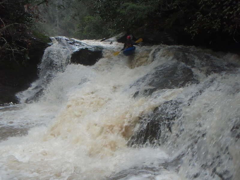
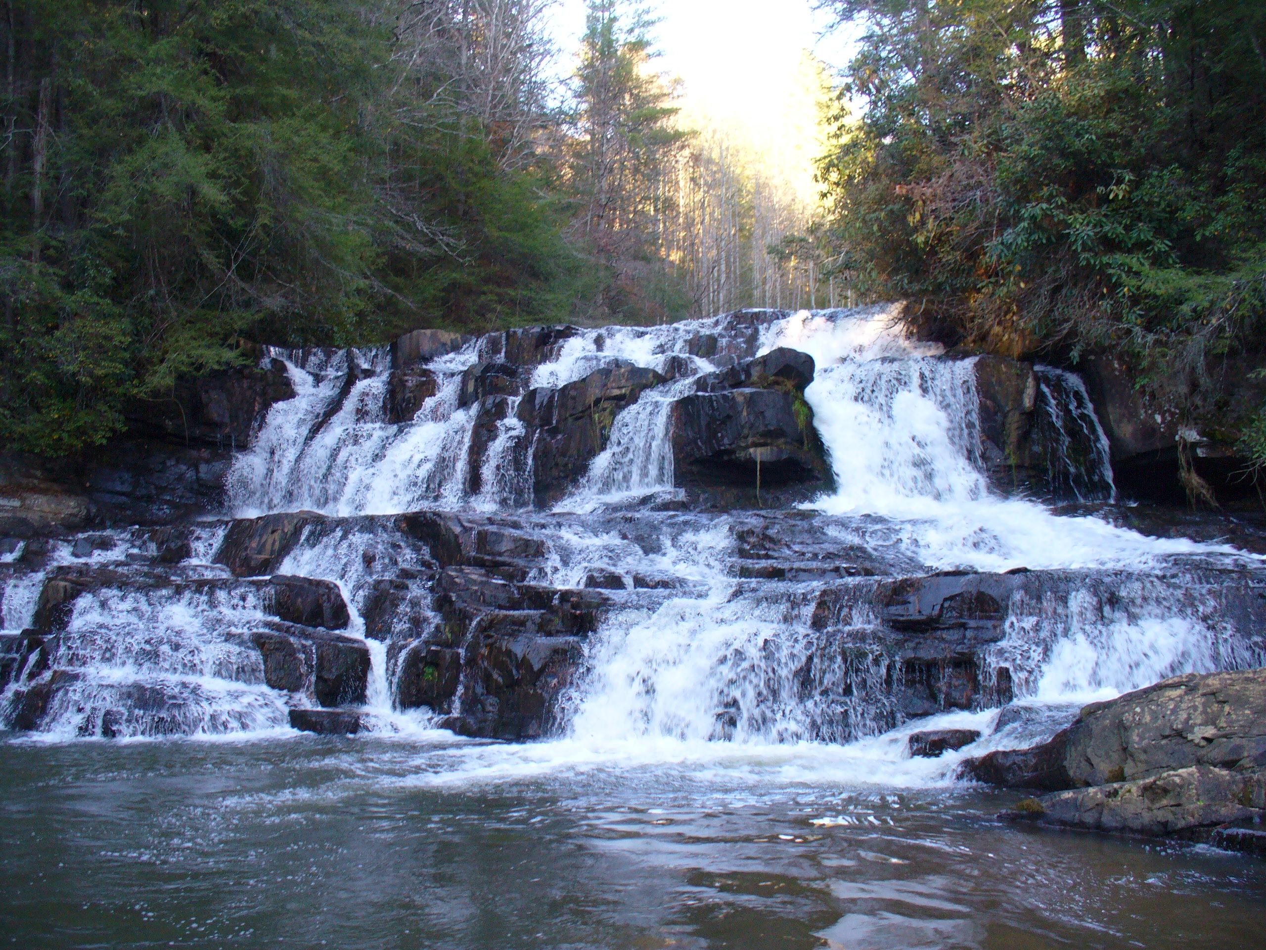
Last major drop on the upper section of the Stekoa.
Nice early drop on Stekoa Creek.
Dec 28, 2008
Top and Middle drops of Clayton Powerplant at -2'. It looks like it would clean up with more water
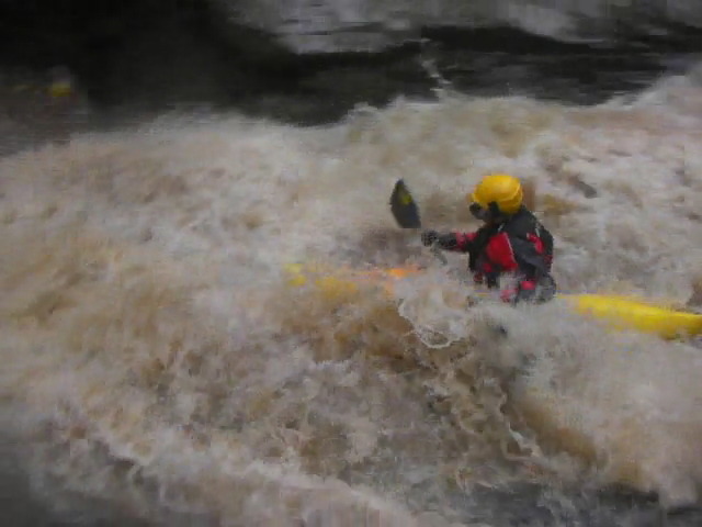
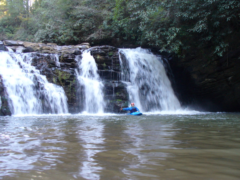
David Spotts runs the second major drop on the Upper Stekoa. Watch the right at the bottom here, because even at this level there is a toilet bowl with a decently high eddy fence... being caught here at high water would be ugly. Fortunately I think that at higher water it would be easier to avoid the Right Side.
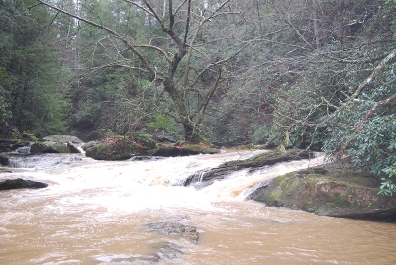
The gorge is very beautiful if you can look past the poor water quality and the trash floating in the eddies. This tree is growing up in the middle of the river above the 2nd slide
David Spotts about to drop the 2nd drop of 20-20. Unfortunately, I was having camera issues and missed the money shot. At this level the 2nd drop of 20-20 went, on the River Left. Much Lower and I'd think it'd be hard not to dry out and fall off face first.
At this level, double crack has a clean line from Middle to Left of Middle off of the rock in the foreground.
At -2' the middle line opens up avoiding the 'Mean Holly Tree'
Jul 16, 2007
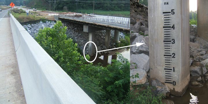
I painted a paddler's gage on the new Hwy 441 south bound bridge over Stekoa on 7/14/07. To see it, you'll need to park on Rickman Airfield Road, carefully cross 441 to the median between the north and south bound bridges. The gage is on the South bound bridge river right, downstream pilon. Please report your levels and low, medium and high info so we can dial this gage in and develop a correlation. E-mail info to me at h2olevelcheck@hotmail.com. -- Thanx -- Rob Maxwell
Jul 14, 2007
The Paddler's Gage for Stekoa Creek is on the new South bound bridge of Hwy 441. Its on the downstream river right pilon and easily seen from the median between the bridges. Park on on Rickman Airfield Road and cross 441 carefully to view the gage.
Dec 13, 2005
Be aware that the city of Clayton dumps it's 'treated' sewage into Stekoa. It isn't called 'Stinkola' for nothing.
Jan 1, 1900
This is the 2nd Major Rapid on upper Stekoa Creek. It is a slide that drops 15' or so verticle. The level was -12' on the gage painted on 441, and the Chattooga was at 1.6
This is the 2nd Major Rapid on upper Stekoa Creek. It is a slide that drops 15' or so verticle. The level was -12' on the gage painted on 441, and the Chattooga was at 1.6. We ran it later at -8' and the hole at bottom was starting to get sticky, one boat got stuck in it for 5 minutes.
This is the 3rd Major Rapid on upper Stekoa Creek. The level was -12' on the gage painted on 441, and the Chattooga was at 1.6. It is a double drop of about 40 feet total. The photo is of the top part of the drop. Land on bedrock.
This is the 3rd Major Rapid on upper Stekoa Creek. The level was -12' on the gage painted on 441, and the Chattooga was at 1.6. It is a double drop of about 40 feet total. The photo is of the bottom part of the drop. Landing seemed pretty shallow. We portaged, but with more water the bottom of the drop defently look like a go.
This is the 4th Major Rapid on upper Stekoa Creek. The level was -12' on the gage painted on 441, and the Chattooga was at 1.6. It is about 10 feet or so verticle drop that had a bad crack sieve on right side and left look a little nasty with the low water. Middle is clean but might be hard to hit with lots of water.
This is the 5th Major Rapid on upper Stekoa Creek. The level was -12' on the gage painted on 441, and the Chattooga was at 1.6.
This is the last big rapid on Upper Stekoa Creek gorge. The level was -12' on 441 bridge and Chattooga was at 1.6 very low.