Kings
3. Kings River Powerhouse to Big Creek Cove(Hidden Kings)

| Difficulty | II(III) |
| Length | 7.3 mi |
| Avg Gradient | 22 fpm |
| Gauge | Kings Inflow Pine Flat Res |
| Flow Rate as of 1 hour | 699 cfsbelow recommended |
| Reach Info Last Updated | December 16, 2016 |
This section of the Kings River is usually only available when Pine Flat reservoir gets very low. When storage in Pine Flat is 300,000 acre feet or less, most of this river section returns. The reservoir can get low in late summer and fall of dry years. During these periods the outflow from the Kings River Powerhouse can provide enough flow for fun boating. Sometimes the reservoir will still be low during the winter when big storms provide large flows. Some years the reservoir may remain low enough to make the run worthwhile during the early spring snowmelt season. The reservoir will quickly rise during spring runnoff and during wet winters.
The army corp page for Pine Flat gives the exact reservoir surface elevation. The normal take-out at the mouth of Big Creek is 750' elevation. Since the gradient is around 17 feet per mile near Big Creek, you should be able to estimate how much flat water you have to paddle at any lake elevation.
Mileage and Elevations:
Location
Mile
Elevation
Drop
Kings River Powerhouse
0
910'
0'
Mouth of Big Creek
7
750'
160'
Mouth of Sycamore Creek
8
730'
180'
Trimmer
9
715'
197'
Take-out: Drive around Pine Flat reservoir on Trimmer Springs Road. Beyond Trimmer Springs, the road goes around and crosses two major inlets. The first is Sycamore Creek, the second is Big Creek. Just as the road leaves the main reservoir and turns north into the Big Creek inlet, there are some turnouts and a dirt road/trail leading back down towards the main reservoir. Park there. GoogleMap of Take-out hi
...
If there is enough flow in the river above the powerhouse, boaters can launch at Kirch Flat or higher. The first rapid below the Kirch Flat rafting access area is a wide drop with choppy waves.
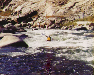
This is a steep and powerful rapid when there is flow above the powerhouse. The water drops over a wide bar from river right to left, then piles against giant boulders on river right. This rapid is as big as any in the Banzai section above and perhaps more intimidating than most.
Launch below this rapid when the main flow is coming from the powerhouse.
In late summer and fall, the river flow is too low to boat until the powerhouse turns on. Launch in the pool by the powerhouse outflow.
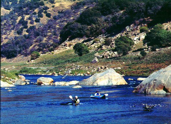
The river is very wide and flows around a large number of small boulders. The current is modest so it makes a great slalom practice area.
An easy rapid constricts down as it picks up speed. A surprise hole waits at the bottom in the middle of the channel.
Similar to first rapid; long and gradual, but with a pile of rocks in the bottom middle instead of a hole.
A reservoir elevation of 880 feet reaches to about here.
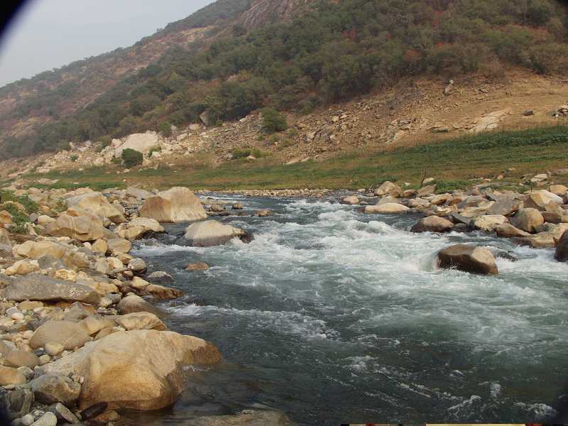
Below Third Rapid, fast current and small waves with scattered rocks continue for over a half mile. The gradient increases a bit at mile 1.7 and at mile 1.9 there are some bigger waves.
Four giant boulders sit in the middle of the river. They appear to have come from a cliff high on river left. The current is moderate, so it is easy to paddle all around these boulders to inspect them.
Immediately below the Giant Boulders is a small island. Take the left channel for the easiest set up. The right side of the river below the island is guarded by a thick band of rocks. There are several channals through these rocks from the right back to the left side. A debri fan from a steep drainage on the left blocks the left side and creates a steep chute back to the right side. The chute is wide and easy at the top but constricts towards the bottom where there are several deep wave holes and a final exposed rock just left of center. (at 1100 cfs)
Elevation here is around 860'.
Approximate end of the river when the reservoir surface is at 840 feet.
The river will reach this far when the reservoir elevation is at 800 feet. Three sets of high voltage transmission lines cross the reservoir just before this point.
The river extends to this area when the lake is at elevation 780. Current will extend a little ways past this.
Aug 18, 2002
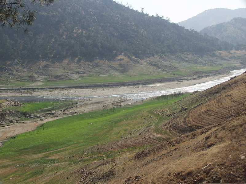
This view is from the road looking down at the confluence of Big Creek and the Kings river. There is no way around it. You just have to carry your boat up this hill from the river to the road.
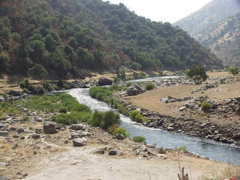
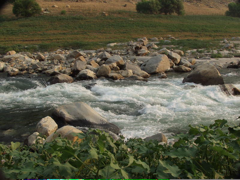
Looking from the road downstream to the nice boulder field and past to the first class 2 rapid. These boulders make for a great practice area. Boaters can even paddle back upstream to the put-in fairly easily from here.
Aug 18, 2002
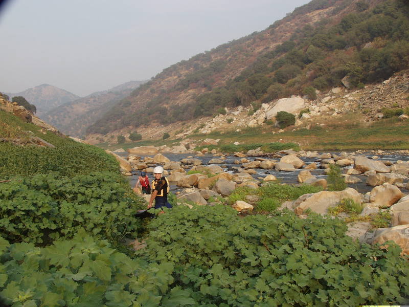
We typically launch into this short man made channel below the powerhouse. It would be easier to launch into the main river out of sight to the left, but there is a large rapid there which is usually too shallow to run at this time of year.