Arkansas
10. Parkdale Launch to Canon City (Royal Gorge)(Royal Gorge)
| Difficulty | III-IV(V) |
| Length | 10 mi |
| Avg Gradient | 46 fpm |
| Gauge | Arkansas River at Parkdale, Co. |
| Flow Rate as of 52 minutes | 221 cfsIII+(IV)low runnable |
| Reach Info Last Updated | May 17, 2026 |
Water allocation has always been – and always will be – a major issue in the arid West. Colorado has long struggled with how to best use and share the wealth of water its mountains provide. Recent and ongoing efforts will chart the future of water diversions and could [...]Read More
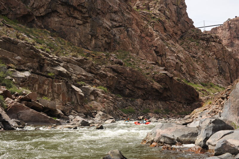
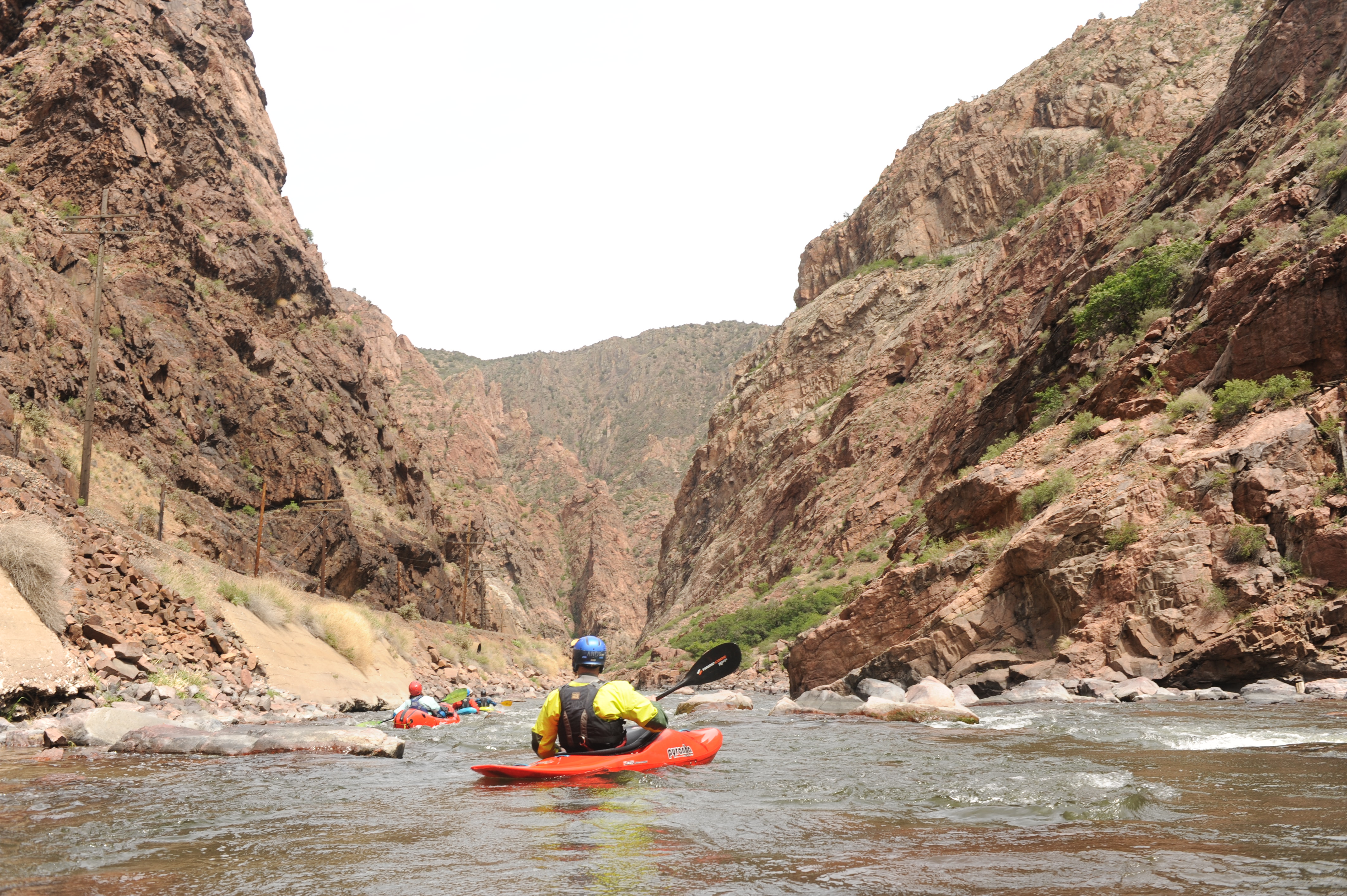
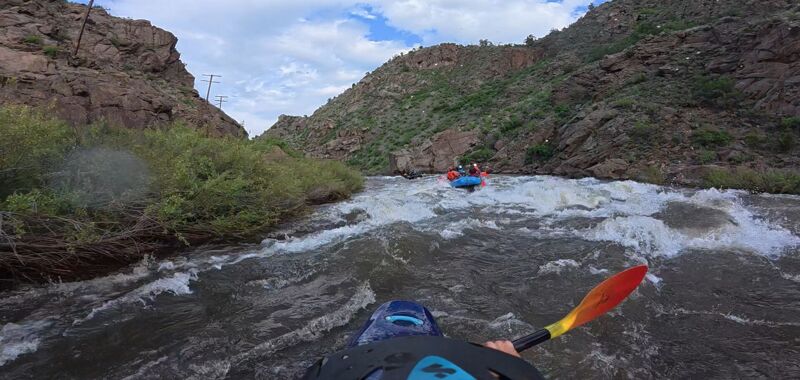
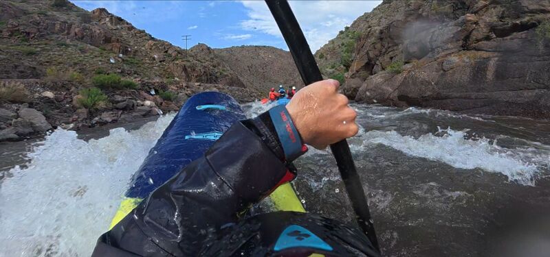
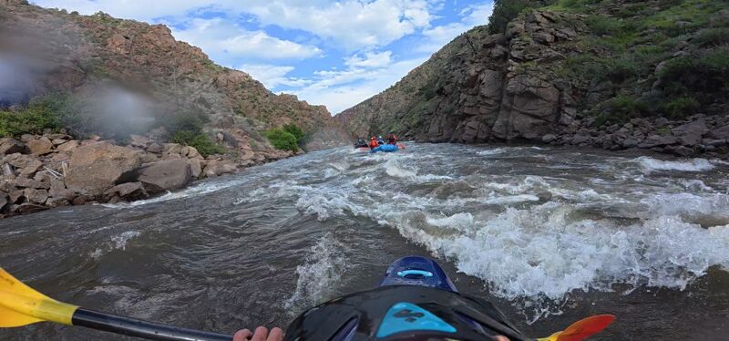
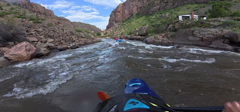
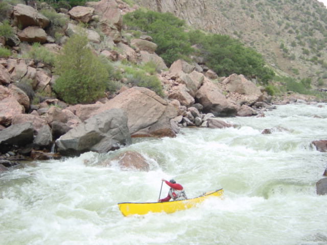
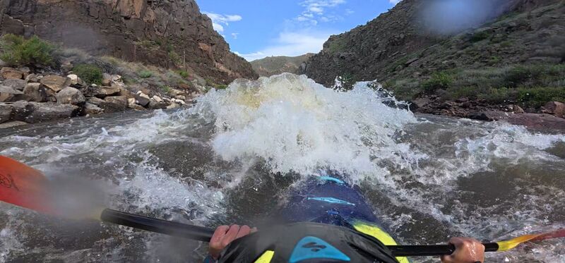
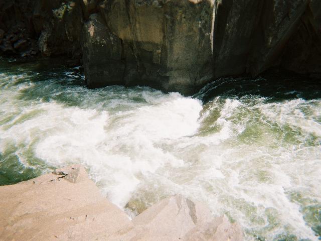
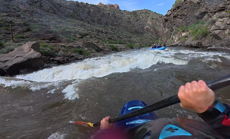
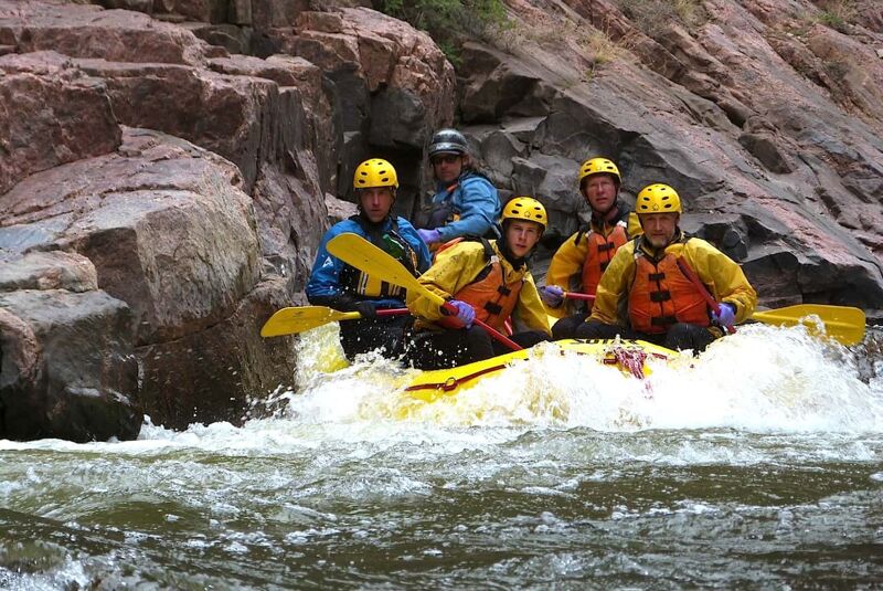
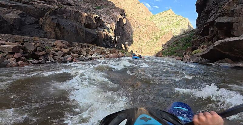
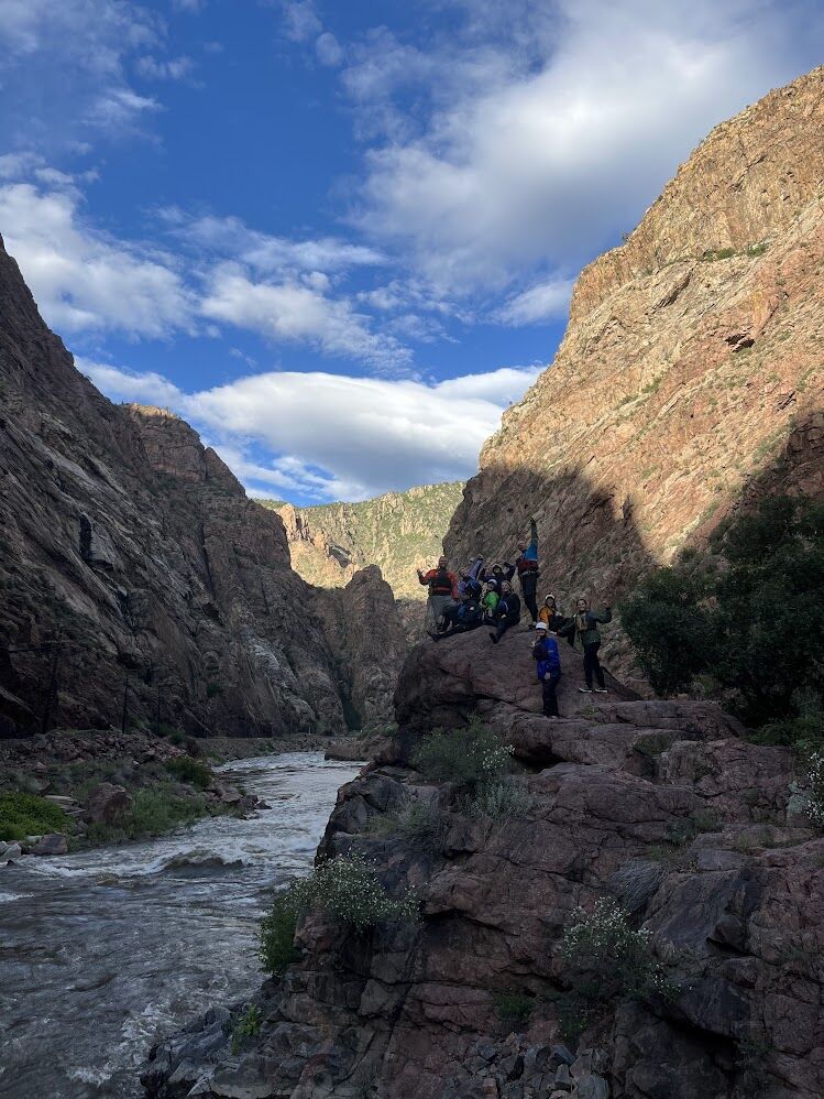
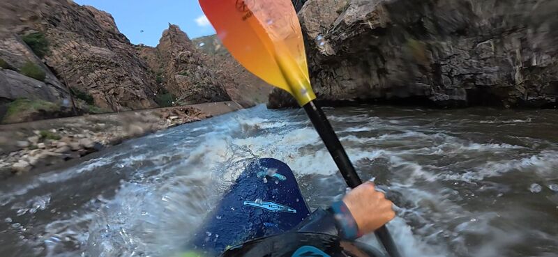
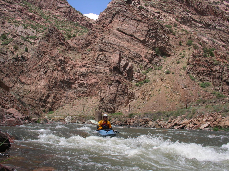
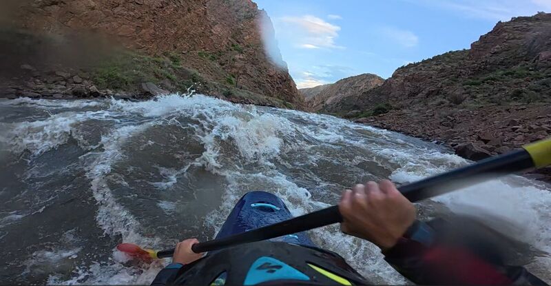
The Royal Gorge is one of the defining whitewater runs of the Arkansas River: a 10.5-mile descent into a canyon nearly a thousand feet deep, where the river accelerates through a sustained sequence of rapids beneath towering granite walls. Averaging 46 feet per mile, the run offers a distinctly continuous character, especially from Primero downstream through Ed’s Rock, where rapids blend together with few meaningful breaks in the action. At lower flows the Gorge features technical pool-drop rapids while still demanding precise boat placement and quick recovery skills. As flows rise, the river transforms into a powerful big-water run with long wave trains, exploding lateral waves, and massive hydraulics that can feel far more consequential than the gradient alone would suggest. The deep canyon, cold water, and limited access contribute to the committing nature of the run.
The setting of the Royal Gorge is as memorable as the whitewater itself. The river threads through a narrow chasm, at times only about 150 feet wide, with sheer walls rising directly from the water. Railroad tracks cling to river left for the entire length of the canyon, and paddlers can expect to be part of the show for passengers aboard the Royal Gorge Route Railroad—the only other way to experience the Gorge from within the canyon itself. Remnants of an old water pipeline remain visible on river right, reminders of the area’s industrial past. Midway through the run, the canyon reaches its maximum depth beneath the Royal Gorge Bridge, which spans nearly 1,000 feet overhead while tourists peer down into the gorge below. While individual rapids such as Sunshine, Sledgehammer, the Narrows, and Boat Eater have earned reputations of their own, the Royal Gorge is best experienced as a continuous run where the character of the canyon and river matter as much as any single rapid. The Gorge rewards paddlers with the skills and judgment to enjoy this special place across a wide range of flows. Even
...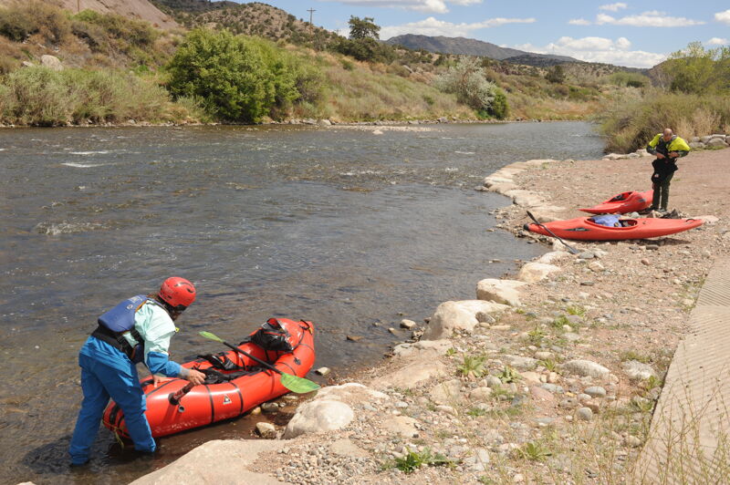
The Parkdale Recreation Site, located about 12 miles west of Cañon City along U.S. Highway 50, serves as a primary public put-in for the Arkansas River just upstream of its entry into the Royal Gorge. Signed as the Parkdale Recreation Area, this access point is part of the Arkansas Headwaters Recreation Area and is administered by Colorado Parks and Wildlife. The site offers ample parking, an expansive shade-covered picnic area, a permanent toilet, and a changing area, along with a well-developed launch featuring two large boat ramps. A valid Colorado Parks and Wildlife pass covers use of the site, or visitors can pay the standard $10 daily vehicle fee at an on-site electronic kiosk, which includes all occupants of the vehicle.
El Primero is the first rapid of the gorge and is the start of a sequence of three rapids that come in quick succession offering a warm up and introduction to the run. El Primero comes in two parts. In the first half run towards the middle and then back left to stay away from the wall due to a small hole that may pull you into a small undercut depending on the level. For the second half just stay in the middle and read and run
Stay center and enjoy the wave train. Approximately halfway through the rapid you will encounter a rock or hole, depending on level, towards center right that is pretty easy to see and miss.
This rapid is an easy wave train; remember to wave to Skag the face on the wall and splash some water for good luck in the gorge. Enjoy your last few chill moments before the next \~30 minutes of class 4 whitewater. If you are at this point and find the rapids to be overly challenging, you have two options for an exit: the first is to hike the couple of miles back to the put-in and the second is to hike up the trail on river left and walk back to US 50. The run is progressively challenging are you descend into the gorge.
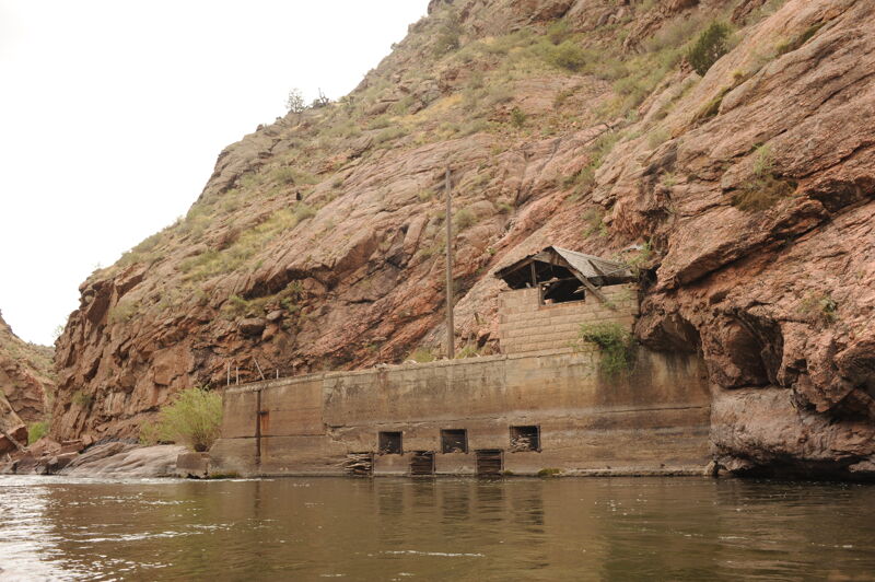
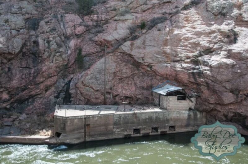
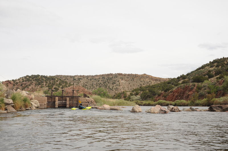
Pumphouse is a two part rapid. Run towards center at the start working to keep the laterals from pushing you onto the old pumphouse. For the second half start center then work right of center unless you want a big hit in which case stay center to left of center. The name Pumphouse comes from the old building on the right from where the caretaker would open the dam gates to fill the pipeline that flows from all the way through the gorge on river right into Cañon City. The pipeline was built from 1908 and 1910 and was a 7-mile long, 30-inch cedar pipe that supplied water to the city for many years. The pipeline was abandoned in 1973.
Run center through this easy wave train that flows into Sunshine, the first class IV of the day. The name Caretakers comes from the small white house river right where Cleo Combs lived and was the caretaker of the pipeline throughout the royal gorge. Combs's job was to walk along the pipeline and check for leaks in which case he would repair them to ensure a steady flow into the city. The caretaker's house can be a cool place to pull off and enjoy the legacy of the gorge.
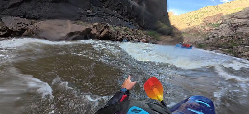
Sunshine is the first big rapid in the gorge recognized by a very large boulder marks the entrance river right. The rapid can be scouted on the right which is also a portage option for kayaks. The line and level of difficulty changes depending on level (Class III-IV at \ 3,000 cfs). At 2000 cfs and above you can run right and keep a bow right angle making sure to stay out of the big holes through the middle of the rapid; the farther center you go the bigger it gets. At flows below 2000 cfs start river left and drop through about a 7' chute into a hole then start working back right, a little over half way down be ready for a big hole coming from right shore called El Giante (The Giant). Safety can be set on river left at the very bottom of Sunshine but if running during the summer expect commercial photographers to be standing on the rock creating the eddy. After running Sunshine, be ready to drop straight into the next class III+ to IV The Greatful Dead
This rapid is a read and run big water class III+ with lots of large holes to miss that then transitions into a fun set of haystacks before the last feature where you want to run right to left avoiding the pour overs on both sides of the river. At flows under 900 watch the rock that appears in the middle of the slot, a new feature as of summer of 2025. You have a couple of eddies on left and right to regroup if needed before dropping into Sledgehammer.
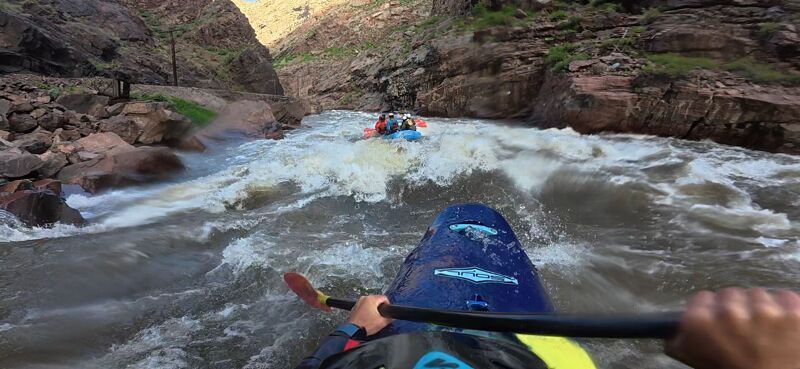
Sledgehammer is often the crux of the run the best line depends on flows. At 2000 cfs start left and you will see the first big hole that covers the whole middle to right side of the river. This drop is called Bird Drop. Once past this feature, work back to the middle quickly, run the big rooster tail, then work your way back to the left. The river lets you catch your breath for a moment before pulling back in before two large holes, run similar as before with bow left angle staying out of the holes in the middle. At high flows only the strongest will want to venture to the center although though it washes out above 4000 cfs. Be careful with the eddy in the middle and the rock at the bottom known as Tractor Beam due to its tendency to pull boats into it when guides aren't paying attention.
Hey Diddle Diddle (Stay the Heck Out of the Middle). Start left then move back right and ride the eddy line down to avoid the hole at the bottom known as Car Crash due to how hard the hit is. It is a simple line that can be high consequence if you run the middle.
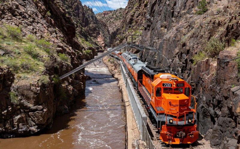
The Narrows is the most dramatic section of the Royal Gorge where the bedrock walls extend a mere 40' wide and rise 1000' overhead. The challenge builds with the flow as the water has nowhere to go but up forming complex long ten-foot high wave with holes. Generally stay to the center and avoid the reinforced wall along river left that has protruding metal used a reinforcements for the rail bed. The railroad bridge in this section was considered a modern marvel when it was constructed in 1879. Originally, the entire weight of the bridge was supported by three steel A-frames, but it was later fortified by rock and concrete when the train was upgraded from narrow gauge to dual gauge in 1890. The Fishbowl comes at the end of the Narrows where the old funicular tram descends from the rim. At one time tourists could ride this tram down into the gorge but it was severely damage in the 2013 wildfire and is no longer in service.
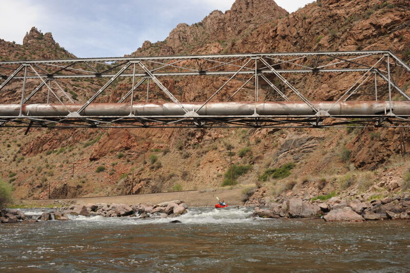
Wallslammer rapid starts just past the end of the hanging railroad bridge on river left and passes underneath the Royal Gorge Bridge. The goal here is to stay off the right wall. Start center, missing the hole near the top on river right known as the vortex that is notorious for grabbing boats and slamming them into the wall, giving the rapid its name. One past the hole run center with bow left angle and using the laterals coming off the right wall to keep you out of trouble. The Royal Gorge Bridge high overhead is currently the highest bridge in America and the 26th highest bridge in the world standing at 956ft above the Arkansas River. Construction on the bridge began in June 1929 and was finished and opened to the public just 7 months later in December 1929.
Corkscrew is a great rapid to catch your breath for a moment after running the Narrows. Start river center to center left and just work to stay center, stay off the rocks at the bottom left in the corner. Right after the rocks you will encounter a good hit before rounding the corner to Boat Eater.
Boat Eater can be simple to run but the river will let you know if you run it wrong. Start in the center and enjoy some fun waves until you start seeing some waves splashing up. Once you see the waves angle your bow to the right and push through the lateral coming from the right shore riding the eddy behind the rock creating the lateral until you pass Boat Eater hole--you will know when you pass it. Boat Eater forms around 1200 cfs and just gets bigger and bigger as the water comes up. Below 1200 cfs you can run left of the rock that creates the hole and splat your bow along the rock to get pushed around the corner.
Triple drop is a pretty simple read and run with some large holes mainly river center to center right. If trying to stay conservative run left and stay there but if you want some big hits run closer to center left. A large hole at the bottom drop can catch you off guard so run center left of it at the bottom.
Corner Pocket is a common regrouping spot in the Royal Gorge and offers a couple good eddies. There is an eddy above the corner on river right, followed by another behind the rock wall on the right that can hold a large number of boats. The feature is defined by two prominent rocks: Soda Rock (with a pillow called Soda Fountain), located near river center, and Picnic Rock, which protrudes from river right and is visible from upstream where the canyon briefly widens. From roughly 2,000 to 3,500 cfs, Corner Pocket can be run either left or right of Soda Rock. The left line is the more conservative option: break through the lateral, stay left of the rock, and you will generally wash into an eddy below. As flows rise above about 3,500 cfs, Soda Rock begins to submerge and forms a large, retentive hole in the center of the river, making the left line the only reliable option. The right line is available at lower and medium flows and becomes the only route below about 2,000 cfs. Run right of Soda Rock with a strong rightward angle to avoid being pushed into the wall on river right. This line also provides access to the eddy behind Picnic Rock and the beach below, which is a popular stopping spot. At flows above 4,000 cfs, avoid catching the right eddy behind Picnic Rock, as re-entering the river can become difficult and may require a short portage downstream.
Just past the concrete abutment Lion's Head forms a play hole at modest to high levels. It can form some of the biggest haystacks on the gorge at high water but for most water levels just follow the wave train and have fun. Around halfway down the wave train you will encounter a pretty good hit. Just stay straight and it goes.
At all water levels run right of Tombstone, the bridge pylon in the middle of the river. Laterals can be pushy at some flows so run right with you bow angled to the right and you will pass by with no problem. The small buildings you see river left after passing Tombstone are part of the Royal Gorge Railway's Christmas Village.
You've done it, give yourself a pat on the back and from here on out the river is read and run. One good hit remains around halfway through the rapid where a lateral hole is near the center. Just T up and hit it.
Pipeline is named for the section of the Royal Gorge pipeline you pass under, bringing you full circle from paddling past the pump house at the top of the gorge. Pipeline rapid is chill at most flows. Run towards to the right to stay off the middle shoal then when passing under the pipeline go left of cetner to avoid the boulders on river left. About a tenth of a mile past the water pipe that the river passes under is Ed's Rock, located in the center of the river. Named for Ed Hansen. Touch the rock as you pass by. Ed is a founding member of “Gorge Club” which forms when the river hits 3000 cfs. The first rule of Gorge Club is: Nobody swims in Gorge Club. The second rule of Gorge Club is: Nobody swims in Gorge Club.
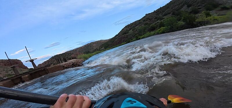
For boaters, the main line is generally straightforward but should be approached with care. At most flows, run center-right and follow the downstream wave train. A prominent rock or pour-over near the center of the crest provides a useful reference—stay to the right of it. At lower flows, the preferred line shifts toward far river left where the drop is cleaner. As with any low-head diversion, conditions vary with level, so scout if you’re unsure. This structure serves as the headworks for the historic Hydraulic Ditch, one of the earliest and most senior diversion systems in Cañon City. Established in the mid-to-late 1800s, it diverts water into a gravity-fed canal that still conveys flow through town and supplies a broader network of irrigation and municipal users.
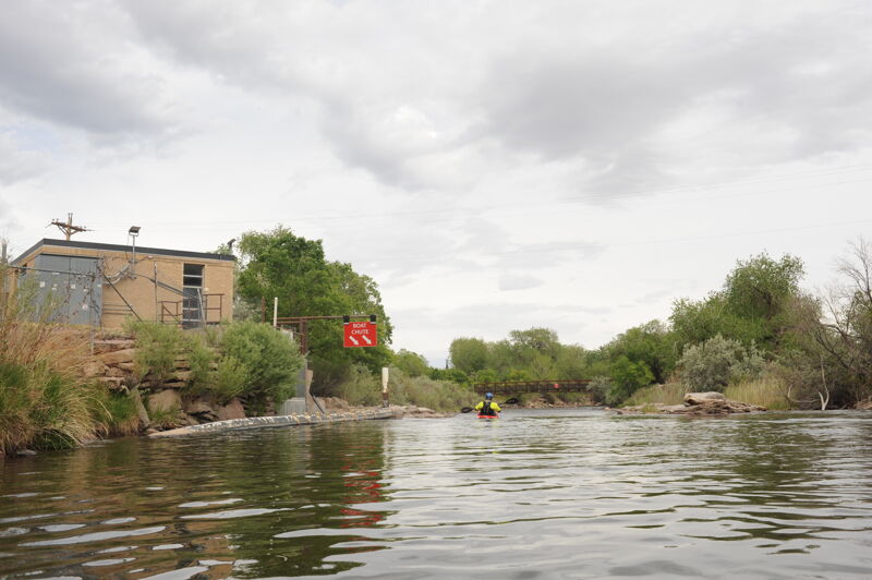
Big red signs signal the approach of the Cañon City Municipal Intake. Be sure to follow the signs that direct you the boat chute on river left. Be sure to avoid the hazardous low-head dam feature to river right. This diversion is the primary municipal intake for Cañon City that diverts water directly into the city’s treatment and distribution system.
Centennial Park in Cañon City serves as the standard take-out for this reach on river right, offering easy access via U.S. Highway 50 by crossing the 4th Street Bridge and following short, well-signed turns into the park. The site features a solid boat ramp, ample parking, and restrooms, making for a convenient and well-developed take-out. Located within the park is the Cañon City Whitewater Park, completed in 2010, which includes multiple in-channel features, sandstone step terraces, and enhanced river access points following extensive riverbank stabilization and habitat restoration. Beyond its boating function, Centennial Park is a popular community space with shade, picnic tables, grassy areas, a children’s play area, and a wading pool, with food and refreshments available within walking distance. As a shared public space, boaters are encouraged to keep the area clean and represent the paddling community respectfully.
May 4, 2026
The water was low but we still had plenty of fun enjoying the Royal Gorge at approximately 290 cfs. We put on at Parkdale around noon without a shuttle on the faith that we would figure something out in the end in Cañon City. None of us had done the run in over 20 years so we did not remember details but the rapids were relatively straightforward pool-drop rapids that we were able to boat scout without issue. Despite the low flow rapids like Sunshine and Sledgehammer still required class IV skills and featured technical lines. As we were coming through the Narrows we encountered a group in the middle of a boat recovery illustrating what happens if you get too close to the river left wall where large pieces of metal are used to reinforce the railbed. The boat was wedged in a solid 3 point pin and throw ropes and pulleys proved ineffective in moving the boat after about an hour of concerted effort. The paddler was able to flag down the train for a ride out and we all continued on through the gorge. We were at the take-out shortly before 4pm and did manage to find a shuttle back to the put-in.
Jun 7, 2025
Jul 7, 2022
When in Canon City for the Open Canoe Slalom Nationals, I organized a quick morning trip through the Gorge. A local kayaker named Hoka Bob, led another kayaker, Marty from Wisconson, Jerrod and Mike from Alabama paddling plastic OC1's and me, in an Empty Canoes FH (kevlar Ocoee). Team Alabama was impressive to watch! Launching off of rocks and doing 540 spins. Going everywhere I was trying to avoid.
My class III+ paddling had been infrequent the last 2 years but still convinced myself that this was an oppurnity I should not pass up. I watched some YouTube videos of kayak runs from 1200cfs down to 350cfs. I was under the impression that the level was around 800cfs, not 1030. If I had read the trip report from Paxton Jones, I might have thought better of the plans. Happy to report that everyone, myself included, stayed upright and unscathed. I would agree with Paxton that it is a bit more serious than the AW discription implies. Perhaps that is an open boater's perspective. Perhaps my rusty skills were a factor. I did seem a touch harder than section II of the Lochsa at similar flows.. in my opinion, a comparable run.
Awesome trip! Glad I did it!!
Alan B.
Missoula, MT and Bellingham WA
Sep 26, 2016
This is NOT class III. If you are not a solid IV boater you have no business in this river. Anyone who tells you this is III you should tell them about a nice play wave called Toilet Bowl in Gore Canyon (that is no more a guaranteed swim than a class III boater in the gorge at moderate flows) Even at 350 cfs this is still IV -...and the last hole in Sunshine remains IV+. A swim here would never be volunteered. At 1500 cfs the whole river is IV+. It becomes a funnel of fast water and in the Narrows especially. if you swim you will find yourself dragging your finger nails along the rock wall or concrete in an attempt to stop for a quarter mile. If you want a comparison the Royal at 350 cfs is very similar to the Zume Flume section of Browns Canyon. At 1500 in the Royal you better be comfortable surfing and rolling in the middle of Zume Flume. If you like Dowd Chute around 1000 cfs you will be right at home in the Royal. As long as you can handle it for 5 miles. Yes, I intend to scare you and protect you. Do not make this run your first 4+