| Difficulty | III+ |
| Length | 1.4 mi |
| Avg Gradient | 97 fpm |
| Reach Info Last Updated | April 2, 2005 |
River Description
North Fork Yellowleaf Creek, just off Highway 280 south of Birmingham near Oak Mountain State Park, could be either a 0.5 mile or 1.5 mile run. The 1.5 mile run would be from the Ivy Branch confluence through the Big Narrows, then through the Narrows, ending at the first major confluence from river right downstream of the Old Hwy 280 / CR 377 (Mountain Crest Rd) intersection. Here are the details on the first 0.5 mile run starting at the Ivy Branch Confluence through the Big Narrows from Judson Douglas:
The put-in is on Old HWY 280, where the Ivy Branch (which goes under the road) and Narrows creek come together. There is a place to pull off, and could hold about 4 cars. The take-out is on Old HWY 280, .5 miles from the put-in (there is a pull off there), you take 2 steps away from the creek and you're in your car!
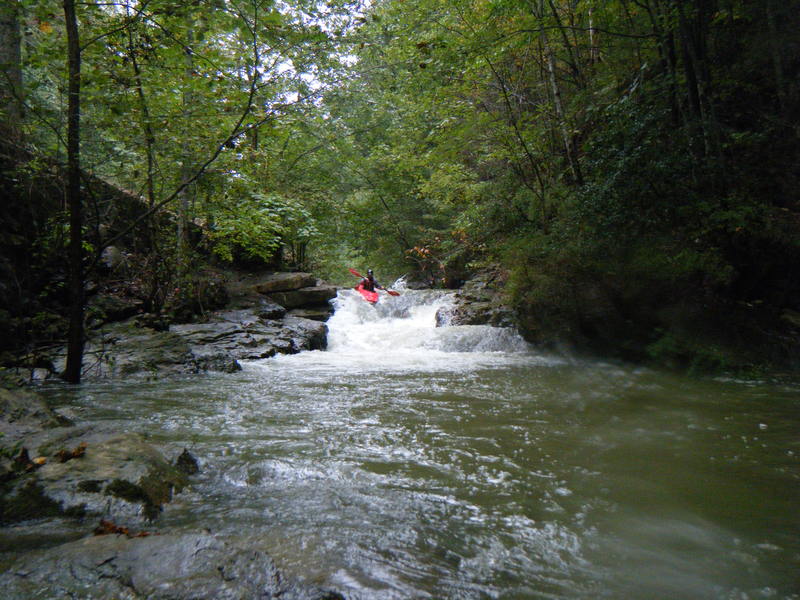
You should really look at all drops on this creek before you run it! The creek starts off with some fun class II drops and rapids. There are about 5 before the first big drop. Ah the first drop , NICE. It is about 6 feet all together. If you run left (harder) you have to do a really hard right turn, and if you don't bad things can happen - 'broken bones' from smashing into a large rock. If you run right it's almost a vertical drop, but you will need more water than what I ran it with. After that you have a 30-foot slide that drops some, but not a lot. Then you have what we call 'solar falls' which drops about a foot (we named it this because of the solar panel that is up on the road). Then you have a good class III tight move on river right. Not hard, just fun. After this it's just class II rapids similar to Graves Creek for about 30 yards.
Now all the hard stuff. You come around the creek and have a good class III rapid, this makes a right hand turn. If you roll here then you could get hurt-there are many sharp rocks in the creek bed. Then you come to the first semi-pool of the creek (10 feet). After that you come to a slide that dr
...River Features
Put In
Access PointDistance: 0 mi
Take Out
Access PointDistance: 1.5 mi
Trip Reports
Log in to add a report?
Untitled
Oct 15, 2009
Yellowleaf gauge @ 8.33'
KL
Kenneth Lavender
Apr 7, 2006
At the end of last summer I placed a wooden guage on the right side of the small bridge at the put. I hope this helps everyone out now that they can get an accurate reading of the water level.
Also, it seems that there are people who would not like us paddling this micro, because someone keeps cutting down trees to block the stream. I have already removed one bad strainer and will probally have to remove this new one. There is also a new low land dam that someone has constructed not far from the put in. So far this has not changed much but we will see.