Long Devil's Fork
Headwaters to Richland Creek (3+2 miles)

| Difficulty | III-IV(V) |
| Length | 5 mi |
| Avg Gradient | 155 fpm |
| Gauge | Richland Creek Near Witts Spring, Ar |
| Flow Rate as of 32 minutes | 0.89 ftbelow recommended |
| Reach Info Last Updated | February 23, 2018 |
River Description
Note: The combination of Steep banks and lots of deadfalls tend to clog the creek with wood from time to time, so keep look out. Best current option is to run Richland Creek and hike up the trail on creek right to the Falls.
This is a very small creek. Tight slots, fast slides, waterfalls, undercuts. Highlight is Twin Devil's Falls. Last 2 miles are on Richland Creek at high water.
Put-in: Go South on Newton County Road 5050 from the Ketcherside Mtn intersection of Newton County Roads 5050 and 5070. Park near where USGS TOPO map shows road Elevation 2059 the Lurton 7.5 minute Quad. Follow faint remains of old logging road SE downhill then turning to NE and continuing down ridge to the creek junction just below Elevation 1600. Carry from main road is about 0.7 miles to put in, which is actually on the fork East of what is labeled Long Devil's on the topo map. Ketcherside Mountain can be accessed by taking Richland Creek Road North from Richland Creek Campground or by taking Hwy 123 East from Hwy 7 at Lurton and turning right on Newton County Road 5070.
Take-out: Continuing East on Hwy 16 from Ben Hur for 1.5 miles and turn onto Upper Falling Water Road and take a left on Falling Water Road to NFS Richland Creek Campground. This road will parallel Falling Water Creek most of the way. This can also be reached by taking Falling Water Road farther East off Hwy 16.
This run is very similar to Big Devils, but has generally cleaner drops, longer slides, and fewer undercuts. Just below the first waterfall (8 to 10 feet), you will encounter 'The Devil's Playground' - look for the tight runnable channel down the river left side through the boulders. After this is the fast entrance to the Twin Falls. The highlight of the trip. Depending on water level, you may either run the Long Devil's, or access and run t
...River Features
Put-in Parking

Park along CR32 and head East to the creek
Put In
Drainage: ~1.23 square miles
Just downstream of the listed put-in coordinates (after the juncture of three side-streams in quick succession), drainage area is ~1.23 square miles (as calculated by USGS StreamStats 4.2.0 software). Also, as labeled on that software, the indicated put-in is actually on a tributary of Long Devil's Fork. (What is marked as Long Devil's Fork has its headwaters very near the junction of Newton 5070 Road and Newton 5080 Road.)
Just prior to merging with Big Devil's Fork, drainage has risen to ~5.11 square miles.
Big Devil's Fork at that point has drainage of ~3.8 square miles, for a combined drainage of ~8.9 square miles. Not far downstream, you'll enter Richland Creek, and the combined drainage after the confluence will be ~41.6 square miles (obviously meaning a huge jump in volume in that run).
Millstone Falls
10+ falls into a deep pool. Named for some millstones left over from an old mill.
Devil's Playground
Some tight slot moves between the boulders below Millstone Falls. Might have to get up close and personal with the rocks.
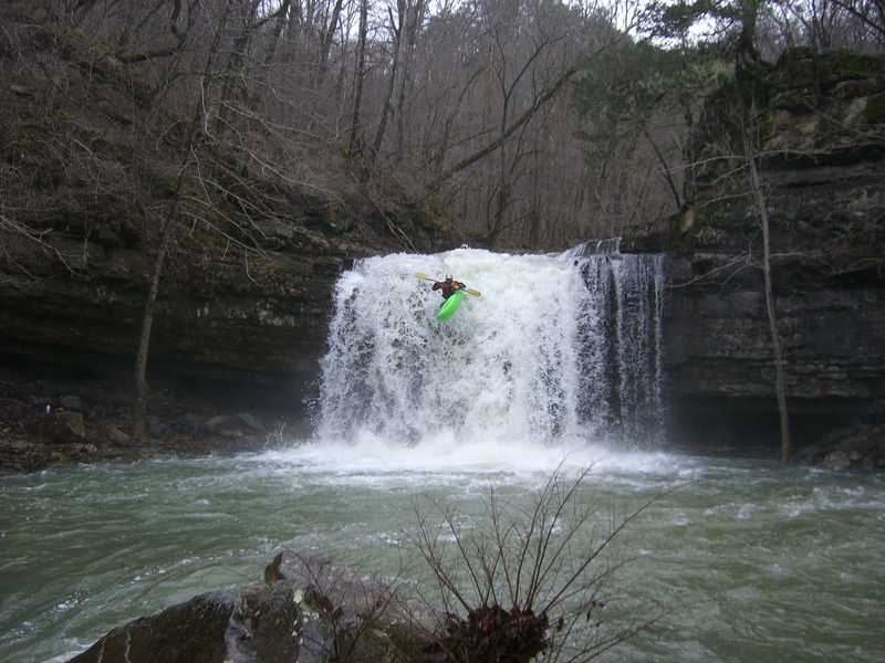
Twin Devil's Falls
Visual impressive spot as Long Devils Fork and Big Devils Fork plunge off twin waterfalls to join in the pool below. Make sure there is enough water to get a launch off the lip as the shelf rock at the bottom extends out to the curtain.
Take Out
Richland Creek Confluence
Devil's Fork enters Richland Creek. Be prepared for the meat of Richland with a healthy flow.