Chattahoochee
8 - Metro Columbus/Phenix City(Columbus Whitewater Park)

Oct 29, 2018
The river is great I have been down there 3 times this month. I would recommend to just go to waveshaper island and play at waveshaper and good wave. If you want to do this go to the end of 12th street and use the parking garage. the garage is free on the weekend
Oct 4, 2015
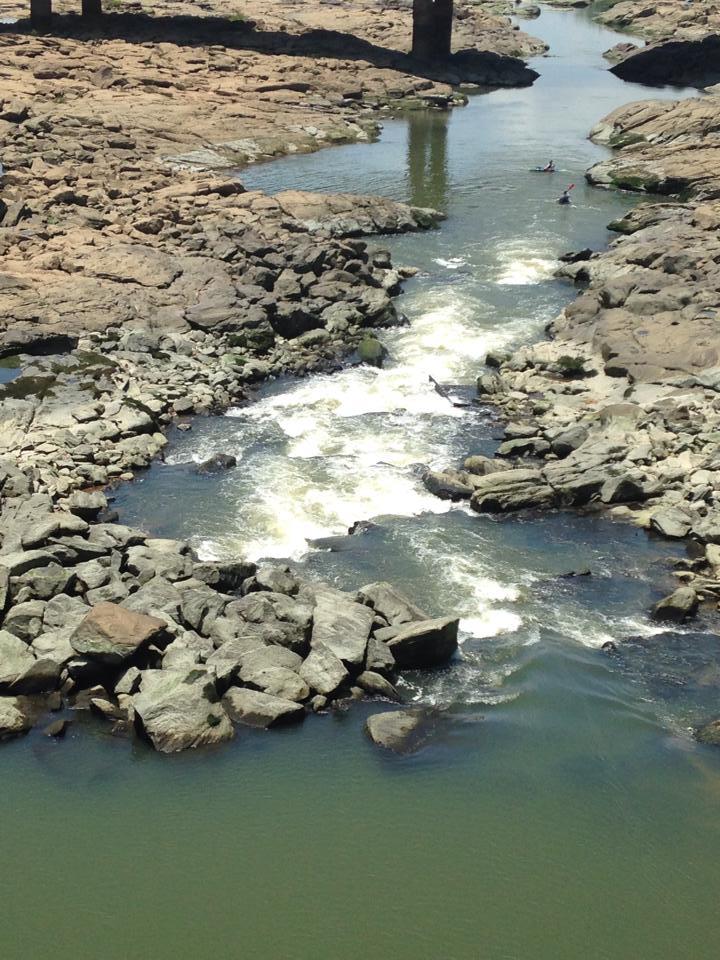
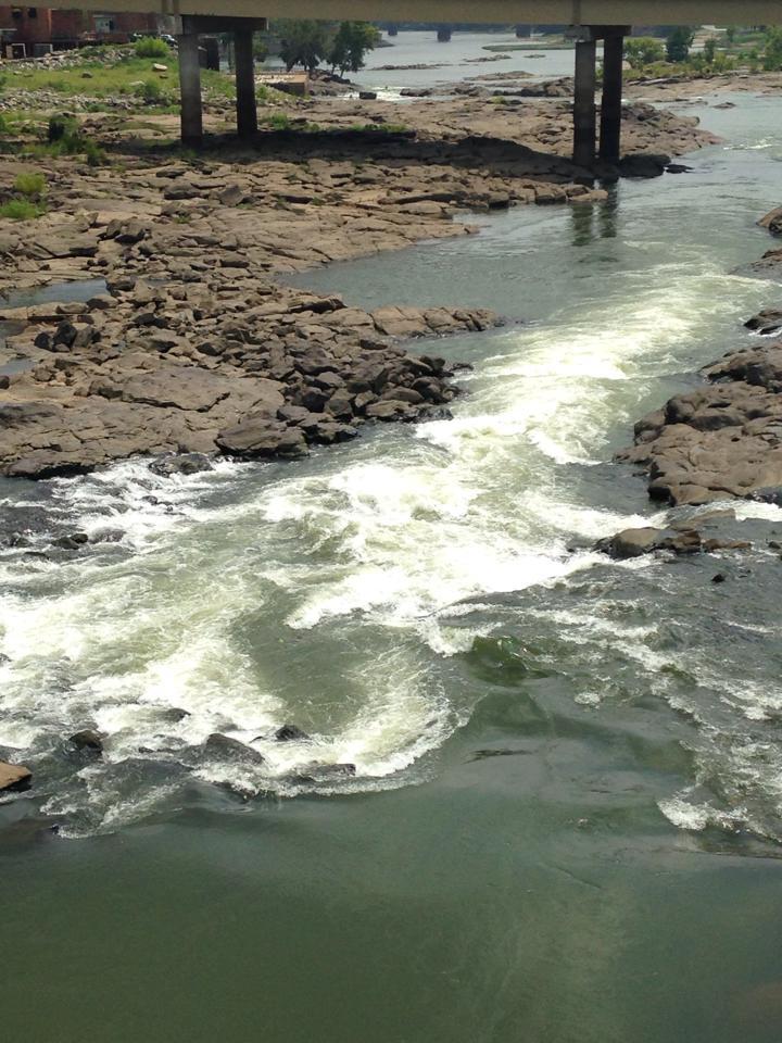
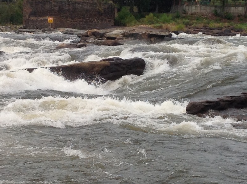
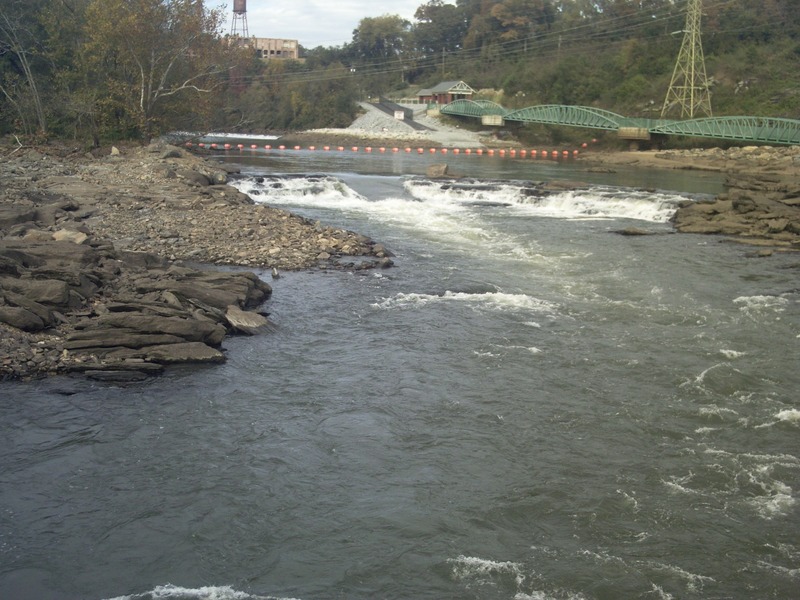
During a shutdown of river flow, a picture of Tie Snake with only residual flow present
Nov 18, 2013
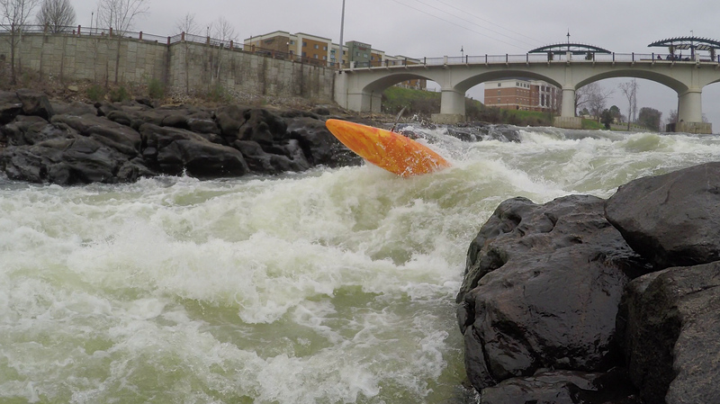
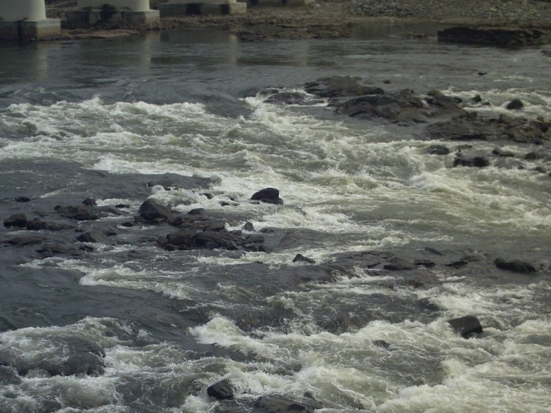
Monkey Wrench is a hole that is created at higher flows. It must be caught on the fly. A quick recovery is required if you flush out of the hole. Cutbait rapid is just below this feature.
Nov 18, 2013
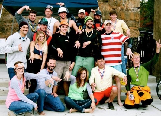
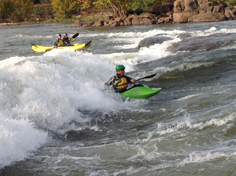
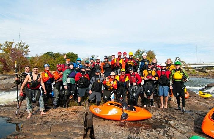
This picture was taken during the first Columbus Whitewater Games. The Jackson clan along with other world class paddlers made an appearance and competed with us. The paddle monkeys are a group of local Columbus paddlers. Mostly play boaters, they will show you a good time when you visit their playground.
Nov 18, 2013
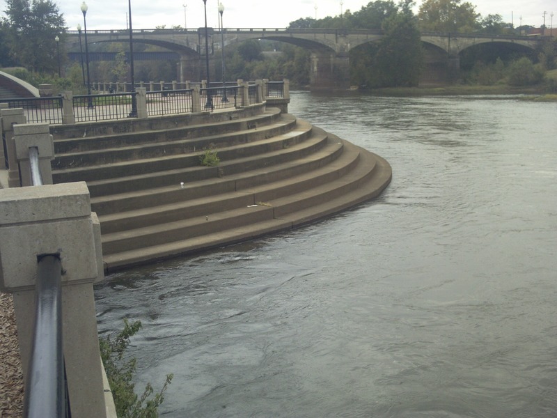
These steps are a couple hundred yards down stream of the island and wave shaper. It has been dubbed rehab because if you miss that roll this is where you must swim if you want to get out of the river. During high releases it is a hard swim. Once you manage the swim and climb out you are given plenty of time on your long hike back to ponder why you missed your roll.
Nov 14, 2013
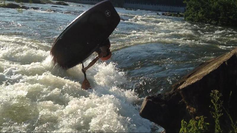
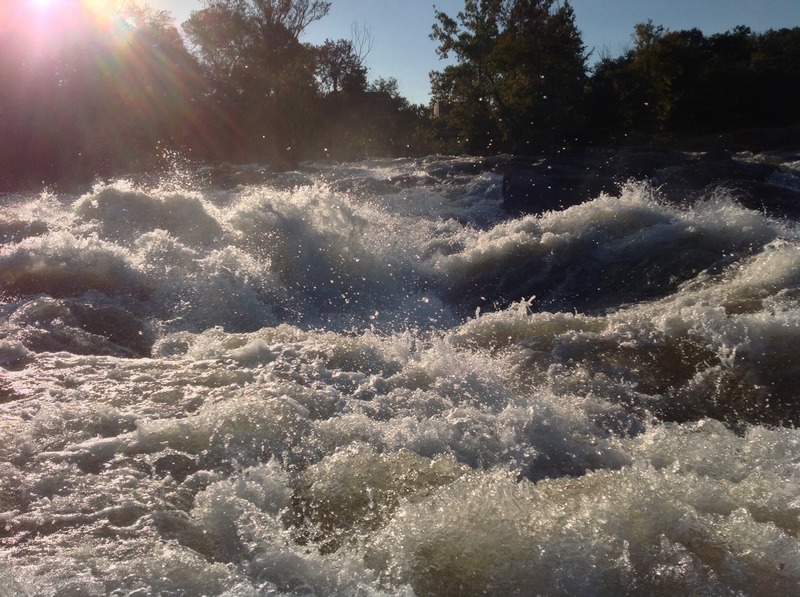
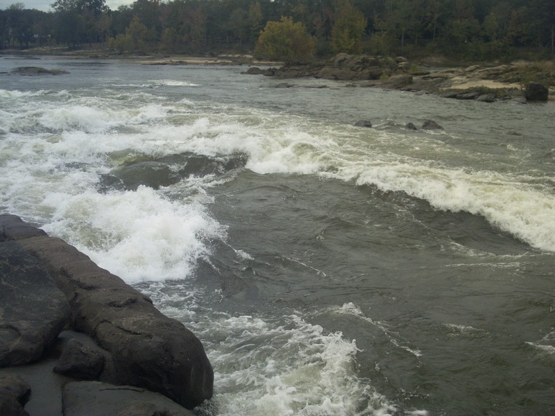
This is the rooster tail that is formed at about 9000 cfs in Cutbait. At this level this is pushing a class 4 feature do to the hole following.
Nov 14, 2013
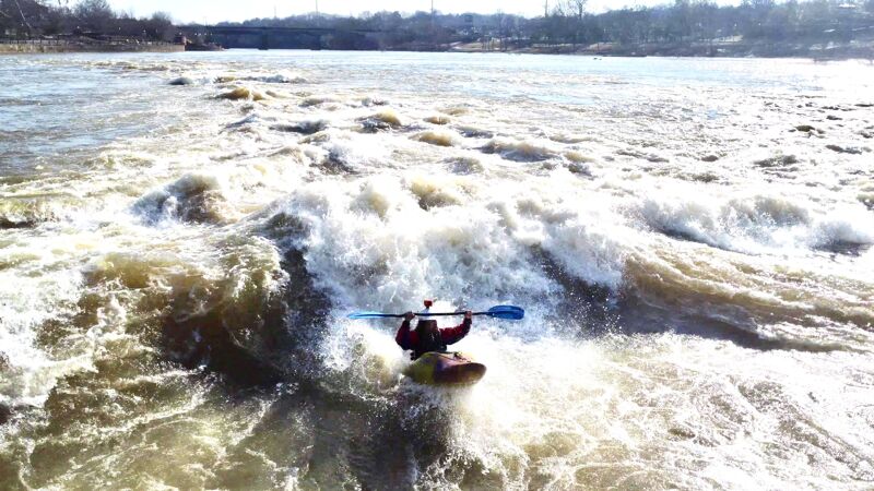
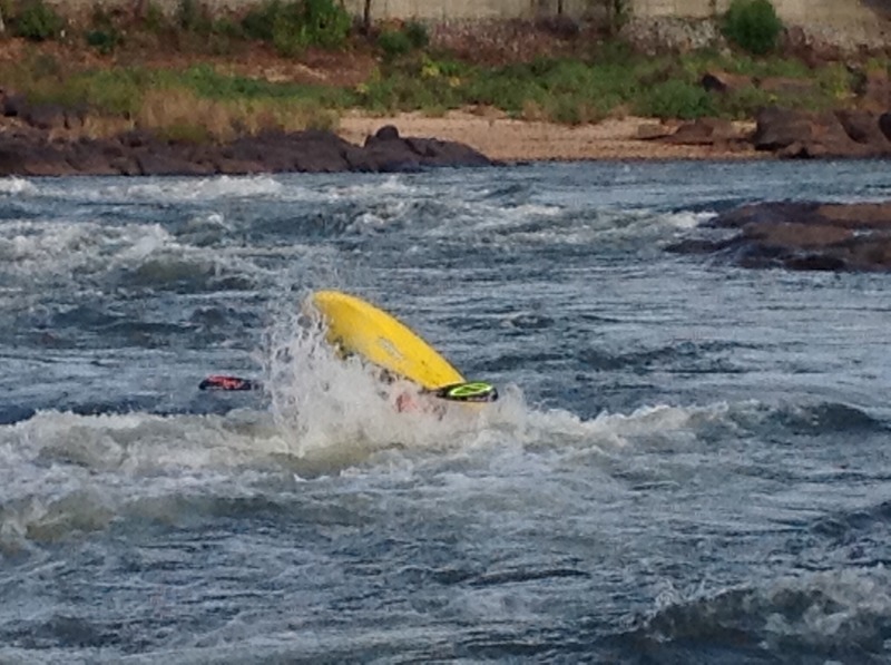
Rick Thompson surfing Good Wave. This wave gets much larger when levels are 6000 to 10000 cfs. The wave starts to wash out about 14K cfs.
Nov 14, 2013
This is a view of the hole at cut bait at about 9000 cfs. Professional paddlers such as Hunter Katt have played in this hole at this level.
Nov 12, 2013
A rather straightforward rapid at lower levels. Preferred line is straight down the tongue.
Nov 12, 2013
At this level there are river right and river left sneak lines. The preferred line is to run river right in the rapid. Boof the rock shelf and run the boil line. This helps avoid the hole in the right side of the rapid. This hole is somewhat retentive and rolling up here will place you against rocks. Please scout this rapid as it changes greatly at various release levels.
Nov 11, 2013
Taken November 2013 during the River Games. EJ Jackson & Clay Wright amongst others are in the picture after play boating in Cutbait hole.
Nov 11, 2013
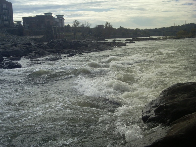
This is at 4000cfs. A fairly mild release level. Levels can be as high as 13000 cfs on the extreme side. I advise scouting all rapids due to the ever changing river level. At slightly higher levels a nice wave train is created which leads you in to The Great Wave.
Oct 4, 2007
GPB article today about new and exciting kayaking below Phoenix dam due to low water opening up coweta falls region. (see link)
http://gpbnews.blogspot.com/2007/10/low-water-levels-great-kayaking.html
if anyone has info locally please post thinking about a road trip.
Oct 23, 2005
Kirk front surfing the good wave at approximately 7 ft.
Chris surfing under the lights. the level was probably a little under 7 ft.
There is a stadium light at the powerhouse that shines right on the hole.
Oct 5, 2005
An ok level - it gets much better and retentive. Here the level is probably going down causing the wave to rise and break. It can be very dynamic.
Oct 30, 2003
Eagle/Phenix Dam is runnable and has been run. I'd post the video on here but I don't want to encourage anyone else to do it. I ran it when there was just enough water going over to get a clean move off it. The danger is that there are only a few safe landing zones where there are not rocks at the bottom and it's impossible to judge where they are from the top. I had someone on the island below to line me up correctly. We measured it at 22ft. The play spot on river right is good at optimum levels, but very rarely do they run a good level consistently. With the normal release you have to be there to catch the water rising when there is a short interval when the hole is good, but then quickly washes out. At a good level, it's a nice spot where you can spin,cartwheel,blunt, and loop. ( See loop video above). You can predict when the release will start by looking at the usgs gage at 280. The release times generally run in patterns which are apparent in the 7 day graphs. There is a smaller shallow hole, as pictured above under 'cartwheel hole' which is pretty fun in a short boat. The big hole in the middle line, known as the cut bait hole, at the normal release is very trashy and should be avoided.
Van Atkins chattahoocheeoutdoors@charter.net
Oct 10, 2003
Sent: Monday, October 06, 2003 12:00 PM
To: 'Paddlers4Christ@yahoogroups.com'
Subject: RE: [Paddlers4Christ] Chattahoochee at Columbus
Looks like you have gotten interested in something I have been wanting to do
ever since a couple Columbus, GA paddlers put me onto that spot. I was
leading them down Potato Creek when they told me about it and they said they
often play it after work in the evenings when they release. They said the
flow does not usually come up to a good playable level until after 5 or 6
PM, but then again that info was based upon the drought years we have been
having before this year; this year I am sure the release is a different
story with more water being released more often. The gauge to look at to
check and see if it is running is at
http://ga.waterdata.usgs.gov/nwis/uv/?site\_no=02341505
http://ga.waterdata.usgs.gov/nwis/uv/?site\_no=02341505&agency\_cd=USGS
&agency_cd=USGS which is located at US280 which is just south of this park
and play spot. I have been down there a couple times to check it out and
possible put-in and take-outs and to look at the dams they are talking about
removing. There is an awesome river walk they are developing on the
Columbus side that is going to go several miles all the way from well below
the last rapid/the play spots clean up to the dam at 'Bibb City'. That
river walk they are developing looks like it is going to be a real family
friendly environment for family walks or bike riding. You could bring both
your boat and mountain bike down to this one. The parking and put-ins for
the park and play spots are right now on the Phenix City, AL side to the
north of the Dillingham Street Bridge and south of 13th Street. To bad the
river walk and the park-and-play put-ins are not on the same side of the
river. The rapid there is called Rock Shoals and the dam on the upstream
side at the top of the shoals is I believe called the Eagle Phenix Dam. I
ended up finding three different places to park and then carry the boat to
the base of Rock Shoals. The next dam just a little further upstream is
like approximately a 12 foot high dam and then there is the City Mills Dam
further upstream. Then another couple miles or so further upstream is
approximately a 35-40 foot high dam that they generate electricity at around
the 'Bibb City' area of north Columbus. It would really surprise me if they
take that dam out at 'Bibb City' but I imagine there is some really good
whitewater behind it. Further yet upstream above US 80 is a substantial dam
called Oliver Dam. Probably zero chance that one is coming out, but we can
always dream. :-) When I have seen the play spots at the base of Rock
Shoals I think the flow was around 10,000 CFS. The Eagle Phenix Dam is at
the top of the rapid. You can paddle up to the bedrock at the base of the
shoals and carry your boat up the portions of the bedrock that is out of the
water and either run a very creekish type of run on the far river right, a
high volume flow run down the middle with a huge hole at the bottom, or a
high volume run down the far river left that ends in some good size wave
train waves at the end. Looked like several of those waves in the wave
train were very playable. I would like to find out from the locals what
that center hole is like before I pop into it or at least paddle out there
and get right to it and study it for a while before I jump into it. Since
the Eagle Phenix Dam is your basic low head pour-over type of dam, the
danger here is the water could rise on you very quickly when they start
releasing water from the dam at 'Bibb City' so be careful if you decide to
hike up the shoals itself and have an idea when they tend to increase the
flow amounts. From the times I have checked the internet gauge, I have seen
it go from 1000 to 10,000 CFS very quickly. If it looks low and you do not
know when they will be increasing the flow, then the safe thing to do is do
not climb up on the shoals. At 10,000 CFS there are definitely play spots
to be found; my guess is at 1000 CFS there is nothing there worth the drive
to get there. Let me know if anyone else has any other info. Thanks,
Mark Hicks <><
Sep 30, 2003
Good looking playspot!! Are the dams runable? Whats the word on dam removal??
The water looked pretty clean, I'm guessing west point lake traps the nasty stuff drifting down from atlanta.
Sep 11, 2003
The hole is pretty good at this level. You can cartwheel and loop pretty well, with ok blunts on the outside shoulder.
Once the good hole gets blown out, this shallow hole to the river right of the other hole comes in. It's shallow, but with a short boat you can spin and cartwheel left and right.