Massie's Creek
Wilberforce

| Difficulty | III-IV(V) |
| Length | 0.6 mi |
| Avg Gradient | n/a |
| Gauge | Massies Creek at Wilberforce Oh |
| Flow Rate as of 23 minutes | 382 cfsmedium runnable |
| Reach Info Last Updated | April 30, 2026 |
Local authorities do not consider this a legal run. Paddler's attempting this reach run risk of fine and confiscation of gear. See comment below.
from Rick Roberts' post to Boater Talk, http://oldbt.boatertalk.com/forum/BoaterTalk/416235:
At 100 CFS it's not that narrow. Class wise I'd call it a very technical 3 with consequences in that if the worst happened, it's a short access to being able to walk out. No serious swims. Lots of drops in the 3-6 foot level and big rocks. This is a very low flow.
A 3 because there would be a lot of maneuvering to do. Very easy to walk around anything you might not want to run.
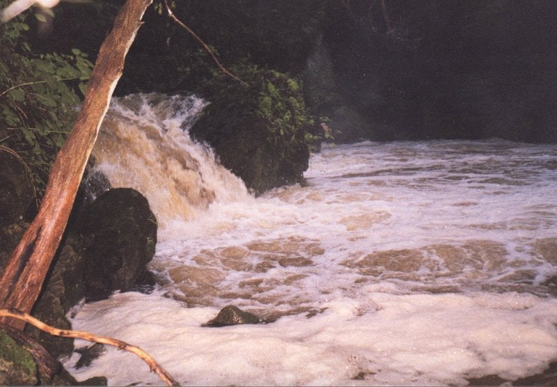
At 250 CFS this becomes a III+/IV with lots of danger due to strainers and sieves.
At 500 CFS this becomes a IV/V with smaller eddys and even more risk.
The dam at the start of it is part of an old quarry.
I've seen it at 125 CFS and there were no boils or anything indicating serious hydraulics.
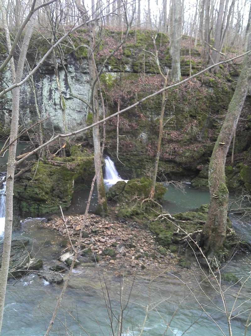
Description: The dam at the put-in is well over 15 feet.
The run is over a mile long, and there are only 2 good drops.
Both are near the beginning of the run, in a very pretty gorge.
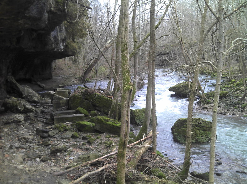
The last 2/3 of the run is basically flat with lots of strainers.
For a park and huck park at the waterfalls trailhead. Access is restricted proceed with caution.
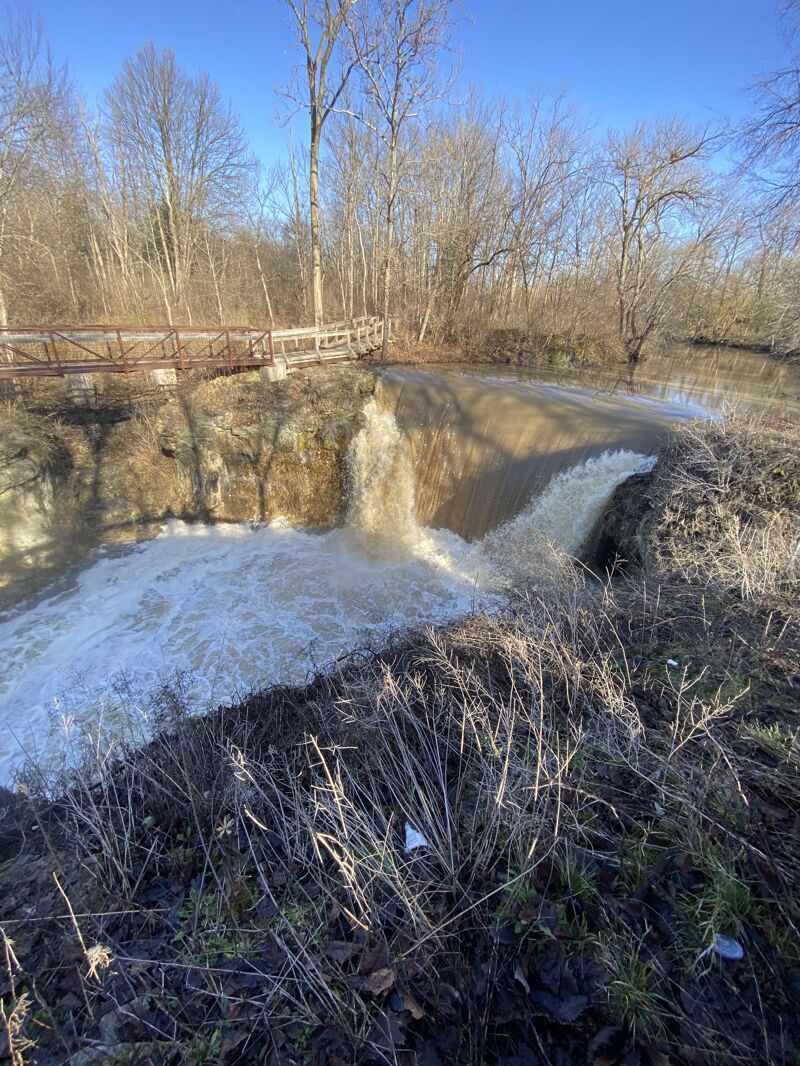
About a 25 foot waterfall if run in the middle from top to bottom. The middle line offers recirculation risk and a hard landing. The main line is to run off the river right flake and hit the reconnect for a smooth boof down. At 400 CFS the boils at the bottom become quite pushy making it hard to catch the eddy to walk back up to huck again. Again, access is limited in the park so maintain a discrete profile. I have seen the falls at 800 CFS and would consider them to be unrunnable. The boil rejects back into the curtain and recirculation is a guarantee. Above 400 CFS this run should be considered class IV-V and should not be run without serious scouting.
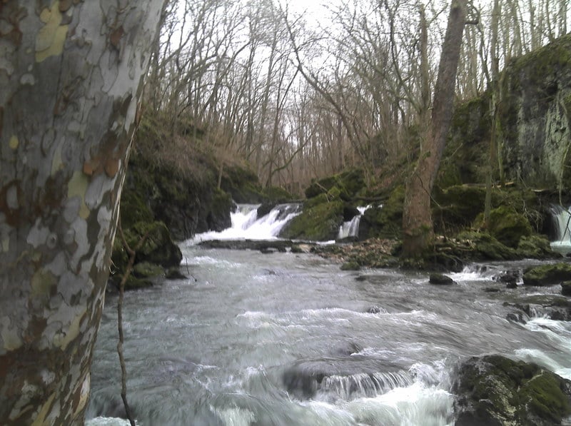
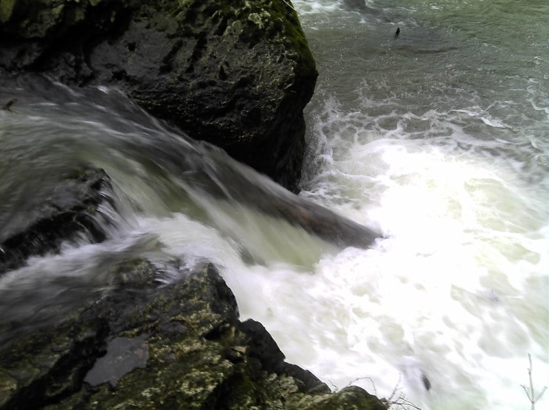
SCOUT FOR WOOD!!!. The past few times I have been to Massie's this rapid has been choked full of wood. Scouting can be done from the island in the middle of the river, or from the river right bank. There are a few different lines here, the easiest line would be to boof in the center of the river down a 6 foot ledge. River right can be run in a similar fashion, but not that far river right has a sieve. Staying a towards the center is probably your best bet. On the far river left channel there is a slot that has been called Pin Ball, as someone who ran it hit their head on both sides of the narrow slot. This moves ends in a shallow, steep, recirculating hole that will be very hard to get out of. This seems to be the least wood choked route, but should still be scouted from the island in the center. Take a few righties to clear the hole and you are in good shape.
This again offers two choices, and again should be scouted for wood before dropping. Scouting can be done from river right bank via walking trail. The past few times I have been here there has been wood in the river right boof. River left offers another boof, but note far river left throws you into a rock wall. At 250 CFS, that is really your only option. At 400 CFS you can be to the right of the left channel for a clean 6 foot boof. After this you can paddle down to the put in or look for access on the river right side to carry back and lap the section again.
Jan 1, 2012
Once you finish the big rock filled drops the rapids become rather easy.