Davidson River
1. Forest Service Road 475-A @ Cove Creek to Low Head Dam(Upper Davidson)
Jan 1, 2011
Ran this back three weeks ago at around 3 ft. Was very fun and I recommend putting up at the Trailhead...around the bridge I think. It's fun little boogie water and some drops and ledges.
http://www.youtube.com/watch?v=LEPvrWc5kM8
http://www.youtube.com/user/stownplayer#p/u/12/D-OEPEkn7ow
Dec 2, 2009
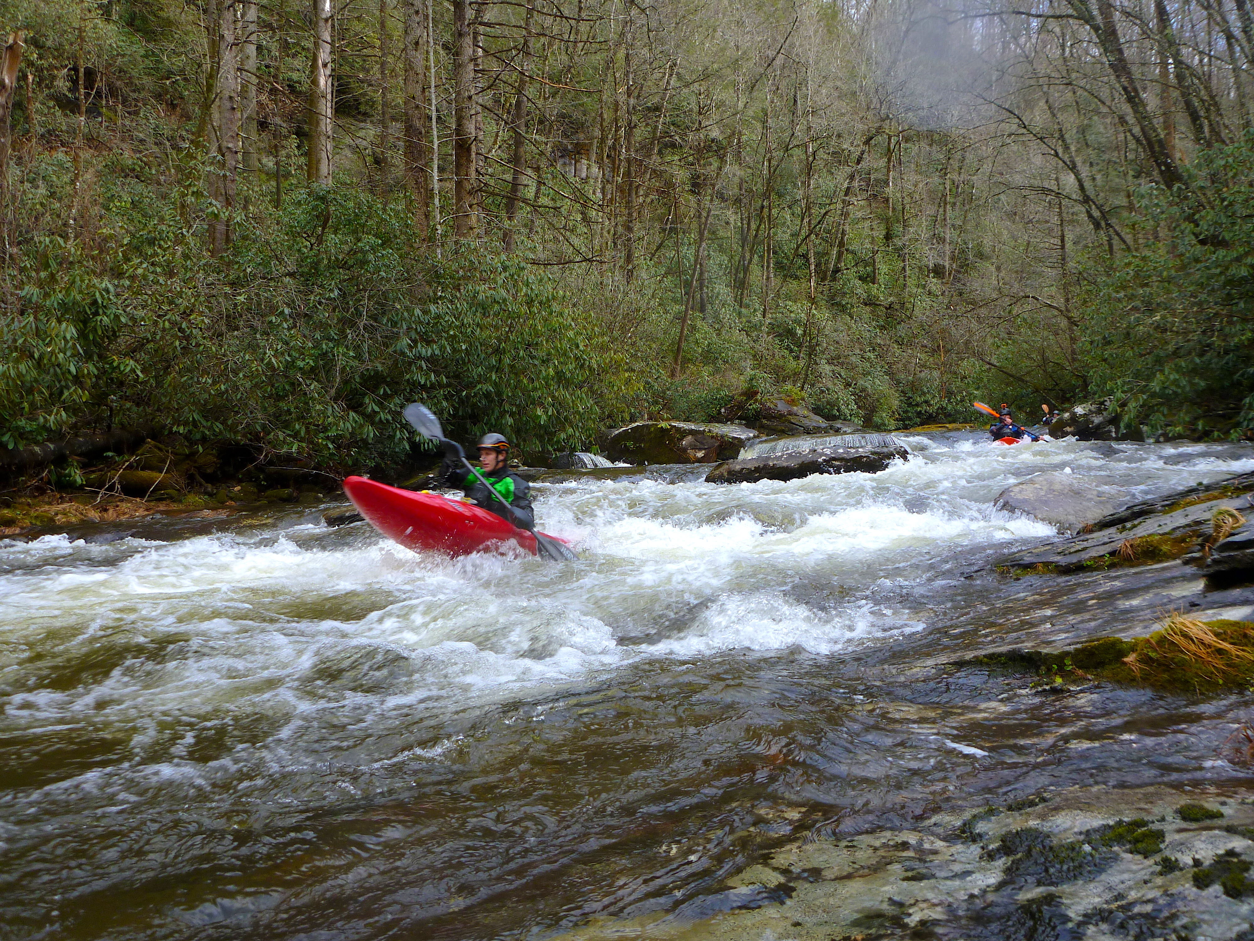
Today Nick I., Ryan I., and myself decided to check out the Top Davidson, Upper Upper, or whatever the section above the normal put in should be called. Our only beta was that there was a clean 20 something foot cascade up in those hills. Long story short the beta did not disappoint. Today the Davidson peaked at 3.2, and we read a level of 2.0 feet on the Top Davidson gauge, which is by the bridge a few hundred feet from the trail head. Hiking upstream 1.5 hours yielded an excellent micro creek run, on par with the Big East of the Pigeon in quality but easier in every way and short, not counting the hike. The trail is pretty good till the end when it splits up a trib. Cross this trib and keep hiking upstream off trail. Scout well for wood on you're way up. We only had to portage twice, but there's plenty in play. Be aware of the wood in the cl.II rapid downstream of the bridge as well, you will not see it on you're hike up.
We put in just downstream of where the creek forks almost equally. With more water you could go up higher. The level we had today seemed like a good medium-low. Aside from some great bedrock drops there is one spot where an old diversion dam poses a problem. Currently this is runnable but very sketchy due to wood, and a big concrete cave in the dam. We all walked this one.
After running out on the upper we had the good fortune to meet some of the folks who helped groom this stream over the summer. Again, nice work fellas, it was effort well invested.
Charley B.
Sep 22, 2009
An alternate put-in can be found upstream at the Daniel Ridge trailhead. This adds about 1/2 mile to the run, including one good ledge drop/boof about 100 yards below where FR475 crosses the river.
Mar 26, 2009
There is a section further up the river once it diverts from the dirt road that has potential for some good class III/IV micro creeking. You have to hike up it and there is currently a lot of wood but there are a handfull of slides and small drops up there that look good to go.
Jan 2, 2006
Davidson River Road (FR-475) is now open again.
Sep 2, 2004
From Boatertalk:
Depends on flow New
Forum: BoaterTalk
Re: Question for anyone who has run the Upper Davidson... jvernon1235 New
Date: Sep 02 2004, 20:15 GMT
From: canoeman
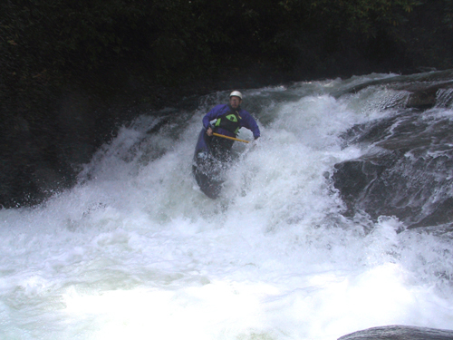
I tend to think of it as class III+ to easy IV. It is shorter and easier than the North Fork but it as at least three significant drops on it. Whale Tail, the first one below where a major creek comes in, stern squirted me one time at high water. That wouldn't be such a big deal except I was in a 12-foot open boat. Not far downstream is Breakfast, Lunch and Dinner. At high water I would say that rates Class IV, although it is pretty straightfoward. There are lots of other interesting rapids. Should be good to go today from what I see on the guage. Watch out for strainers. It is a micro creek and they can go all the way across.
Mar 20, 2004
On 2/6/04 the davidson was running at 4.5 ft. on the USGS gauge after 3 inches of rain. Myself along with Ned Steadman put on a rougly 3:30 and ran from the first brigde on daniels ridge trail to the above the lowhead dam. The whole run was runnable except whalesback which looked like it could swallow a school bus. At flows around 3- 3.5 whalesback is runnable on the far right but the hole looks quite stiff. At 4.5 the river is pumping all the way from the start to the finish. There are mostly large holes and powerful chutes and low hanging limbs/trees. Whalesback, Whalestail, and BLD should and all be scouted. If you swim hold onto your paddle or kiss it goodbye. At these levels the river becomes solid IV. Portaging is hard in most places at these levels. BLD is almost impossible to portage at this level.
Alex
May 11, 2003
Date: May 07 2003, 13:14 GMT
From: tallman
So we guess it was at least 4 feet. Went to the upper Davidson instead, found it at 3.65 feet at 6:30p. Got in two runs. What a fun little section! It's roadside & short, much more of a micro creek. There are a couple of rapids that might be about class IV: 'whale tail' & 'breakfast, lunch & dinner' the rest of the run is just super continous boogie water. Excellent looking water quality, excellent scenery. There were five in our group: me, davidson, micklouie, shannon & (a very nice local, originally from Hungary... sorry I forgot your name!) ~ Great evening on fun water.
Sep 28, 2002
Good technical run for creeking. Starts off with a quick drop into a hole,will grab yah but hang on will flush out. Next drop scout river right,big rock in middle of river to look out at. Big whale tail rock to slide off of,keep right into an eddy to set up for final run. Peal out and hang on for a fun river channel run down to bottom. Rest of river good drops. Boat scout, if you want to scout can be done on river right.
Good level 2.0 on gauge on USGS
Check gauge at bridge at Hwy 280 and entrance to Pisgah Forest.
If you want any more info please feel free to email me.
Mike
Sep 28, 2002
This hole can get sticky at higher levels. Its boxed in by a cliff on RR and by and undercut on RL. A curler at the top will kick you left, make sure to compensate.