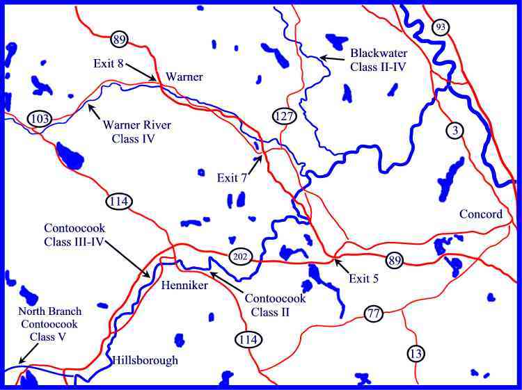
Contoocook
3. Henniker (class II section)
| Difficulty | II(III) |
| Length | 2.1 mi |
| Avg Gradient | 18 fpm |
| Gauge | Contoocook River Near Henniker, Nh |
| Flow Rate as of 1 hour | 5.39 ftbelow recommended |
| Reach Info Last Updated | March 11, 2022 |
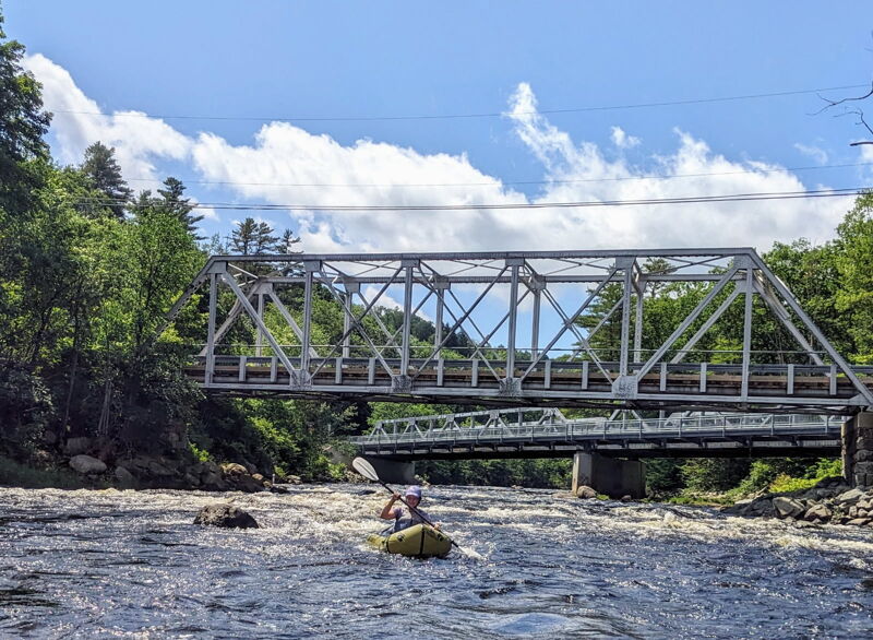
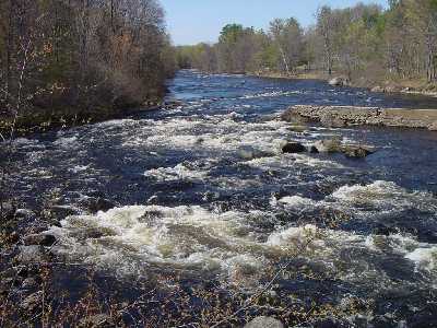
This is a nice easy class II medium size river. At higher levels it has a big water feel to it with large waves, holes, and turbulance. But even at high water all these features are easily run or avoided. The toughest stretch is a broken dam just upstream from the bridge to the takeout. Scout this drop from the bridge before you run. At medium and high levels there is a nice surfing wave at the outflow through the broken section of the dam. The river starts out with quickwater and class I rapids after the bridge in the center of town the difficulty picks up to class II. Be catious in high water (above 9') this section can increase in difficulty.
Put in elevation........419'Take out elevation......383'Total drop..............36'Average drop/mile.......18'Distance................2.0 milesRiver width average.....70'River geology...........Small to medium granite bouldersRiver water quality.....Fair to good, clarity fair to good.Scenery.................The river runs through the center of Henniker, starts and ends in a rural area.Wildlife................Deer, Merganzers, Blue herons.Put in
I-93 from southern NH just before Concord take I-89 north
Approximately 9 miles take the exit 5 ramp to Rt 202 West (Henniker/Keene).
Take the Henniker/Bradford exit.
Take a left (east) on NH 114.
Approximately 1/2 mile to the blinking light in Henniker center take a right onto Western Ave.
Approximately 1.5 mile look for a wide shoulder on the right just before the twin bridges.
Alternate directions from Rt 101 Manchester.Rt 114 North to Downtown Henniker. Cross the bridge and take a left onto Western Ave. Follow it to the put in.
Take out
Head back to the intersection of NH-114 and continue straight through the intersection, this is now Main st.
Take a right at the 'y' intersection just past t
...Jun 19, 2025
Figured I should add a report for packrafting. We put-in at the end of Freight Train (around a half-mile above the twin bridges), and took out in the right eddy after Ramsdell Bridge. Ran twice. Good level for packrafting - decent control of the boats around the dam to get in middle channel under bridge and avoid rocks on river right. Some nice curling waves. Were a bit leary of metal, but didn't find any. Had to be careful of broken bottles at takeout steps - there is a really nice takeout at the river right eddy - nice steps - below Ramsdell Bridge.