Cache La Poudre
02. Big South Campground to Tunnel Picnic Ground(Spencer Heights)
| Difficulty | V |
| Length | 2.4 mi |
| Avg Gradient | 162 fpm |
| Gauge | Cache La Poudre at Canyon Mouth Near Fort Collins |
| Flow Rate as of 1 day | 252 cfsstale data |
| Reach Info Last Updated | April 28, 2025 |
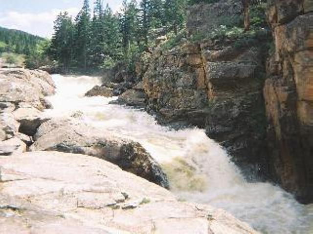
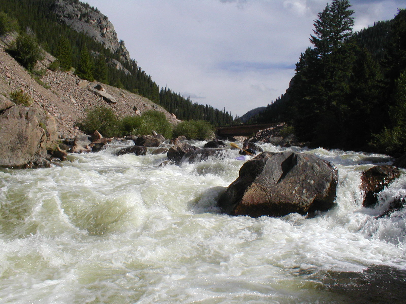
The first mile of this run is typical Colorado whitewater. Bouncy undefined Class IV in a boulder garden riverbed. At Rocket Launcher(V) the character takes a turn as the river cuts into bedrock. Get out to scout when you see a large house-sized rock spliting the current. Most paddlers will run Rocket Launcher until the day they get stuck in the hole at the bottom, from that day on they all walk it... Just downstream is Poudre Falls, have your takeout eddy pre-scouted for this one. This series of 3 waterfalls could be described as the perfect nightmare. If it wasn't for the last fall Poudre Falls would be run all the time. The last waterfall has incredibly lethal consequences, and the odds of being upright and in control by the last fall are slim to none. All but a select few sickos portage without a seconds thought. The gorge just below the falls(V-) is fun and pushy, it looks big but just run it down the middle. There will be one more big rapid(V) before crossing under Highway 14. Directly after the bridge is Boneyard(V), watch out for the undercut on the bottom right (it's paddler magnetic). For the next 1/2 mile you are in a narrow gorge, there are a few Class V drops in here. Watch out for wood, it has a tendancy to wedge between the narrow walls badly. After the gorge you have 2 more good Class V rapids before the takeout. Don't snooze, the river will appear to be mellowing out before these rapids.
The correlation between the gauge at the canyon mouth and this run isn't very reliable, especially at low flows. The outflow from the upstream reservoirs can make a big difference, and the inflow from the Laramie River tunnel (right at the takeout) can inflate the lower readings. Water levels in this run can rise very quickly from snowmelt on a hot spring day.
As of 2012, the best gauge is painted on a rock on river right, just downstream from the highway bridge at the top of Boneyard. 2.5 on this gauge is medium; above 3 is probably high (have a
...Access is at the Highway 14 Bridge.
Access is at the Tunnel Picnic Site administered by Arapaho and Roosevelt National Forests.