Line Creek
Slippery Rock Run
May 22, 2010
| Reporter | Matt Todhunter |
So I went and scoped out the creek last night. The first thing I did was go check out the take-out on Stallings Road. Unfortunately, the entrance to Stallings Road on McIntosh Trail is blocked by a locked gate and about 10 'No Trespassing' signs. It looks more like a trail instead of a road - I don't think a car's been down it in years. So in my opinion, this take-out is out of the question for use. If you wanted to still boat down to this take-out and hike to the road (McIntosh Trail), Google Earth says it's about 0.65 miles from the creek to the road.
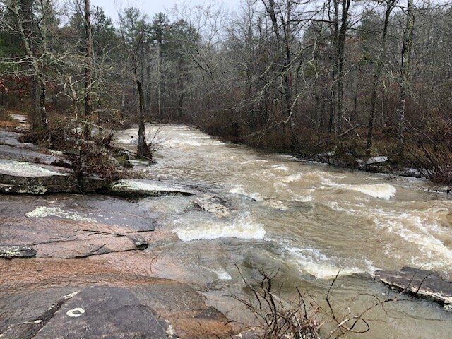
Next, I didn't walk much of the trail of the nature preserve, but did walk down to look at the Shoals, and as the comment below says, there is a creek-wide pine tree down (there is actually a picture of this on Google Earth). As two comments below says, when the water is up, it might be skirtable on far river right, if there is enough water going to the other side of the small island that the top of the tree is on.
As for the take-out in the neighborhood that Mark Hicks mentioned - the only place I could see that being feasible is on Plantain Terrace, about 500-600 yards on the right, after you make the left from Terra Verte. There is a space of about 4 lots with no houses, and the creek comes relatively close to that road in that spot. But I saw no trail from the car. If someone could confirm or deny this is the location, that would be great.
As for alternate take-outs besides Stallings Road, my only thoughts are to go all the way down to the bridge at Rockaway Road, or if you have a somewhat-offroad vehicle, there is a neighborhood under development off Rockaway (Heritage Point Parkway), and it looks like one of the cleared but unpaved roads goes all the way back to the creek.