Line Creek
Slippery Rock Run
February 3, 2011
| Reporter | Matt Todhunter |
Finally got to run this yesterday @ 180 cfs. Just slightly bony, but definitely runnable at this level. Here's my report:
Take trail at back of the Line Creek Nature Area parking lot down to creek. Follow the sign to the shoals (not creek trail). Put in at shoals. Putting in above this (Mule Rock, Ridge Trail, etc) is not advised as it is mostly flat water with at least two trees down across the creek. Do not get out on the river right bank for any reason - it is all private property and is heavily posted with No Trespassing signs. Water quality is ok and doesn’t stink, but is not beautiful by any measure and is brownish.
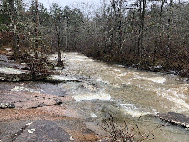
The run starts out immediately with shoals and wave trains. This is typical of the whole creek - nothing extremely exciting, but still fun for locals. At lower flows there is a mandatory portage just past the civil war bridge remnants where a pine tree blocks the majority of the creek. Here 90% of the flow goes to the river left of a small island (where the tree is blocking) and the rest goes to the right of the island. At higher flows there may be enough water going to the river right of the island. I tried going right of the island at 180 cfs and ended up having to carry my boat over rocks.
Surfable waves abound all down the creek. The last and largest rapid is right as the creek bends to the left. I guess this is where the play wave is, as there was a great surfable hole at the bottom of the slide on river left. If I could play in it at 180 cfs, I imagine it can get pretty stout when the flow is really up. After the last rapid, the river continues to bend to the left then straightens out - nothing but flat water from here on down. I took out about 150 yards or so past the last rapid on river left - there was a tree with what looks like a decent place to pull a boat up. The trail that follows the entire run is right there - continue to walk downstream about 30 yards and the trail up to Plantain Terrace is marked with surveyor’s tape on your left. The trail is kind of steep, and it dumps out in a wooded area between some houses in a neighborhood. I’m not sure how cool the folks in the neighborhood are about leaving a vehicle there, so I had my wife come pick me up when I finished the run.
Shuttle is 5 minutes. The run takes about 30 minutes if you just run it.