Potomac, North Fork of South Branch
5. Head of Hopeville Canyon to Hopeville(Hopeville Canyon)

| Difficulty | II-III |
| Length | 4.5 mi |
| Avg Gradient | n/a |
| Gauge | N F South Branch Potomac River at Cabins, Wv |
| Flow Rate as of 30 minutes | 86 cfsbelow recommended |
| Reach Info Last Updated | September 1, 2021 |
River Description
Tony Allred Jr.: October 15, 2018. The approach to the right side ledge described below has silted in, diverting more water to the channel to the left of the ledge. As a result there is much less water in the ledge at moderate levels and at low levels the ledge may be dry.
Robert Farmer beta'ed:
March 19, 2007. At the 2nd island, the left looked rocky, so I went right, over a 3-4-ft ledge. This was no problem, but I recommend staying centered, as the sides looked a bit junky. Also, after you pass an impressive, overhanging pinnacle-kind of formation on river left, just downstream there is a tree leaning down into the water at a 45-degree angle; this would be alarming enough, but in avoiding this obstacle, one tends to get pushed toward a partially-submerged, roostertail-kind of rock that could really be quite painful etc. The level was 5.7/1100 cfs--a nice level, by the way. And the scenery is first-rate, as well. Cliffs virtually all of the way. The snow was fresh on river right, and gone on river left--quite scenic!! Only one or two places felt low; the rest of the river felt well-above minimum.
There are no tedious, flat spots on this section, just pleasantly moving slower spots between enjoyable rapids. Also, 'the former Dolly Campground' is a grassy area between the road and the river just downstream of Dolly Town Rd. (28/1). Alternatively, there is a large pull-off just upstream, near a long rock ridge on river right. The popular takeout is where the road and the river come together again, 1/4 mile upstream of Jordan Run Rd. (28/7). An excellent run!
John Hefti testified:
I ran it for the first time after the flood of '85, and was very surprised to see that landslide rapid was entirely gone! I had not run the canyon in over 25 years, so I though I had not yet gotten to landslide until I was exiting the canyon. It seems that the spot where it used to be is now a flat pool, backed up behind a new garvel bar. I thought my memor
...River Features
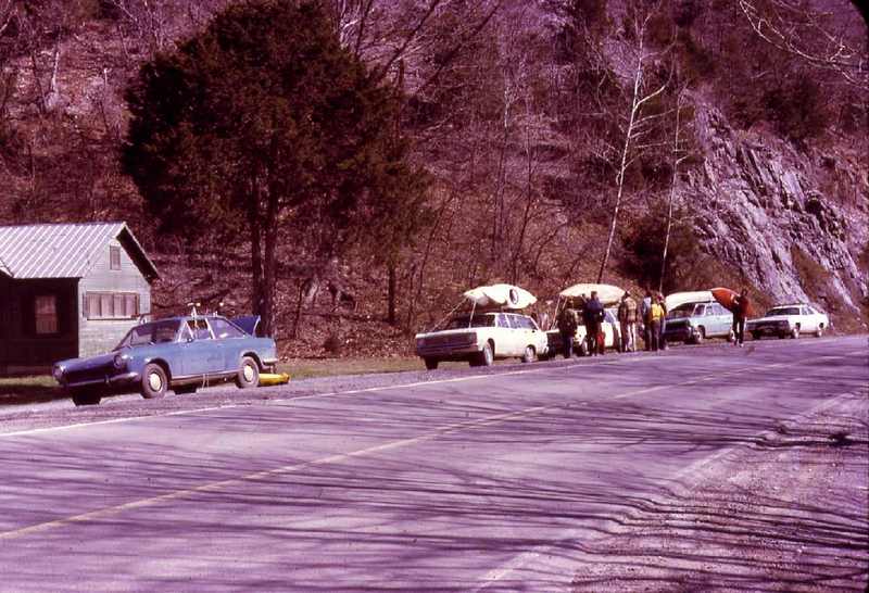
Put In
Put-in - The put-in is on Rt. 28 about 8 miles north (downstream) of Seneca Rocks. The put-in is off of a large pull-out as the river comes right up to the road, with a rock outcropping across the river.
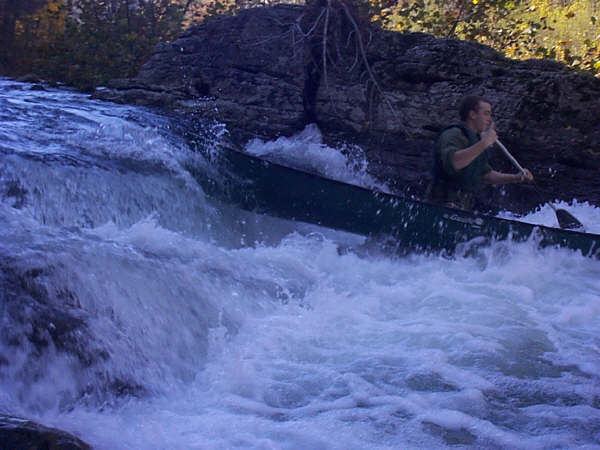
The Hopeville Canyon Ledge
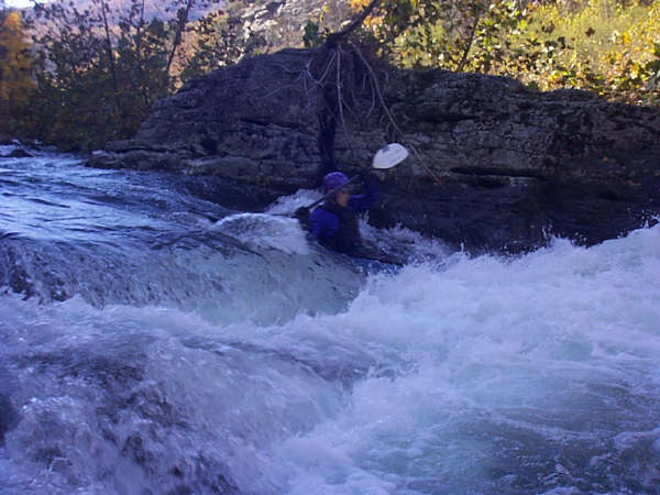
The Hopeville Canyon Ledge - As pictured. Hit the middle and punch on through. The ledge can be avoidable by staying river left.
Landslide Rapid
Landslide Rapid - Landslide rapid has a log in the channel below where you enter on river left. Also some rocks have shifted, which make the entrance move of entering left, hitting the micro eddy, and peeling out, more difficult. This rapid is not the pre 1985 'Landslide' rapid (which was lost due to the appearance of a gravel bar just below it in the 1985 flood), but a rapid formed by a new landslide that occurred a number of years ago, well after the flood.
The "dam"
The 'dam' - This is a man-made dam at the end of the trip with a Class III breakout on river right. Currently the 'dam' has a log across the top but the right side breakout was clean. There are options on the right of the main rapid as long as you commit to them as you go around the bend to approach the main rapid). Both right side options were okay in April of 2023.
Take Out
The take out is just north of Hopeville across the road from the Jordan Run. rd intersection. (or 3 miles further down the rd at the Smoke Hole Rd. bridge)
Trip Reports
Log in to add a reportHopeville Run at low flow - Anthony Daniel
Apr 10, 2023
I ran the canyon 3x times easter weekend 2023 as part of a wvwa gathering. Levels were from 5.4 to 5.2 (lower end flows) . Landslide rapid has a log in the channel below where you enter on river left. Also some rocks have shifted, which make the entrance move of entering left, hitting the micro eddy, and peeling out, more difficult. The first run I pinned against the log, apparently there is some stuff below the surface as well. Trying to wiggle off I flipped and swam. On the 2nd run I was more successful running alongside the log. The third time we walked. This spot becomes more difficult as the water drops.
The 'dam' at the end of the trip has a log across the top. 'The crease' was clean and the routes around the main rapid (options on the right as you go around the bend) both went okay in April of 2023.
Nicholas Ingalls
Feb 8, 2020
Just ran this from Seneca to through Hopeville, despite the flood last year no significant changes to the rapid. Little bit of wood on the edges as usual but nothing worrisome
John Duke
Nov 8, 2002
This is the biggest ledge on this trip
The gauge is Cabins at 5.4 or 850 c.f.s.
Also the petersburg gauge was 3.5 or 1200c.f.s.