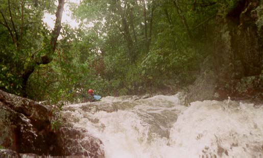
Taum Sauk Creek
Taum Sauk Mountain to Little Taum Sauk Creek (7 miles)
| Difficulty | IV-V |
| Length | 7.3 mi |
| Avg Gradient | 170 fpm |
| Reach Info Last Updated | December 30, 2005 |
Dropping off Taum Sauk Mountain, this might be the steepest stuff in the state. Check out the description in Chris Amelung's Mo Creekin, which says that this crick was first run in 1998--and that it rarely has enough water to run.
Lat/longitude coords are a SWAG.
Check out the Taum Sauk Mountain State Park website.
History:
Taum Sauk Creek was first run on Sunday, 26 July 1998, by Chuck McHenry, Chris Amelung, and John Tansil. An account of the run, written by McHenry, appeared in the Oct/Nov 1998 issue of the River Log, newsletter of the Missouri Whitewater Association.
No trip reports yet.