Cache La Poudre
10. Below Filter Plant to Picnic Rock Access(Filter Plant)
| Difficulty | II-III |
| Length | 3.2 mi |
| Avg Gradient | 44 fpm |
| Gauge | Cache La Poudre at Canyon Mouth Near Fort Collins |
| Flow Rate as of 11 hours | 237 cfslow runnable |
| Reach Info Last Updated | June 2, 2025 |
American Whitewater has been actively engaged in advocacy on the Northern Integrated Supply Project (NISP), which proposes to divert water from the Cache la Poudre River to fill the planned Glade Reservoir northwest of Fort Collins. Because the proposed diversions would occur just upstream of the popular Filter Plant [...]Read More
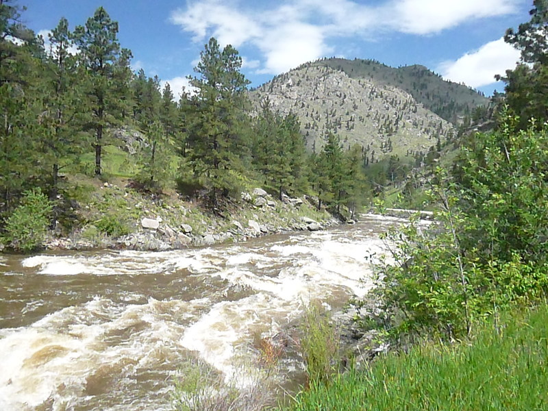
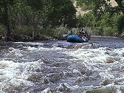
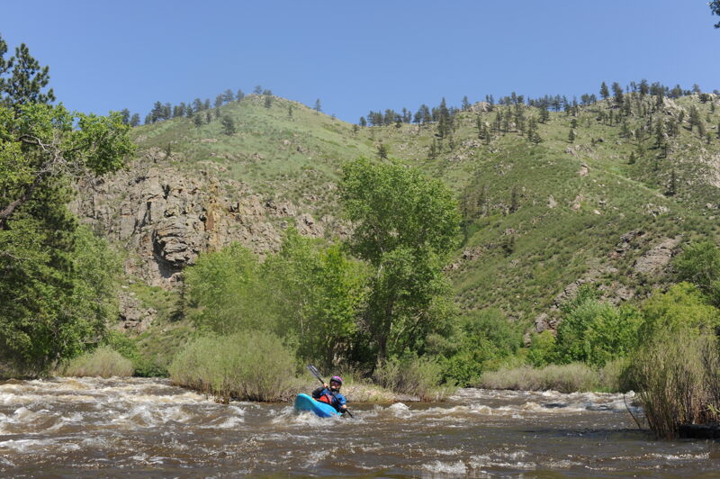
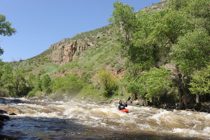
This is the beginner run on the Poudre, named for the old Fort Collins water filtration plant at what is now Gateway Natural Area. There are only a few named rapids with swift moving water in between. In the low water season of late summer, this is a popular tubing destination. It's wider and shallower than the sections upstream, giving it a shorter boating season.
Filter Plant sits between two diversion dams, making it hard to measure its flow. The Pineview Rock gauge is above the Northern Poudre Supply Canal diversion (upstream of the put-in), and the Canyon Mouth gauge (shown on this page) is below the Poudre Valley Canal diversion (downstream of the takeout). Hey, all river beta is guesswork anyway, right?
See Colorado Rivers and Creeks II, by Banks and Eckardt (The Bible), for info on this and most of the other Colorado runs. See also: Big South (Class V/VI), Joe Wright Creek (Class V), Spencer Heights (Class V/VI), South Fork (Class IV/V), White Mile Run/Upper Rustic (Class III), Grandpa's Gorge/Lower Rustic (Class III/IV), The Narrows (Class IV/V/V+), Upper Mishawaka (Class III/IV), Lower Mishiwaka (Class III),
...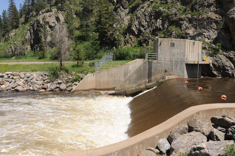
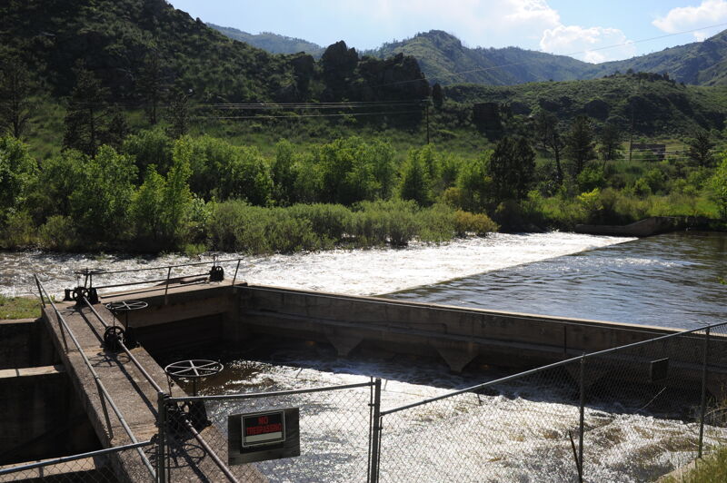
The Gateway Diversion Dam is located upstream of Gateway Park and means that it's not possible to link Filter Plant with the sections upstream. The dam serves to divert water for municipal use for the City of Fort Collins. American Whitewater is working to address public safety at this high hazard low-head dam and provide for boat and fish passage.
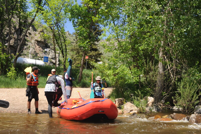
The most convenient put-in for Filter Plant, Gateway Natural Area <https://www.fcgov.com/naturalareas/finder/gateway> is owned by the City of Fort Collins. It has a large parking lot, picnic areas, and a boat ramp. Entry costs $8/day, or an annual pass is $40/year. Gateway Natural Area seems to be the only place that the City charges for entry, but the annual pass is separate from County and State annual passes.
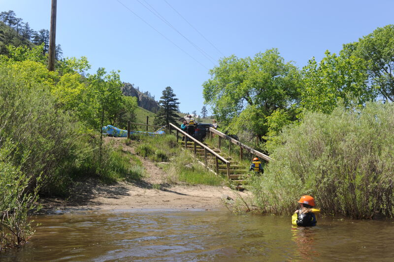
A short distance downstream of Gateway Natural Area, the US Forest Service maintains a set of wooden stairs to access the river. Limited free roadside parking is available here, but watch for traffic. Google Maps link: https://goo.gl/maps/2MAr214Vk6PvuzJGA
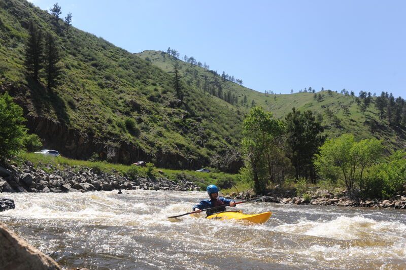
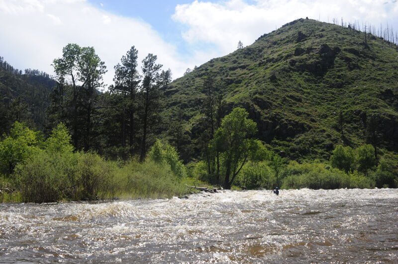
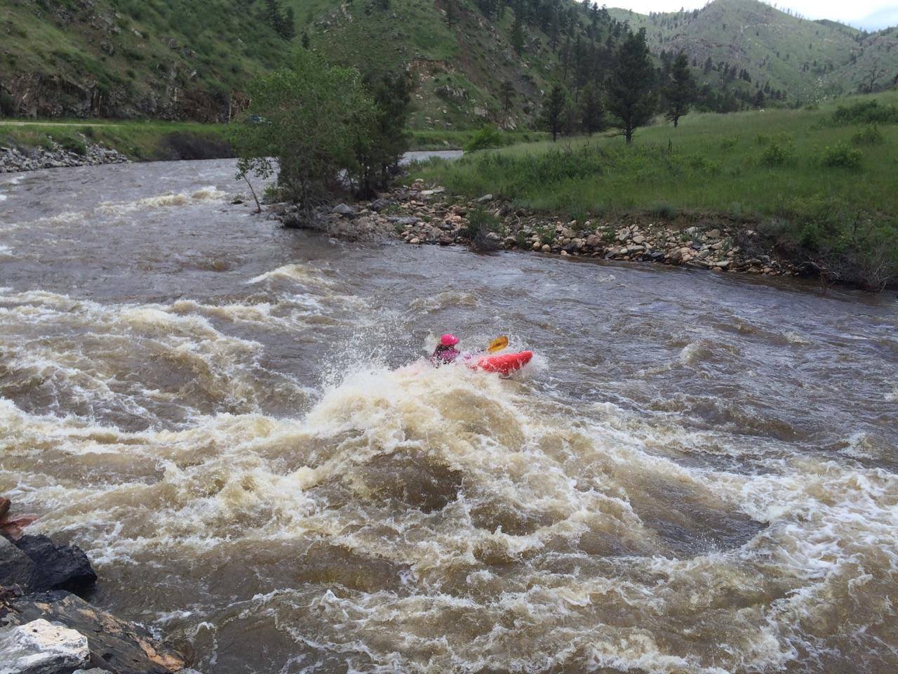
The river makes a sharp left-hand turn, with a wave train here. The waves can be substantial at high water.
This rapid is shortly above the road bridge, where the river splits around an island. The left channel is wider and deeper, and the right channel closes off at flows below about 800 cfs. The two channels rejoin below the island, creating swirly eddy lines that have caused more than one beginner kayaker to swim.
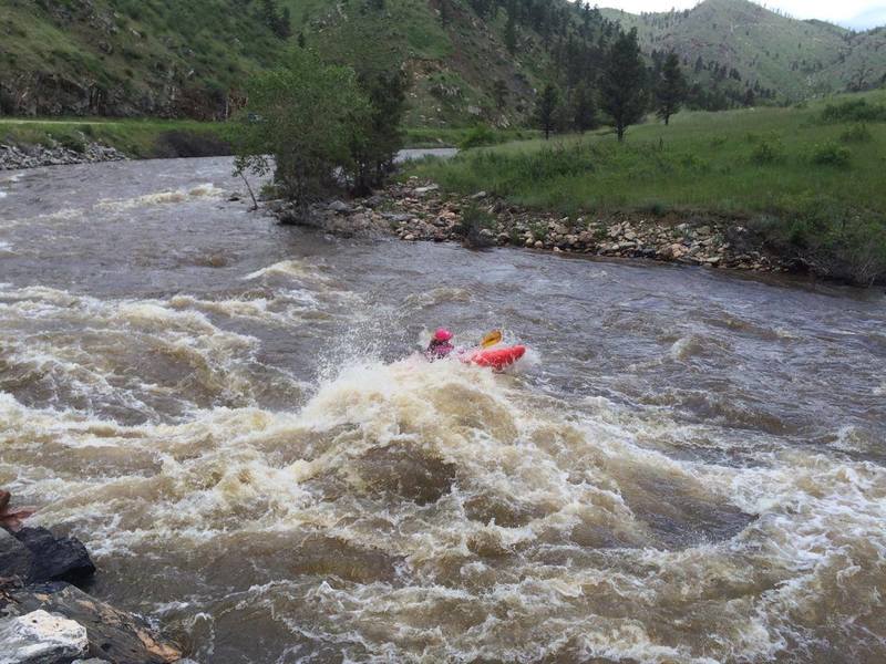
This rapid is on a sharp right turn shortly below the road bridge. It has a large rock or hole in the middle, with cobbles stretching from the center rock to the left shore. Tailwaves then stretch a short distance downstream. At low water, the rock is passable in a narrow channel along the right shore. At flows above about 1200 cfs, a wider left line is also available. It's possible to road-scout Mad Dog from a couple of pull-outs, and possible to scout from river level by landing on a small beach around the corner upstream. The river scout doesn't have much of a trail; you're more likely to get injured by stepping on a cactus while scouting than by running the rapid blind. This rapid is named for Brian 'Mad Dog' Maddox, a longtime Poudre Canyon resident, kayaker extraordinaire, and author of 'River Guide to the Cache La Poudre River.'
The straightaway below Mad Dog begins the easier water of the second half of the run
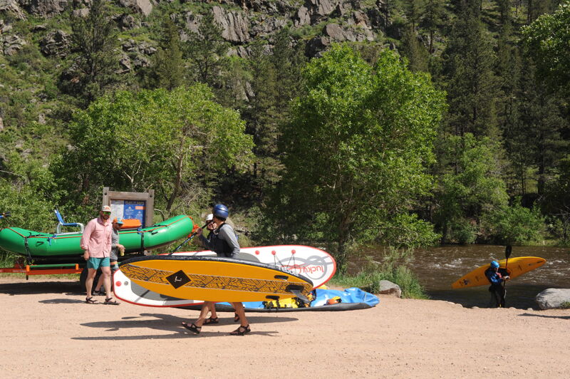
Picnic Rock takeout offers free parking, picnic shelters, a bathroom, and a few places to take a boat out of the river. It's not possible to drive quite to the river's edge anywhere, so a short boat carry is required.
A short distance below the takeout is a low-head dam. Don't try to keep boating!
Jun 8, 2015
~3700cfs (5') 6/6/15