Kootenai Creek
trailside

| Difficulty | IV-V |
| Length | 1.7 mi |
| Avg Gradient | 250 fpm |
| Gauge | Lost Horse Creek Abv Lost Horse Ditch |
| Flow Rate as of 2 hours | 89 cfsbelow recommended |
| Reach Info Last Updated | May 22, 2025 |
Kootenai Creek is the most accessible high quality creek run in the Missoula and Bitterroot valleys. The creek starts high in the Bitterroot Mountains and flows through a spectacular but low gradient glacial canyon before the bottom drops out about 1.25 miles upstream from the canyon mouth. The upper part of the run is studded with nice class III and IV drops seperated by short sections of calmer water. Then, the final quarter mile or so falls in a nearly continuous series of 3-10 foot bedrock drops. All these drops are fun and runnable, and an occassional eddy exists between them. The highlight for many is the 10 foot falls which requires a good boof and a river-right line to avoid the room of doom on the left. The bedrock nature of the creek and its easy access make it a staple for many area paddlers. Here is a video of the whole lower section with three laps off skinny hips and the falls.
The Kootenai Creek trailhead is located a short drive up N Kootenai Creek Road from Highway 93 and is well signed. You can't miss the big sawtooth ridges above the canyon. From the trailhead, hike up until you get tired or run out of gradient and put on. Be sure to carefully scout for wood on your hike up!
Most of the whitewater run is on private property, including the trail. Paddlers have two options for enjoying the creek in a manner that has been OK with the landowners. First, and recommended, is that paddlers run the creek and take out immediately below the last drop (before entering the little slot canyon) and walk the small trail up to the main trail, and then walk back to your car on the main trail. Second, if you really want to paddle through the slot canyon sometime go ahead and paddle out to the public road downstream. DO NOT take out after the slot canyon and hike up to your car, as this is trespassing and is not OK with the landowners. This is a really good system for paddlers based on mutual good-wi
...You can launch wherever feels right on Kootenai depending on how much warm up you want, how much hiking you want to do, and where the wood is located in the run at any given time.
A lead in drop leads to a tight slot against the right cliff wall. Its a fun move that can go wrong any number of ways. Getting a good boof with a touch of right angle usually goes well.
A 10 foot or so waterfall run as far right as you can get. A class IV move, but in context of the continuous section it can trend towards a class V sequence at some water levels.
The final drop of Kootenai Creek involves a fun right to left sliding boof in the right channel. TAKE OUT immediately below the drop and walk the obvious rough trail up to the main trail. While the slot canyon downstream is cool, it requires paddling quite a ways to a public road crossing. DO NOT take out below the canyon because this is private property (uless you go all the way to the road).
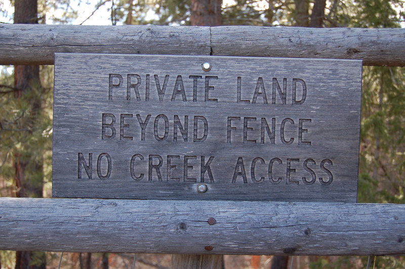
Park here to start your hike up. Your trip begins and ends here. Be sure to take out right below the last drop (before the slot canyon) and walk upslope to the main trail to respect private property. To avoid trespassing and respect the landowners DO NOT paddle through the slot canyon and walk straight up to the parking lot.
Jun 10, 2025
We've been using the Lost Horse Creek Gage to correlate flows: We've found a rough 1:1 correlation.
We've gone three times:
* 500 CFS on this gage is a nice Medium-low.
* Around 600 CFS on that gage and things started to feel pretty fluffy: Water starts to pour over the boof-rock that closes in skinny hips. We did a lap around this high and felt like it was the high side of medium flows.
I personally think lower flows are great on this creek, and will stick to around 500 CFS.
Jul 27, 2007
New online guide for Montana area whitewater; check it out!
www.montanaeddyhop.blogspot.com
Apr 29, 2007
Want to see more photos of Kootenai Creek? Check out my website. www.infinitymountain.com
Have fun!
Robin
May 13, 2002
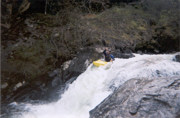
This is Cody Howard going over the biggest drop on Kootenai Creek. Notice the Room of Doom of river-left side of the falls. Avoid that, and this is low flows so a boof is recommended!
This is our group (allen, cody howard, josh, and jemery) heading through the canyon for the takeout around the corner.
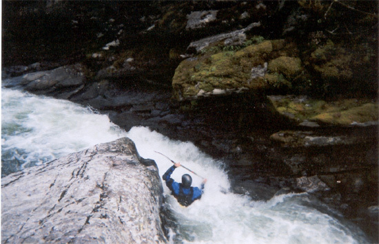
This is Josh on the last drop/slide of Kootenai Creek. You're going to want to have right-hand angle, cause, notice the rock in the center. -CODY HOWARD
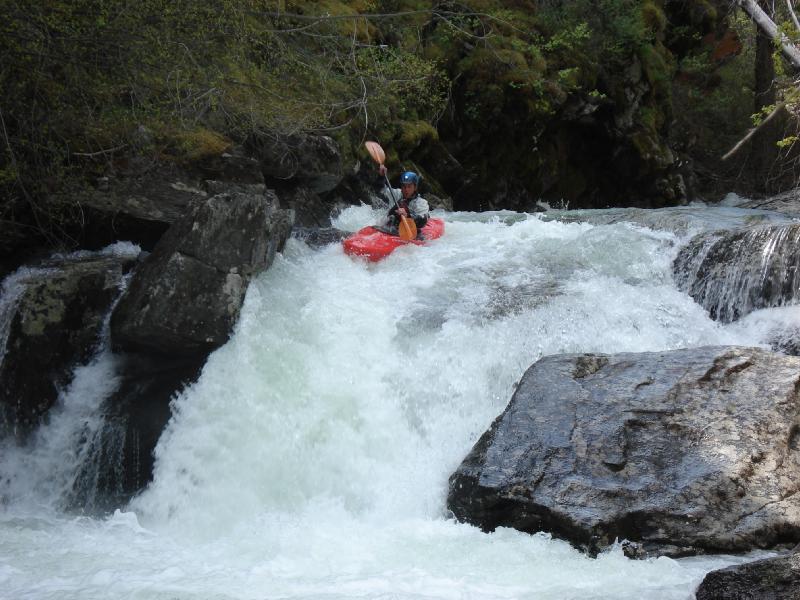
This is Jeremy going through the pinch. This is the drop right above the falls. At this level there was an eddy on river left. This drop you have to be careful, cause it is undercut. -CODY HOWARD
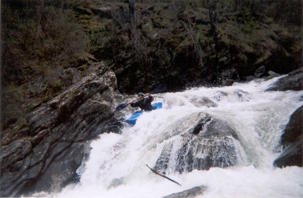
This is Jeremy going over the falls. -CODY HOWARD
Check out the full-sized version of this shot by clicking here.
This is Josh on the last drop/slide of Kootenai Creek. You're going to want to have right-hand angle, cause, notice the rock in the center. -CODY HOWARD