| Difficulty | I-II(III) |
| Length | 11.2 mi |
| Avg Gradient | n/a |
| Gauge | Souhegan River at Merrimack, Nh |
| Flow Rate as of 1 hour | 31 cfsbelow recommended |
| Reach Info Last Updated | May 26, 2014 |
River Description
The Indian Ledges section of the Souhegan is a touring river with a combination of flatwater, quickwater and few class II and III rapids.
The trip can be split up since there are a number of access points all along the river.
This section starts near the Oval in downtown Milford; It ends in Merrimack in a public park by the Turkey Hill Road bridge upstream of the Wildcat Falls section.
Access Point__River Miles__River Character
and Features__Notes
Milford Oval
0.0 miles
Flatwater
Put-in/Park in public park on river-left behind the Post Office across the river from the Oval.
Bridge St. Pedestrian Bridge
0.3 miles
Six foot dam 75 yards below bridge, then class I-II and quickwater. Class III rapid under Route 101 bridge at mile 2.3.
Limited parking on river-right along street. Put-in/take-out on river-left by the bridge, or walk downstream to put on below the dam.
Route 122 (Ponemah Rd) Bridge
2.8 miles
Quickwater
Access to large parking area and put-in via dirt road 100 yards north of bridge.
Boston Post Road Bridge
5.25 miles
Quickwater
Nice boat ramp and parking area.
Country Road Bridge (aka Fields Bridge)
7.3 miles
Class II ledge at 8.7 miles, Indian Ledges rapid (class III) at mile 8.8. Carry on right or run class II on left then line down main channel.
Small parking area with river access at intersection of Country Road and Seaverns Bridge Road.
Turkey Hill Road Bridge
11.25 miles
Take out to avoid Wildcat falls.
Public park with small parking area.
River Features
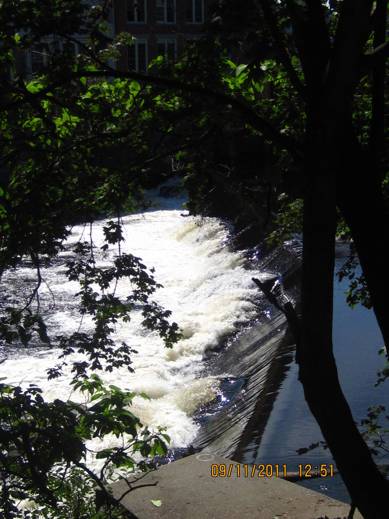
Bridge Street Pedestrian Bridge
Access PointPortageHazardDistance: 0.3 mi

Six foot dam 75 yards below the bridge.
Park along street. Put-in on river-left at bridge or walk downstream on path and put on below the dam.
Trip Reports
Log in to add a reportMA
Matthew A Rotier
May 12, 2014
Ran this section yesterday. It was at 330cfs so it was pretty scratchy but still doable. We put in at Boston Post and took out at Turkey Hill. A warning that there are a number of river-wide trees down along the route. You can sneak around most of them but there is one a hundred yards upstream from the final take out that was a mandatory portage for us. Would probably be passable at higher levels. We took out just to the right of the tree. Fortunately there is a path that takes you up to the parking lot from there.
JO
Joe ONeil
Sep 12, 2011
The dam is about 6 ft and slanted not sure you can run it