| Difficulty | I |
| Length | 26 mi |
| Avg Gradient | 9 fpm |
| Gauge | Town Creek Near Oldtown, Md |
| Flow Rate as of 35 minutes | 17 cfsbelow recommended |
| Reach Info Last Updated | March 10, 2026 |
River Description
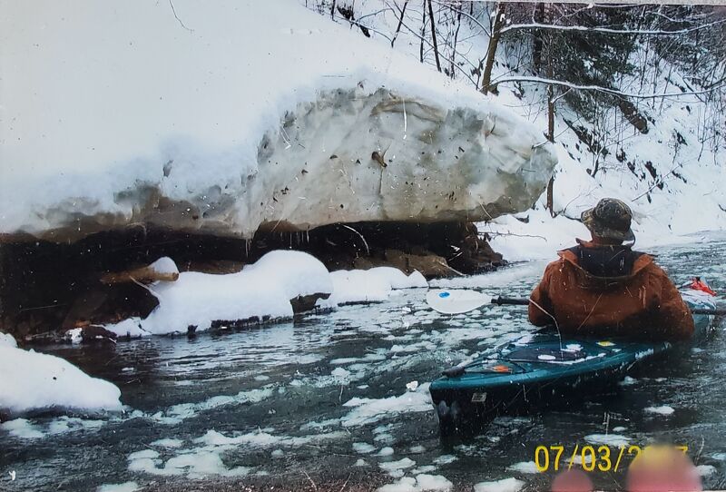
Ed Evangelidi testifies:
This is a quiet gem in Maryland. Not much is said about this creek but those who know it return to it often. The upper stretches above I-68 have better rapids and require more water to float a boat.
Access points from John Duke
See the Pa. section of town creek for upper access
Mile 16.3--Old rt.40 bridge:Put-in At the Sewage treatment plant but park across the street
Mile 16.5---Town creek road bridge over Flintstone Creek 1 mile above town creek:There is crappy access here for a quick mile to the Confluence.
Mile 19.0---Town Creek road bridge over Murley Branch:There is decent access at this point for a 0.7 mile run down this tributary to the confluence.
Mile 20.5---Old williams rd. bridge:This Has Good access (probably a good place to begin an overnighter to the Potomac Confluence).
Miles 23.5 and 24.3---Town creek road bridges:The lower bridge has good access
Mile 28.8: upper ford of lower town creek road: Posted!
Mile30.3---Greenridge State Forest has a small tract of land on river right,could be a nice place for 'camp'?? No close access.
Mile 31---Lower ford of Lower town creek road:Posted
Mile 36.3---North side of Manford road ford:posted,I have not checked out the south side.
Mile 36.7+-, Public land:Possible good riverside camp but no near access.
Mile 39.3---Oldtown road bridge:Haven't been there
Mile 42.5---Md. State 51 Bridge:To steep and busy for me!!
Mile 43.5---C&O canal Aquaduct: Good parking on gravel road with a fairly steep carry
Mile 43.6---Confluence with the MIGHTY PO.
Note: nearly all access points are on PRIVATE land and permission should be secured if possibe!
Camping Areas
1: Greenridge State Forest has 100 real nice
...River Features
Put-In - Old rt.40 bridge
Access PointDistance: 0 mi
Mile 16.3--Old rt.40 bridge:Put-in At the Sewage treatment plant but park across the street.
River Access: Old Williams Rd. bridge
Access PointDistance: 4.07 mi
River Access: Old Williams Rd. bridge: This Has good access (probably a good place to begin an overnighter to the Potomac Confluence).
Lower Town Creek Road Bridge - River Access
Access PointDistance: 7.76 mi
The lower Town Creek Road bridge has good access.
Potential River Access - Maniford Rd
Access PointDistance: 19.04 mi
North side of Manford road ford:posted. I have not checked out the south side.
Take-Out - Potomac River (C&O canal Aquaduct)
Access PointDistance: 26.1 mi
Mile 43.5---C&O canal Aquaduct: Good parking on gravel road with a fairly steep carry
Trip Reports
Log in to add a reportKC
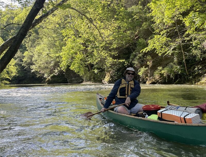
Town Creek Flintstone to Potomac - Kai Caraher
Jun 3, 2026
Continued down from upper section looking for a camping spot after Flintstone. Had to go a few miles to find a nice gravel beach that was not next to pasture or within sight of a farm house. Flow at USGS gauge was 275 cfs in the morning, which was just fine with loaded canoes. The gradient was 5 to 10 fpm, and provided great fishing and rapids all day. Found a nice secluded camping spot after an island 21 miles downstream from Flintstone. The pullout after the Town Creek Aqueduct was muddy and the portage to the parking was steep but good footing.
JD
Joseph Dove
Mar 7, 2007