Zigzag
Hwy 26 to Lolo Pass
Nov 29, 2025
I did a run, down Zigzag after Thanksgiving. There were several strainers in various places. Some were easy to miss others were a bit of a surprise.
Apr 12, 2023
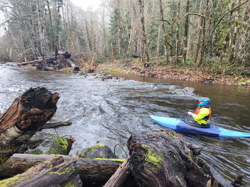
We paddled the Zigzag 4/11/23 at a fast, medium flow. The Sandy gauge peaked at 4,000 cfs in the morning, with a low snow-line. It was down to around 3,700 while we were on the river. We put in at the Pioneer Bridle trailhead (just upstream of Tollgate campground). There were two logs to dodge adjacent to Tollgate campground that could be scouted before putting on, the rest of the run from there down was clean as far as the Zigzag goes aside from a large fish habitat installation a short distance above the confluence with the Sandy river that has been there for awhile. It can easily be portaged left, either via a pathway, or within the jam sort of on the left. Eddies at the jam were small, but manageable one boat at a time today. The river was just as engaging and enjoyable as I remembered. We continued down the Sandy to Brightwood, and that was fun as well at this level.
Jan 31, 2020
2/1/2020 Log-jam at lower end of Tollgate CG is now a single, 8' diameter tree across entire creek. It might be possible to boof over it on river left which will then feed you directly into a tight 3+ (4 at this flow) drop. Lower water and it becomes a trap around a blind corner after 100 yards of eddy-free boating. Wood situation is slightly improved through the CG, the rapid shortly below the upper put-in known as '26 Moves' still has wood and no great stopping or portage options. For a number of years, we have been putting in just below this drop. '26 Moves' is the steepest, most continuous piece on the river and becomes more user-friendly below it.
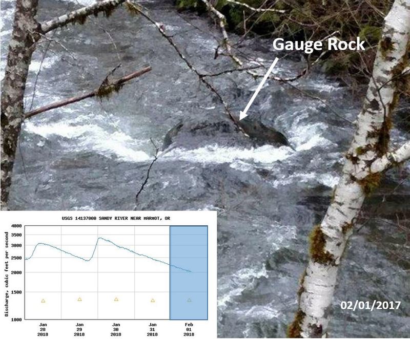
Feb 1, 2018
5/24/2017 Ran from the upper end of Tollgate CG to the Sandy River confluence at Lolo Pass Road. Sandy at Marmot was 2200, Sandy below Bull Run 10.5/3200. This flow is probably at the high end of prudent. Eddies are pretty scarce at this level and they disappear entirely with much more water. HIGHLY recommend putting in below the logjam at the lower end of Tollgate CG as there are portages at upper, middle and downstream ends of the CG as well as a blind left that is spooky but runnable (wood on right bank where the only micro-eddy is for stopping/scouting). The only way to stop before the logjam is a tiny, one-boat eddy on the left that you have to know about in advance after a long-stretch of eddy-free water. It is very hairy trying to manage multiple boats approaching this hazard. On a straightaway after a right-bend below the logjam is an easy log-hop on the left which can be scouted from the left bank at the corner. From here to the giant logjam-complex about a mile below the Highway 26/Still Creek confluence the river is completely clean and great fun with the rapid below the Road 20 bridge being the standout. Portaging the big jam is an ordeal (on the right through the woods). Starting the portage 50 yards upstream is better as it becomes more difficult to enter the woods the closer you get to the jam. This is a great flow if you're cautious, scout blind corners and always have your next eddy figured out in advance.
Feb 1, 2018
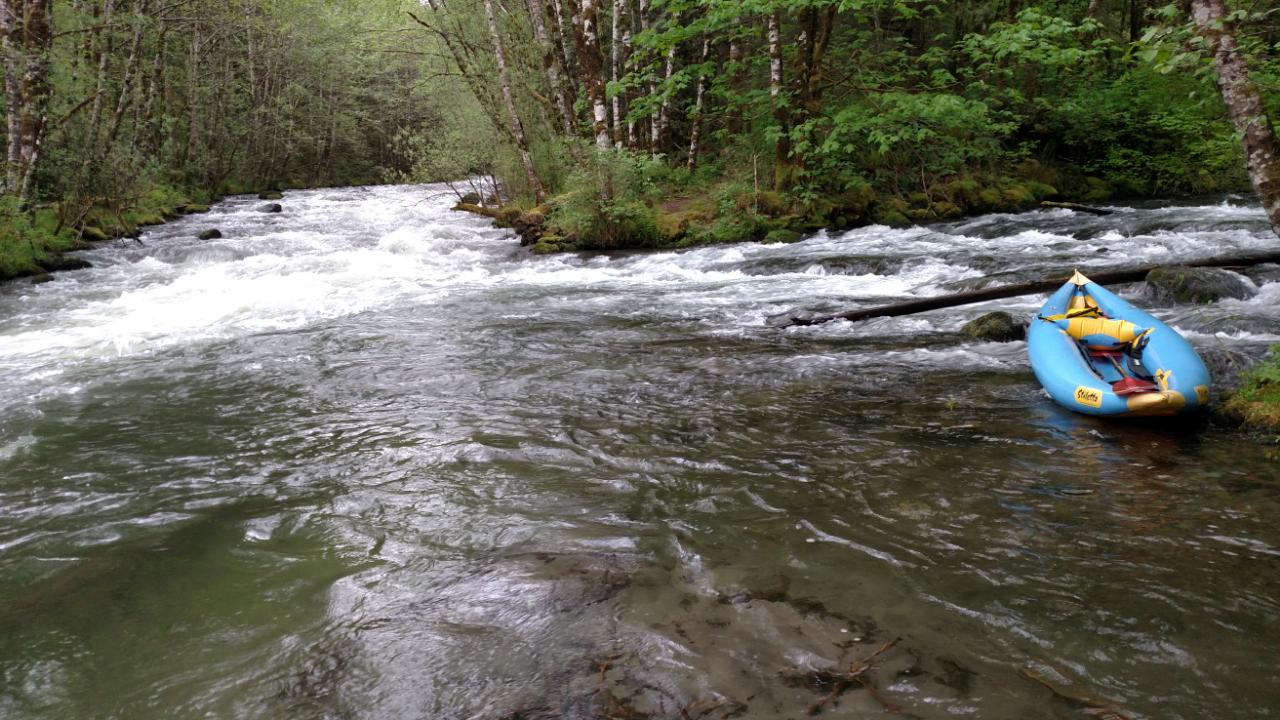
Zigzag gauge at a med/low flow, in the Winter and rainfed. Note the eddy behind the rock, this is a fair first time flow.
This rock is just downstream from the Road 20 bridge (visible from the bridge).
To get to the Hwy 20 bridge: From the lower Hwy 26 bridge over the Zigzag, drive upstream just over 1/2 mile and turn right onto Rd 20. In less than a minute you will cross this bridge, look downstream for the rock
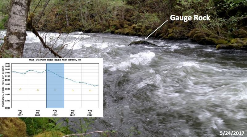
May 26, 2017
This rock is just downstream from the Road 20 bridge (visible from the bridge).
This was a healthy flow, lots of fun if you know the run, a little stressful if you don't. If the rock has water going over it, it is not a good first time flow.
To get to the Road 20 bridge: From the lower Hwy 26 bridge over the Zigzag, drive upstream just over 1/2 mile and turn right onto Road 20. In less than a minute you will cross this bridge, look about 100 feet downstream on the right for the biggest rock.
5/24/2017 and snowmelt-fed.
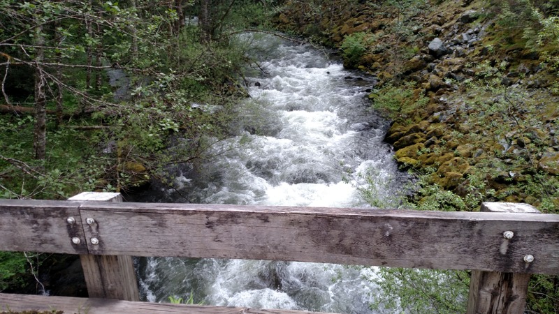
May 26, 2017
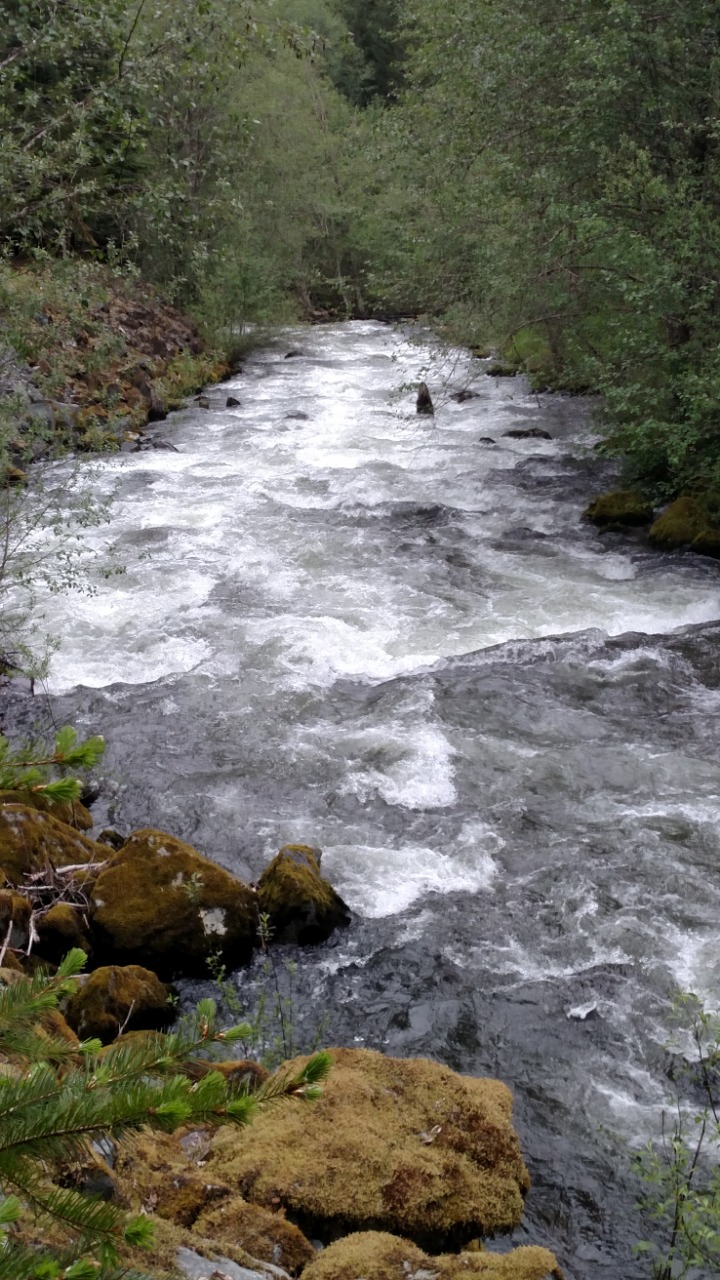
Looking upstream from the Rd 20 bridge.
To get to this bridge: From the lower Hwy 26 bridge over the Zigzag, drive upstream just over 1/2 mile and turn right onto Rd 20. In less than a minute you will cross this bridge.
The flows seen here are about as high as you would want for a first time flow, lots of fun if you know the run, a bit stressful if you don't.
5/24/2017 @ about 2,200 cfs from snowmelt on the Sandy Gauge.