Flathead, Middle Fork
5. West Glacier to Blankenship Bridge
| Difficulty | I-II |
| Length | 5.4 mi |
| Avg Gradient | 8 fpm |
| Gauge | M F Flathead River Near West Glacier Mt |
| Flow Rate as of 51 minutes | 2550 cfsmedium runnable |
| Reach Info Last Updated | August 22, 2025 |
This popular run is a favorite for day trips, family floats, and first-time visitors seeking an accessible taste of the National Wild and Scenic Flathead River. Several outfitters offer trips on this segment of the river: list of rafting tour companies. The reach begins at West Glacier, just outside the entrance to Glacier National Park, and follows the river’s northern boundary downstream to its confluence with the North Fork at Blankenship Bridge.
The run is generally rated Class I–II, with swift currents, broad gravel bars, and occasional riffles. At typical summer flows it offers a mellow float suitable for rafts, canoes, and kayaks with basic moving-water skills. Early in the season, higher flows create stronger eddies and faster currents—particularly at Devil’s Elbow, where a bedrock outcrop forces a dramatic right-hand bend—but hazards remain limited compared to upstream canyon sections.
Scenery is the highlight: crystal-clear water, sweeping views into Glacier National Park, and the chance to spot eagles, osprey, or even the occasional black bear along the shoreline. Cobble bars and small beaches provide good options for rest stops and swimming on hot days.
Access is straightforward. Put in at West Glacier Bridge near the Park entrance. The take-out at Blankenship Bridge lies just upstream of the confluence with the North Fork; parking is limited and the area is often busy in summer. Day use is available on river left, while river right has long been a popular location for dispersed camping. Just upstream of Blankenship, the Middle and North Fork join to form the main Flathead.
Busy access point on river left in West Glacier on river left that is also used as a take-out for the popular whitewater run just upstream.
Devil’s Elbow is a dramatic bend where a bedrock outcrop forces the river hard to the right. At lower flows it’s a scenic corner with swift current; at medium flows it becomes pushy but fun; and at high flows it turns into the most dynamic spot on the float. While less hazardous than the features on the canyon run upstream, it remains the one place on this section where paddlers should stay especially alert.
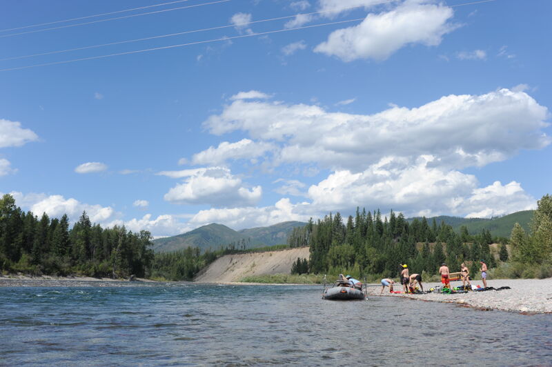
The gravel bar on river right downstream of the bridge has been a popular dispersed camp site that can get busy during the summer. Day use river access for river runners is available on river left where cars an be parked for those enjoying a multi-day trip that ends at the bridge.
Aug 20, 2025
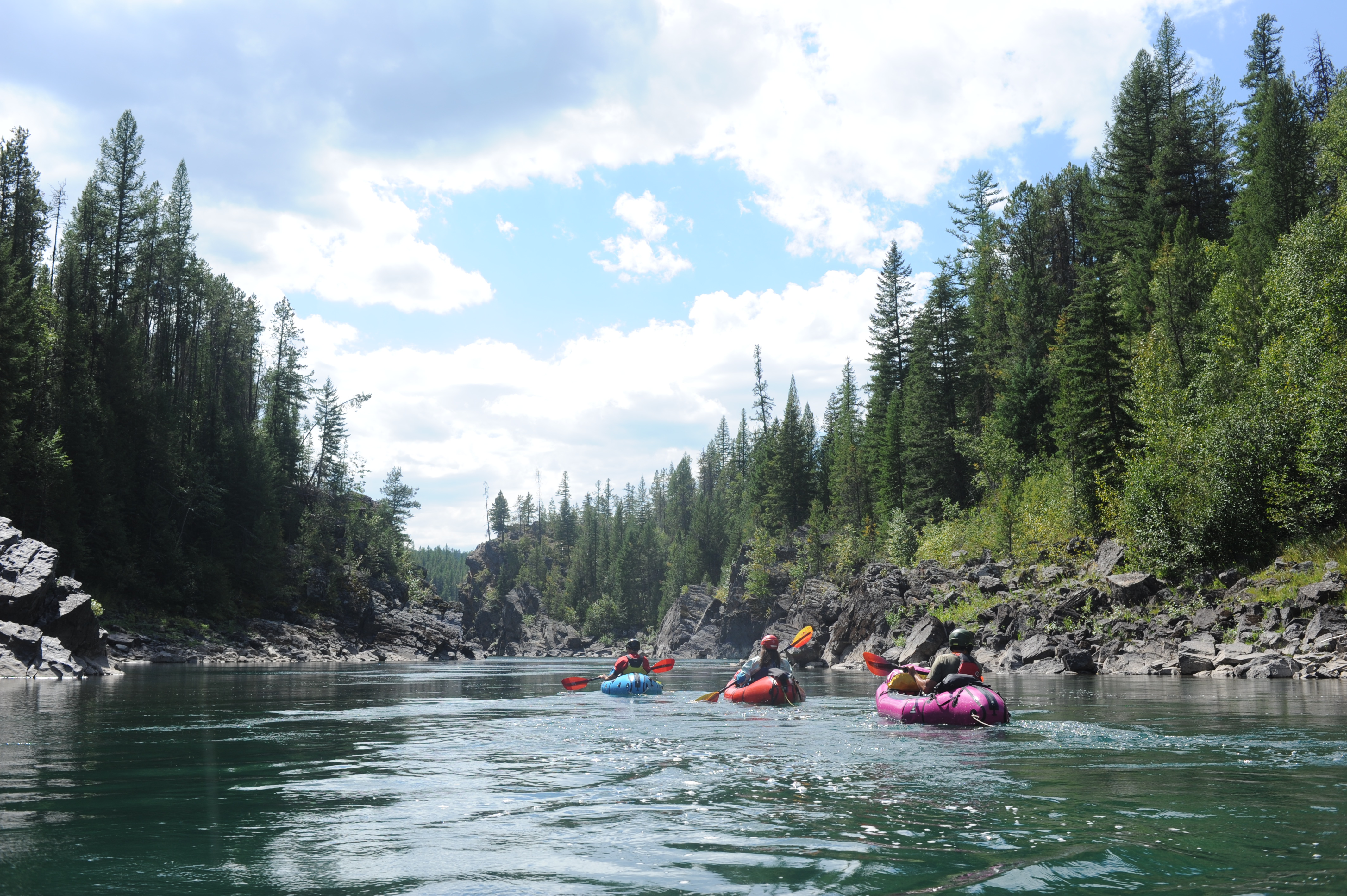
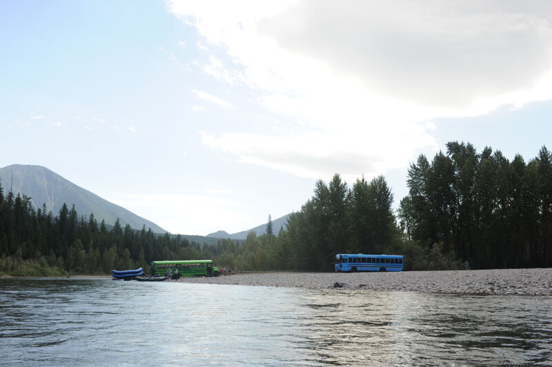
We paddled this section of the Middle Fork Flathead on the last day of a five-day packrafting trip from Granite Creek to Blankenship Bridge. Our take-out vehicle had been parked for the duration of the trip on the downstream river-left side of the bridge.
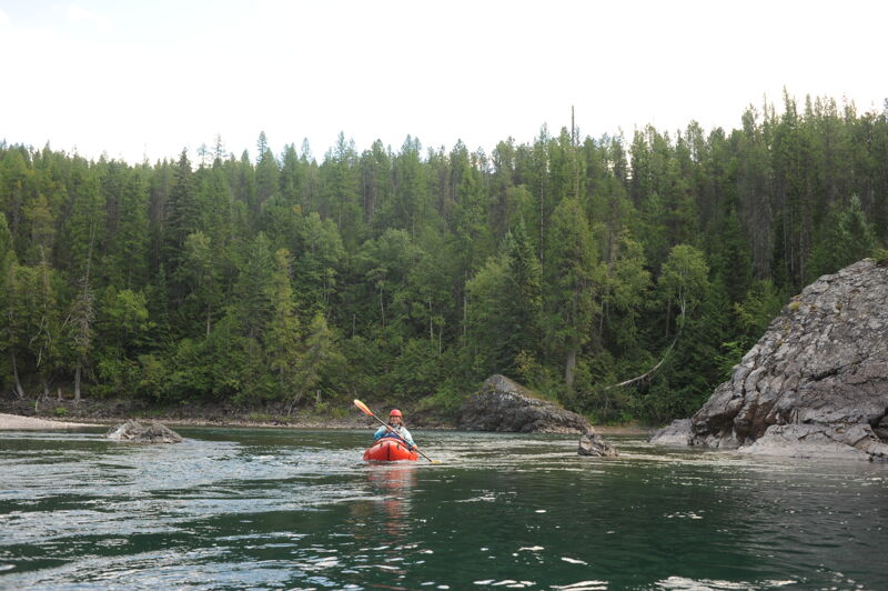
Float time for this reach was about 1 hour 15 minutes, though it’s easy to go slower and enjoy the scenery, wildlife, and gravel bars along the way. At 740 cfs, the river was fully navigable and accommodated a variety of craft we saw, including recreational kayaks, drift boats, paddleboards, and fully loaded rafts. At lower flows, some gravel bars may become shallow, but at this level the section is straightforward and accessible.
The float was scenic, with shoreline forest and bedrock outcrops that added to the experience. Devil’s Elbow was a particularly attractive bend that presented no navigational challenges at this flow. The water was crystal clear, allowing us to see trout beneath the surface. While a few riverside homes were visible, most of the shoreline remained natural and visually appealing.
Dec 9, 2020