Colorado
03. Pumphouse campground to State Bridge(Pumphouse)

Feb 7, 2021
Here is a video of the Upper Colorado based on the below comments. A lot of fun!
Jul 22, 2020
Did this run with inflatable kayaks on 7/16/2020 at 950cfs. It took 5 hours and was a great run for beginners and intermediates with II and II+ rapids. There are some stretches of flat water but the scenery and the railroad tracks keep things interesting. If you want a shorter run you can get out at the Radium Campground or Rancho Del Rio. Rancho Del Rio looks like a fun place to stay with cabins and and a bar & grill. They have inflatable raft and kayak rentals and operate a shuttle service which was $60 from Pumphouse to State Bridge. Just a note about camping at Pumphouse - it is first come first serve as is the Radium campground so your best odds are to get their mid-week. We showed up on a Wednesday and there were open spots but by Thursday it was full.
Nov 20, 2018
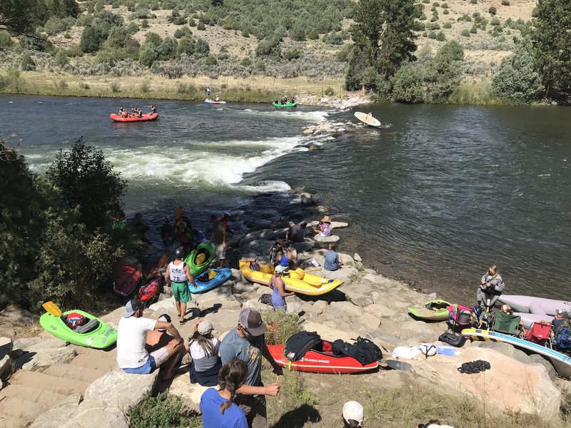
The Gore Canyon Whitewater Park, located at the Pumphouse Campground, is a man-made feature that secures a water right for the river.
Sep 12, 2017
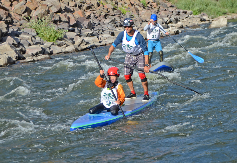
Aaron and Nate Pruzan racing in the 2016 Downriver SUP Sprint at Gore Fest.
Mar 24, 2015
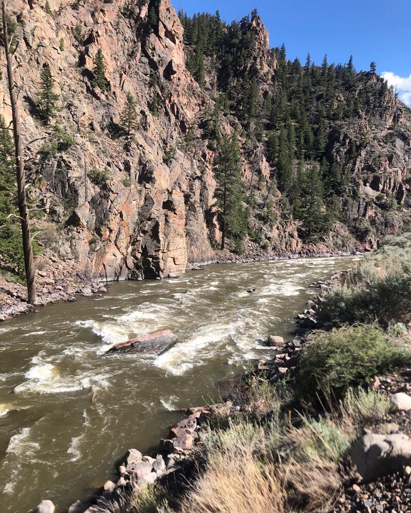
launch 3 at Pumphouse ~860 cfs
Mar 24, 2015
~860 cfs
Oct 14, 2004
Names are based on BLM guidebook at www.co.blm.gov/kra/documents/uppercoloradoriverbrochure.pdf
Names ending in L or R indicate river left or right respectively. Waypoints with elevations are from the field. Lat/Lon are WGS 84.
UC11,RM11,N39.99050 W106.50754,0 ft
UC11AL,Pumphouse campground & landing,N39.98775 W106.51116,6965 ft
UC12,RM12,N39.97760 W106.51620,
UC12A,Little Gore Canyon,N39.97015 W106.51905,0 ft
UC12BL,Abandoned Diversion Tunnel,N39.96713 W106.52399,6922 ft
UC13,RM13,N39.96686 W106.52504,
UC13A,Needle Eye Rapid II+,N39.96682 W106.52511,6918 ft
UC13BL,Cabin Ruins,N39.96614 W106.53393,6887 ft
UC14,RM14,N39.96165 W106.53989,0 ft
UC14AL,Hot Springs,N39.96003 W106.54083,6902 ft
UC14BL,Picnic Site,N39.95950 W106.54363,6904 ft
UC14CR,Cabin campsite,N39.95981 W106.54998,6894 ft
UC14DL,Cottonwood campsite,N39.95882 W106.54990,6910 ft
UC15,RM15,N39.95504 W106.55008,0 ft
UC15AL,Radium campground & landing,N39.94897 W106.55651,6882 ft
UC16,RM16,N39.94532 W106.55466,
UC17,RM17,N39.94136 W106.57056,
UC17A,Red Gorge,N39.93934 W106.57290,0 ft
UC17B,Red-Eye Rapid,N39.93553 W106.57601,6856 ft
UC17C,Yarmony Rapid II+,N39.93367 W106.57680,6847 ft
UC17DL,Island campsite,N39.92923 W106.57852,6838 ft
UC18,RM18,N39.92732 W106.57830,
UC18AL,Bench campsites 3x,N39.91944 W106.57831,6848 ft
UC18BR,Lone Tree campsite,N39.91390 W106.57953,6825 ft
UC19,RM19,N39.91385 W106.57967,
UC20,RM20,N39.91324 W106.59563,0 ft
UC20A,Slackwater Ends,N39.90790 W106.60670,6809 ft
UC21,RM21,N39.90077 W106.60937,
UC21AL,Rancho Del Rio,N39.89519 W106.60890,6792 ft
UC22,RM22,N39.89070 W106.61660,
UC22AR,Yarmony access,N39.89060 W106.61672,6803 ft
UC23,RM23,N39.87898 W106.63096,
UC23A,Cable Rapids,N39.87106 W106.63741,6773 ft
UC24,RM24,N39.86506 W106.64011,
UC24AL,Piney River,N39.85494 W106.64196,6751 ft
UC25,RM25,N39.85690 W106.64652,
UC25AR,State Bridge landing,N39.85699 W106.64690,6743 ft
UCRD,Pumphouse Road,N39.97672 W106.50109,0 ft
Jan 1, 1900
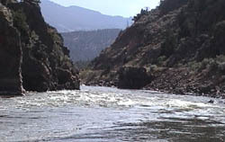
Top of Yarmony Rapid. Rock Creates a massive hole at high water.
Jan 1, 1900
Photo courtesy of and copyright by www.allaboutrivers.com.